Time Period of IOP
1200 UTC 28 Nov-0300 UTC 29 Nov
Overview of IOP
A very intense short wave trough formed over
the
The S-Pol radar showed precipitation moving
through the Oregon Cascades from 0400 UTC
After the cold front passed through
After 1600 UTC 29 November there were a few
decaying convective cells to the east of the radar Fig.
16. From 1700-1922 UTC 29 November, the
Convair flew a vertical profile for microphysical measurements over
The ETL S-band
vertically-pointing radar showed detailed vertical and horizontal structures
during the passage of the storm over
Convair-580 Summary
UW Flight Number:
1891
Period of Flight:
1810-2329 UTC,
Main Accomplishment of Flight:
Measurements in
pre-frontal, frontal and postfrontal conditions across the Oregon
Cascades. Landed in
Instrument Problems:
SPEC CPI,
Flight Scientist:
Peter V. Hobbs
Approximate UTC Timeline (Local time= UTC-8 hours) Activity for UW Flight 1891:
|
1822-2015 |
Transit to |
|
2035-2048 At 43˚16.1'/124˚29. |
9' (on |
|
2048-2053 . |
NE à SW descending |
|
2053-2107 . |
SW-NE at 19,500 ft |
|
2109-2132 |
NE à SW descending to 17,000 ft. |
|
2134-2148 |
|
|
2149-3 |
NE à SW descending to 14,500 ft. Picked up significant ice on descent to 14,500 ft. Circled in clear air at SW point to shed ice. |
|
~2225-2240 |
|
|
2240 |
Return to SW with slow descent (more icing in Cu). |
|
Land at |
|
|
2329
|
2330 Engines off. |
UW Flight Number:
1892
Period of Flight:
0011-0129 UTC,
Main Accomplishment of Flight:
Transit from
Instrument Problems:
As for Flight 1891.
Flight Scientist:
Peter V. Hobbs
Approximate UTC Timeline (Local time= UTC-8 hours) Activity for UW Flight 1892:
|
00?? |
Takeoff. |
|
0016-0031 |
Climb to 10,000 ft. Cloud tops |
UW Flight Number:
1893
Period of Flight:
1558-2039 UTC,
Main Accomplishment of Flight:
Vertical profile from 15,000 ft down to 2,000 ft
between Sweet Home and Santiam Pass, Oregon, in postfrontal conditions. Measured CCN spectra in inflow to clouds over
Cascades and in outflow. Profile through
small cumulus clouds over PNNL PARSL site at
Instrument Problems:
Discrepancy between FSSP-100 and PVM-100. Intermittent outages of HVPS.
Flight Scientist:
Peter V. Hobbs
Approximate UTC Timeline (Local time= UTC-8 hours) Activity for UW Flight 1893:
|
1606 |
Takeoff. |
|
1606-1709 |
Transit to Sweet Home. |
|
1709-1725 |
Sweet Home à Santiam à 15,000 ft à 10,500 ft. No cloud at this height. |
|
1725-1750 |
Return to Sweet Home à descending to get into cloud tops, 10,000 ft à 5,000 ft à 2,000 ft. |
|
1755-1810 |
CCN spectra in inflow air to clouds just west of Santiam at 2,000 ft. |
|
1810-1830 |
West à Sweet Home à Santiam. |
|
1830-1855 |
To PARSL site. |
|
1857-1912 |
CCN spectra in outflow below cloud base near PARSL site. |
|
1914-1922 |
Spiral up over |
|
1922 . |
Transit home |
P-3 Summary
P-3 Flight Number:
011128H, IMPROVE 01
Period of Flight:
1936 UTC 28 November-0122 UTC
Main Accomplishment of Flight:
Support of
UW Convair operations (SW-NE transect) over
Instrument Problems:
-
Flight Scientist:
Nick Bond
Approximate UTC Timeline (Local time= UTC-8 hours) Activity for P-3 Flight 01:
193613 UTC (47.90024, -122.28056) .755°, 965.6 mb, 3.0 m Engine Start
194312 UTC (47.90022, -122.28049) 5.593°, 965.0 mb, 3.0 m Block Out. Taxi to 16R
195517 UTC (47.90895, -122.28560) 179.130°, 968.6 mb, 5349.0 m Takeoff
195859 UTC (47.77825, -122.42265) 260.415°, 884.1 mb, 901.0 m Cloud physics system up but with some initialization problems.
200534 UTC (47.53393, -122.76604) 181.575°, 689.7 mb, 2593.0 m Radar system up, recording on DR1. Slewable (AOC) antenna. LF at 2 RPM.
201207 UTC (47.20762, -122.95032) 205.434°, 574.3 mb, 4289.0 m Tech swapping cards on precip/cloud probes to get data into proper size range. Echo tops near 6km.
201939 UTC (46.76801, -123.12292) 181.582°, 554.9 mb, 4436.0 m PMS data looked good as we came through echo last few min; now in clear. ETA Pt A is 2047UTC. Echoes thinning out here.
203124 UTC (46.07021, -123.10075) 175.955°, 556.5 mb, 4275.0 m Crossing Columia; echoes picking up, especially east of track
204001 UTC (45.53973, -123.02272) 175.024°, 561.6 mb, 4428.0 m Descending to 7kft, requesting 6kft. Echoes not too horizontally extensive, a little spotty, shallow.
204407 UTC (45.29348, -123.01978) 183.274°, 745.8 mb, 2191.0 m Tech bringing cloud physics back online. Top of BB near 2km.
204853 UTC (45.01687, -123.03389) 180.966°, 794.4 mb, 1774.0 m At Pt A, tracking 180. On tail view (out only to 40km range), echo generally more extensive west of track, tho some stuff hanging over Cascades to east.
205138 UTC (44.86903, -123.03319)
180.763°, 792.6 mb, 1691.0 m Passing
over
205603 UTC (44.61491, -123.03305) 180.067°, 795.4 mb, 1733.0 m Echo picking up slightly to west of track.
210014 UTC (44.37672, -123.03346) 180.964°, 795.7 mb, 1719.0 m Some orographic enhancement/echo slant suggested on LHS. Cloud & precip probe data continue to look high quality. Melting aggregates, clusters of needles.
210737 UTC (43.97016, -123.03192) 179.703°, 795.6 mb, 1640.0 m Precip picking up as we
210917 UTC (43.87938, -123.03072) 178.763°, 795.4 mb, 1651.0 m Cold-frontal type shear (w/ suggestion of head structure) between 10-20 km range on LHS; some precip enhancement, but certainly no strong NCFR signature
211025 UTC (43.81692, -123.03029) 180.692°, 795.7 mb, 1625.0 m At Pt F, turning east, climbing to 9kft.Top of solid echos 3-3.5 km; top of BL near 2 km (round numbers)
211431 UTC (43.76334, -122.62691) 88.611°, 736.9 mb, 1098.0 m At Pt G, turning to track 360.Nice fallstreaks originating near 4-5 km.
211821 UTC (44.03061, -122.56519) .182°, 736.8 mb, 1827.0 m Continued fallstreaks w/evidence of generating cells
212338 UTC (44.43035, -122.56558) 359.102°, 736.6 mb, 1867.0 m Vr data show continued suggestion of cold-frontal type shear, immediately west of our track. Still no hint of NCFR enhancement however. Bulk of steady precip appears to be ahead of cold-frontal wind transition.
212718 UTC (44.71851, -122.56601) 1.039°, 736.7 mb, 2004.0 m Echoes again on the wane; perhaps general decrease of precip intensity to north, or alt. Tendency for SW-NE cold-frontal orientation putting best echoes farther east at north end of pattern.
213056 UTC (44.99189, -122.55467) 40.073°, 725.5 mb, 2200.0 m At Pt B, turning east & climbing to 11kft
213503 UTC (45.01260, -122.11125) 115.543°, 656.1 mb, 2077.0 m At Pt C, turning to track 180. Echo coverage more extensive to east of track.
213710 UTC (44.89366, -122.08392) 181.803°, 656.6 mb, 1972.0 m Some evidence of orographic enhancement (sharp western edge to heavier precip) 5-10 km west of our track. Tech took brief MPEG movie of tail showing frontal-like shear and associated west edge of frontal and/or orographic precip enhancement.
214242 UTC (44.54816, -122.08353) 179.451°, 656.2 mb, 2152.0 m Suggestion of KH waves at echo top to west of track last few min. More gen cells on RHS 2143-44. Some perturbations on J-W liquid water 2145-46.
215055 UTC (44.07003, -122.08437) 181.335°, 656.6 mb, 1670.0 m Picking up some significant rime ice on wings, J-W reaching ~0.5 g/kg
215303 UTC (43.94911, -122.08315) 179.848°, 656.5 mb, 2403.0 m Radar down at 2148:17. Lost de-ice on Prop #2, need to climb.
215510 UTC (43.82835, -122.08342) 181.248°, 656.4 mb, 2046.0 m Radar back up & recording on DR1. Convair will be at 14.5 kft, so we are requesting 16kft. At Pt H, turning east.
215937 UTC (43.77388, -121.64743)
89.487°, 572.1 mb, 3064.0 m At
220753 UTC (44.18489, -121.61774) .023°, 537.2 mb, 3475.0 m Nice visualization of precip spillover on crest to LHS. Echo dissipates totally 10-20 km east of our track.
221729 UTC (45.00552, -121.61293) 28.210°, 542.6 mb, 3719.0 m At Pt D. More precip extending east of our track here at north end, so will proceed with last leg (east-J).
222503 UTC (44.81872, -121.13411) 180.539°, 682.9 mb, 2419.0 m Now south-bound on east-J. Still at -6.1 oC, so not much hope of getting rid of ice. Fairly smooth even here in lee.
223217 UTC (44.36913, -121.13553) 179.246°, 682.9 mb, 2174.0 m Some echo on this leg, but not much, principally west of track, desert in view below. Planning J-K-G.
223621 UTC (44.11808, -121.12251) 179.916°, 682.8 mb, 2040.0 m Running out of echo, 5 min from turn. Shedding some ice here at –5 oC. Planning 10 kft J-K. Then climb to >13kft.
224244 UTC (43.74215, -121.11388) 123.986°, 682.9 mb, 1258.0 m At Pt J. Convair preparing to land for refueling; they had major icing issues, unsure if they want to execute 2nd pattern.
225306 UTC (44.26260, -121.47310) 322.695°, 683.2 mb, 2079.0 m Plan climb to FL 130 at K. Once again nice spillover coming off crest LHS
225459 UTC (44.36508, -121.55649) 356.377°, 654.3 mb, 2370.0 m At K, spiraling up. Consulted w/ Roles; suspended recording of Spectal Width and saved to IMPR1; according to Roles this will improve radar system stability (and save tape ;) Mix of pristine crystals (needles, dendrites) and amorphous forms as we climb.
230621 UTC (44.13600, -121.88629) 233.935°, 606.1 mb, 2316.0 m LF suggests increasing postfrontal activity (NNE-SSW bands?) immediately off shore. Some discussion of sticking with today's situation (vs. A separate flight tomorrow) to do postfrontal work.
231008 UTC (44.01292, -122.12607) 234.278°, 606.0 mb, 2636.0 m Elevated "secondary BB" feature exhibits top near our FL
232200 UTC (43.73032, -122.49013) 339.262°, 724.1 mb, 1865.0 m At Pt G. Turning to track 360. Dynamic slip pressure is iced up, so winds messed up, but can be corrected post-flight.
233106 UTC (44.37158, -122.57019) 1.593°, 735.5 mb, 2025.0 m Further suggestion of echo "plumes" coming off sloped terrain features to east (RHS) of our track past few min. However, echo definitely on wane as we proceed north abeam of less impressive terrain. Temps on this leg are running 3 °C cooler than 1st iteration.
234008 UTC (45.04402, -122.55222) 34.309°, 719.1 mb, 2224.0 m At Pt B, climbing to 11kft. Minimal shallow echoes here.
234417 UTC (45.09106, -122.12123) 103.131°, 655.0 mb, 2111.0 m At Pt C, turning to track 180.
000625 UTC (43.79105, -122.03868) 163.161°, 651.1 mb, 1831.0 m At Pt H, climbing to 13 kft. Precip once again picked up toward south end of pattern abeam of higher terrain
000950 UTC (43.71880, -121.70859) 87.814°, 606.4 mb, 2634.0 m At Pt I, turning to track 360. LF continues to suggest NNE-SSW banded structures--one roughly through our present location, and another more closely tied to coastal range, perhaps additional band(s) about 100 km offshore
001656 UTC (44.26968, -121.61063) 1.643°, 606.2 mb, 2874.0 m Just went through biggest bump of day, though nothing obvious on radar.
002258 UTC (44.75838, -121.61922) 359.929°, 606.3 mb, 2829.0 m Still has been suggestion of nice sloped (hydraulic jump?) type flow transition coming off crest on LHS
Will ferry Paine via Olympia at FL 140
002620 UTC (45.03315, -121.62498) 358.606°, 604.8 mb, 2752.0 m At Pt. D. Beginning ferry home.
002926 UTC (45.23274, -121.73640) 334.783°, 537.3 mb, 3658.0 m Switched to dual-PRF (3200/2133, Nyquist of +/- 48) for ferry. Setup file is MPRS1. Evidence of contaminated 1st trip echo (by 2nd trip) at 0034 etc etc.
004957 UTC (46.79881, -122.78369) 332.549°, 537.1 mb, 4679.0 m Radar system temporarily offline
010138 UTC (47.64162, -122.55238) 352.935°, 851.3 mb, 1146.0 m Back in echo, but no sign of 2nd trip, likely owing to low freezing level & absence of nearby terrain. Expecting 16R.
010848 UTC (48.11996, -122.34639) 67.652°, 884.8 mb, 779.0 m Secured radar system
011521 UTC (47.91954, -122.28584) 179.790°, 968.5 mb, 1.0 m Landed
The S-Pol radar was run continuously in the same mode of operation for the complete length of the field project.
Summary of
Launch times at:
1726 UTC 28 Nov
1813 UTC 28 Nov
2051 UTC 28 Nov
Summary of Leeside
Sonde Launches
Launch times at: Black Butte Ranch, OR (a.k.a. ISS-3), Lat: 44.379, Lon:-121.679, Elev: 1027 m
1530 UTC 28 Nov
2100 UTC 28 Nov
0000 UTC 29 Nov
0250 UTC 29 Nov
Summary of NWS Sonde
Launches from Salem (SLE)
Launch times:
1200 UTC 28 Nov (standard)
1500 UTC 28 Nov (special)
1800 UTC 28 Nov (special)
2100 UTC 28 Nov (special)
0000 UTC 29 Nov (standard)
0300 UTC 29 Nov (special)
Summary
of Snow Crystal Ground Measurements
Measurement times:Every 15 minutes from
2330 UTC
28 Nov-0200 UTC 29 Nov (at
Time Period of IOP
1200 UTC 29 Nov-0000 UTC 30 Nov
Overview of IOP
The major storm of 28-29 November was
followed the next day by a much less intense short wave trough, which passed
over the radar area between 0900 UTC 29 November and 2100 UTC 30 November 2001.
At 500 mb, this weak short wave moved rapidly from the west northwest from a
longitude of 150oW at 1200 UTC 29 November (Fig.
1a) to 135oW by 0000 UTC 30 November (Fig.
1b). It was over the Oregon-Washington area at 1200 UTC 30 November (Fig.
1c). The trough was evident at 850 mb at 135oW at 0000 UTC 30
November (Fig.
2a), and by 1200 UTC it was affecting
Convair-580 Summary
No flight
P-3 Summary
No flight
The S-Pol radar was run continuously in the same mode of operation for the entire length of the field project.
Summary of
Launch times at:
1625 UTC 29 Nov
1914 UTC 29 Nov
Summary of Leeside
Sonde Launches
Launch times at: Black Butte Ranch, OR (a.k.a. ISS-3), Lat: 44.379, Lon: -121.679, Elev: 1027 m
1515 UTC 29 Nov
1700 UTC 29 Nov
1850 UTC 29 Nov
2055 UTC 29 Nov
2300 UTC 29 Nov
Summary of NWS Sonde
Launches from Salem (SLE)
Launch times:
1200 UTC 29 Nov (standard)
1500 UTC 29 Nov (special)
1800 UTC 29 Nov (special)
2100 UTC 29 Nov (special)
0000 UTC 30 Nov (standard)
Summary
of Snow Crystal Ground Measurements
Measurement times:Every 15 minutes from
1500 UTC
29 Nov-2215 UTC 29 Nov (at
IOP
3: 30 November –
Time period of IOP
1200 UTC 30 Nov-1400 UTC 1 Dec
Overview of IOP
The third short wave in
this rapid succession of frontal systems passed through during the period 0900
UTC 30 November and 2100 UTC 1 December 2001. A 500 mb trough formed over
the ocean to the west of Oregon (Fig.
1a), moved westward as it intensified (Fig.
1b), and was located so that the 500 mb jet was over Oregon at 1200 UTC on
1 December (Fig.
1c). The accompanying 850 mb trough formed (Fig.
2a) and moved westward while intensifying (Fig.
2b) until it was situated with strong south southeasterly warm advection
over Oregon at 1200 UTC on 1 December (Fig.
2c). The surface low was initially about 987 mb (Fig.
3a). It deepened to 980 mb by 0000 UTC on 1 December (Fig.
3b), and further deepened to 973 mb by 1200 UTC, when it was centered just
west of
The ETL S-band profiler
observations from 1400-1700 UTC showed the precipitation to be in a nearly continuous
layer of snow containing convective fallstreaks extending downward from about 4
km AGL into a bright band located just above the ground (Fig.
7a, Fig.
7b). At about 0000-0300 UTC the warm-frontal portion of the frontal cloud
system was moving across the S-Pol radar area (Fig.
4c, Fig.
4d). The S-band profiler showed a continuous layer of cloud with a bright
band rising from about 1.0 to 1.2 km AGL in this warm frontal zone (Fig.
7c). In the apparent warm sector, the S-band profiler showed deeper and
more discrete convection with a melting level at about 1.3 km (e.g., Fig.
7d). From 0900-1500 UTC 01 December, satellite imagery suggested that the
cold-frontal portion of the cloud system was moving across the radar area (Fig.
4e, Fig.
4f). The S-band profiler showed a continuous layer of precipitation with
the bright band dropping rapidly from 1.3 down to about 0.8 km AGL (Fig.
7e). By 1800 UTC the postfrontal region of convective cloudiness was
passing over the region (Fig.
4g), and the S-band profiler was showing discrete convective cells (Fig.
7f). By 2100 the comma of the bent back occlusion was moving over the S-Pol
area (Fig.
4h). The leading portion of the frontal cloud system had SE-NW oriented
bands of enhanced radar echo at 0300 UTC 1 December (Fig.
5a).
By 0600 UTC the regions of enhanced echo were more globular (Fig. 5b). By 0900 UTC a band of strong echo, oriented roughly north-south, was just west of the S-Pol radar (Fig. 5c). At 1200 UTC a continuous broad region of echo, apparently associated with the front, was centered over S-Pol, with the bright band evident near the radar location (Fig. 5d). At 1500 UTC the back edge of the continuous frontal echo was over the mountains with cellular postfrontal echo moving in behind it (Fig. 5e). The ETL S-band profiler showed the echo associated with the frontal band aloft and lowering to the surface from 0900-1200 UTC 1 December (Fig. 6a). From 1200-1500 UTC, the echo seen by the S-band profiler was in a thick continuous layer with the bright band dropping as the colder air moved in (Fig. 6b). From 1500-1800 the echo seen by the profiler became a pattern of discrete convective cells (Fig. 6c).
Convair-580 Summary
No flight
P-3 Summary
No flight
The S-Pol radar was run continuously in the same mode of operation for the length of the field project.
Summary of
Launch times:
No launches
Summary of Leeside
Sonde Launches
Launch times:
No launches
Summary of NWS Sonde
Launches from Salem (SLE)
Launch times:
1200 UTC 30 Nov (standard)
0000 UTC 01 Dec (standard)
1200 UTC 01 Dec (standard)
Summary
of Snow Crystal Ground Measurements
Measurement times:
No Measurements
IOP
4:
Time Period of IOP
1200 UTC 1 Dec-0000 UTC 2 Dec
Overview of IOP
Postfrontal conditions prevailed following the third short wave trough (described above). The satellite infrared sequence shows the convective cloudiness passing over the radar area (Fig. 1a, Fig. 1b, Fig. 1c). The P-3 aircraft flew a mission this day. When the aircraft arrived in the S-Pol radar area from 1500-1600 UTC 1 December 2001, the back portion of the frontal precipitation was over the mountains to the east (Fig. 2a, Fig. 2b). The ETL S-band profiler showed convective cells (as described above (Fig. 3). For about two hours (~1600-1800 UTC) the aircraft executed a dual-Doppler radar pattern in the moderately intense postfrontal precipitation over the mountains east of the S-Pol radar (Fig. 2c, Fig. 2d). At 1907 UTC the S-Pol particle identification algorithm indicated graupel at or just above the melting level over an extensive region (Fig. 4). From ~1900-2100 UTC the aircraft executed a microphysical sampling pattern (Fig. 2e, Fig. 2f, Fig. 2g, Fig. 2h ). The P-3 left the study region at about 2100 UTC.
Convair-580 Summary
UW Flight Number:
1894
Period of Flight:
1456-1656 UTC,
Main Accomplishment of Flight:
Convair-580 returned to Paine Field just after
crossing the
Instrument Problems:
-
Flight Scientist:
Peter V. Hobbs
Approximate UTC Timeline (Local time= UTC-8 hours) Activity for UW Flight 1894:
|
1508 |
Takeoff. |
|
1508-~1610 |
Transit to south of |
|
~1610-1656 |
Return to Paine Field. |
P-3 Summary
P-3 Flight Number:
011201H, Improve 02
Period of Flight:
1456 UTC 1 December-? UTC
Main Accomplishment of Flight:
The P-3 took dual-Doppler measurements in intense postfrontal precipitation.
Instrument Problems:
-
Flight Scientist:
Nick Bond
Approximate UTC Timeline (Local time= UTC-8 hours) Activity for P-3 Flight 02:
Engine Start
Block Out
Takeoff
145652 UTC (47.91171, -122.28354) 7.621°, 965.3 mb, 1255.0 m taxiing
rain before takeoff
150438 UTC (47.87386, -122.31438) 237.682°, 923.3 mb, 402.0 m takeoff
150729 UTC (47.79729, -122.49591) 225.594°, 812.3 mb, 1568.0 m in mod snow
151348 UTC (47.48796, -122.65120) 199.355°, 609.9 mb, 3709.0 m in clear air ci above
152455 UTC (46.82231, -122.96526) 194.306°, 553.2 mb, 4461.0 m in higher cloud layer
152834 UTC (46.61064, -123.03784) 192.813°, 553.6 mb, 4391.0 m in clear air again
152931 UTC (46.55721, -123.05576) 192.804°, 553.6 mb, 4107.0 m back in cloud
154012 UTC (45.90298, -123.03680) 174.783°, 558.6 mb, 4013.0 m in clear after light jolt in and out of clouds
154645 UTC (45.47778, -122.97495) 139.437°, 575.8 mb, 4208.0 m descending into clouds
155657 UTC (45.15850, -123.00327) 185.158°, 794.1 mb, 1745.0 m tail radar indicates good convection to west
171047 UTC (43.77438, -121.83636) 94.728°, 607.6 mb, 2571.0 m broke out on top - sunshine!
181936 UTC (44.14136, -122.50940) 61.082°, 538.1 mb, 4178.0 m in cloud..
62) 242.829°, 557.1 mb, 3875.0 m broken layer below, scattered clouds at flight level
205749 UTC (45.97282, -123.09065) 355.921°, 466.3 mb, 5413.0 m NW of Portland at 20K, between layers
The S-Pol radar was run continuously in the same mode of operation for the length of the field project.
Summary of Mobile
Upstream Sonde Launches
Launch times at: Creswell, OR, Lat: 43.9200, Lon: -123.0250, Elev: 165 m
1700 UTC 1 Dec
1913 UTC 1 Dec
2229 UTC 1 Dec
Summary of Leeside
Sonde Launches
Launch times at: Black Butte Ranch, OR (a.k.a. ISS-3), Lat: 44.379, Lon: -121.679, Elev: 1027 m
1455 UTC 1 Dec
1755 UTC 1 Dec
2055 UTC 1 Dec
Summary of NWS Sonde
Launches from Salem (SLE)
Launch times:
1200 UTC 1 Dec (standard)
1500 UTC 1 Dec (special)
1800 UTC 1 Dec (special)
2100 UTC 1 Dec (special)
0000 UTC 2 Dec (standard)
Summary
of Snow Crystal Ground Measurements
Measurement times:Every 15 minutes from
1500 UTC 1 Dec-2245 UTC 1 Dec (at Santiam Pass, Corbett, and Tombstone Sno Park)
Time Period of IOP
1200 UTC 2 Dec-1200 UTC 3 Dec
Overview of IOP
The fourth short wave in this multi-day sequence was a comma cloud, which formed in the cold air behind the main frontal zone of the long wave trough. The comma cloud was associated with a well defined 500 mb short wave trough moving toward and over Oregon from 1200 UTC 2 December 2001 to 1200 UTC 3 December (Fig. 1a, Fig. 1b, Fig. 1c). The passage at 850 mb was accompanied by the winds weakening and changing from southerly to westerly to northerly (Fig. 2a, Fig. 2b, Fig. 2c). The surface low pressure centered moved northeastward across western Oregon while rapidly weakening (Fig. 3a, Fig. 3b, Fig. 3c). The infrared imagery shows this cloud system approaching Oregon at 0600 UTC 2 December 2001 (Fig. 4a), and it moved into the radar area at 1200 UTC (Fig. 4b). By 1800 UTC it was over the Oregon Cascades (Fig. 4c), and by 0000 UTC 3 December it had moved north into Washington (Fig. 1d). The precipitation area of the comma cloud was moving over the S-Pol radar at 1500-1700 UTC 2 December. The radar echo showed this region of precipitation to be a contiguous region of weaker echo with embedded cells of moderate intensity, suggesting a convective substructure (Fig. 5a, Fig. 5b, Fig. 5c).
Convair-580 Summary
No flight
P-3 Summary
No flight
The S-Pol radar was run continuously in the same mode of operation for the entire length of the field project.
Summary of Mobile
Upstream Sonde Launches
Launch times:
No Launches
Summary of Leeside
Sonde Launches
Launch times:
No launches
Summary of NWS Sonde
Launches from Salem (SLE)
Launch times:
1200 UTC 2 Dec (standard)
0000 UTC 3 Dec (standard)
1200 UTC 3 Dec (standard)
Summary
of Snow Crystal Ground Measurements
Measurement times:
No measurements
Time Period of IOP
1630 UTC 4 Dec-0600 UTC 5 Dec
Overview of IOP
The fifth and sixth short waves in this multi-day sequence moved in rapidly from the west northwest on 3-4 December 2001. At 500 mb the first short wave trough was evident at 1200 UTC 3 December at about 145 oW (Fig. 1a). By 0000 UTC 4 December, this trough was at about 132 oW (Fig. 1b), and it was centered over the Washington and Oregon Cascades at 1200 UTC 4 December (Fig. 1c). The infrared satellite imagery shows a quasi-frontal cloud system associated with the first short wave trough moving into the S-Pol radar area in Oregon at 2300 UTC 3 December 2001 (Fig. 2a). At 0500 UTC 4 December the cloud area of the short wave was centered over the radar area, with one major component still northwest of the radar, and another band of enhanced brightness east of the radar (Fig. 2b). By 1100 UTC, the quasi-frontal cloud band had moved east of the radar, and postfrontal convective clouds were located in the western part of the radar area (Fig. 2c). By 1700 UTC , the enhanced cloud pattern of the second short wave trough was moving over the radar and had the appearance of a jet streak cloud system (Fig. 2d). This feature strengthened and moved in and became centered over the southern portion of radar area (Fig. 2e). The S-Pol low-level PPI scans were picking up echoes of precipitation moving into the area at 0500 UTC 4 December (Fig. 3a). At 0800 UTC a solid frontal-like band of precipitation about 80 km in width was centered over the radar (Fig. 3b). By 1100 UTC this main band of echo had moved over the mountains to the east, and the echoes in the vicinity of the radar had begun to look more postfrontal in character (Fig. 3c). Cellular echoes were still present at 1400 UTC but were smaller and weaker (Fig. 3d).
The P-3 and Convair flew in the second short wave, as it continued to intensify over the radar area. At 0000 UTC 5 December the enhanced infrared cloud top image was covering the southwestern quadrant of the S-Pol radar area, and the cloud area was being cut off abruptly on its eastern edge, apparently, by orographically induced downward motion (Fig. 4a). The P-3 entered the radar area at about 2300 UTC 4 December and was starting its dual-Doppler pattern at 0000 UTC 5 December (Fig. 5a). At 0300 UTC the satellite infrared enhance cloud top formed a frontal-like band oriented SW-NE and centered over the S-Pol radar (Fig. 4b). At this time the P-3 was flying a microphysical sampling pattern on an east-west track across the mountains east of the S-Pol radar (Fig. 5b). The Convair flew a vertical profile from 16,000 to 13,000 ft above the P-3 on west-east track over Santiam Pass. The ETL S-band profiler showed that the precipitation at this time was highly convective, with updrafts appearing at about 1.5 km AGL (Fig. 6).
Convair-580 Summary
UW Flight Number:
1895
Period of Flight:
2247 UTC 4 December-0151 UTC 5 December 2001
Main Accomplishment of Flight:
Vertical profile from 16,000 to 13,000 ft on west-east track over Santiam Pass. (P-3 flew below Convair-580.) Landed in Eugene.
Instrument Problems:
Possible problems with PMS 1-D cloud probe
Flight Scientist:
Peter V. Hobbs
Approximate UTC Timeline (Local time= UTC-8 hours) Activity for UW Flight 1895:
|
2257 |
Takeoff. |
|
2257-~0001 (12/5) |
Transit to start point. |
|
~0001-0023 |
West à east, 16,000 ft. |
|
~0023 à |
0050 East à west desc. to 14,500 ft. |
|
0050 à 0115 |
(waiting for clearance) West à east at 14,5000 ft. |
|
~0118 à ~0125 |
East à west desc. to 13,000 ft. |
|
~0125 |
Broke off at ~0125 UTC on west bound leg due to pilot's airspeed indicator going out. Measurements on descent into Eugene. |
|
0151 |
Engines off. |
P-3 Summary
P-3 Flight Number:
011204H, IMPROVE 03
Period of Flight:
2227 UTC 4 December-0327 UTC 5 December 2001
Main Accomplishment of Flight:
The P-3 took dual-Doppler and microphysical data in conjunction with the flight of the Convair.
Instrument Problems:
-
Flight Scientist:
Nick Bond
Approximate UTC Timeline (Local time= UTC-8 hours) Activity for P-3 Flight 03:
2:27pm Engine Start
2:32pm Block Out
2:39 pm Takeoff
Actual takeoff
entered cloud base
224526 UTC (47.72373, -122.51717) 230.612°, 781.3 mb, 2035.0 m wind 250o at 15 kts
224807 UTC (47.60429, -122.62686) 192.210°, 718.2 mb, 2596.0 m tail radar up 5 minutes ago.
225854 UTC (46.91788, -122.93411) 185.375°, 569.8 mb, 4345.0 m radar down. Convective tops around aircraft to 4.5 km.
230331 UTC (46.59182, -123.05453) 196. 23 cloud station up and working.
230640 UTC (46.36724, -123.11476) 175.418°, 571.0 mb, 4140.0 m radar back up 5 minutes ago.
231136 UTC (45.99902, -123.06897) 172.824°, 572.2 mb, 4064.0 m radar down. Within widespread echo at mid-levels. Radar was filling in before it went down. Temp -25.2 oC
231741 UTC (45.57755, -123.00696) 175.738°, 572.0 mb, 4368.0 m all radars up again. Within widespread/uniform ice cloud from 5 km to surface. Echoes surprisingly uniform even if with steep lapse rates.
231904 UTC (45.48827, -123.02010) 189.826°, 594.5 mb, 4087.0 m started decent to 6 k ft one minute ago.
232448 UTC (45.11684, -123.04106) 178.609°, 810.6 mb, 1759.0 m at 6 kt feet. Widespread echo around the aircraft to 75 km. Echoes light < 25 dBZ
232735 UTC (44.94235, -123.03590) just south of point A. To 25 dBZ over foothills 20 km west of aircraft. Nice gradual sloping echo field over foothills. 4.5 km deep. Temp -5.5 oC, winds 250o at 37 kts.
234707 UTC (43.76271, -123.02628) 162.932°, 797.9 mb, 1619.0 m At point F, starting climb to 8kt. Radar echo was weakening as we approached point F. Just light echo to15 dBZ within 20 km of aircraft.
235138 UTC (43.73425, -122.61497) 56.622°, 753.0 mb, 1457.0 m At point G, starting northbound leg at 8kt ft. Temp -8C, winds 242/38kts. Echoes below aircraft to 24 dBZ.
000510 UTC (44.68037, -122.56819) 359.471°, 752.7 mb, 1741.0 m Stratiform precip has filled in more around aircraft. Getting great doppler coverage and microphysics at -9 oC, winds 244/31kts.
000955 UTC (45.01089, -122.56090) 9.463°, 743.5 mb, 2009.0 m At point B, starting climb to 11 kft. Got some nice dendrites around –10 oC.
001155 UTC (45.12153, -122.43289) 70.908°, 669.9 mb, 2837.0 m reached 11 kft. Winds 255o/43kts, temp-15.7 oC, dewpoint-16.7 oC.
001425 UTC (45.10608, -122.16867) 136.625°, 669.8 mb, 2585.0 m stratiform precip to 24 dBZ. Some evidence of a secondary bright band around 2.5 km, probably within max dendrite growth region.
001630 UTC (44.97415, -122.10022) 176.733°, 669.9 mb, 2680.0 m reached point C a couple minutes ago. Winds 250o/42kts. temp-17 oC
002758 UTC (44.22675, -122.08504) 179.899°, 669.9 mb, 2282.0 m temps have gradually increased to -15.2 oC. winds 257o/42kts. Right at top of enhanced precip to 22 dBZ.
003435 UTC (43.78763, -122.08191) 164.033°, 666.3 mb, 1788.0 m At point H, climbing to 13 kft. Still in widespread precip. Did not notice any distinct precip enhancements over individual peaks during past leg. At 13kt temp=-19 oC, 283o/43kts.
003906 UTC (43.74596, -121.63779) 14.105°, 618.3 mb, 2583.0 m At point G at 13kft. Winds 270o/41kts. Precip covereage drops off significantly 15 km to the west of plane.
005110 UTC (44.59812, -121.61647) 359.603°, 617.8 mb, 2882.0 m radar down.
005151 UTC (44.64896, -121.61702) 359.558°, 617.9 mb, 2952.0 m radar quickly back up. Echoes only to the left of plane. Some evidence of sloping echo along the lee slope. Temp -19.5 oC, wind 270o/43kts
005700 UTC (45.022011447 UTC (44.53233, -121.59709) at point D, descending back down to 10kt. Encountered some lee wave turbulence just before point D.
010607 UTC (44.75910, -121.13535) 180.062°, 693.3 mb, 2301.0 m no much precip arround plane. Just to 5 DBUTC.
010857 UTC (44.57002, -121.13284) 189.086°, 692.4 mb, 2176.0 m Breaking southbound leg at lat of point Q. To start west leg at 13 kft. Very little echo here.
011024 UTC (44.53767, -121.23328) 270.525°, 642.2 mb, 2788.0 m reached 13kft. Temp -17.7 oC, winds 270o/40kts.
011512 UTC (44.53263, -121.63080) 271.160°, radar down for a couple minutes. Nice wave length structure in vertical velocity and a few good bumps.
011913 UTC (44.53313, -121.95842) 269.604°, 642.0 mb, 2321.0 m more widespread precip and dendrites. Started descent at 0121 UTC.
012522 UTC (44.53279, -122.46231) 269.800°, 752.2 mb, 1842.0 m ambient temperature about –9 oC; with large rimed dendrites and what appears to be some liquid water in cloud.
013023 UTC (44.52911, -122.87538) 268.495°, 752.3 mb, 2036.0 m Convair headed home about 1:20 UTC (lost air speed indicator).
013241 UTC (44.52745, -123.06622) 271.598°, 750.7 mb, 2317.0 m started climb and turn; uniform precip to west before we initiated turn.
014011 UTC (44.46234, -122.61966) 237.720°, 645.4 mb, 2943.0 m Very obvious secondary bright band extending across tail radar display; well below level of aircraft
014430 UTC (44.40684, -122.90321) 32.776°, 645.7 mb, 3296.0 m about over point M. Will hold 12k ft until point 0. -16.5 oC ambient. rimed dendrites.
015501 UTC (44.43151, -121.71146) 90.902°, 643.4 mb, 2572.0 m Wind holding right near 50 kt. Precip very steady state with little horizontal variation.
020030 UTC (44.39371, -121.61902) 282.060°, 644.9 mb, 1948.0 m Started descent to 10k ft. Very close to crest of Cascades - westbound.
020344 UTC (44.38945, -121.87445) 267.629°, 694.7 mb, 1544.0 m 10k ft ambient temp -13.5 oC; plenty of dendrites.
021522 UTC (44.37776, -122.82436) 270.147°, 694.6 mb, 2747.0 m Very near point M. 10K ft ambient temp as warmed to about -12.5C. Wind 256o at 35kt.
021825 UTC (44.37933, -123.07571) 277.089°, 693.7 mb, 2922.0 m End of leg west bound beginning climb....up up and away. Heading home....a keeper!
025838 UTC (47.32586, -122.73151) 8.994°, 808.0 mb, 1747.0 m radar taken down.
032237 UTC (47.90707, -122.28560) 178.341°, 985.6 mb, 9.0 m landed.
032705 UTC (47.90024, -122.28056) 176.644°, 985.6 mb, 6920.0 m Engine off and block in
The S-Pol radar was run continuously in the same mode of operation for the length of the field project.
Summary of Mobile
Upstream Sonde Launches
Launch times at: Rowland, OR, Lat: 44.2800, Lon: -123.0650, Elev: 97 m
1630 UTC 4 Dec
2059 UTC 4 Dec
0131 UTC 5 Dec
0327 UTC 5 Dec
Summary of Leeside
Sonde Launches
Launch times at: Black Butte Ranch, OR (a.k.a. ISS-3), Lat: 44.379, Lon: -121.679, Elev: 1027 m
2255 UTC 4 Dec
0055 UTC 5 Dec
0250 UTC 5 Dec
0450 UTC 5 Dec
Summary of NWS Sonde
Launches from Salem (SLE)
Launch times:
0000 UTC 5 Dec (standard)
0300 UTC 5 Dec (special)
0600 UTC 5 Dec (special)
Summary
of Snow Crystal Ground Measurements
Measurement times:Every 15 minutes from
2145 UTC 4 Dec-0300 UTC 5 Dec (at Santiam Pass, Corbett, and Tombstone Sno Park)
Time Period of IOP
2125 UTC 5 Dec-0030 UTC 7 Dec
Overview of IOP
Another short wave and frontal cloud band crossed Oregon between about 0000 and 1200 UTC 6 December 2001. The 500 mb trough was at 135o west at 0000 UTC (Fig. 1a ) and had moved past Oregon by 1200 UTC (Fig. 1b). The 850 mb wind was turning to southwesterly at 850 mb at 0000 UTC (Fig. 2a) and had turned westerly following the front at 1200 UTC (Fig. 2b). The satellite imagery for the 12 hour period preceding the passage of the frontal system showed an interesting development in the enhanced cloud top pattern in the southern half of the S-Pol radar area (Fig. 3a, Fig. 3b). Precipitation associated with this feature was present on the S-Pol radar at 1200 UTC 5 December (Fig. 4a). This feature was passing over the ETL S-band profiler between 1200 and 1500 UTC 5 December (Fig. 5a). The S-band profiler showed convective structure in the form of vertically extensive fallstreaks.
By 1700 UTC only postfrontal-type orographic showers were evident over the mountains east of the radar (Fig. 4b). The Convair flew a brief mission in the radar area at around 2200 UTC, as the echo aloft (as defined by the circular echo at the 1.5 deg elevation angle of the S-Pol display) was moving into the S-Pol radar area (Fig. 6).
At 0000 UTC 6 December, the satellite imagery showed a solid SSW-NNE oriented band of cold cloud top passing over the radar area in association with the frontal system (Fig. 3c). On radar it appeared as a broad continuous region of light precipitation, with a bright band evident as a circle of high reflectivity near the radar in the 1.5 degree elevation base scan (Fig. 4c). Most of the echo in the picture is evidently snow above the 0 deg C level. At 0300 UTC, the echo in the frontal cloud band took on a fine scale cellular structure, seen both on the S-Pol radar and by the ETL S-band profiler (Fig. 4d, Fig. 5b) There was a double structure in the high cloud band associated with the frontal system.
The second band of enhanced infrared imagery passed through the radar area at 0600 UTC (Fig. 3d). The back edge of this feature corresponded to the surface frontal passage. The radar echo associated with this cloud band associated with the front was generally very light except over the mountains where it was manifested as showers of moderate intensity, which were aligned in the manner of wavelike rainbands (Fig. 4e). For many hours following the frontal passage orographic clouds remained over the mountains in the westerly flow. The cloud tops were quite low (e. g. at 1200 and 1800 UTC; Fig. 3e , Fig. 3f). Despite the low cloud tops the precipitation in this postfrontal orographic regime was of moderate intensity (Fig. 4f, Fig. 4g). This persistent postfrontal orographic precipitation was at least as intense and continuous as the earlier prefrontal (Fig. 4c) and frontal (Fig. 4e) periods. The persistent postfrontal precipitation appeared on the ETL S-band profiler as a continuous layer of precipitation with a well defined melting layer and fine-scale embedded cellular structure (Fig. 5c).
Convair-580 Summary
UW Flight Number:
1896
Period of Flight:
2125-2249 UTC, 5 December 2001
Main Accomplishment of Flight:
Transit flight from Eugene, Oregon, to Paine Field, Washington. Passage through ice clouds and virga at ~13,000 ft over Oregon.
Instrument Problems:
As for UW Flight 1895.
Flight Scientist:
Peter V. Hobbs
Approximate UTC Timeline (Local time= UTC-8 hours) Activity for UW Flight 1896:
No timeline form
P-3 Summary
No flight
The S-Pol radar was run continuously in the same mode of operation for the entire length of the field project.
Summary of Mobile
Upstream Sonde Launches
Launch times at: Creswell, OR, Lat: 43.9200, Lon: -123.0250, Elev: 165 m
0058 UTC 6 Dec
0358 UTC 6 Dec
0602 UTC 6 Dec
Summary of Leeside
Sonde Launches
Launch times at: Black Butte Ranch, OR (a.k.a. ISS-3), Lat: 44.379, Lon: -121.679, Elev: 1027 m
0000 UTC 6 Dec
0300 UTC 6 Dec
0600 UTC 6 Dec
Summary of NWS Sonde
Launches from Salem (SLE)
Launch times:
0000 UTC 6 Dec (standard)
0300 UTC 6 Dec (special)
0600 UTC 6 Dec (special)
Summary
of Snow Crystal Ground Measurements
Measurement times:Every 15 minutes from
0000 UTC 6 Dec-0600 UTC 6 Dec (at Santiam Pass, Corbett, and Tombstone Sno Park)
and from
2000 UTC 6 Dec-0030 UTC 7 Dec (at Santiam Pass Sno Park)
Time Period of IOP
1200 UTC 8 Dec-0600 UTC 9 Dec
Overview of IOP
A 500 mb short wave trough was at 137 deg west and approaching Oregon at 1200 UTC 8 December (Fig. 1). At 850 mb, the winds over Oregon were southwesterly ahead of the trough (Fig. 2 ), and the band of moisture being advected from the southwest at this level extended to 20 deg north (Fig. 3 ). The surface pressure pattern exhibited a rather weak trough off the coast at this time (Fig. 4). The frontal cloud band was approaching the northwest Oregon coast at 1200 UTC 8 December 2001 (Fig. 5a). By 1800 UTC the main frontal cloud zone was centered over the S-Pol radar (Fig. 5b). By 2100 UTC, S-Pol was seeing echo associated with the frontal cloud band ; it was a contiguous region of weak echo with some embedded cellular elements; the P-3 aircraft was beginning to fly a dual-Doppler pattern in this echo (Fig. 6a). The surface front was reportedly near the leading edge of this cloud band. The rear portion of the frontal cloud region had a more intense appearance with a sharp back edge and patches of colder cloud top that looked wavelike in some enhancements. Possibly these are another example of wavelike rainbands. This cloud band was moving across the northwestern portion of the S-Pol area by 0000 UTC 9 December (Fig. 5c ). The radar echo was a contiguous region of diffuse snow echo of moderate intensity with a bright band surrounding the radar location in the 1.5 deg elevation PPI, and the two aircraft were flying a coordinated pattern, with the P-3 continuing the dual-Doppler pattern and the Convair flying a microphysics vertical profile (Fig. 6b, Fig. 6c ).
The back edge of the radar echo associated with the frontal cloud band had a wavy continuous pattern of narrow intense echo when it passed the radar at 0300 UTC (Fig. 6d ). It looked like a narrow cold frontal rain band but apparently was not, as the front was reportedly in the leading edge of the cloud band, as noted above. By 0600 UTC the frontal cloud region had passed the radar area (Fig. 5d ), and the radar showed only weak postfrontal cells over the mountains to the east of S-Pol (Fig. 6e).
Convair-580 Summary
UW Flight Number:
1897
Period of Flight:
2018-2351 UTC, 8 December 2001
Main Accomplishment of Flight:
Profile from 7,000 to 17,000 ft through postfrontal rainband on Oregon coast (P-3 flew below Convair-580). Landed in Eugene.
Instrument Problems:
Counts in clear air on PMS 1-D cloud probe.
Flight Scientist:
Peter V. Hobbs
Approximate UTC Timeline (Local time= UTC-8 hours) Activity for UW Flight 1897:
|
2028 |
Takeoff. |
|
2028-2151 |
Transit. |
|
2151-2206 |
East à west through front at 7,000 ft. |
|
2209- |
2219 West à east climb 7,000 ft à 9,000 ft. |
|
2223-2232 |
East à west at 9,000 ft. |
|
2235-2244 . |
West à east at 11,000 ft |
|
2244-2255 |
East à west at 11,000 ft. |
|
2257-2310 . |
West à east climb to 13,000 ft |
|
2310-2317 |
East à west at 13,000 ft. |
|
2318 |
West à east climb to 17,000 ft. |
|
|
|
UW Flight Number:
1898
Period of Flight:
0024-0600 UTC, 9 December 2001
Main Accomplishment of Flight:
Takeoff from Eugene, Oregon. Profile from 19,000 ft down to minimum allowable altitude over Santiam Pass in postfrontal conditions (possibly same rainband in which measurements were obtained on UW Flight 1897).
Instrument Problems:
Counts in clear air on PMS 1-D cloud probe.
Flight Scientist:
Peter V. Hobbs
Approximate UTC Timeline (Local time= UTC-8 hours) Activity for UW Flight 1898:
|
0032 |
Takeoff. |
|
0032-0056 |
Transit to start point southwest at 17,000 ft. |
|
0056-0130 |
Southwest à northeast at 17,000 ft. |
|
0130 à 0151 |
Northeast à southwest climb to 19,000 ft. |
|
0151 à 0206 |
Southwest à northeast at 19,000 ft. |
|
0211 à 0225 |
Southwest ß northeast descent to 15,000 ft. |
|
0230 à 0240 |
Southwest à northeast at 15,000 ft. |
|
0243 à 0258 |
Southwest ß northeast descent. to 13,000 ft. |
|
0300 à 0312 |
Southwest à northeast at 13,000 ft. |
|
0318 à 0337 |
Southwest ß northeast descent to 11,000 ft. |
|
0341 à 0400 |
Southwest à northeast at 11,000 ft. |
|
0400-0430 |
From northeast to southwest at minimum altitude above terrain. (Little icing picked up—rainband?) |
|
0430-0447 |
CCN spectra measurements below cloud base just south of Eugene in in-flow air to orographic clouds. |
P-3 Summary
P-3 Flight Number:
011208H, Improve 04
Period of Flight:
1930 UTC 8 December-0324 UTC 9 December 2001
Main Accomplishment of Flight:
The P-3 flew a mixture of east-west legs through the rainband, and north-south box pattern legs.
Instrument Problems:
-
Flight Scientist:
Nick Bond
Approximate UTC Timeline (Local time= UTC-8 hours) Activity for P-3 Flight 04:
193042 UTC (47.0024, -122.28056) 348.466°, 990.1 mb, 9.0 m Engine Start
193746 UTC (47.90020, -122.28056) 178.822°, 989.9 mb, 9.0 m Block Out
194929 UTC (47.91655, -122.28580) 178.704°, 991.2 mb, 8.0 m Takeoff temp 8.2 oC, wind 185o/12 kts
195119 UTC (47.85594, -122.33766) 235.451°, 915.1 mb, 826.0 m at 700 m, wind 190o/43kts temp 4.3 oC; cloud base 1000 m; 210/40kts at 1500 m, temp 2.6 oC/0.4
195928 UTC (47.55371, -122.66574) 195.373°, 654.2 mb, 3474.0 m radar up, wind 217o/55kts at 3600 m; winds at 700 mb 10-20deg more southerly than progged by models.
200853 UTC (47.07281, -122.91345) 180.152°, 570.6 mb, 4545.0 m FSSP has been in zero bin (default) (not much except for top bin). Wind 220o/65Kts and temp -15.5 oC/-15.8, flying through mid-level ice, see precip 60 km to west over coastal mts.
202002 UTC (46.41760, -123.12372) 194.735°, 573.5 mb, 4103.0 m switched FSSP to bin 3 (seeing 4-5 bins) at 570 mb. Wind 216o/56kts
203052 UTC (45.76229, -123.04787) 174.400°, 585.2 mb, 3930.0 m start decent down to 6 kft.
203913 UTC (45.24809, -123.01306) 184.851°, 813.5 mb, 1780.0 m reached 6kft at point A; switched FSSP back to 1 bin as we descend into precip. Temp –8 oC at 3500m plan to head west to the coast at 44 23".
205349 UTC (44.34367, -123.03656) 187.153°, 813.8 mb, 1727.0 m turning towards west, will track along lat to 124.5o at 7kt ft, temp at 7kft is -2.2 oC, well defined precip band 25 km west of coast
210051 UTC (44.31748, -123.62224) 268.013°, 756.2 mb, 2252.0 m temp dropped to -4.8 oC at 7kft. Entering the leading edge of band.
210424 UTC (44.31105, -123.92717) 269.664°, 756.3 mb, 2044.0 m encountered some mod turbulence over coastal range. Well defined ne-SW band 20 nmi from coast. Near the coast, there is cyclonic shear, wind reduction to 226o/12kts
211219 UTC (44.29455, -124.59361) 266.523°, 754.2 mb, 2422.0 m penetrating band at 7kft. Winds slowly coming up to 240o/33kts. Temp at -5.0 oC. going to 125 oW then turning back to east.
212711 UTC (44.30285, -124.21559) 88.861°, 622.4 mb, 3915.0 m at the coast heading west at 13kft, temp -10.5 oC, precip band not as well defined near coast. FSSP set to level 1 a few minutes ago.
213240 UTC (44.30750, -123.61615) 90.302°, 629.5 mb, 3571.0 m started decent down to 7kft. A lot of SCW at –8 oC, not much ice.
213612 UTC (44.35722, -123.29138) .689°, 745.9 mb, 2428.0 m started turn to the northwest. Not much precip just to the east of coastal mountains.
214020 UTC (44.59759, -123.48404) 326.896°, 784.3 mb, 1740.0 m getting a lot of needles here at –4 oC. Heading to 123 50" to start first north-south leg.
214720 UTC (44.94147, -123.80867) 325.684°, 784.5 mb, 1636.0 m entering band. Mod turb. Winds came around to 280/20kts. Descending down to 6kft.
215032 UTC (45.03992, -123.79863) 153.784°, 815.6 mb, 1629.0 m heading south for Doppler leg at 6kft. Lots of nice dendrites at -3 oC.
215655 UTC (44.62613, -123.84238) 180.432°, 815.8 mb, 1552.0 m back in the needles. At -3 oC. Winds 280o/38kts. A nice sloping echo of leading edge of precip 20 nm east of plane
220607 UTC (44.03448, -123.84196) 177.844°, 815.3 mb, 1722.0 m winds have decreased 300o/11kts. More SCW and some needles
221023 UTC (43.75362, -123.83566) 219.179°, 815.4 mb, 1453.0 m stared turn to west at 6fkt.
221447 UTC (43.74487, -124.17946) 329.985°, 815.1 mb, 1790.0 m heading north along band at 6kft. Right along precip band (to 25 dbZ), which has broadened as it made landfall. Temp -3.5 oC, wind 283o/35kts
221832 UTC (43.97832, -124.17075) 359.193°, 815.7 mb, 1806.0 m right in frontal band, nice dendrites, wind 280o/43kts. Some mod bumps. Winds down to 304o/12kts 8 minutes later.
222950 UTC (44.65799, -124.16823) 359.817°, 816.8 mb, 1783.0 m precip is quite stratiform (no defined band anymore). Very little or no enhancement of precip over coastal range even though winds 280o/12kts.
223518 UTC (44.99809, -124.15778) 42.150°, 816.8 mb, 1782.0 m started turn to east. Wind 293o/21Kts at 6kft. Temp -3.5 oC; nice dendrite-like particles.
223837 UTC (44.98188, -123.84419) 147.255°, 816.9 mb, 1500.0 m turn to south. Retracing previously done southbound leg. Wind 300o/23kts. Precip enhancement more evident over coastal range.
225430 UTC (43.91177, -123.82748) 185.301°, 816.6 mb, 1534.0 m winds increasing again to 290o/35kts
225603 UTC (43.81120, -123.83583) 195.913°, 816.2 mb, 1463.0 m turn to head west back to coast for another box. Winds 288o/37kts temp -3.8C. Within a broad straitform band to 30 dBZ near surface.
225852 UTC (43.76714, -124.04846) 258.232°, 816.4 mb, 1635.0 m radar taken down (LF was frozen). Winds up to 280o/43kts at 6kft
230227 UTC (43.90622, -124.16901) 1.529°, 816.8 mb, 1791.0 m made turn to north a few minutes ago. Radar back up.
232009 UTC (44.99059, -124.15999) 27.526°, 816.3 mb, 1790.0 m start turn to east at 6kft. Temp -4.0 oC. 262o/14kts.
232849 UTC (44.64435, -123.83098) 179.288°, 816.7 mb, 1682.0 m aircraft turned to south ~10 min ago along same southbound leg.
233214 UTC (44.41893, -123.81813) 124.741°, 816.8 mb, 1571.0 m turn to east half way through track. Report of fropa at S-pol and precip is at the Casacade foothills. Still in widespread stratiform echo to25 dBUTC.
233643 UTC (44.38310, -123.40706) 164.631°, 816.6 mb, 1459.0 m turn to south to finish leg in the lee of the coastal range. Temp -2.6 oC, wind 290o/27kts
234650 UTC (43.76064, -123.32285) 84.884°, 816.4 mb, 1436.0 m turn east to head towards point to start lawnmower patterns. Wind 266o/17Kts some needles and SWC drops.
234953 UTC (43.78027, -123.03145) 34.979°, 816.7 mb, 1569.0 m heading north at point F. Wimd 264o/10Kts. Broader precip band orientated NNE-SSW.
000518 UTC (44.74072, -123.03261) 357.737°, 816.8 mb, 1723.0 m nice overhanging echo in the lee of the coastal range to the west of track. Wind 270o/14Kts. Temp -3.0 oC
000859 UTC (44.98566, -123.03218) 15.608°, 816.0 mb, 1750.0 m started east turn at point A. Ascending up to 8kt ft. At 8kft, temp -6.3 oC, wind 275o/39kts.
001259 UTC (45.01235, -122.60570) 107.345°, 756.6 mb, 2016.0 m At point B, heading south at 8kft. Wind 274o/33Kts temp -6.2 oC, plate like ice particles. Good radar coverage on either side of plane.
001546 UTC (44.83629, -122.56950) 180.569°, 757.2 mb, 1641.0 m radar down at 00:15:00, back up at 00:18:22UTC
003042 UTC (43.88220, -122.56665) 179.995°, 757.1 mb, 1632.0 m penetrated through front at 8kft 10 min ago. Winds now 235o/24kts. Downward sloping echo over windward slope (front?)
003208 UTC (43.79451, -122.56262) 151.953°, 755.1 mb, 1889.0 m At point G, heading east. Ascended up through shear layer. Wind 218o/47Kts at 11kft temp -9.0
003726 UTC (43.80333, -122.05820) 8.581°, 674.0 mb, 1853.0 m At point H, heading north. Echo very weak (5DBUTC) under plane, but some enhancement (to 25 dBZ) over windward slopes
005308 UTC (44.97742, -122.08389) 353.379°, 674.2 mb, 2660.0 m At point C, heading west back to point B. At 11kft, temp -11.3 oC, wind 242o/30kts. Start decent to 8kft at 00:56:00UTC
005849 UTC (45.00520, -122.53674) 245.799°, 747.5 mb, 1932.0 m At point B, heading south at 8kft. Temp -7.0 oC, wind 286o/30kts
011735 UTC (43.79920, -122.56389) 152.371°, 756.3 mb, 1947.0 m At point G, heading east to point H, climbing to 11 kft. At 11kft, winds 222o/43kts, temp -10.5 oC
012206 UTC (43.77466, -122.12546) 75.845°, 675.4 mb, 1608.0 m At point H, heading north to point C. Start of echo 20 nmi to the east of plane (which is near the crest),. Some spillover evident.
014008 UTC (45.00423, -122.17944) 272.472°, 706.2 mb, 1664.0 m At point C, heading west to point B. Descending down to 8kft.
014412 UTC (45.00835, -122.50406) 261.594°, 756.5 mb, 1869.0 m At point B, heading south to point G at 8 kft., wind 285o/17Kts, temp -7.1 oC
020310 UTC (43.78083, -122.55771) At point G, heading to point H, ascending to 11 kft. At 11kft, wind 245o/27kts.
020834 UTC (43.78786, -122.07257) 358.298°, 674.1 mb, 1863.0 m At point H, heading north. Wind 238o/35Kts. Temp -11.8 oC. echo extends to crest, but fairly weak to 24 dBZ, tops to 17 kft.
021406 UTC (44.18874, -122.08324) .261°, 674.0 mb, 2815.0 m winds slowly veering to 255o/23kts. Temp -12.0 oC. Echo tops becoming more shallow. Some enhancement over ridges.
022708 UTC (45.11547, -122.10173) 336.687°, 648.0 mb, 2305.0 m At C, heading home. Interesting case, great documentation of microphysical/precip evolution of a landfalling front.
025645 UTC (47.23756, -122.78838) 15.834°, 856.3 mb, 1344.0 m radar taken down. Freezing level 1200 m.
032022 UTC (47.91183, -122.28566) 179.097°, 991.3 mb, 9.0 m landed. Penetrated nice Puget Sound convergence zone to the north of Paine. +- 3-4 m/s vertical motion. Nice shear layer from 270o/20 kts at 900 m to 220o/12kts at 200 m
032440 UTC (47.90025, -122.28049) 260.359°, 250.6 mb, 9.0 m block in
The S-Pol radar was run continuously in the same mode of operation for the entire length of the field project.
Summary of Mobile
Upstream Sonde Launches
Launch times at: Creswell, OR, Lat: 43.9200, Lon: -123.0250, Elev: 165 m
1816 UTC 8 Dec
2118 UTC 8 Dec
0021 UTC 9 Dec
Summary of Leeside
Sonde Launches
Launch times at: Black Butte Ranch, OR (a.k.a. ISS-3), Lat: 44.379, Lon: -121.679, Elev: 1027 m
1600 UTC 8 Dec
1800 UTC 8 Dec
2100 UTC 8 Dec
0000 UTC 9 Dec
0300 UTC 9 Dec
0600 UTC 9 Dec
Summary of NWS Sonde
Launches from Salem (SLE)
Launch times:
1200 UTC 8 Dec (standard)
1500 UTC 8 Dec (special)
1800 UTC 8 Dec (special)
2100 UTC 8 Dec (special)
0000 UTC 9 Dec (standard)
0300 UTC 9 Dec (special)
Summary
of Snow Crystal Ground Measurements
Measurement times:Every 15 minutes from
1800 UTC 8 Dec-0500 UTC 9 Dec (at Santiam Pass, Corbett, and Tombstone Sno Park)
Time Period of IOP
1800 UTC 11 Dec-0200 UTC 12 Dec
Overview of IOP
A short wave trough in the northwesterly jet moved from the northwest into Oregon at 500 mb from 0000 to 1200 UTC 10 December 2001 (Fig. 1a, Fig. 1b). The 850 mb trough moved in a similar manner, and the 850 mb wind shifted to weak westerly by 1200 UTC (Fig. 2a, Fig. 2b). The tongue of high relative humidity did not extend far south in this case (Fig. 3a , Fig. 3b).
The cloud pattern associated with this short wave had a frontal structure in the infrared satellite imagery. It was approaching the S-Pol radar area from the northwest at 0000 UTC 10 December Fig. 4a and was directly over the region at 0600 UTC Fig. 4b . The Portland radar showed a broad region of continuous radar echo at 0637 UTC (Fig. 5a). By 1200 UTC, the coldest cloud top band was past the S-Pol radar area Fig. 4c . The Portland radar nonetheless showed a broad region of radar echo with postfrontal convective lines offshore (Fig. 5b). The precipitation over and to the east of the radar at this time was either frontal, orographic, or both. By 1800 UTC the infrared imagery showed mid-level cloud tops over the mountains just east of S-Pol (Fig. 4d). The Portland radar showed the orographic precipitation over the mountains distinctly at this time (Fig. 5c).
Orographic precipitation in the Oregon Cascades continued through 11 December. The Little Meadows Oregon Snotel observing site, located on the western slope of the Cascade Mountains just east of the S-Pol radar, recorded 1.6 inches of precipitation between 1200 UTC 10 December and 1200 UTC 12 December.
Convair-580 Summary
No flight
P-3 Summary
No flight
The S-Pol radar was run continuously in the same mode of operation for the entire length of the field project.
Summary of Mobile
Upstream Sonde Launches
Launch times at: Rowland, OR, Lat: 44.2800, Lon: -123.0650, Elev: 97 m
2208 UTC 11 Dec
Summary of Leeside
Sonde Launches
Launch times at: Black Butte Ranch, OR (a.k.a. ISS-3), Lat: 44.379, Lon: -121.679, Elev: 1027 m
1800 UTC 11 Dec
2100 UTC 11 Dec
0000 UTC 12 Dec
Summary of NWS Sonde
Launches from Salem (SLE)
Launch times:
1800 UTC 11 Dec (special)
2100 UTC 11 Dec (special)
0000 UTC 12 Dec (standard)
Summary
of Snow Crystal Ground Measurements
Measurement times:Every 15 minutes from
1900 UTC 11 Dec-0200 UTC 12 Dec (at Santiam Pass, Corbett, and Tombstone Sno Park)
Time Period of IOP
1800 UTC 12 Dec-0609 UTC 13 Dec
Overview of IOP
A barely perceptible trough at 137 oW at 1200 UTC 12 December 2001 UTC 12 December 2001 became better defined and was located on the Oregon coast at 0000 UTC 13 December (Fig. 1a, Fig. 1b). At 1200 UTC on 12 Dec, warm advection from a previous system was evident along the Oregon coast, and the formative trough at 137 west was just barely perceptible (Fig. 2a, Fig. 2b). By 0000 UTC the wind was stronger and southwesterly at 850 mb. The tongue of high relative humidity at 850 mb did not extend especially far south, only to about 25 oN (Fig. 3a, Fig. 3b). At the surface, the pressure gradient and warm advection intensified along the coast from 1200 UTC 12 December to 0000 UTC 13 December (Fig. 4a, Fig. 4b). Cold advection following this system was extremely weak.
The infrared satellite imagery for 1200 UTC 12 December (Fig. 5a) showed clouds along the coast, apparently associated with the warm advection lingering there after the previous passed over the coast. This region of clouds eventually merged with the warm frontal region of the trough moving in from the west. The warm-frontal region of the cloud system was over the coastline and moving over the S-Pol radar area by 1800 UTC (Fig. 5b). By 2100 UTC (Fig. 5c), the warm-frontal part of the cloud system had become enhanced over the mountains, while the more intense cold frontal part of the cloud system was still over the ocean west of the S-Pol radar area.
The Convair flew in this system from 2332 UTC 12 December-0548 UTC 13 December. The cold-frontal cloud and precipitation was moving over the western part of the S-Pol radar area at 0000 UTC (Fig. 5d, Fig. 6a). By 0100, the cold-frontal clouds had intensified over the mountains (Fig. 5e, Fig. 6b). At 0200 UTC the intensified frontal clouds over the mountains were still apparent, while weak postfrontal convective cells were appearing west of the radar (Fig. 5f, Fig. 6c). At 0300-0400 UTC the postfrontal convection was over the mountains and more was west of the radar, while a patch of intensified clouds was evident over the oceans on the leading edge of the warm advection region of the next frontal system approaching from the west (Fig. 5g, Fig. 5h, Fig. 6d, Fig. 6e). This patch of cloudiness was moving over the S-Pol radar area during the period 0500-0600 UTC(Fig. 5i, Fig. 5j, Fig. 6f, Fig. 6g).
Convair-580 Summary
UW Flight Number:
1899
Period of Flight:
2329 UTC 12 December-0549 UTC 13 December 2001
Main Accomplishment of Flight:
Profile over Santiam Pass in moderate precipitation (frontal passage?).
Instrument Problems:
PMS 1-D cloud probe counting in clear air. PMS 2-D cloud probe (?). Icing of FSSP-100.
Flight Scientist:
Nick Bond
Approximate UTC Timeline (Local time= UTC-8 hours) Activity for UW Flight 1899:
|
2329 |
Engines on. |
|
2334 |
Out of blocks. |
|
2345 |
Takeoff. |
|
2356 |
Potential science power problems. |
|
0005 |
HPVS and 2-DC probes look okay. |
|
0020 |
Lat 46˚/long 123˚, undercast just below flight level 16,000 ft. |
|
0031 at 45˚34'/123˚33' |
17,000 ft, wind 290 @ 27 m s–1. In clear air between undercast and thin overcast; some ice settling from aloft. |
|
0046 at 44˚41'/124˚14'. |
Changed west point 30' east. |
|
0049 at 44˚31'/124˚11' |
Main cloud decks coming together. Surprising winds (from ~300˚). Beginning first run at 18,000 ft. 2-DC and HVPS probes functioning. Temp –19˚C, wind ~300 @ 25 m s–1. |
|
0057 |
Very near cloud top; only small crystals showing on HVPS. |
|
0106 at 44˚20'/122˚48' |
Hitting higher ice crystal concentrations but near east end of precipitation band. |
|
0109 |
End of first east-west run; starting westward descent. |
|
0114 |
Suspicious winds (52 m s–1!). |
|
0117 . |
HVPS acting odd last 5 min |
|
0119 |
Out of precipitation, co-pilot's airspeed indicator out à bad winds. |
|
0126 |
End of second east-west run; between decks. |
|
0128 |
Beginning third east-west run at 16,000 ft.. |
|
0137 |
Early part of leg mostly in clear air. |
|
0138 at 44˚24'/122˚48'. |
Considerable concentrations of ice; some relatively large. |
|
0139 |
Airspeed and winds back (200˚ @ 24 m s–1). |
|
0142 |
End of third leg, TA -14. |
|
0143 |
Airspeed/winds bad again. Heading west. |
|
0147 at 44˚24'/122˚31'. |
Heavier precipitation here, light chop, winds back. Little precipitation aloft at west end of leg. |
|
0158 |
End of fourth leg; CLR. |
|
0200 |
Begin fifth east-west at 14,000 ft; between decks. |
|
0209 at 44˚25/122˚18'. |
In light precipitation. |
|
0348 |
Shed ice on viewing bubble. |
|
0350 |
In fairly thick cloud; few or zero large particles. |
|
0353 |
At 8,000 ft wind 250˚ @ 20 m s–1. Ice building up again. |
|
0356 |
Mostly out of precipitation; shedding ice again. |
|
0358 |
2-DC probes temporarily obscured. |
|
0359 |
Descending to 6,000 ft. |
|
0400 |
Descending to 4,000 ft. Freezing level about 5,000 ft. |
|
0405 |
Descending to 3,500 ft for CCN legs, then 3,000 ft, then 2,500 ft. |
|
0410-0415 |
Trying to find locally higher cloud bases. |
|
0417 |
Starting CN counter. Short intervals of diffuse thin clouds. |
|
0420-0424 |
Mostly in cloud, CN measurements compromised. |
|
0431 |
Finished low-level work not much below cloud base. |
|
0436 |
Freezing level about 8,000 ft. |
|
0458 |
In ice on ferry home. Temperature ~–15˚C. |
|
0509 |
Ice over. |
|
0526 |
Shutting down data systems. |
|
0544 |
Landed. |
|
0549 |
Engines off. |
P-3 Summary
No flight
The S-Pol radar was run continuously in the same mode of operation for the entire length of the field project.
Summary of Mobile
Upstream Sonde Launches
Launch times at: Rowland, OR, Lat: 44.2800, Lon: -123.0650, Elev: 97 m
2110 UTC 12 Dec
2357 UTC 12 Dec
0226 UTC 13 Dec
0609 UTC 13 Dec
Summary of Leeside
Sonde Launches
Launch times at: Black Butte Ranch, OR (a.k.a. ISS-3), Lat: 44.379, Lon: -121.679, Elev: 1027 m
2100 UTC 12 Dec
0000 UTC 13 Dec
0300 UTC 13 Dec
0600 UTC 13 Dec
Summary of NWS Sonde
Launches from Salem (SLE)
Launch times:
1800 UTC 12 Dec (special)
2100 UTC 12 Dec (special)
0000 UTC 13 Dec (standard)
0300 UTC 13 Dec (special)
Summary
of Snow Crystal Ground Measurements
Measurement times:Every 15 minutes from
2100 UTC 12 Dec-0445 UTC 13 Dec (at Santiam Pass, Corbett, and Tombstone Sno Park)
Time period of IOP
2040 UTC 13 Dec-0815 UTC 14 Dec
Overview of IOP
A rapidly deepening 500-mb short-wave trough approached the Pacific Northwest between 1200 13 December and 0000 14 December 2001 (Fig. 1a, Fig. 1b). During this period the surface cyclone rapidly deepened from 997 to 983 mb as it approached Vancouver Island (Fig. 2a, Fig. 2b). Meanwhile, a well defined baroclinic cloud shield was moving over the West Coast by 1900 UTC (Fig. 3), which was a little faster than forecast by the operational models. The 0000 UTC 13 December AVN numerical model run seemed to have the best timing for this event (not shown).
Before the start of the IOP at 1900 UTC, the precipitation was somewhat convective over the windward slope, with interesting north-south parallel bands over the barrier (Fig. 4). The convective plumes to 4 km ASL seemed to be situated near the various ridges along the western Cascades (Fig. 5). By 21:39 UTC widespread heavy stratiform precipitation was occurring over the IOP site (Fig. 6), with a well defined bright band to 45 dBZ near 2 km ASL and cloud tops above 8 km (Fig. 7). There was tremendous cross-barrier flow at 850 mb (Fig.8). As a result, there was significant orographic precipitation enhancement over the windward slopes around this time (Fig. 9), with an interesting area of reflectivity enhancement sloping downward from 4 to 2 km ASL from the first set of windward ridges. In addition, there was significant precipitation shadowing in the lee, an ice overhang above 7 km ASL, and low-level precipitation spillover in the immediate lee of the crest.
The P-3 and Convair reached the study area at about 2300 UTC. At this time there was still widespread stratiform precipitation. The P-3 successfully completed the full doppler north-S patterns between 2300 and 0100 UTC (Fig. 10a, Fig. 10b). During this period, the precipitation turned slightly more convective aloft (Fig. 11). This could also be seen on IR satellite, with the "ragged" area of cold cloud tops over the study area (Fig. 12). There was also significantly more precipitation in the lee at 2300 UTC compared to two hours ago (Fig. 9, Fig. 11), therefore allowing the P-3 to complete all north-south Doppler legs. Meanwhile, the Convair executed SW-NE flight tracks descending down from around 5.5 km ASL. Winds at the S-Pol radar site were gusting strongly. The peak gusts gradually increased from 30 to 37 m/s (the absolute peak value) during the period of about 2300 UTC 13 December through 0100 UTC 14 December. (Exposure of the anemometer was not ideal, so these values are only an indication of the actual speed. In any case it was exciting to be there!)
At 0000 UTC, the S-Pol particle identification algorithm indicated graupel above the bright band over an extensive region of echo (Fig. 17). The ETL S-band profiler showed a deep continuous layer of echo with a bright band at about 1.7 km AGL between 0000 and 0300 UTC (Fig. 18a). The radial velocity data in this figure showed a considerable region echo between 2 and 3.5 km AGL in which the radial velocity was zero or upward, indicating updraft of a meter per second or more. The pattern showed alternating convective scale cells of upward velocity, just above the melting layer. This pattern is consistent with the appearance of graupel at this level in the S-Pol particle identification field. The apparent upward vertical air motions were greatest when the cold air came in and the bright band dropped about 0200 UTC. After 0300, the S-band profiler showed the bright band drop eventually to the ground in the postfrontal period (Fig. 18b, Fig. 18c). Bob Houze and Brad Smull visited the S-band profiler site on the morning of the 14th and found a few inches of snow on the ground (Fig. 19a). Snow was falling while they were at the site, and Bob's dog Schaefer collected some aggregates (Fig. 19b).
The P-3 began its second set of north-south Doppler legs along the lower windward slope by 0130 UTC. During this second set of legs the back edge of the deep upper level cloud/precipitation shield was moving across the study area (Fig. 13), while a second band was moving in from the west (Fig. 14, ). The P-3 continued to fly over the windward slope as these frontal precipitation bands moved across the region (Fig. 10c, Fig. 10d, Fig. 10e). The surface front made landfall at the coast shortly before 0300 UTC (Fig. 15).With the passage of the upper-level frontal band the winds diminished at flight level (2-3 km ASL) from near 40 m/s to 30 m/s but with no apparent wind shift and no surface frontal passage was reported yet. The precipitation character also turned more convective, with tops 4-6 km ASL. The P-3 encountered some lee wave activity at 0226 UTC and saw dramatic evidence of precipitation spillover to the north of Santiam Pass at 0232 UTC. The P-3 did not complete easternmost north-south leg because there was limited precipitation downwind of the Cascades.
As the Convair began its second mission around 0400 UTC, the P-3 executed a NE-SW cross mountain transect over Santiam Pass at 10 kft (Fig. 10f). The surface front reached the study area at McKenzie Bridge by 0430UTC (Fig. 16). At 0500 UTC, scientists aboard the P-3 reported seeing a well defined orographic cloud extending 20-30 km upwind of Santiam Pass, to about 4.5 km AGL. The S-Pol radar during this time period showed SW-NE oriented wavelike bands of echo within this orographic cloud (Fig. 10g). The P-3 ended its mission at 0514 UTC, after completing its final south to north Doppler leg just west of Santiam Pass. The Convair continued to fly in postfrontal convection on the windward slopes till after 0730 UTC (Fig. 10h, Fig. 10i).
Convair-580 Summary
UW Flight Number:
1900
Period of Flight:
2131 UTC 13 December-0327 UTC 14 December 2001
Main Accomplishment of Flight:
Profile from 20,000 to 14,000 ft in southwest-northeast direction over Oregon Cascades in precipitation associated with main rainband of a strong cold front. (P-3 did "lawnmower" flight pattern for air motion measurements.) Convair-580 landed in Eugene, Oregon.
Instrument Problems:
PMS 2-D cloud probe erratic.
Flight Scientist:
Nick Bond
Approximate UTC Timeline (Local time= UTC-8 hours) Activity for UW Flight 1900:
|
2131 |
Engines on. |
|
2136 |
Out of blocks. |
|
2143 |
Takeoff. |
|
2203 |
Ferry in constant precipitation 2-DC probe down. |
|
2218 |
Winds 250˚ @ 28 m s–1 (15,000 ft). |
|
2220 |
2-DC back up but images look bad and suspiciously low concentrations. |
|
2230 |
Trying to restart 2-DC probe system. |
|
2244 |
HVPS temporarily down. |
|
2249 |
Larger crystals on HVPS. |
|
2304 |
2-DC looking okay. |
|
2322 |
At southwest starting point; begin first run, 20,000 ft, wind 250˚ @ 45 m s–1, T = –18˚ to –19˚C. |
|
2334 |
End of first leg. |
|
2338 |
Second leg heading southwest (20,000-18,000 ft). |
|
2352 |
No visual sign of back edge of band. |
|
2357 |
End of second leg. |
|
2359 |
Starting third leg heading northeast, 18,000 ft, wind 245˚ @ 45; T= –16˚ to –17˚C. |
|
0005 |
S-Pol and P-3 reporting echo tops of 7 & 8 km; latter seems more likely. |
|
0012 |
End of third leg. |
|
0015 |
Start of fourth leg (18,000-16,000 ft). |
|
0025 |
Everything working fine; appears to be low LWC (~0.01 g/m3). |
|
0035 |
Wind speeds dropping off 42 to 32 m s–1. |
|
0039 |
End of fourth leg. |
|
0041 |
Start of fifth leg heading northeast, 16,000 ft, wind 250˚ @ 31; T = –14˚ to –16˚C. 2‑DC looks kind of bad (will cycle power). |
|
0057 |
End of fifth leg. |
|
0101 |
Start sixth leg, head southwest, 16,000-14,000 ft. |
|
0120 |
A bit more intense precipitation, stronger winds and turbulence at southwest end of leg. End of sixth leg; clear slot at flight level right at end. |
|
0130 |
Start of seventh leg, heading northeast, 14,000 ft, wind 250˚ @ 40 m s–1; T –12˚ to –13˚C. Light to occasionally moderate chop at southwest end of leg. |
|
0141 |
Much smoother ride. |
|
0145 |
End of seventh leg. |
|
0148 |
Start of eighth leg heading southwest (14,000-12,000 ft). |
|
0149 |
Locally enhanced winds over Santiam Pass (~48 m s–1). |
|
0200 |
Some riming and small patches of high LWC. |
|
0217 |
End of eighth leg. |
|
0221 |
Start of ninth leg heading northeast, 11,000 ft, wind 255˚ @ 32 m s–1, T ~–8˚C. |
|
0228 |
Hitting some clear patches. |
|
0229 |
2-DC out then back. |
|
0237 |
End of ninth leg; considerable precipitation in lee of Cascade crest (aloft). |
|
0240 |
Start of tenth leg (stepped descent). |
|
0243 |
Apparently cracked a window. Short patches without precipitation in lee of crest, 10,000 ft, T ~–6˚C. |
|
0257 |
Hitting moderate chop. |
|
0304 |
Shed ice on window. |
|
0309 |
End last leg; heading for Eugene. |
|
0324 |
Landed at Eugene. |
|
0327 |
Engines off. |
UW Flight Number:
1901
Period of Flight:
0438-0815 UTC 14 December 2001
Main Accomplishment of Flight:
Takeoff from Eugene, Oregon. Profile across Santiam Pass in same storm system as UW Flight 1900 but in postfrontal conditions. (P-3 up only during initial portion of flight).
Instrument Problems:
-
Flight Scientist:
Nick Bond
Approximate UTC Timeline (Local time= UTC-8 hours) Activity for UW Flight 1901:
|
0438 |
Engines on. |
|
0450 |
Takeoff. |
|
0500 |
CCN instrument on. |
|
0505 |
Winds at 3,000 ft 280˚ @ 18 m s–1. |
|
0520 |
Broke off level work & climbing. |
|
0521 |
Many parameters not updating. |
|
0526 |
Hitting up to 0.4 g/m3 LWC and sizable ice crystals. |
|
0532 |
Heading for Santiam Pass. Cloud below 14,000-15,000 ft. |
|
0533 |
PVM zeroed. |
|
0536 |
Skimming tops at 13,700 ft. |
|
0540 |
Lighter but still continuous precipitation in lee until just before endpoint. |
|
0541 |
End of first leg. |
|
0545 |
Start second leg, heading southwest (13,700-12,000 ft). |
|
0547 |
Spotted some capped columns. |
|
0555 at 44˚17'/122˚9'. |
Out of most precipitation. |
|
0609 |
End of leg 2; continuous precipitation in last portion of leg. |
|
0613 |
Begin third leg heading northeast, 12,000 ft, wind 270˚ @ 17 m s–1. |
|
0620 at 44˚16'/122˚11' |
Winds now 245-250˚ @ 25 m s–1. |
|
0625 |
Precipitation cut off in immediate lee (some occasional bursts). |
|
0629 |
End of third leg. |
|
0633 |
Starting fourth leg (12,000-10,000 ft). |
|
0636 |
Sizeable patches of precipitation in lee. |
|
0643 |
Dropping to 10,000 ft west of pass. |
|
0649 |
Large flakes at ~9,000 ft and T ~–10˚C. |
|
0654 |
Dropping to 6,000 ft, columns appearing. |
|
0658 |
End of fourth leg; some needles near end. Heading to Paine Field. |
|
0706 |
Ascent for ferry heading due north over S‑Pol radar, precipitation up to 166. |
|
0810 |
Landed. |
|
0815 |
Engines off. |
P-3 Summary
P-3 Flight Number:
011213H, Improve 05
Period of Flight:
2040 UTC 13 December-0611 UTC 14 December 2001
Main Accomplishment of Flight:
-
Instrument Problems:
-
Flight Scientist:
Brian Colle
Approximate UTC Timeline (Local time= UTC-8 hours) Activity for P-3 Flight 05:
204023 UTC (47.90025, -122.28064) 99.084°, 972.9 mb, 3.0 m Engine Start. Wind 198o@2.4 kts. T=6.4 oC. Td=6.3 oC Psfc=973
204606 UTC (47.90031, -122.28116) 337.734°, 972.7 mb, 9.0 m Block Out
205210 UTC (47.92112, -122.28416) 358.712°, 973.6 mb, 7.0 m Radar up
205238 UTC (47.92168, -122.28316) 83.813°, 973.3 mb, 8.0 m One hour delay called. Number one start valve problem. Heading back to the hangar.
205850 UTC (47.90800, -122.28348) 177.899°, 972.1 mb, 9.0 m Radar down.
215401 UTC (47.90053, -122.28056)
91.433°, 969.3 mb, 3.0 m Engine Start. Variable light wind
170-250o
220054 UTC (47.90047, -122.28058) 176.032°, 968.9 mb, 3.0 m Block out
T=7.1;Td=6.8. Wind on taxiway 179@13.9. Psfc=969.5
220921 UTC (47.90670, -122.28555) 179.077°, 970.8 mb, 5.0 m Take off.
221213 UTC (47.81314, -122.35242) 276.158°, 882.5 mb, 839.0 m Radar starting up.
222037 UTC (47.53315, -122.66292) 193.810°, 706.0 mb, 2696.0 T=3.9 oC; Td=3.9 oC; Z=9700m. Needle and aggregates.
222600 UTC (47.26814, -122.87079) 220.686°, 628.9 mb, 3626.0 m Excellent radar coverage. Precip. highly stratiform with clearly visible bright band.
224401 UTC (46.10787, -123.01904) 177.581°, 560.7 mb, 4382.0 m Still very good radar coverage. Temperature warming as we move south. T= -12.4 oC. Dendrites.
225323 UTC (45.47267, -122.97414) 180.315°, 564.4 mb, 4474.0 m Start descent to 6000ft. Wind 255o/57 kts at 14250.
-8C: 12200ft. Dendrites. Few needles and needle clusters. Wind 252o/59. RH 100%
-4C: 9900ft. More needles. Wind 249o/66 kts. Area of moderate chop.
225855 UTC (45.12265, -123.00816) 204.683°, 731.3 mb, 2497.0 m Freezing level. 7650Ft. wind 241o/59 kts. Moderate chop.
230244 UTC (44.94910, -123.06636) 175.970°, 798.0 mb, 1732.0 m Point A. 6450Ft AMSL. T1.6. RH=100%+. Wind 238o/77 kts. Moderate chop. Convective cell about 15km ahead.
230558 UTC (44.78348, -123.05608) 179.093°, 798.2 mb, 1758.0 m 6450 ft. 60 mile from PT F. Wind 235o/70 kts. T=1.9. Mainly liquid water. Some aggregated melting ice. Good radar coverage. Mainly stratiform with some embedded cells. Chop still moderate.
231338 UTC (44.37650, -123.03514) 178.358°, 798.8 mb, 1739.0 m 35 miles from F. Whole AF leg at 6450 feet so far. T:1.2 oC, wind 235o/69 kts. Gust to 80 kts. Hurricane force winds just reported by pilot:)
231934 UTC (44.07651, -123.02928) 180.249°, 798.4 mb, 1727.0 m Surface visible. Cloud base approx. 6100.
Traffic seen. Climbing to 8000 early.
232047 UTC (44.00908, -123.02951) 180.162°, 797.9 mb, 1702.0 m False alarm. Staying at 6450ft. 12Miles from F. T=1.4 oC, wind 238o/74 kts. Smooth air
232439 UTC (43.81005, -123.02853) 181.999°, 797.1 mb, 1667.0 m At point F. Climbing to 8000ft. T=1.5 oC, wind 236o/68 kts.
AF Leg took 23mins 40 secs
FreeUTCing:7400ft.
Level 8350ft. T=-1.6 oC. Moderate chop. Aggregates
232753 UTC (43.77461, -122.69901) 91.271°, 743.1 mb, 1485.0 m Radar down. Wind 233o/68 kts
233127 UTC (43.96507, -122.56126) 357.398°, 742.8 mb, 2008.0 m Just north of G. 62 miles to B. 8350Ft. T=-2C. Wind 234o/68.
F->G : 3min 55sec
233349 UTC (44.13544, -122.56654) 359.674°, 742.9 mb, 2094.0 m Radar up. 50 miles from B. T=-2.6 oC; Td=-1.5 oC, wind 235o/70. Moderate chop. Td>T for some time now. Supersat water expected but some values look a little too sat. Prob. OK but worth checking. Radar coverage is still excellent. Some cellular echoes to the west.
233827 UTC (44.48302, -122.56723) 357.889°, 743.0 mb, 1595.0 m Microphysics down. 30 miles from B
234526 UTC (45.00491, -122.56227) 28.705°, 741.7 mb, 1994.0 m At point B. G->B leg done at approx 8350ft. G->B took: 16mins 30secs
T=-1.7. 240/75. Making the turn and climbing to 11K.
Physics back up.
234746 UTC (45.03534, -122.29631) 90.753°, 677.8 mb, 1969.0 m 10800: T=-5.9 oC, wind 249o/80 kts
Note: -4 oC at 9780 feet. Needles, aggregates and some rimed dendrites
234912 UTC (45.03246, -122.12306) 111.936°, 660.5 mb, 2136.0 m At point C. 11360 feet. T= -6.6 oC. Td= -7 oC, wind 247o/75.
B->C 4 mins.
235147 UTC (44.88167, -122.08351) 178.777°, 660.9 mb, 1787.0 m Predominately needles. Lots of them. T= -6.8 oC. Smooth air
235624 UTC (44.61497, -122.08304) 179.572°, 661.0 mb, 2333.0 m Still almost all needles. Starting to get a some ice on the wing.
At 41 miles from H T= -6 oC. Td= -7.2 oC, wind 250o/83.
000331 UTC (44.20911, -122.08203) 179.647°, 661.0 mb, 2073.0 m Microphysics down again. Enhancement over terrain ridges seen on radar.
000955 UTC (43.81623, -122.08873) 171.254°, 661.2 mb, 1817.0 m C -> H leg completed in 21min 3secs. Leg at 11350 ft. Pretty smooth leg.
T= -7.6 oC; Td= -8.3 oC, wind 257o/81
001152 UTC (43.77084, -121.89420) 98.640°, 622.8 mb, 2260.0 m H->I Climbing to 13 kft.
13380Ft: T=-10.2 oC; Td=-10.7 oC, wind 255o/82 kts
001344 UTC (43.74422, -121.66594) 98.596°, 609.9 mb, 2677.0 m At I. H->I Approx 4 mins.
T=-9.8 oC; Td=-10.1 oC; wind 254o/80. Microphysics still down.
002204 UTC (44.30367, -121.62157) 355.846°, 609.9 mb, 2946.0 m T=-9.7. Td=-10.8 oC. Wind 255o/77 kts. Very smooth air.
003200 UTC (45.02245, -121.55893) 76.014°, 613.6 mb, 2990.0 m At point D. I->D completed at approx 13380 ft. Time: 16mins 34secs
T=-8.9 oC ;Td=-13.2 oC; wind 261o/60 kts.
003213 UTC (45.02721, -121.53154) 76.456°, 618.9 mb, 2954.0 m Descending to 10000ft towards pt east.
-8 oC@12200ft
11000ft: t=-5.4 oC; Td=-8 oC, wind 255o/84 kts
003506 UTC (45.06289, -121.16113) 105.521°, 686.9 mb, 2266.0 m At Pt east. Time for D-> E 4mins 5secs.
10360Ft: t=-4 oC; Td=6.2 oC, wind 256o/80. Heading towards Pt J
Precip thinning substantially to the east
004154 UTC (44.66370, -121.13007) 178.466°, 687.4 mb, 2276.0 m Radar down. 53 miles from Pt J
004430 UTC (44.51184, -121.13329) 182.143°, 687.4 mb, 2127.0 m Radar up. 42 miles from J. T= -4.7 oC; Td=-5.2 oC; wind 250o/74 kts
004649 UTC (44.38351, -121.13603) 181.523°, 687.2 mb, 2146.0 m 36 miles from J. Slight chop.
005106 UTC (44.11162, -121.12985) 176.601°, 687.1 mb, 2032.0 m Microphysics back up.
RH is dropping rapidly in last 10 miles. Dropped 4 oC while I typed this. Now T= -2 oC, Td= -8.5 oC. No cloud particles
005526 UTC (43.86850, -121.14572) 275.722°, 676.7 mb, 1724.0 m At J. 11000. -4.1/-9.4. 251/80. E->J 20 mins 3 secs.
Heading to K and climbing to 13K
12200Ft: -6/-11.5
005922 UTC (44.04223, -121.29639) 326.311°, 610.0 mb, 2835.0 m Cloud particles observed again. Can see lee suppression on radar
010402 UTC (44.30408, -121.52985) 310.596°, 609.7 mb, 2997.0 m At K.
J->K 8mins 48 secs
011119 UTC (44.14043, -122.00313) 244.154°, 609.8 mb, 2898.0 m 49 miles from F. Huge dendrites very pristine dendrites visible.
Beautiful!
011255 UTC (44.10531, -122.10925) 246.192°, 610.7 mb, 2601.0 m Now descending slowly from 13K to 6K. 44 miles from F. Will get some descent data below:
13000: T=-10.9 oC; Td=11.1 oC; wind 255o/73 kts
12000: T=-9.1 oC; Td = -9.5 oC; wind 257o/71 kts. Big dendrites.
T=-8 oC; At UTC=11300; Td=-7.9 oC; wind 255o/65 kts.
11000: T=-7.4 oC; Td=-7.1 oC; wind 255o/65 kts
10000: T and Td= -5.4 oC; wind 256o/60 kts. Slight chop. Aggregates, rimed
t=-4; UTC=9100ft; td=-4.1; 252/52. Crystals look very rimed. Few needles appearing. Quite a lot of liquid water.
8000: t/td = 2.2/2.2 240/52. Moderate chop.
0C: UTC=6450ft Td=0.5 oC; 239/50 kts Nearly isothermal from 7100 to 6500 (0 to -0.9C). Areas of fairly severe chop.
012836 UTC (43.83696, -123.04393) 4.566°, 796.2 mb, 1684.0 m Missed the turn due to the chop! 69 miles to A. 6500 feet.
Sitting on the freezing level. Wind 237o/55 kts.
013404 UTC (44.24532, -123.02542) .590°, 796.3 mb, 1734.0 m 45 miles from A. Seem to be out of the rough stuff.
T/Td=0.7/-0.1. 231/57
014713 UTC (45.06541, -122.68637) 76.303°, 769.3 mb, 1993.0 m At A. T/Td= 0.4 oC/0.5 oC; wind 243o/62 kts. Mod. Chop. F->A approx 18min 20sec but approx as missed the turn at F. Leg done at 6500 feet.
Now heading to B and climbing to 8K. (Data taken at A, but LHS entry added between A and B
014911 UTC (45.02110, -122.54942) 187.778°, 769.2 mb, 1678.0 m At B. 7425. A->B 4mins 20 secs. T= -1.5 oC, Td=-1.2oC, wind 229o/57 kts. Moderate chop. Precip. Thinning around us but filling back in to the west.
015742 UTC (44.54487, -122.55588) 177.452°, 739.8 mb, 1603.0 m At 8450ft 45 miles from G. T/Td=-3.1 oC/-3.2 oC. Wind 239o/59 kts
020114 UTC (44.34431, -122.54181) 185.496°, 739.9 mb, 1587.0 m 34 miles from G. Just flew through a warm area. temperature rose to about -1.5 oC for same altitude (8450ft). Lots of needles seen.
020604 UTC (44.08192, -122.56676) 178.914°, 739.8 mb, 1287.0 m Moderately severe chop briefly. Precip. Seems to be filling in to our NW, with 40 dBZ on -ve tilt scan. Still very little echo directly around us. T/td= -3.2 oC/-3.6 oC, wind 240o/60kts
021123 UTC (43.78807, -122.52592) 123.970°, 710.9 mb, 2223.0 m Lots of needles. At G. T/Td=-3 oC/-5.2 oC, wind 148o/60 kts
Majority of BG flown at about 8450ft except initial part when still climbing. B->G time:22mins 10 secs.
021409 UTC (43.78519, -122.21391) 86.534°, 659.0 mb, 2452.0 m Reached H after Climb to 11400ft. T/Td=-8.4 oC/-7.7 oC. Very few cloud particles. Wind 246o/75 kts. G->H 4 mins 20sec.
021823 UTC (44.03703, -122.07861) 358.048°, 658.9 mb, 1934.0 m 58 miles from C. Radar is really thinning except to NW. T/Td=-9.3 oC/-8.5 oC; wind 238o/60 kts. Much more turbulent than first lawn mower leg.
022749 UTC (44.73656, -122.08429) 1.152°, 658.2 mb, 2190.0 m Just hit an updraft (poss gravity wave) at about 2:26:20. Jump in cloud particles and precip. At about the same time. Radar has really filled in again. Fair amount of large crystals.
023112 UTC (44.99904, -122.07504) 23.138°, 643.6 mb, 2836.0 m At point C. H->C 16 mins. Climbing to 13kft at heading to D.
023247 UTC (45.05436, -121.91560) 80.380°, 604.2 mb, 2899.0 m Levelled at 13600 and making the turn 10 miles from D. T=-13. Dewpoint sensor just failed ( possibly iced up). Slowly coming back to life. C->D 4mins 28sec
023533 UTC (45.02706, -121.60718) 171.953°, 608.1 mb, 2819.0 m Heading towards I. T=-11.6 oC (Dewpoint still all over the place). Wind 245o/60 kts. Fairly ice crystals. Td settling down to about -11.5 oC. Good radar to west. Looks like some embedded convection, thinner to the east. Hitting some more bumps. 3m/s at approx 2:40:30.
025855 UTC (43.85142, -121.65674) 9.896°, 607.9 mb, 2467.0 m Just passed I. Data at I: T/Td -12.4 oC/-12.8 oC, wind 248o/72.5 kts.
D->I 22mins 50secs. Leg done at 13473. Not doing JE leg. Now heading to K for slow descent to F. Nice dendrites.
030332 UTC (44.24029, -121.54128) 11.165°, 607.9 mb, 2920.0 m Can see upslope in radar and shallowing echo in the lee around the 20 km range ring.
030450 UTC (44.31419, -121.57469) 251.429°, 608.2 mb, 2965.0 m At K, 13460ft. Leg time: 7min 22sec. T=-11.5 oC; td=-15.9 oC; wind 251o/63 kts
030914 UTC (44.20963, -121.88518) 243.084°, 613.3 mb, 2404.0 m
13200: T/Td=-12 oC/-12.2 oC. Wind 250o/62 kts
12925: T/Td=-11.3 oC/-11.7 oC, wind 252o/67 kts
12000: T/Td=-10 oC/-10.1 oC, wind 248o/62 kts
T=-8 oC: Z=11150ft; Td=-8.8 oC; wind 250o/63 kts
11000: T/Td=-7.6 oC/-8 oC, wind 250o/60 kts. Transition to mostly needles
10000: T/Td=-6.9 oC/-6.3 oC, wind 250o/52 kts. Moderate turbulence 10100-10000.
9000: T/Td=-5.3 oC/-4.6 oC, wind 253o/51 kts. Still mod turb.
T=-4 oC: Z=8230ft; Td=-3.3 oC, wind 245o/53 kts.
8000: T/Td=-3.6 oC/-2.7 oC; wind 247o/49 kts
Rimed crystals and aggregates. Moderate turb.
6500: T/Td=-0.8 oC/-0.9 oC; wind 257o/36 kts.
Moderately severe turb. Good radar coverage. Cloud depth still about 6km.
032619 UTC (43.80268, -123.03801) 330.302°, 797.1 mb, 1651.0 m At point F. T/Td=-1.2 oC/-0.8 oC; wind 258o/44 kts
K->F 21min 45sec
033008 UTC (44.06456, -123.03282) .425°, 797.2 mb, 1699.0 m Nice view down below of Eugene! Much less precip. Here. Pretty smooth.
033239 UTC (44.23717, -123.03268) 358.915°, 797.5 mb, 1716.0 m Slight chop.
033747 UTC (44.58102, -123.03406) 359.874°, 797.2 mb, 1735.0 m Significant turb at 3:36:30. 8m/s vertical motion.
033946 UTC (44.71900, -123.03276) 359.356°, 797.5 mb, 1750.0 m Very little radar coverage at the moment. Almost no precip. A little cooler towards A too. T/Td=-2.2 oC/-2.4 oC, wind 256o/47 kts. Can see Salem
034239 UTC (44.91833, -123.03246) 357.954°, 797.4 mb, 1752.0 m Nose radar indicates a few cells ahead. And it was right!
034422 UTC (45.03324, -123.00653) 52.561°, 796.0 mb, 1760.0 m Made the turn at A. Hit a big bump. +7.5 and -10.0. Approx 3:44.
Climbed to 9500 heading to C.
Moderate to moderately severe chop. T=-6.6 oC/-6.3 oC, wind 249o/58 kts
F->A 18min 50sec.
034955 UTC (45.05311, -122.38309) 91.384°, 708.6 mb, 1851.0 m 12 miles from C 9570ft. Radar coverage increasing again as we near the crest. Now climbing to 11000ft
035157 UTC (45.05337, -122.14508) 92.811°, 658.5 mb, 2444.0 m 2.5 miles from C. 11465Ft. Making the turn. T/Td=-9.9 oC/-10.6 oC, wind 258o/55 kts. Needles and plates. Heading to H.
A-> C 8 mins 25 sec
040230 UTC (44.40169, -122.08786) 178.701°, 657.9 mb, 2129.0 m 37 miles from H. T/Td=-10.6 oC/-12 oC, wind 251o/55 kts
Moderate
chop. Good dual Dopplar coverage
041230 UTC (43.75751, -122.01875) 82.840°, 644.4 mb, 1866.0 m At point H. T/Td=-10.5 oC/-10.9 oC, wind 256o/47 kts
C->H 19 min 50sec
Leg flown at 11468ft. Fairly smooth until 6 miles from H, then slight chop.
041315 UTC (43.79543, -121.95770) 25.337°, 624.4 mb, 2051.0 m Climbing to 13 kft
-14 oC@13450ft Td=-16 oC. Heading to Q at 13500ft. Good radar coverage in this area Some cells off to the right
042236 UTC (44.50196, -121.54060) 23.526°, 607.4 mb, 2810.0 m 2 miles from Q at 13500. About 5 mins ago saw amazing St.Elmos fire on the Cockpit window. Just like a plasma ball. I wonder what the ice crystals looked like.
T/Td=-14.2/-16 252/63.
042542 UTC (44.56725, -121.62730) 239.508°, 618.9 mb, 2943.0 m Descent to 10500:
12000:T/Td= -11.2 oC/-12.2 oC, wind 263o/55 kts. Slight chop.
11000: T/Td=-9 oC/-10.8 oC, wind 261o/51 kts
Moderate chop at 10500ft.
043048 UTC (44.42516, -121.95438) 240.069°, 684.9 mb, 1820.0 m Moderate to moderately severe turbulence.
043339 UTC (44.34417, -122.14482) 237.510°, 683.0 mb, 1718.0 m Fairly high frequency turbulence. Radar sketchy to right (NW), but good coverage to left (SE) with some embedded convection.
043710 UTC (44.24981, -122.36620) 240.271°, 684.1 mb, 2100.0 m 36 miles from P. Much calmer air. T/Td=-9.7 oC/-14 oC, wind 246o/56 kts. Almost no precip at flight level
043912 UTC (44.19259, -122.49872) 239.014°, 683.5 mb, 2423.0 m More moderate chop. 28 miles from P. Main echo still off to left, much less to the right, though it seems to be weakening everywhere now especially forward scan.
044740 UTC (43.94512, -123.06372) 221.651°, 683.9 mb, 2881.0 m At P T/Td=-10.5 oC/-12 oC, wind 250o/38 kts. QP leg 24min 25sec.
Climbing to 11500 feet heading to pt H.
045132 UTC (43.85425, -122.72160) 98.068°, 660.9 mb, 2591.0 m Experiencing some moderate chop. 4:48:37 VV=7m/s.
22 miles from H. UTC=11400ft. T/Td= -12.1 oC/-12.8 oC, wind 246o/58 kts
045647 UTC (43.79759, -122.12804) 73.223°, 660.3 mb, 2164.0 m 2.5miles from H. T/Td=-11.4 oC/-14.2 oC, wind 253o/65 kts
PH leg: 9mins 25 secs. Starting H->C at 11400ft
050117 UTC (44.11195, -122.08255) 359.948°, 660.1 mb, 1752.0 m Moderate turbulence. Radar really filling out again to east with terrain enhancement. Can see echo sloping up the terrain.
050656 UTC (44.52946, -122.08780) 359.636°, 659.5 mb, 2335.0 m Short burst of dendrites and/or hex columns interrupting the previously boring crystals. T=-12.2 oC; Td=-12.8 oC
051019 UTC (44.78056, -122.08989) .205°, 660.2 mb, 2236.0 m Haven't seen a detectable wind shift but its getting colder along this leg. At H it was -11.4 oC/-14.2 oC. Now it is –13 oC/-13 oC. Humidity is fluctuating rapidly between supersaturated and about 90%.
051328 UTC (45.00151, -122.08720) 359.738°, 660.1 mb, 2475.0 m t C: UTC=11400ft A->C 16mins 35secs
T/Td=-12.5 oC/-13 oC. Wind 246o/47 kts.
Now climbing out to cruising altitude and heading home.
051656 UTC (45.22256, -122.20308) 334.582°, 576.4 mb, 3772.0 m
14000: T/Td=-19.1 oC/-19.1 oC
15500: T/Td=-21 oC/-27.6 oC
16500: T/Td=-24 oC/-25.5 oC, wind 242o/49 kts
Level at 16600: T/Td=-23 oC/-27 oC, wind 246o/47 kts
Above precip. But a fair depth of ice still overhead.
055332 UTC (47.74178, -122.55676) .859°, 853.7 mb, 1118.0 m Heading into final approach. 4700 feet. Starting to hit some chop. Wind 270o/10 kts, not seeing the expected strong southerlies yet.
4000ft: wind 270o/28 kts. 1.6C VV:+- 5m/s
3500ft: wind 300o/95.3 kts
3000ft: T/Td=3.2 oC/2 oC, wind 297o/11 kts
2500ft: T/Td=4 oC/3.4 oC, wind 297o/2 kts
2000ft: T/Td=5.3 oC/3.2 oC, wind 199o/8 kts
060951 UTC (47.90208, -122.28159) 104.958°, 964.8 mb, 10.0 m Landed about 0607UTC. Taxi to hangar.
061130 UTC (47.90023, -122.28058) 261.763°, 964.9 mb, 10.0 m Engines off.
The S-Pol radar was run continuously in the same mode of operation for the entire length of the field project.
Summary of Mobile
Upstream Sonde Launches
Launch times at: Creswell, OR, Lat: 43.9200, Lon: -123.0250, Elev: 165 m
2101 UTC 13 Dec
2356 UTC 13 Dec
0405 UTC 14 Dec
0643 UTC 14 Dec
Summary of Leeside
Sonde Launches
Launch times at: Black Butte Ranch, OR (a.k.a. ISS-3), Lat: 44.379, Lon: -121.679, Elev: 1027 m
2100 UTC 13 Dec
2211 UTC 13 Dec
0000 UTC 14 Dec
0300 UTC 14 Dec
0600 UTC 14 Dec
Summary of NWS Sonde
Launches from Salem (SLE)
Launch times:
2100 UTC 13 Dec (special)
0000 UTC 14 Dec (standard)
0300 UTC 14 Dec (special)
0600 UTC 14 Dec (special)
Summary
of Snow Crystal Ground Measurements
Measurement times:Every 15 minutes from
2100 UTC 13 Dec-0715 UTC 14 Dec (at Ray Benson Sno Park)
Time period of IOP
1800 UTC 15 Dec-0600 UTC 16 Dec
Overview of IOP
The P-3 flew from 2200 UTC 15 December-0400 UTC 16 December 2001. At 2200 UTC 15 December 2001, the infrared satellite imagery showed a frontal cloud pattern extending far to the southwest, into the tropics (Fig. 1a). A wave on the front centered at about 128 oW was just moving into the Pacific Northwest. A second wave was forming along the frontal cloud band at 150 oW. The warm-frontal sector of the first wave was moving across the S-Pol radar area (Fig. 2a). At 0100 UTC 16 December, the two waves on the frontal system were well defined and apparent at 125 oW and 145 oW (Fig. 1b). The warm-frontal clouds had moved east of the mountains. The region of most enhanced cloud cover (i.e. the leading portion of the cold-frontal cloud band), was moving across the radar area (Fig. 2b). At 0400 UTC, the cold-frontal cloud band of the first wave was over the radar area, with an apparent suppression of cloudiness east of the Cascade Range (Fig. 1c, Fig. 2c).
The two waves in the frontal cloud pattern were identifiable in the MM5 initial fields. At 0000 UTC 16 December, the 500 mb flow over the eastern Pacific was southwesterly, extending from a long wave trough line at 150 west all the way to the Oregon-Washington coast (Fig. 3a). The first short wave (hard to see in the 500 mb flow) was moving over the coast. The second short wave trough lay in the axis of the long wave trough at 150 west. By 1200 UTC, the first short wave had moved east of Washington and Oregon as had the long wave ridge, and the second trough had moved eastward over the ocean to about 145 west (Fig. 3b). The 850 mb map for 0000 UTC 16 December showed a frontal zone in the temperature pattern, extending from Vancouver Island southwestward to 160 west (Fig. 4a). The first wave seen in the satellite imagery was manifest as a warm front moving into Washington and Oregon. The P-3 flight described below took place in the warm frontal and warm sector region seen in this 850 mb pattern. By 1200 UTC 16 December the warm-frontal region had moved east of Oregon and Washington, and the frontal zone over the ocean had moved rapidly eastward (Fig. 4b). The 850 mb winds on these maps were strong southwesterly throughout the 0000-1200 UTC time period. The relative humidity pattern at 850 mb showed that this frontal system was drawing on humidity from well south of 20 north latitude (Fig. 5a, Fig. 5b). The surface map at 0000 UTC showed the warm front moving into the Washington-Oregon region (Fig. 6a). The surface map at 1200 UTC showed that the whole frontal system had moved rapidly eastward during the 0000-1200 UTC time period (Fig. 6b).
During the P-3 flight, the radar echo had a rather convective appearance, and the echo pattern was concentrated over the windward slopes just east of the S-Pol radar (Fig. 7a, Fig. 7b, Fig. 7c, Fig. 7d, Fig. 7e, Fig. 7f). The P-3 flew a short dual-Doppler pattern (north-south legs) followed by a cloud physics pattern. From the radar/flight track images, it can be seen that during the time of the flight the precipitation on the windward slopes varied in intensity. Convective bands oriented north-south appeared to move west-east into the mountains and intensify.
Convair-580 Summary
No flight
P-3 Summary
P-3 Flight Number:
011215H, IMPROVE 06
Period of Flight:
2159 UTC 15 December- ~03?? UTC 16 December 2001
Main Accomplishment of Flight:
The P-3 flew one complete box pattern.
Instrument Problems:
-
Flight Scientist:
Nick Bond
Approximate UTC Timeline (Local time= UTC-8 hours) Activity for P-3 Flight 06:
220528 UTC (47.70618, -122.59233).2 mb, 2309.0 m Heading for Pt. A after 2159 takeoff
220917 UTC (47.51405, -122.71321) 207.083°, 667.4 mb, 3156.0 m Near cloud top
221344 UTC (47.30615, -122.91550) 215.731°, 574.0 mb, 4399.0 m 2D probes turned on; in clear air
223953 UTC (45.42513, -122.97736) 176.836°, 573.0 mb, 4478.0 m Begin descent to Pt. A
225359 UTC (44.50285, -123.03435) 179.094°, 812.0 mb, 1716.0 m About halfway between Pt. A and Pt. F; breaks in pcp to west; more solid cellular pcp to east; cld phys shows droplets
225908 UTC (44.17738, -123.03098) 181.462°, 811.9 mb, 1555.0 m Aft scan shows higher echoes to west of cellular variety between 20 and 40 km
230529 UTC (43.78178, -123.02838) 154.401°, 808.9 mb, 1648.0 m Pt. F; never broke out of pcp completely as was expected; heaviest pcp just to the east during later part of the A-F leg
231255 UTC (43.96243, -122.56686) .868°, 752.5 mb, 1972.0 m Beginning of G-B leg; both aft and fore scans show 20-25 dBZ cells less than 20 km to west; rest of pcp is very shallow associated with low-level drizzle
232323 UTC (44.65295, -122.56152) .496°, 752.8 mb, 1507.0 m Back into "cloud sandwich", upper lvl cld not feeding low lvl cld. Radar echo is more scattered to the east now.
232552 UTC (44.81773, -122.56006) .509°, 752.5 mb, 1831.0 m Cirrus and cirrostratus aloft now, sun breaking through.
Moderate (20-24 dBZ) echoes to east 30-40km in fore scan.
233024 UTC (45.02323, -122.37131) 88.784°, 694.5 mb, 1963.0 m Hit pt. B, now heading east and up to 11,000 ft. Quickly back into solid pcp; needles and columns; occasional supercooled droplets; T=-5.0 oC
234639 UTC (44.07178, -122.08182) 178.854°, 670.3 mb, 1720.0 m Leg C-H; heavier pcp definitely to the west, not to the east; near and slightly above cloud top most of this leg (11000 ft)
000554 UTC (44.49175, -121.61642) .336°, 618.2 mb, 2692.0 m Fairly boring I-D leg; overcast above, undercast too;
dual Doppler showing shallow, spotty echoes to the east of the crest.
More consistent echoes to west between 20-60km
Visually, cloud top is deeper to the west.
Very dry air up here...11% RH and Td as low as -30 oC!!!
001611 UTC (44.95650, -121.49205) 183.439°, 618.1 mb, 3143.0 m 41 miles to K, hit burst of pcp just SE of pt. D
Td up to -9
Rimed looking ice in cld phys
001912 UTC (44.74217, -121.51292) 184.033°, 618.1 mb, 2936.0 m Shallow cloud below, in fact, breaks in clouds visible 24 miles to K
Nice view! Snow on ground...skiing anyone?
002434 UTC (44.36786, -121.45424) 124.980°, 619.5 mb, 3061.0 m Beginning descent to 500 feet AGL at Sisters Airport...
11000: cloud top
9000: rimed columns ... T/Td: -3 oC/-4 oC
7500: freezing level; cloud base nearly coincident
003055 UTC (44.09501, -121.12379) 318.655°, 736.8 mb, 1589.0 m Climbing back up from about 6000 feet...
8000: hit cloud base again
10000: occasional needles/columns; T/Td: -3.5 oC/-3.5 oC
11500: cloud top
13500: very dry air aloft; T/Td: -9.0 oC/-25.0 oC
14500: T/Td: -11.0 oC/-37.0 oC
004037 UTC (44.21339, -121.74120) 232.934°, 615.2 mb, 2372.0 m Headed SW to G, 13000 feet
Suddenly hit saturation; T/Td: -9.7/-10.0
Dual Doppler showing moderate echoes 5-20 km to NW
004557 UTC (44.01340, -122.10869) 232.812°, 695.4 mb, 1604.0 m 25 miles to G...overcast thickening, slight turbulence
Descended to 10000 feet
Supercooled water here; T/Td: -3.0 oC/-3.0 oC
8000 feet: freezing level...drizzle drops
005214 UTC (43.79205, -122.52101) 232.995°, 750.2 mb, 1829.0 m At G, turning to head north
Alt: 8070; T/Td: 0.6 oC /0.6 oC
Dual Doppler paints embedded convection with pretty high echo tops 20-40km to the west.
005605 UTC (44.00900, -122.57747) 1.434°, 750.5 mb, 1762.0 m Echoes creeping closer as we move north, fore scan shows a 24-28 dBZ cell about 25 km to the west.
56 miles to B
010253 UTC (44.47274, -122.56552) 359.646°, 750.6 mb, 1631.0 m Dual Doppler showing significant echo in this region and extending to the east about 30 km. Echoes around 28 dBZ.
Flight level is just below the melting level (8070 feet).
010659 UTC (44.75183, -122.56433) 359.728°, 750.5 mb, 2141.0 m Nearing B (15 miles to it)...
Temperature slightly lower, now below fzg; T/Td: -0.3 oC/-0.3 oC
Dual Doppler showing moderate convection 20 km to the east in both aft and fore scans.
011416 UTC (45.02063, -122.18108) 90.436°, 670.2 mb, 2093.0 m Nearing C (3 miles)...
supercooled water at 11000 feet; T/Td: -5.0 oC/-5.4 oC
some turbulence as we head south of C
mixture of crystals and supercooled droplets
011646 UTC (44.90257, -122.07399) 182.668°, 668.1 mb, 1886.0 m Heavier pcp showing up 5-10 km to the west.
Drying out a little bit at flight level; T/Td: -6.0 oC/-11.6 oC
012412 UTC (44.40771, -122.08272) 179.910°, 668.1 mb, 2108.0 m Heavier pcp now over 10km to west.
Main pcp appears to be 15-30 km to west.
Not really in cloud at this time, but picking up crystals nonetheless.
Crystals probably being carried by slightly stronger west wind aloft after being carried out of the top of the embedded convection to the west.
Hit pt. H; now heading NW to a point west of S-POL to begin west-east stack
014129 UTC (44.02298, -122.52454) 292.409°, 554.0 mb, 3927.0 m UTC=16000 feet
Still dry up here; T/Td: -14.5 oC/-35.7 oC; RH: 14%
021654 UTC (44.38802, -122.59798) 272.390°, 569.4 mb, 4244.0 m Finished east leg at UTC=16000 feet; now headed west at UTC=15000 feet (about 4.5 km)
clear air
022628 UTC (44.40033, -123.43687) 272.012°, 595.2 mb, 3993.0 m UTC=14000; nearing west point of west-east stack
clear air
023804 UTC (44.41163, -122.35083) 88.715°, 595.9 mb, 3329.0 m finally starting to see some meaningful echoes again
most of the action appears to be to the north
22 miles to Santiam Pass
grazing cloud top from time to time
not a smooth of a ride anymore
024912 UTC (44.37727, -121.61859) 293.549°, 644.9 mb, 2532.0 m Hit eastern point (O), pcp is dying out...
heading west again and descending to 10000 feet
last leg
025153 UTC (44.38393, -121.83156) 271.601°, 672.6 mb, 1906.0 m Seeing a mixture of supercooled droplets and columns on this leg
T/Td: -5.0 oC/-5.5 oC
Z=10300
025512 UTC (44.38754, -122.07114) 268.706°, 701.9 mb, 1299.0 m weak echo here...seeing some ice crystals now
T/Td: -3.0 oC /-3.0 oC
UTC=9500 feet
The S-Pol radar was run continuously in the same mode of operation for the entire length of the field project.
Summary of Mobile
Upstream Sonde Launches
Launch times at: Creswell, OR, Lat: 43.9200, Lon: -123.0250, Elev: 165 m
0020 UTC 16 Dec
0339 UTC 16 Dec
Summary of Leeside
Sonde Launches
Launch times at: Black Butte Ranch, OR (a.k.a. ISS-3), Lat: 44.379, Lon: -121.679, Elev: 1027 m
0000 UTC 16 Dec
0300 UTC 16 Dec
Summary of NWS Sonde
Launches from Salem (SLE)
Launch times:
1800 UTC 15 Dec (special)
2100 UTC 15 Dec (special)
0000 UTC 16 Dec (standard)
0300 UTC 16 Dec (special)
0600 UTC 16 Dec (special)
Summary
of Snow Crystal Ground Measurements
Measurement times:Every 15 minutes from
2230 UTC 15 Dec-0200 UTC 16 Dec ( at Santiam Pass and Corbett Sno Park)
Time Period of IOP
2300 UTC 16 Dec-0815 UTC 17 Dec
Overview of IOP
On 15-16 December, two frontal waves were located along the frontal system moving into the Pacific Northwest (see previous discussion). At 1000 UTC 16 December, the infrared satellite imagery showed the first frontal wave to the east of the Cascades; a region of enhanced cloudiness in advance of the leading edge of the warm-frontal clouds of the second wave was located over Washington at this time (Fig. 1a). A southward extension of the feature over Washington was over the S-Pol radar area (Fig. 2a). Warm-frontal clouds of the second wave were moving over the S-Pol area at 1600 UTC (Fig. 1b, Fig. 2b). By 2200 UTC, the cold-frontal cloud zone of the second wave was moving across the S-Pol radar area from the west (Fig. 1c), and clouds were being suppressed east of the Cascades (Fig. 2c).
At 0000 UTC 16 December, the 500 mb trough was at 132 deg oW and moving rapidly toward Oregon and Washington (Fig. 3a). By 1200 UTC it had pass through the region (Fig. 3b). The 850 mb winds were strong southwesterly at 0000 UTC over Oregon in the warm air ahead of the trough (Fig. 4a). These winds turned to westerly with the trough passage (Fig. 4b). The tongue of high relative humidity extended southwestward into the tropics (Fig. 5a, Fig. 5b). At 0000 UTC, the cold front was approaching the coast (Fig. 6a), and by 1200 UTC it had passed through Oregon with the ridge building up behind it (Fig. 6b).
The P-3 flew a full duration mission from 2300 UTC 16 December-0900 UTC 17 December in this second wave (see further discussion and graphics below). At 0100 UTC 17 December, the cold-frontal cloud band was very well defined and intense in the infrared satellite imagery, and it was located over western Washington and Oregon (Fig. 1d, Fig. 2d). At this time, Bob Houze and Brad Smull were each driving along I-5 in southwest Washington in continuous heavy rain . Around Centralia and Chehalis, they experienced some of the heaviest rain they've seen in a Washington winter storm. Between 3 and 4 inches of rain fell at those locations. The P-3 was flying at this time (Fig. 7a). The radar echo at 1.5 deg elevation showed continuous snow over the S-Pol area with a well defined bright band. The echo maintained this structure for several hours. The P-3 was flying a dual-Doppler pattern through the snow layer. By 0400 UTC , the higher cloud tops had moved east of the mountains of central Oregon (Fig. 1e), but continuous cloud top of lesser height remained over the S-Pol radar area (Fig. 2e). The P-3 aircraft was flying a SW-NE microphysical track at this time, and the echo on S-Pol was beginning to appear more cellular in the western part of the region of radar coverage (Fig. 7b). At 0600 UTC, the S-Pol particle identification algorithms indicated a cellular echo with graupel just above the melting level (Fig. 8). At 0700 UTC, clouds related to the second frontal wave lingered over the Cascades, with a clear zone east of the mountains separating the clouds over the mountains from the higher clouds of the frontal wave far to the east (Fig. 1f, Fig. 2f). The P-3 was flying through the clouds over the mountains at this time, with isolated small cells of a postfrontal nature appearing over the western foothills of the mountains (Fig. 7c). By 1000 UTC 17 December, the cloud regime over western Oregon was entirely postfrontal (Fig. 1g, Fig. 2g).
Convair-580 Summary
No Flight
P-3 Summary
P-3 Flight Number:
011216H, IMPROVE 07
Period of Flight:
01?? UTC 17 December-07?? UTC 17 December 2001
Main Accomplishment of Flight:
The P-3 flew a partial box pattern followed by radar legs in a NCFR (narrow cold-frontal rainband)
Instrument Problems:
-
Flight Scientist:
Nick Bond
Approximate UTC Timeline (Local time= UTC-8 hours) Activity for P-3 Flight 01:
021911 UTC (43.70715, -123.58115) 328.251°, 500.6 mb, 5162.0 m starting over; at turn for start of SW-NE transect
022435 UTC (43.95130, -122.96837) 62.599°, 500.4 mb, 5316.0 m Can see hint of front about 40-50km west. Denser precip and horizontal shear are evident.
Storm is definitely picking up. We are at ~15000ft and still seeing lots of crystals.
031924 UTC (43.98421, -122.86287) 237.677°, 580.1 mb, 4024.0 m Belly radar shows clear line of heavier precip still offshore with NNE tilt. About 75km to the west.
032536 UTC (43.95229, -123.13086) 73.074°, 591.2 mb, 3836.0 m Just went through a dry spot. Are we near cloud top here?
032930 UTC (44.08142, -122.65938) 63.323°, 590.6 mb, 3586.0 m Keep going in and out of regions of crystals, maybe some weak imbedded convection here.
034714 UTC (44.33244, -122.03671) 240.765°, 608.4 mb, 2935.0 m Having radar troubles. I think tech guy is trying to reset it.
040608 UTC (44.12375, -122.67017) 75.041°, 640.1 mb, 3180.0 m Lost front in clutter of coastal range so it must be on shore now.
041138 UTC (44.35647, -122.02489) 57.504°, 639.9 mb, 2572.0 m icing looks to be picking up. Big sticky conglomerate globs of precip are building upon the wing.
042715 UTC (44.35844, -121.99722) 240.281°, 662.1 mb, 2350.0 m light-mod chop. Must be because we are low enough (11000ft) to feel terrain effects.
044240 UTC (44.12762, -122.67867) 73.919°, 691.9 mb, 2654.0 m interesting mix of needles and conglomerates.
044710 UTC (44.29021, -122.16708) 56.875°, 691.6 mb, 2080.0 m Tail radar stopped scanning so is being reset.
044903 UTC (44.38328, -121.96968) 59.209°, 691.6 mb, 1893.0 m Getting rougher. Steady mod chop with some roller coasters. We are at 10000ft and really feeling it.
Seeing large conglomerates again.
045910 UTC (44.48248, -121.67690) 240.882°, 691.9 mb, 2128.0 m ice appears to have cleared the wing. Probably got shaken off! We are still rockin and rollin.
051037 UTC (44.22898, -122.34285) 244.039°, 749.8 mb, 1138.0 mA At 8000ft now on leg of the stack. Catching some good up and down drafts.
051853 UTC (44.01534, -122.80423) 220.703°, 806.1 mb, 1305.0 m closing in on the cold front. Intense echos to our NW so as we make the turn to the north to start the lawn mower we will go right though it.
052202 UTC (43.89362, -122.93988) 217.630°, 807.0 mb, 1532.0 m Radar glitch...reset OK.
053222 UTC (44.03786, -123.01271) .102°, 806.4 mb, 1644.0 m at 6000ft headed north into front and near cloud base (can see lights below off and on). Steady light chop with occasional mod.
053606 UTC (44.29504, -123.01321) 358.893°, 806.2 mb, 1722.0 m Here it comes...nose radar shows narrow, intense band of precip oriented SW to NE.
053805 UTC (44.43284, -123.01038) 2.134°, 805.5 mb, 1751.0 m That was cool! Why did the wind shift from 260 to 220? Also decreased in speed from 50 to 30 kt
Nick's theory is we flew through divergence above a shallow cold front
060550 UTC (44.07926, -122.57018) 180.315°, 745.6 mb, 1344.0 m Radar Glitch. Tech guy is on it...
061607 UTC (43.80743, -122.06879) 357.591°, 663.0 mb, 2036.0 m Heading north on H to C leg. Can see good orographic effects with tail rader...that just went out again...just another reset.
070235 UTC (44.39352, -122.14847) 86.741°, 748.1 mb, 1145.0 m Going through the front again. Not as well defined as before but still holding together.
071458 UTC (45.20436, -122.07608) 1.648°, 648.4 mb, 2423.0 m exiting study area
The S-Pol radar was run continuously in the same mode of operation for the length of the field project.
Summary of Mobile
Upstream Sonde Launches
Launch times at: Creswell, OR, Lat: 43.9200, Lon: -123.0250, Elev: 165 m
0001 UTC 17 Dec
0259 UTC 17 Dec
0332 UTC 17 Dec
Summary of Leeside
Sonde Launches
Launch times at: Black Butte Ranch, OR (a.k.a. ISS-3), Lat: 44.379, Lon: -121.679, Elev: 1027 m
0000 UTC 17 Dec
0300 UTC 17 Dec
0600 UTC 17 Dec
Summary of NWS Sonde
Launches from Salem (SLE)
Launch times:
0000 UTC 17 Dec (standard)
Summary
of Snow Crystal Ground Measurements
Measurement times:Every 15 minutes from
0000 UTC 17 Dec-0815 UTC 17 Dec ( at Ray Benson Sno Park)
Time Period of IOP
1640 UTC 18 Dec-0600 UTC 19 Dec
Overview of IOP
The 500 mb map for 1200 UTC 18 December 2001 showed a trough at about 130 oW approaching the Pacific Northwest coast (Fig. 1a). By 0000 UTC 19 December it had moved into Oregon (Fig. 1b). At 850 mb at 1200 UTC 18 December, the trough was well defined with moderately strong winds, but ahead of the trough, over the Oregon Cascades, the winds were only about 15 m/s from the SSW (Fig. 2a). By 0000 UTC 19 December, the 850 winds were 10-15 m/s from the SW over the Oregon Cascades (Fig. 2b). The tongue of high humidity at 850 mb did not extend south of 20 deg north (Fig. 3a, Fig. 3b). The surface map at 1200 UTC 18 December showed a moderately strong front over the ocean west of Oregon and a strong SW-NE pressure gradient across western Oregon (Fig. 4a). By 0000 UTC, the front had moved over the mountains and the pressure gradient over Oregon was weak (Fig. 4b).
The infrared satellite imagery for 1200 UTC 18 December 2001 showed an intense frontal cloud band moving over the western portion of the S-Pol radar area (Fig. 5a). The back edge of the cold cloud top was offshore. The southwestern portion of the cloud band showed a small scale transverse banded structure, as has been seen in previous cases during the project. By 1500 UTC, the frontal cloud band was directly over the radar area, and a comma cloud was forming south of Vancouver Island (Fig. 5b).
The P-3 aircraft flew from 1700 UTC 18 December-0200 UTC 19 December. The first part of the flight documented flow in the Columbia Gorge. The rear portion of the frontal cloud band was over the Gorge, with precipitation occurring and thus allowing for airborne dual-Doppler radar measurements. The aircraft therefore headed southeast out of Seattle to a point along the Columbia River and then flew WSW along the Gorge till about 1800 UTC (Fig. 5c). Then the P-3 headed south into the S-Pol radar area where they arrived about 1900 UTC (Fig. 6a). From about 1800-2000 UTC the P-3 flew a SW-NE track through the back edge of the frontal cloud and precipitation pattern over the mountains just east of the S-Pol radar (Fig. 5d, Fig. 5e). The 1.5 deg elevation echo in this region in which the P-3 was flying, had the smooth uniform appearance of stratiform snow, as has been typical of the frontal precipitation regions in previous systems seen in the project (Fig. 6b, Fig. 6c) The SW-NE oriented band of echo moving toward the radar from the west of the radar during this time period had a more convective appearance and was located in the tail of the comma cloud seen in the satellite imagery. From 2000-2300 UTC, the P-3 flew a dual-Doppler pattern in the tail of the comma cloud (Fig. 5f, Fig. 6d). The comma cloud was extremely prolific producer of liquid water (multiple excursions above 0.5 g/m**3) and moderate-to-severe icing. As the P-3 flew in the tail of the comma cloud, another cloud band, separated from the tail of the comma by a relatively clear gap in the satellite image, was moving in from the west (Fig. 5e , Fig. 6e, Fig. 5f). By 0000 UTC 19 December, the comma cloud was east of the Cascades, and the P-3 was flying in the next cloud band as it moved over the mountains (Fig. 5g, Fig. 6f). From the viewpoint of the P-3 this latter part of the flight pattern was described by Brad Smull as, "cold-core showers congealing into a more continuous though shallow precip shield as they piled into the Cascades." The shoulder of the next warm-frontal cloud pattern was in the southwest part of the S-Pol radar area. By 0300 UTC the regime over the S-Pol radar was generally postfrontal, with the shoulder of the next warm-frontal pattern still in the southwest quadrant of the radar area (Fig. 5h).
Convair-580 Summary
No Flight
P-3 Summary
P-3 Flight Number:
011218H, IMPROVE 08
Period of Flight:
1640 UTC 18 December-0156 UTC 19 December 2001
Main Accomplishment of Flight:
The P-3 took measurements in the Columbia River George in easterly flow, then flew south to the IMPROVE area to take further measurements.
Instrument Problems:
-
Flight Scientist:
Nick Bond
Approximate UTC Timeline (Local time= UTC-8 hours) Activity for P-3 Flight 08:
164021 UTC (47.90018, -122.28056) 187.461°, 984.3 mb, 6728.0 m Scientists in seats
164639 UTC (47.90016, -122.28053) 189.691°, 985.1 mb, 0.0 m Block-out
165656 UTC (47.91212, -122.28571) 179.011°, 986.3 mb, 0.0 m Takeoff Rwy 16R
170322 UTC (47.68405, -122.58386) 205.962°, 722.3 mb, 2636.0 m Radar system up & recording
172256 UTC (46.69894, -122.45473) 133.855°, 567.1 mb, 3729.0 m Very continuous stratiform precip along our track, echo top ~4 km
173711 UTC (45.99378, -121.41220) 134.405°, 567.6 mb, 3646.0 m Descending for gorge run. Echo still very continuous but weak, peaks ca. 20-25 dBZ. Beautiful cloud physics profile, rimed stellars.
174220 UTC (45.98515, -121.35172) 256.281°, 747.1 mb, 1865.0 m Level at freezing level 8kft/2.5 km, approaching gorge, precip still solid, a bit deeper than near Puget Sound, echo top ca 5 km, tracking along gorge
175002 UTC (45.89145, -121.94844) 257.064°, 747.1 mb, 1892.0 m Nearing west exit of gorge, echo remains continuous, tail Doppler data quality look excellent
175344 UTC (45.84782, -122.20552) 255.374°, 746.8 mb, 1606.0 m Tail radar back up after ~3min gap. Must have jinxed it w/ last comment...
175523 UTC (45.82664, -122.32658) 256.754°, 747.0 mb, 2060.0 m Turning to track 185. Planning south-bound run to Pt F and an abbreviated microphysics stack prior to Convair's arrival
180558 UTC (45.29343, -122.43539) 206.398°, 775.6 mb, 1930.0 m Climbing for south-bound run.
181104 UTC (45.16316, -122.71799) 235.741°, 640.9 mb, 3546.0 m Leveling at FL 120. Echo much reduced, patchy, thin mid-level layer at/just above FL.
181339 UTC (45.08992, -122.87631) 236.949°, 641.3 mb, 3538.0 m In sunshine. S-POL reports that first band is narrow & exiting area, however comma-cloud moving in from west
181545 UTC (45.02713, -123.01631) 230.996°, 641.7 mb, 3532.0 m At Pt A,. LF suggests widespread precip to our west beyond 100 km, but may be getting some sea clutter return as well.
181919 UTC (44.82338, -123.03435) 179.223°, 641.7 mb, 3403.0 m Seeing some 2nd trip return. Flight level wind speeds jumping up here in clear.
182056 UTC (44.73415, -123.02849) 174.951°, 641.6 mb, 3534.0 m Radar down briefly, back up at 1822:03
182503 UTC (44.50752, -123.03520) 183.449°, 641.7 mb, 3517.0 m Radar down again, back up at 1827:20. Echo picking up again, but not too widespread. More structure, suggestion of fallstreaks off RHS at 1828-29.
183452 UTC (43.92133, -123.03767) 177.886°, 641.7 mb, 3456.0 m Considering possibility of microphysical spiral (vs. Stack) through band to expedite sampling before it exits study area. Echo tops now 5-7 km.
183823 UTC (43.73472, -123.08307) 304.192°, 640.8 mb, 3200.0 m At Pt F, tracking toward north.
185220 UTC (44.44820, -121.78845) 79.123°, 514.1 mb, 4008.0 m Turning planning 200 ft/min from 17.5 to 15 kft for "short-stack" leg back to SW. Mass says comma is moving in quickly, makes for excellent/unique mission objective, so we'll expedite stack in order to be back in lawn-mower pattern for comma cloud arrival.
190720 UTC (44.23783, -122.37680) 67.458°, 568.9 mb, 3681.0 m Echo remains solid Now tracking NE
191404 UTC (44.39368, -121.78415) 253.015°, 579.5 mb, 3087.0 m Turning to track SW, descending on this leg. LF is showing signs of distinct north-south band
192306 UTC (44.16237, -122.43259) 288.319°, 628.9 mb, 2950.0 m Turning to track NE at 10 kft.
192733 UTC (44.33087, -122.06317) 56.763°, 629.4 mb, 2496.0 m Track adjustment. Coastal range terrain & lower altitude partially blocking LF view of approaching band (comma cloud?) but
193255 UTC (44.48905, -121.56305) 221.065°, 629.5 mb, 2545.0 m Turning to track SW
194013 UTC (44.31584, -122.04581) 239.107°, 679.8 mb, 2340.0 m Re-booting radar system. Recording back on at 1941.
194434 UTC (44.20309, -122.32155) 241.280°, 694.5 mb, 2095.0 m Seeing echo enhancement over sloped terrain on RHS.
194641 UTC (44.21304, -122.42740) 30.452°, 695.0 mb, 2189.0 m Turning to track NW. Echo fell off rapidly neat this end of stack, clouds looked more convective w/ blue sky surrounding. Bond notes that liquid water concentrations bumped up to 0.4-0.5 g/kg near SW end of track; picked up a lot of rime ice
195537 UTC (44.49869, -121.56516) 196.384°, 695.0 mb, 1776.0 m Turning to track SW, descending slowly to 6kft if possible. Ultimately climb to 17.5 kft and track to Point F (or location identical to IP)
200331 UTC (44.31933, -122.06152) 239.638°, 707.3 mb, 1680.0 m Nearing SW point, again more convective character visually
200922 UTC (44.17089, -122.41576) 216.541°, 751.6 mb, 1654.0 m SW point, tail down at 20:09:30, re-booting. Back up & recording 20:11. Continued eidence of orographic enhancement NW of our track. Descending to 6 kft as we near Pt F.
202402 UTC (44.06465, -123.03087) 2.049°, 812.0 mb, 1661.0 m On north-bound track F--->A. S+ (heavy snow) at flight level. King probe continues to show appreciable liquid water (ca. 0.5 g/kg) yet tail radar indicates only stratiform structure.
202755 UTC (44.32046, -123.01698) .582°, 812.0 mb, 1526.0 m Echo weakening. But thereafter quite cellular in patches
203743 UTC (44.97674, -123.02823) 11.706°, 811.9 mb, 1725.0 m At Pt A, re-booting radar at 2039; back up at
204447 UTC (44.84671, -122.55753) 184.552°, 750.6 mb, 1617.0 m Tracking B-->G at 8 kft.
205318 UTC (44.34588, -122.55576) 178.095°, 750.1 mb, 1638.0 m Echo filling in as we approach north edge of band. Good orographic enhancement on LHS.
205921 UTC (43.98380, -122.56822) 179.863°, 750.7 mb, 1843.0 m King-probe liquid water has again increased to ca. 0.5 g/m**3. Cloud physics data shows nice riming. Tail Doppler shows only moderately deep (4 km) but solid radar echo.
210338 UTC (43.73866, -122.57130) 234.492°, 750.3 mb, 1617.0 m Turning at Pt G to track north to intercept track for microphysics stack
211007 UTC (44.10764, -122.71889) 251.578°, 562.0 mb, 4092.0 m Climbing to 17.5 kft.
211442 UTC (44.20441, -122.34384) 55.765°, 514.7 mb, 4175.0 m Out of ice, terminating climb
213303 UTC (44.15630, -122.52612) 171.907°, 590.8 mb, 3866.0 m Back in seat after taking multiple photos of mod/severe rime ice accumulations on windscreen, spinners. Present flight level is near echo top. Approaching SW point.
213439 UTC (44.15184, -122.38374) 50.417°, 591.2 mb, 3529.0 m Turning to track 050 at flight level 11 kft
214110 UTC (44.45158, -121.75676) 117.525°, 591.6 mb, 2990.0 m At Santiam Pass, turning to track 240o.
215026 UTC (44.19232, -122.33676) 247.228°, 668.2 mb, 2454.0 m Finally lost precip probe (iced up) at 2245. Plan is to descend at SW point to drop off appreciable ice load. Aircraft is shimmying, lots of banging as ice breaks off and hits fuselage/windows. Contemplating quick run to ocean to descend and melt off this crap. Radar continues to work well.
220322 UTC (43.79528, -123.31104) 240.508°, 841.8 mb, 1308.0 m At 5 kft over Wilammette, nice cellular (presumably open-cellular postfrontal) convection, anvil structures. All ice has been shed from airframe. Climbing to 12 kft & reversing course at 2208. Cloud & precip probes both working well again.
221505 UTC (43.97646, -122.95691) 64.999°, 645.0 mb, 3416.0 m Cruising through tops of convection at flight level 12 kft. Tail radar velocities have been somewhat noisier. Will try re- setting COHO.
224212 UTC (44.17358, -122.44063) 321.275°, 696.0 mb, 2460.0 m At far NE point in stack @ 10 kft, echo very shallow, not much in way of in situ microphysics data for much of this leg, though tail Doppler shows evidence of *shallow* orographic enhancement.
225518 UTC (44.50709, -121.50473) 264.558°, 673.2 mb, 2214.0 m Tail down. Back up at 2257. Echo has been on wane. Some light shallow stuff over hills
231356 UTC (44.19987, -122.82361) 299.588°, 575.1 mb, 4231.0 m At end of leg. Heading NW to pick up east-west track. Planning three legs: 15, 12.5 & 10 kft
232254 UTC (44.45208, -123.40541) 85.435°, 571.8 mb, 4351.0 m In solid echo
232632 UTC (44.44413, -122.97610) 91.872°, 571.4 mb, 4170.0 m Echo reduced, but still observed in patches.
233540 UTC (44.36935, -122.11624) 269.865°, 578.6 mb, 3018.0 m Briefly considered moving this stack west to coastal range where yet another band is approaching, but as echo has picked up somewhat have elected to remain close to S-POL.
233929 UTC (44.36725, -122.43269) 268.906°, 588.5 mb, 3544.0 m Some 2nd trip echoes even in single-PRF. Planning to run dual-PRF next leg. Return leg will be at 12.5 kft
235052 UTC (44.36387, -123.41676) 269.137°, 630.3 mb, 3610.0 m Turning to track 090. Switching radar to MEAPRS1 dual-PRF setup (3200/2133).
000733 UTC (44.44151, -121.78403) 115.379°, 630.7 mb, 2440.0 m Turning to track 270, will do slow descent to 10kft. Opting to stay in dual-PRF
001940 UTC (44.38986, -122.70425) 268.589°, 676.3 mb, 3025.0 m Cutting thru tops of weak cells. Considerable 2nd trip contamination, esp. On RHS. Completing our slow descent to 10 kft.
002426 UTC (44.39230, -123.10486) 269.924°, 694.5 mb, 2935.0 m Turning to track 092 at 10 kft.
003746 UTC (44.43443, -121.82796) 91.989°, 694.8 mb, 1505.0 m Turning for final west-bound leg (track 271); will maintain minimum possible altitude this run. Next lower will be 8 kft.
004511 UTC (44.38008, -122.27180) 271.143°, 722.0 mb, 1420.0 m Descending to 8 kft. Have been punching some reasonably well-defined cells, but nothing too rough turbulence wise yet.
004717 UTC (44.38010, -122.44267) 269.811°, 737.4 mb, 1940.0 m Out of 8.5 kft for 7kft. Continued cellular enhancement of terrain-hugging ~stratiform echoes, only ~2 km deep. Cleared to 6kft, out of 7.2 kft at 0050.
005427 UTC (44.50030, -122.91034) 356.165°, 727.2 mb, 2550.0 m Completed leg. Climbing/turning for ferry home to KPAE.
013620 UTC (47.94588, -122.41412) 8.407°, 874.8 mb, 1067.0 m Radar system secured.
015047 UTC (47.91921, -122.28581) 180.372°, 990.2 mb, 2.0 m Landed 16R
015623 UTC (47.90021, -122.28062) 256.952°, 988.2 mb, 1.0 m Block-in. Block-to-block duration 9.2 h
The S-Pol radar was run continuously in the same mode of operation for the entire length of the field project.
Summary of Mobile
Upstream Sonde Launches
Launch times at: Creswell, OR, Lat: 43.9200, Lon: -123.0250, Elev: 165 m
1822 UTC 18 Dec
2137 UTC 18 Dec
0044 UTC 18 Dec
Summary of Leeside
Sonde Launches
Launch times at: Black Butte Ranch, OR (a.k.a. ISS-3), Lat: 44.379, Lon: -121.679, Elev: 1027 m
1800 UTC 18 Dec
2100 UTC 18 Dec
0000 UTC 18 Dec
Summary of NWS Sonde
Launches from Salem (SLE)
Launch times:
1800 UTC 18 Dec (special)
2100 UTC 18 Dec (special)
0000 UTC 19 Dec (standard)
0300 UTC 19 Dec (special)
0600 UTC 19 Dec (special)
Summary
of Snow Crystal Ground Measurements
Measurement times:Every 15 minutes from
1700 UTC 18 Dec-0100 UTC 19 Dec (at Santiam Pass and Corbett Sno Park)
Time Period of IOP
2100 UTC 19 Dec-0609 UTC 20 Dec
Overview of IOP
This case differed from all the previous IMPROVE II cases in that a low to the southwest of Oregon produce easterly flow over the study area, so that the eastern slopes of the Cascades became the windward slope of the terrain. Thus, the orographic enhancement occurred on the eastern rather than the western slopes when the easterly flow became predominant. At 500 mb, a well defined short wave trough was moving eastward, intensifying, deepening, and beginning to cut off between 19 December 1200 UTC and 20 December 0000 UTC ( Fig. 1a, Fig. 1b). As the intensifying low moved eastward, the 850 mb flow changed from weak southerly to strong east-southeasterly (Fig. 2a, Fig. 2b). The tongue of high relative humidity at 850 mb reached into the storm from 15 deg south (Fig. 3a, Fig. 3b). The sea-level pressure and temperature pattern showed a warm front moving over the study area during this time period (Fig. 4a, Fig. 4b).
The Convair flew its first mission from 2229 UTC 19 December-0419 UTC 20 December. The infrared satellite data for 19 December 2200 UTC and 20 December 0400 UTC showed the warm-frontal clouds moving over the region during this time period (Fig. 5a, Fig. 5b, Fig. 5c, Fig. 5d). The Convair flew north-south legs both east and west of the crest of the Cascades to see the warm-frontal structure on both sides of the mountains. Before the aircraft reached the study area, the S-Pol showed a layer of precipitation aloft and gradually lowering (indicated by the shrinking circle of no echo around the radar at 1.5 deg elevation, Fig. 6a, Fig. 6b, Fig. 6c). At 2200 UTC, approximately the beginning of the Convair's first flight, the echoes reached the surface (Fig. 6d). At 2300 UTC, the echo appeared as a relatively featureless continuous layer of snow above a well defined intense bright band (at the first range ring in Fig. 6e). By 0000 UTC 20 December, the bright band was weaker and at a higher altitude, indicating general warming with the passage of the warm frontal region (Fig. 6f). By 0100 UTC, the echo was weakening and disappearing to the southwest of the radar, while the echo to the northeast was more continuous (Fig. 6g). From 0200-0300, the echo to the northeast weakened and more cellular echo appeared to the northeast (Fig. 6h, Fig. 6i), as the cold frontal part of the system approached (cf Fig. 5b).
The Convair's second flight was from 0506-0609 UTC 20 December. The infrared satellite data for 0400 UTC-0600 UTC showed that the S-Pol radar was in a gap between warm-frontal clouds to the east of the mountains and cold-frontal clouds moving in from the west across the Oregon coast (Fig. 5d, Fig. 5e). At 0400 UTC, the S-Pol radar showed the warm-frontal precipitation aloft to the northeast of the radar, and convective (warm sector?) echo just west of the radar (Fig. 6j). At 0600 UTC, the warm-frontal echo to the northeast had disappeared, and a fairly continuous echo was moving in from the southwest (Fig. 6k) in association with the cold-frontal cloud band (Fig. 5e). From 0800-1200 UTC, the satellite imagery showed the cold frontal cloud band moving slowly across the radar area (Fig. 5g, Fig. 5h, Fig. 5i). The satellite images suggest that the frontal cloud band had embedded substructure in the form of transverse wavelike bands (esp. Fig. 5h), and the radar showed weak echo with embedded cellular structure (Fig. 6l, Fig. 6m).
Convair-580 Summary
UW Flight Number:
1902
Period of Flight:
2229 UTC 19 December-0419 UTC 20 December 2001
Main Accomplishment of Flight:
North-south oriented vertical profile from 18,000 to 8,000 ft west of Oregon Cascade crest. West-to-east cross-mountain track in southern edge of rainband. Truncated north-south stack in rainband east of Cascade crest. Landed in Eugene, Oregon.
Instrument Problems:
PMS 1-D cloud probe (?).
Flight Scientist:
Nick Bond
Approximate UTC Timeline (Local time= UTC-8 hours) Activity for UW Flight 1902:
|
2229 |
Engines on. |
|
2231 |
Out of blocks. |
|
2241 |
Takeoff. |
|
2253 |
No TANS/winds. |
|
2257 |
2-DC & HVPS working. |
|
2302 |
Winds now working 160˚ @ 5 m s–1 @ 576 mb. |
|
2322 Lat. 45˚45' |
. Winds 218˚ @ 20-25 m s–1. Possible significance of warm front aloft. |
|
2336 |
Decide to ascend to 18,000 ft. |
|
2340 |
Starting first southbound (18,000-16,000 ft). Wind 215˚ @ 22 m s-1, T ~–21˚C. Solid cloud. |
|
2348 |
Conversation with S-Pol radar operator indicates that legs should be shorten because of back edge of system approaching. |
|
0008 |
CPI not working; open ground visible below. |
|
0010 |
End of leg 1. |
|
0012 |
Start of leg 2 (north bound at 16,000 ft). |
|
0020 |
End of leg 2 (whole leg in precipitation). |
|
0023 |
Start of leg 3 (south bound 16,000-14,000 ft). Winds 205˚ @ 20 m s-1, T ~–14˚C, solid cloud. |
|
0027 |
End of leg 3 (steep descent). |
|
0029 |
Start of leg 4 (north bound @ 14,000 ft). |
|
0033 |
Heavier precipitation; bigger crystals. Wind 210˚ @ 22 m s-1. LWC 0.04 à 0.1 g m-3. |
|
0038 |
End of leg 4. |
|
0041 |
Start of leg 5 (south bound 14,000-12,000 ft). |
|
0049 |
End of leg 5. |
|
0050 |
Possible computer problem; displays not updating. |
|
0056 |
Data displays back. |
|
0058 |
End of leg 6. |
|
0100 |
Start of leg 7 (south bound 12,000 ft). |
|
0107 |
End of leg 7; descent at turn. |
|
0108 |
Start of leg 8 (north bound, 10,000 ft). Wind 212˚ @ 18 m s-1. T ~–5˚C. |
|
0116 |
End of leg 8. |
|
0120 |
Start of leg 9 (south bound 10,000-8,000 ft). |
|
0124 |
2-DC temp. down. |
|
0127 |
End of leg 9. |
|
0128 |
Start of leg 10 (north at 8,000 ft). Wind 185˚ @ 15 m s-1 but noisy. T ~–2˚ to –4˚C. Low LWC (0.05-0.1 g m-3). |
|
0132 |
Some chop |
|
0136 |
End of leg 10 (last north-south). Ferry to Pt. M. |
|
0141 |
Descending to 7,000 ft. |
|
0145 |
Moderate chop; near freezing level. |
|
0150 |
Near cloud base. |
|
0156 |
At Pt. M; lining up to cross mountain |
|
0202 |
Climb to 8,000 ft. |
|
0208 |
Begin climb to 10,000 ft. |
|
~0213 |
Turn and climb for north-south stack. |
|
0228 |
Start first run south bound (18,000-16,000 ft). |
|
0231 |
Wind 200 @ 14 m s–1. T ~–20˚C. Still in light precipitation. |
|
0236 |
Lighter precipitation in south end. |
|
0239 |
Start of second leg north (16,000 ft). Wind 210˚ @ 23 m s-1. T ~–17˚C. |
|
0251 |
End of second leg. |
|
0254 |
Start of third leg south (16,000-14,000 ft). Wind 212˚ @ 16 m s–1. |
|
0305 |
End of third leg. |
|
0307 |
Start of fourth north (14,000 ft). |
|
0311 |
Break in precipitation. |
|
0320 |
End of fourth. |
|
0322 |
Start of fifth south (14,000-11,000 ft). Wind 210˚ @ 17 m s–1. |
|
0326 |
Relatively heavy precipitation near 45˚10'. |
|
0332 |
End of fifth leg. |
|
0334 |
Heading north (descending to min ~8,000 ft). |
|
0340 |
Winds 125˚ @ 22 m s–1 at 8,000 ft. |
|
0341 |
End of descent to 8,000 ft. |
|
0345 |
Quasi-isothermal in climb from 8,000 to 11,000 ft; veering wind. |
|
0349 |
End of south bound climb. Ferry to Salem. |
|
0401 |
Mod. chop and precipitation. Over crest and foothills. |
|
0414 |
Landed at Eugene, Oregon |
|
0419 |
Engines off. |
UW Flight Number:
1903
Period of Flight:
0506-0609 UTC 20 December 2001
Main Accomplishment of Flight:
Transit flight from Eugene, Oregon, to Paine Field, Washington.
Instrument Problems:
PMS 1-D cloud probe (?).
Flight Scientist:
Nick Bond
Approximate UTC Timeline (Local time= UTC-8 hours) Activity for UW Flight 1903:
|
0506 |
Engines on. |
|
0514 |
Takeoff. |
|
0530 |
In light precipitation. |
|
0603 |
Landed. |
|
0609 |
Engines off. |
P-3 Summary
No flight
The S-Pol radar was run continuously in the same mode of operation for the entirelength of the field project.
Summary of Mobile
Upstream Sonde Launches
Launch times at: Rowland, OR, Lat: 44.2800, Lon: -123.0650, Elev: 97 m
2240 UTC 19 Dec
0008 UTC 20 Dec
0306 UTC 20 Dec
0509 UTC 20 Dec
Summary of Leeside
Sonde Launches
Launch times at: Black Butte Ranch, OR (a.k.a. ISS-3), Lat: 44.379, Lon: -121.679, Elev: 1027 m
2100 UTC 19 Dec
0300 UTC 20 Dec
0600 UTC 20 Dec
Summary of NWS Sonde
Launches from Salem (SLE)
Launch times:
0000 UTC 20 Dec (standard)
0300 UTC 20 Dec (special)
0600 UTC 20 Dec (special)
Summary
of Snow Crystal Ground Measurements
Measurement times:Every 15 minutes from
2145 UTC 19 Dec-0400 UTC 20 Dec (at Ray Benson Sno Park)
Time Period of IOP
1200 UTC 22 Dec-0000 UTC 23 Dec
Overview of IOP
A nearly cut-off short wave at 500 mb moved into Oregon during 1200 UTC 22 December and 0000 UTC 23 December 2001 (Fig. 1a, Fig. 1b). The wind at 500 mb turned from southerly to southeasterly during this period. The wind at 850 mb was southerly and weakening during this period (Fig. 2a, Fig. 2b). The tongue of high relative humidity reached southwestward to only about 20 deg north (Fig. 3a, Fig. 3b). The west-east gradient of sea level pressure was very strong at 1200 UTC but decreased during the period (Fig. 4a, Fig. 4b). This west-east gradient favored easterly flow through the Columbia Gorge.
The satellite imagery showed an occluded frontal cloud band moving across western Oregon from 1200-1500 UTC 22 December (Fig. 5a, Fig 5b, Fig. 5c). At 2100 UTC, a comma cloud was moving over western Oregon (Fig. 5d).
The Convair flew two flights between 1400 UTC and 2300 UTC. The Medford radar showed warm-frontal rainbands oriented NW-SE moving through western Oregon from 0900-1200 UTC (Fig. 5e, Fig. 5f). At 1500 UTC, the Medford radar showed the last warm-frontal rainband to the northeast of the radar, while the rainbands over and to the southwest of the radar were changing over to north-south oriented cold frontal rainbands (Fig. 5g). By 1800 UTC the cold-frontal rainbands were still evident but much weaker (Fig. 5h). At 2100 UTC postfrontal convective echoes, located just ahead of the comma cloud were detected to the southwest of the radar (Fig. 5i).
Convair-580 Summary
UW Flight Number:
1905
Period of Flight:
1459-1752 UTC, 22 December 2001
Main Accomplishment of Flight:
Weak warm-frontal rainband from 20,000 to 18,000 ft. Landed in Eugene, Oregon.
Instrument Problems:
PMS 1-D cloud probe (?).
Flight Scientist:
Nick Bond
Approximate UTC Timeline (Local time= UTC-8 hours) Activity for UW Flight 1905:
|
1459 |
Engines on. |
|
1509 |
Takeoff. |
|
1547 |
Hit clouds at ~46˚ north/123˚9'. |
|
1603 |
Broke out of clouds; still some small crystals from aloft. |
|
1612 |
Back in clouds; 2-DC temporarily out. |
|
1614 44˚31'/123˚35'. |
Winds 155-160˚ @ ~22 m s–1. (~5 m s–1 greater than forecast). |
|
1631 |
Turning for start of first leg; popped into clear briefly. |
|
1633 |
Start of leg 1 (northeast at 20,000 ft). Wind 168˚ @ 31 m s–1. T ~–27˚C. Sun dimly visible; only small crystals implying not much growth above. |
|
1648 |
End of leg 1; brighter here. |
|
1650 |
Start of leg 2 (southwest 20,000 à18,000 ft). |
|
1651 |
Dropping down to 18,000 ft due to traffic. |
|
1703 |
Ground becoming visible. |
|
1710 |
End of leg 2; shallow CBs ahead. |
|
1712 |
Start leg 3 (northeast 18,000-20,000 ft). |
|
1719 |
Intercepted cloud/precipitation. Wind 167˚ @ 25 m s-1. T ~–26˚C. |
|
~1728 |
End of leg 3. |
|
1732 |
After conversations with S-Pol radar operator decided to break off pattern and land at Eugene to wait for surface front. |
|
1749 |
Landed at Eugene Oregon |
|
1752 |
Engines off. |
UW Flight Number:
1906
Period of Flight:
1909-2300 UTC, 22 December 2001
Main Accomplishment of Flight:
1) Takeoff from Eugene, Oregon. North-south oriented profile from 20,000 to 10,000 ft in same system as UW Flight 1905.
2) Wind profile in Columbia Gorge. Landed at Paine Field, Washington.
Instrument Problems:
PMS 1-D cloud probe (?).
Flight Scientist:
Nick Bond
Approximate UTC Timeline (Local time= UTC-8 hours) Activity for UW Flight 1906:
|
1909 |
Engines on. |
|
1916 |
Takeoff. |
|
1931 |
In precipitation in vicinity of Santiam Pass. LWC = 0.1-0.2 g m-3. Descent in precipitation east of crest. |
|
1937 |
Beginning spiral ascent to 20,000 ft. |
|
1941 |
Leveling at 12,000 ft for traffic. |
|
2002 |
Getting bright above 18,000 ft. |
|
2004 |
First north-south run (north at 20,000 ft) near top. Wind 150˚ @ 16 m s–1. T ~–29˚C. |
|
2010 |
At north end; turning. |
|
2012 |
Start of second (south, 20,000 à 18,000 ft). |
|
2021 |
End of second; turning. |
|
2023 |
Third north-south (north at 18,000 ft). Wind 165˚ @ 18 m s-1. T ~–24˚C. |
|
2030 |
End of third; turning. |
|
2032 |
Start of fourth (south, 18,000-16,000 ft). |
|
2043 |
End of forth; turning. |
|
2045 |
Fifth north-south (north at 16,000 ft). Wind 170˚ @ 14 m s-1. T ~–20˚C. |
|
2052 |
End of fifth leg; turning. |
|
2054 |
Start of sixth (south, 16,000-14,000 ft). |
|
2104 |
Broke into clear slot. |
|
2106 |
Hit liquid H2O cloud at south end. |
|
2107 |
End of sixth; turning. |
|
2109 |
Start of seventh north-south (north at 14,000 ft). Wind 175˚ @ 12 m s-1. T ~–17˚C. |
|
2117 |
End of seventh leg (somewhat greater precipitation at north end. |
|
2119 |
Start eighth (south 14,000-12,500 ft). |
|
2126 |
Hit clear zone. |
|
2131 |
End of seventh leg. |
|
2134 |
Start eighth leg north-south (north 12,500 ft). Wind 225˚ @ 8 m s-1. |
|
2145 |
End of eighth leg. |
|
2146 |
Proceeding northeast and descending to 10,000 ft in very light precipitation. |
|
2152 |
Heading for Troutdale to do a missed approach. |
|
2202 |
Crossing crest at 45˚10'. Little precipitation reaching surface. |
|
2209 |
Winds into Troutdale at 4,000 ft, 185˚ @ 10 m s-1; 2,500 ft, 110˚ @ 15 m s-1. |
|
2213 |
Over runway 080˚ at 10 m s-1. |
|
2215 |
Rapid wind shift at 2,000 ft. with some turbulence. |
|
2216 |
Ferry to Paine Field. |
|
2257 |
Landed. |
|
2300 |
Engines off. |
P-3 Summary
No flight
The S-Pol radar was run continuously in the same mode of operation for the length of the field project.
Summary of Mobile
Upstream Sonde Launches
Launch times at: Rowland, OR, Lat: 44.2800, Lon: -123.0650, Elev: 97 m
1720 UTC 22 Dec
1856 UTC 22 Dec
2016 UTC 22 Dec
Summary of Leeside Sonde
Launches
Launch times at: Black Butte Ranch, OR (a.k.a. ISS-3), Lat: 44.379, Lon: -121.679, Elev: 1027 m
1500 UTC 22 Dec
1800 UTC 22 Dec
2100 UTC 22 Dec
Summary of NWS Sonde
Launches from Salem (SLE)
Launch times:
1200 UTC 22 Dec (standard)
0000 UTC 23 Dec (standard)
Summary
of Snow Crystal Ground Measurements
Measurement times:Every 15 minutes from
1500 UTC 22 Dec-2115 UTC 22 Dec (at Corbett Sno Park, Hoodoo Ski Lodge)
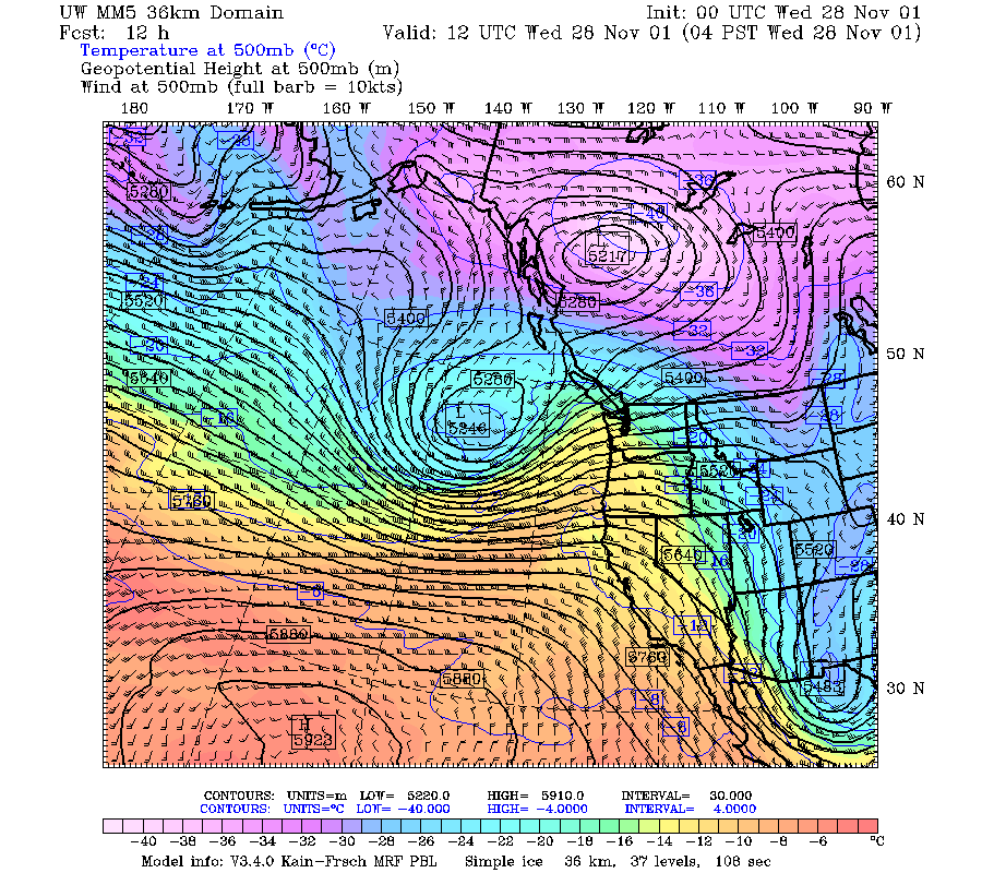
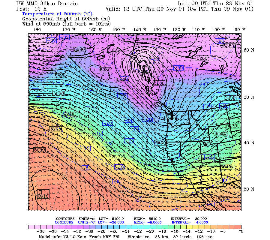
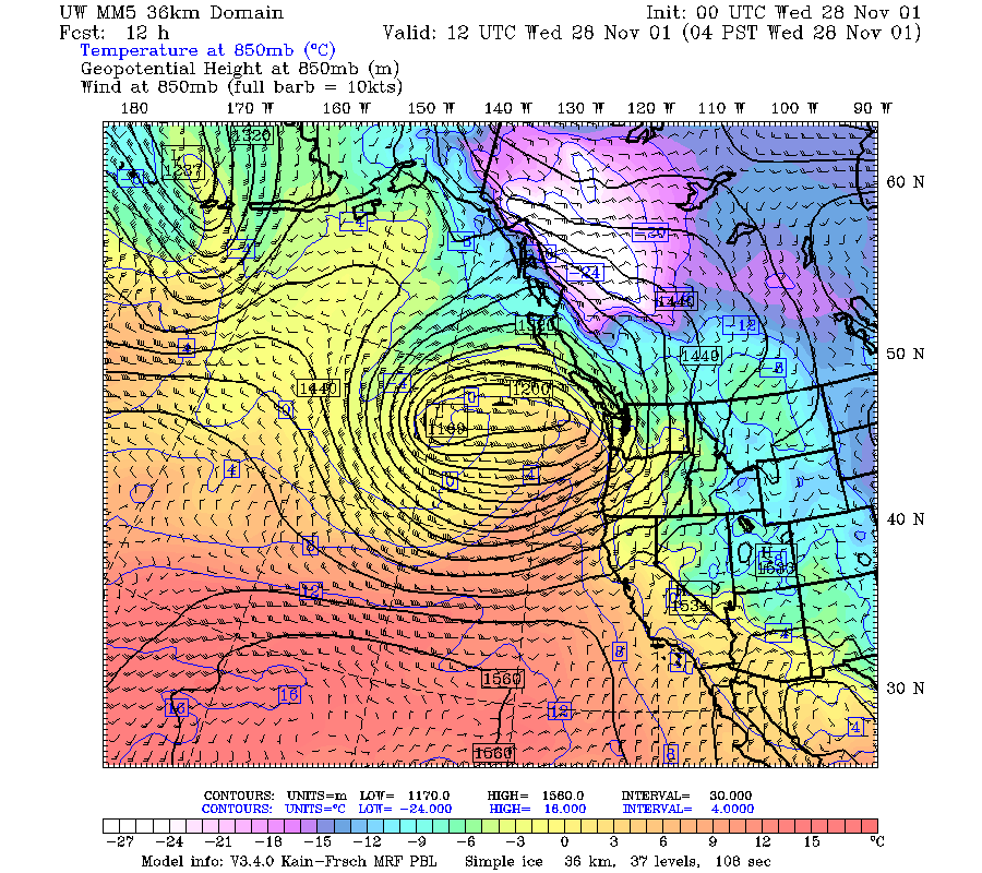
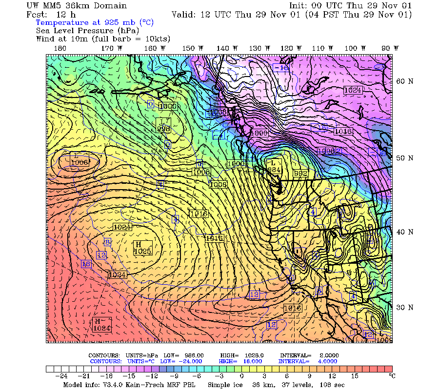
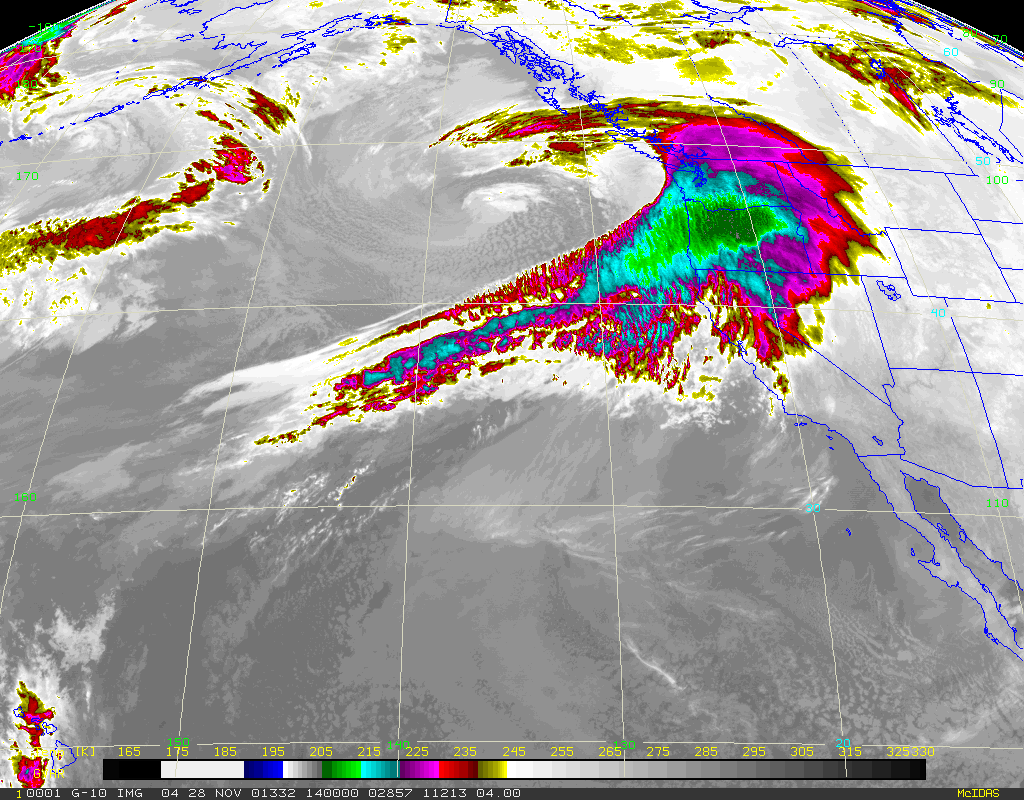
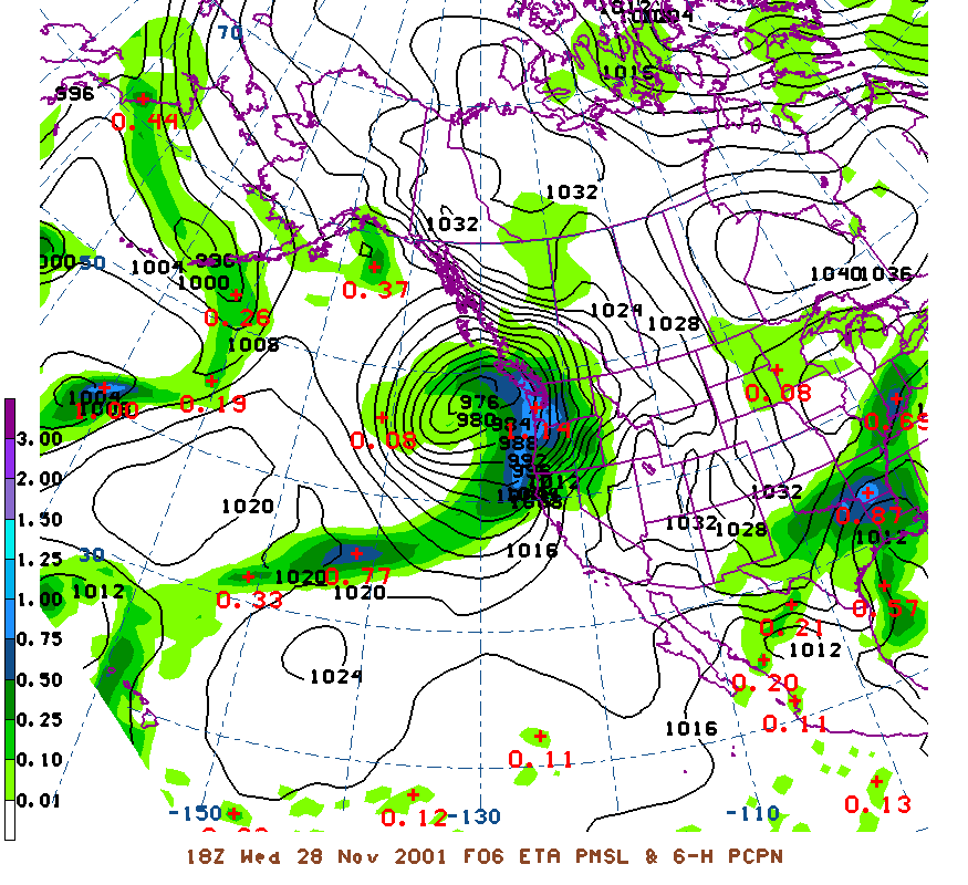
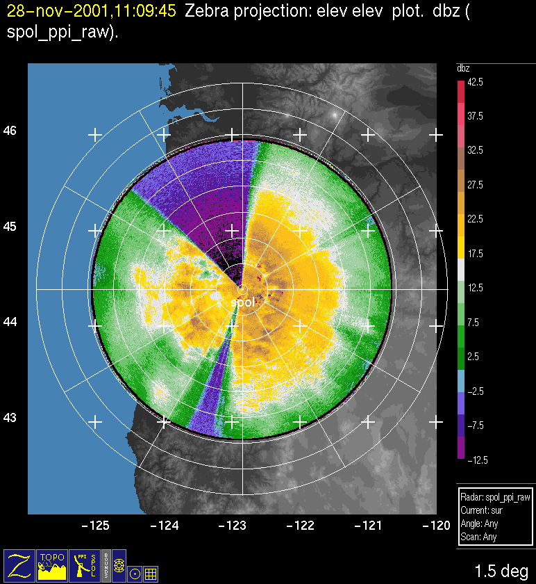
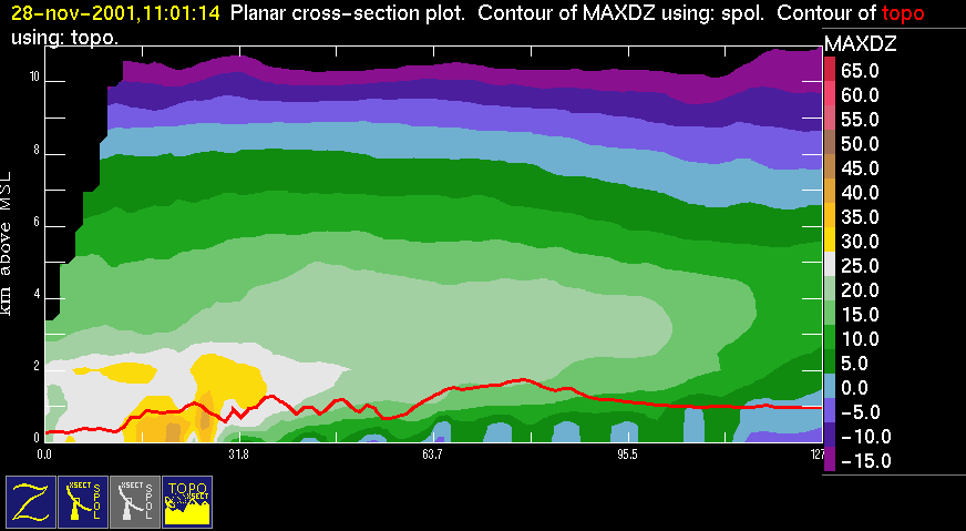
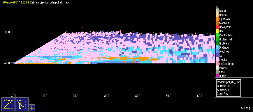
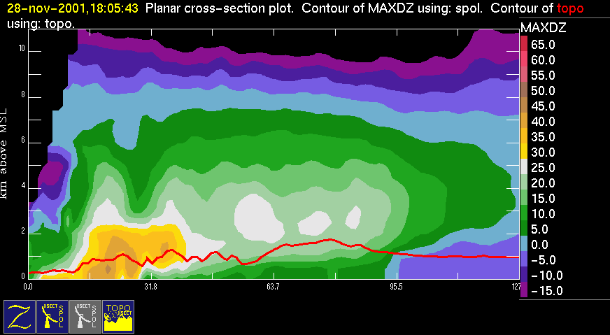
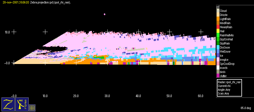
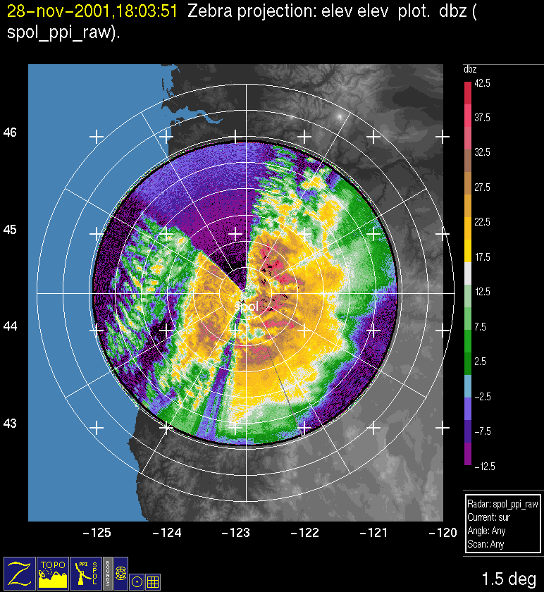
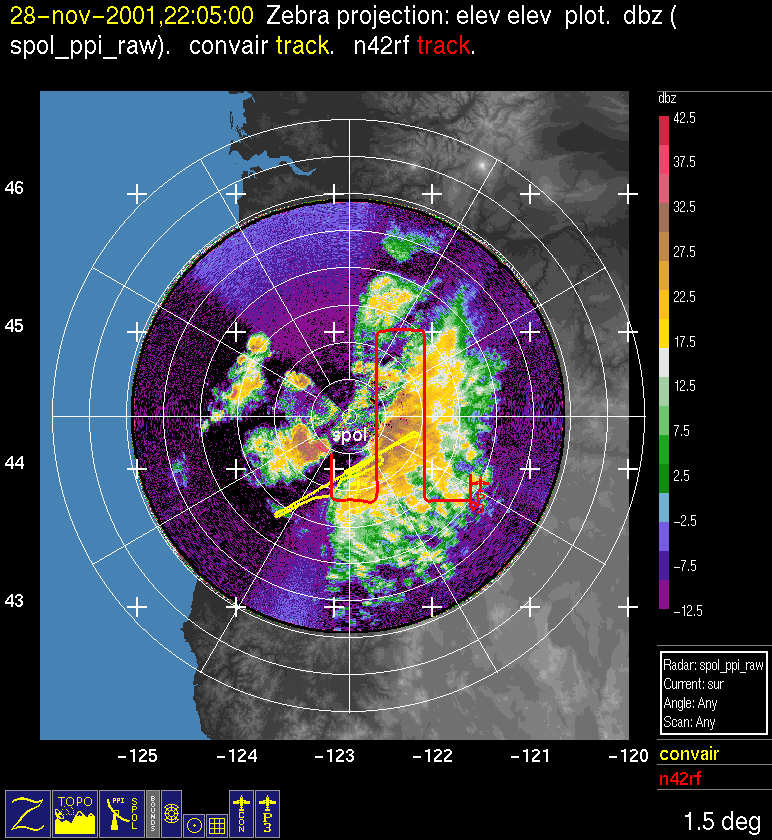
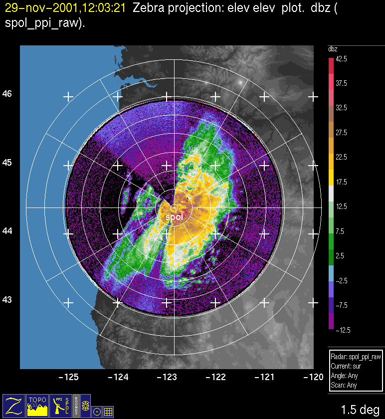
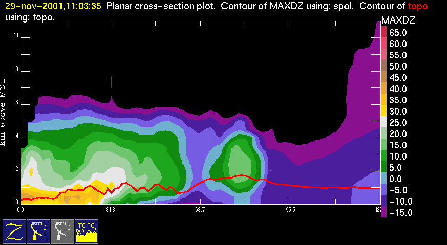
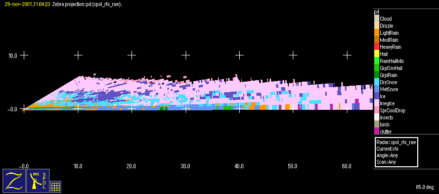
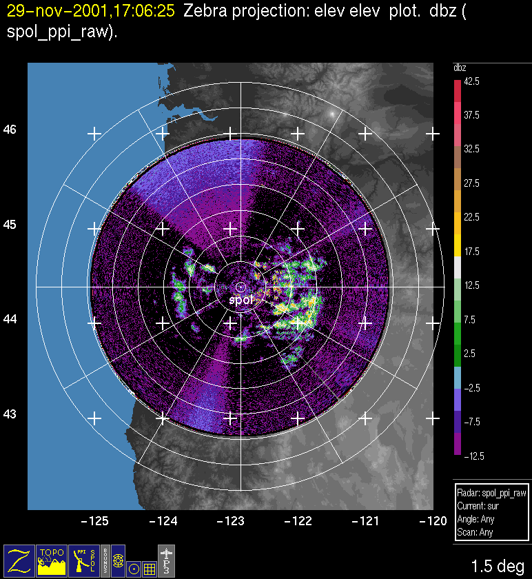
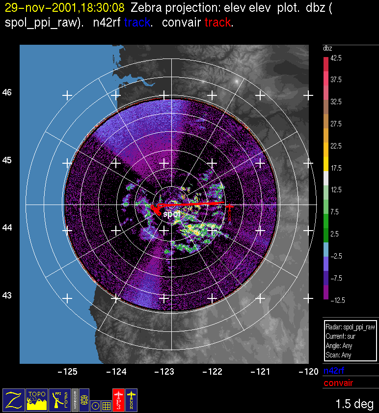
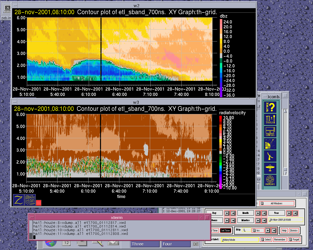
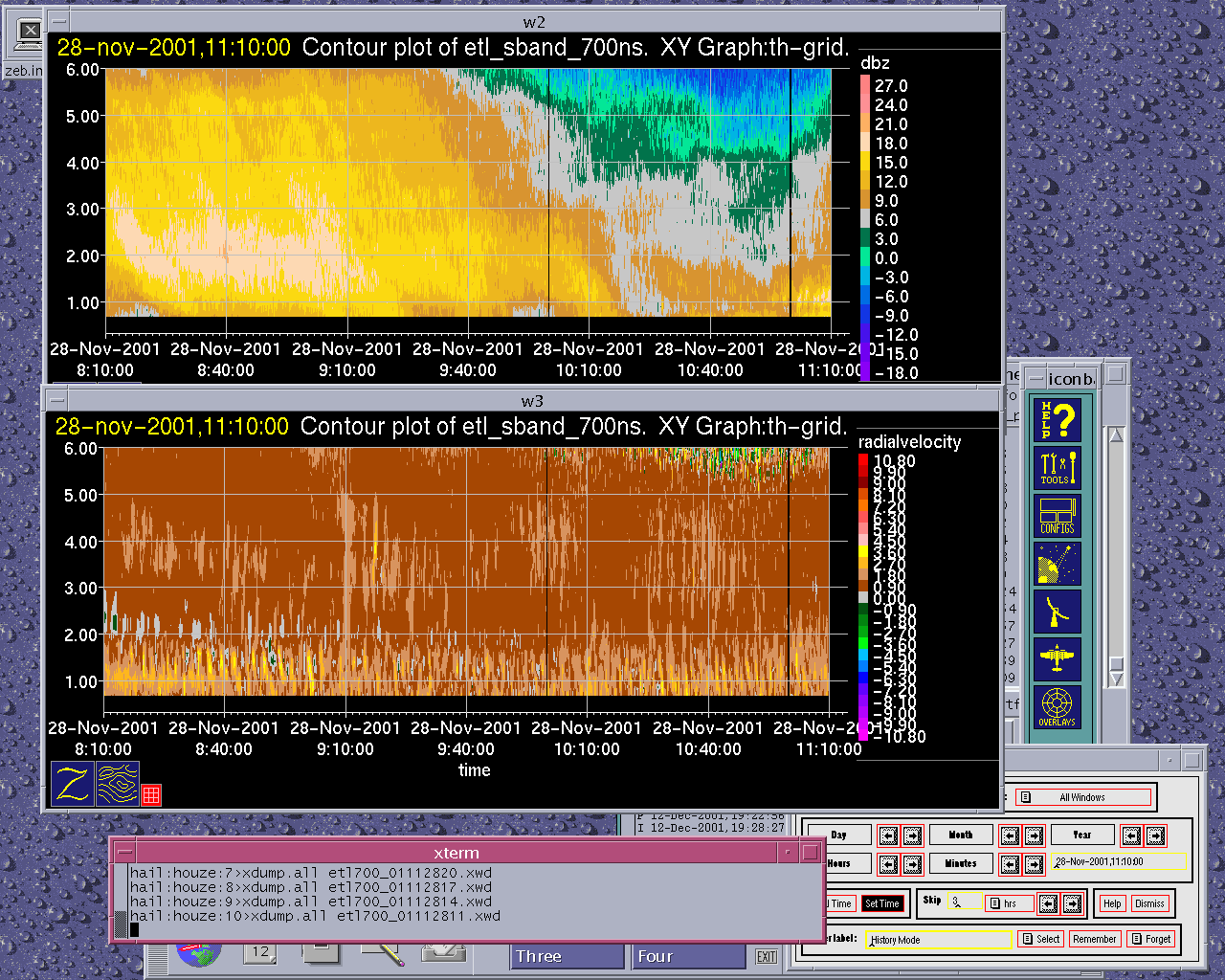
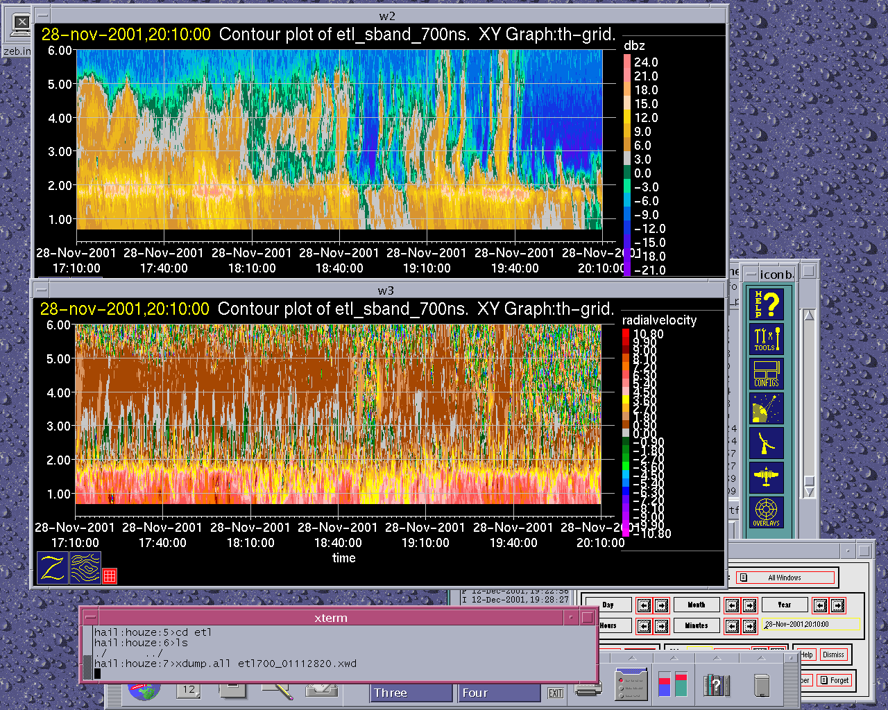
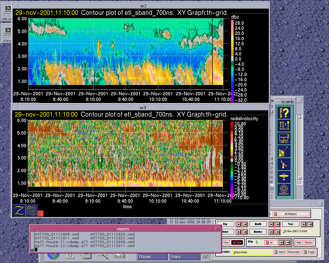
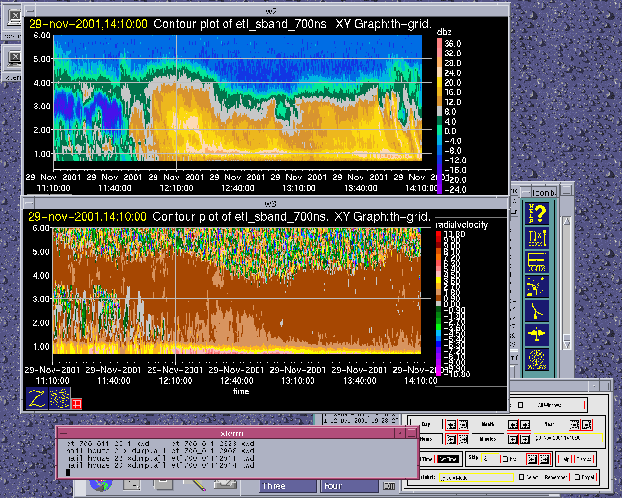
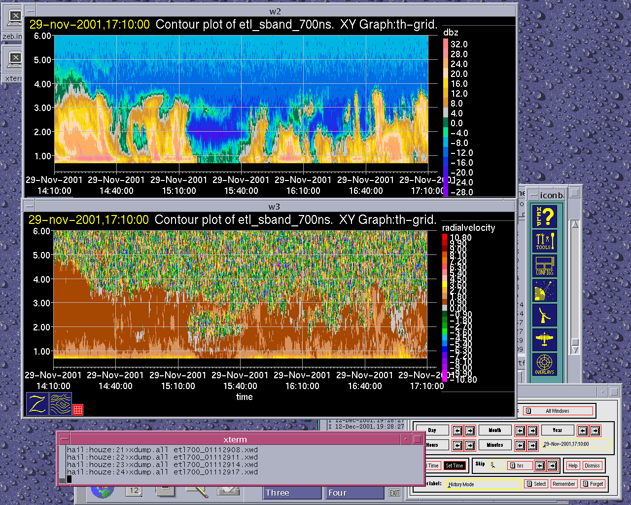
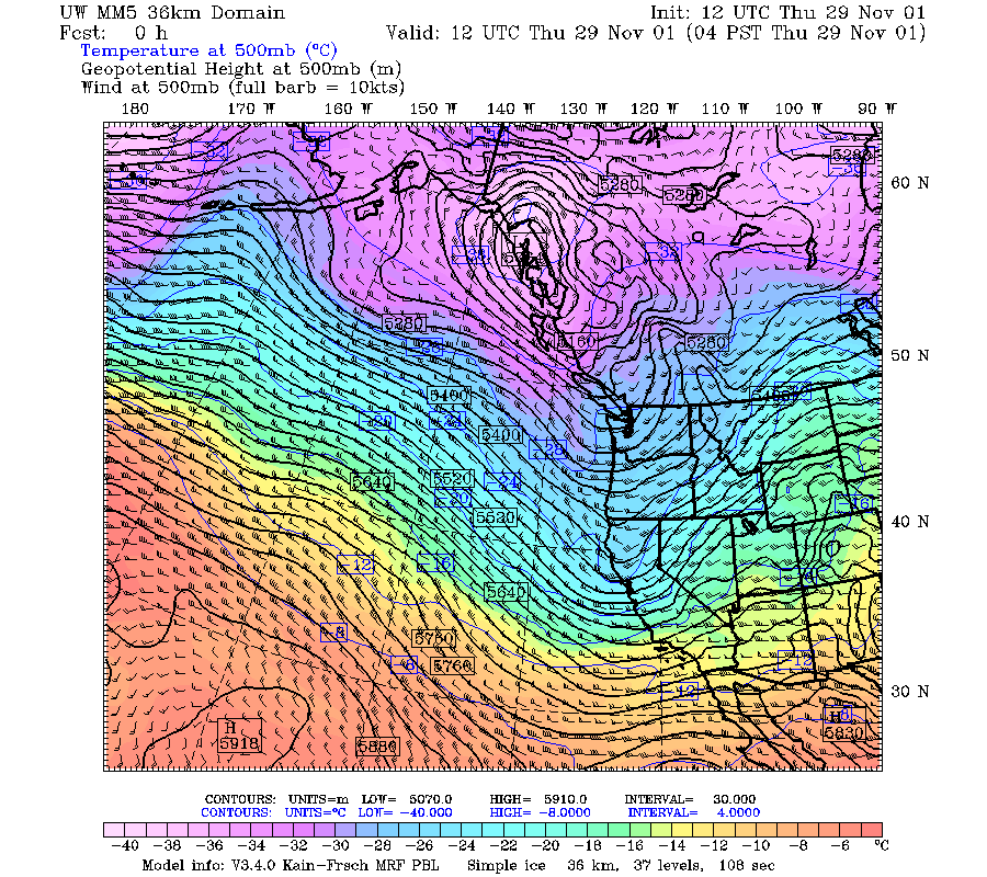
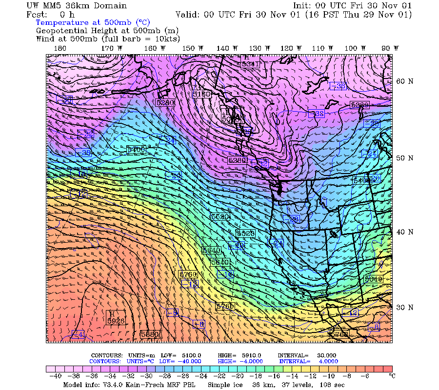
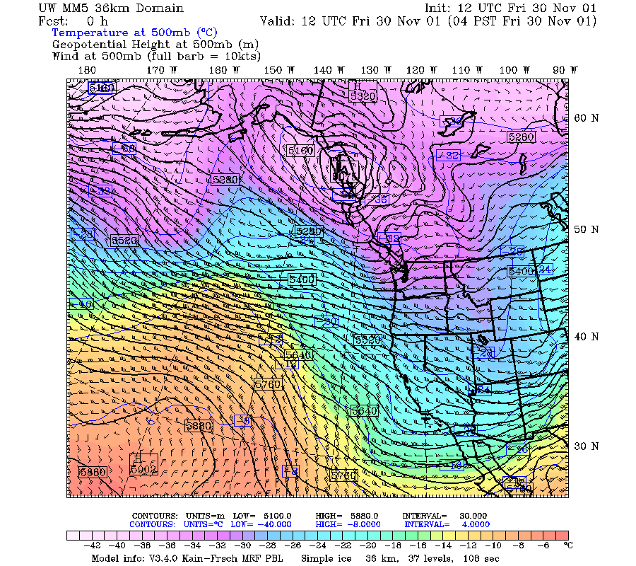
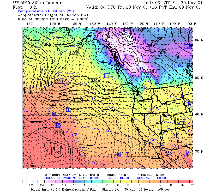
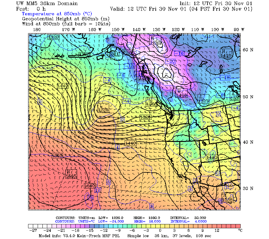
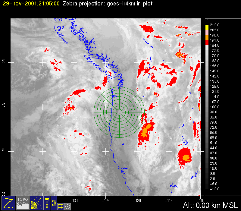
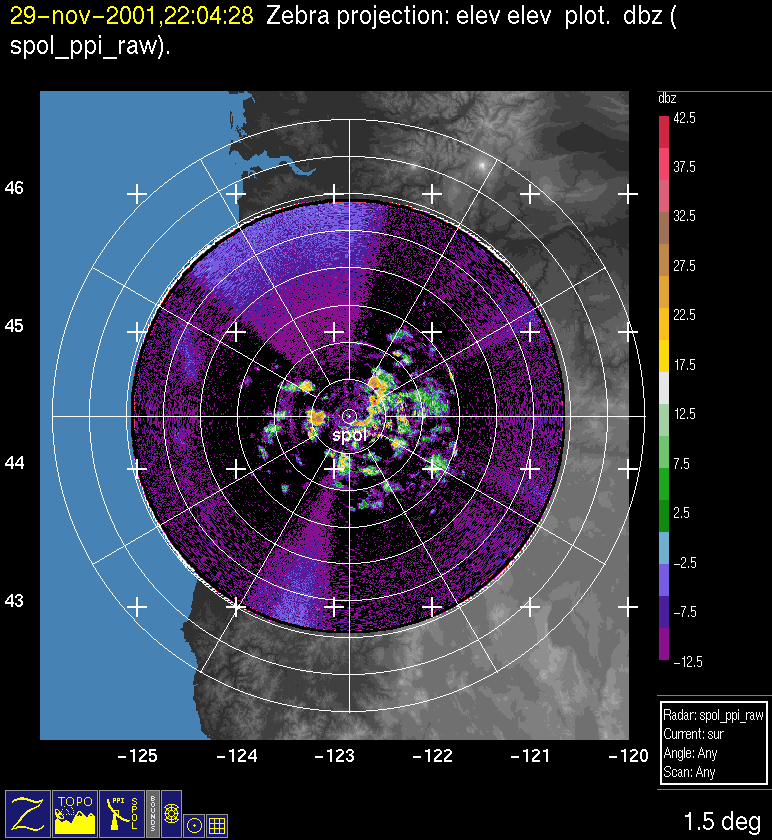
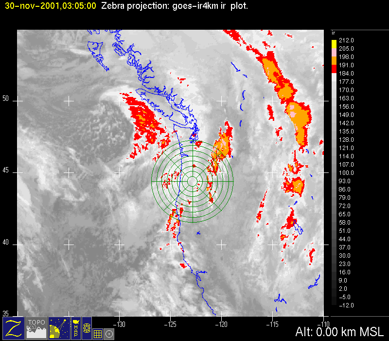
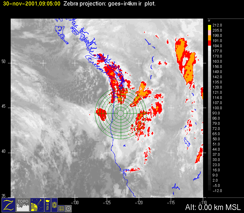
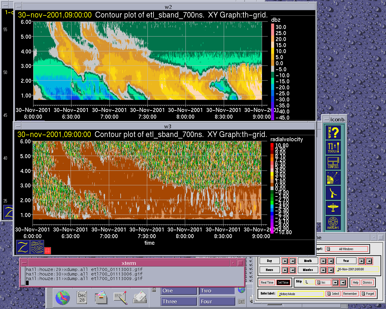
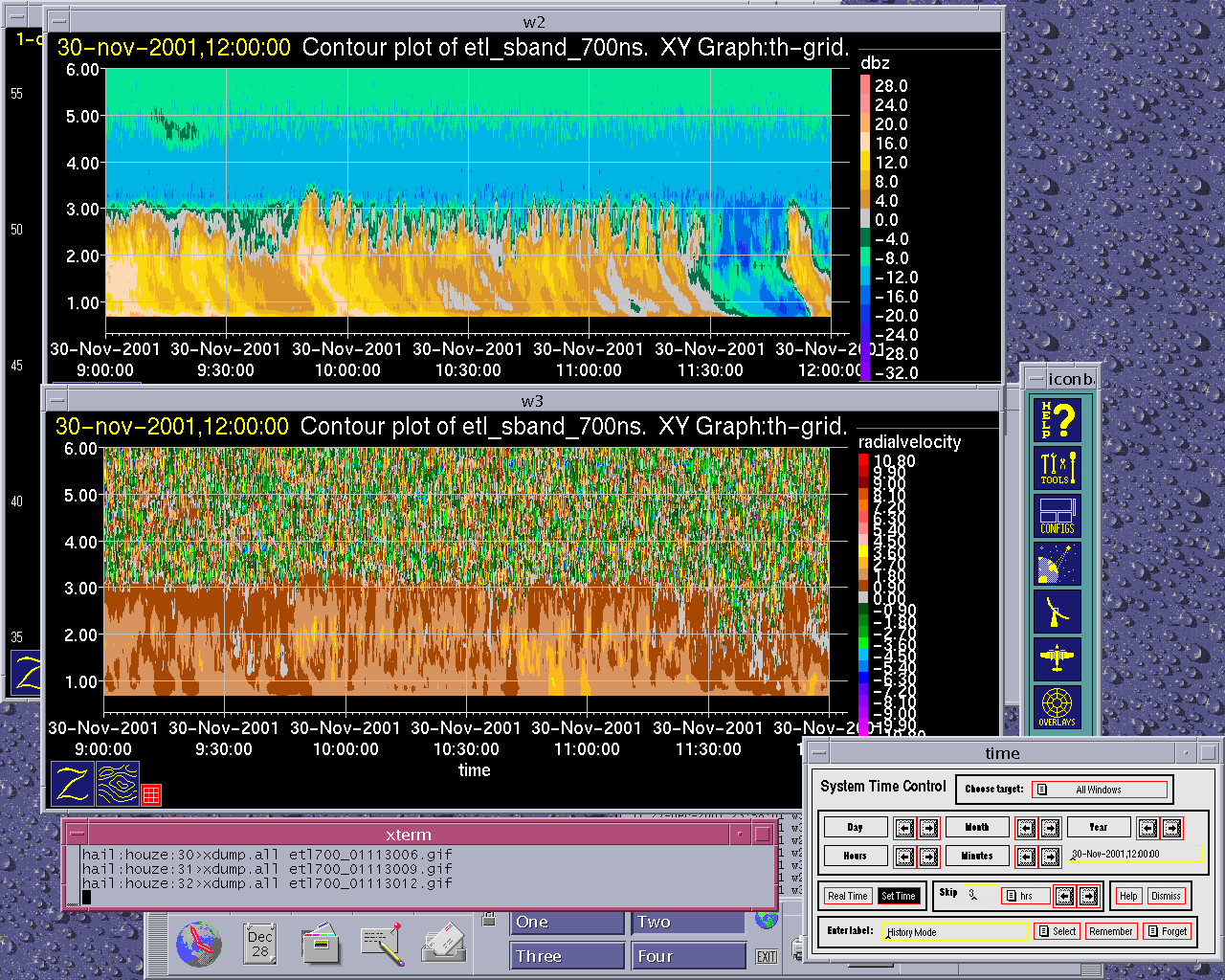
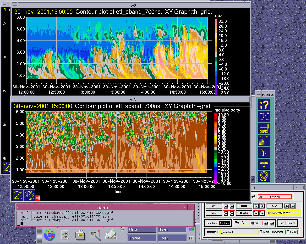
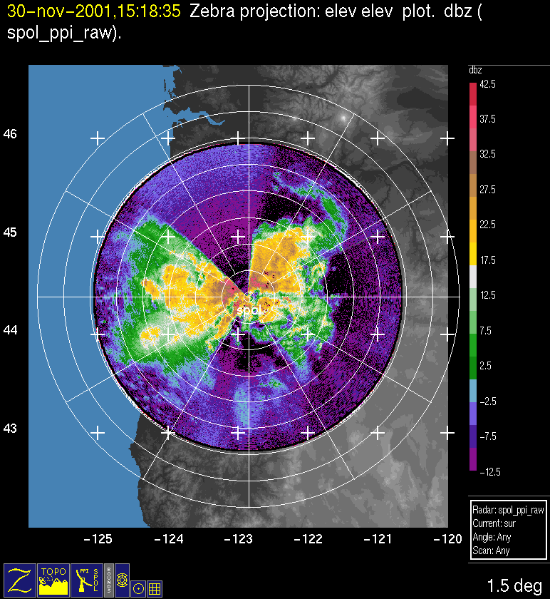
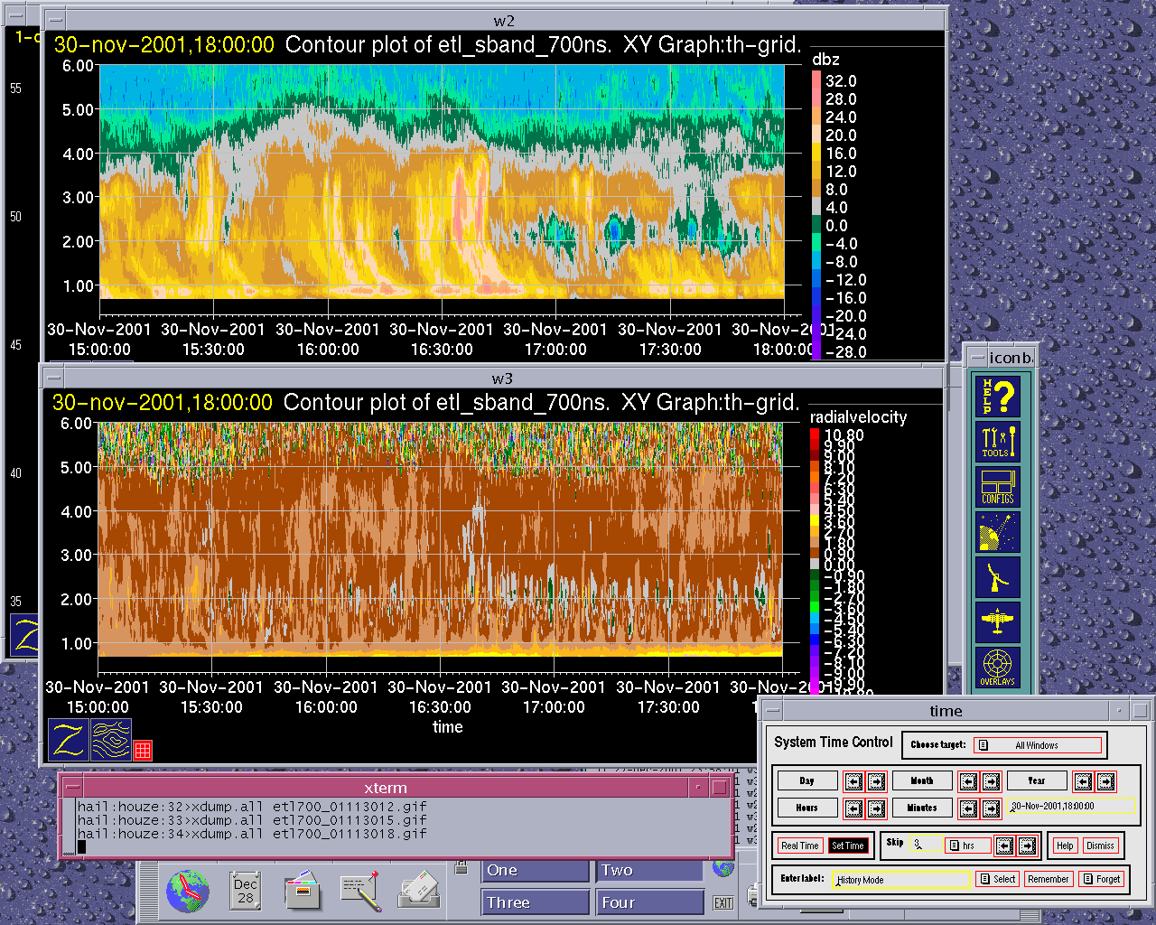
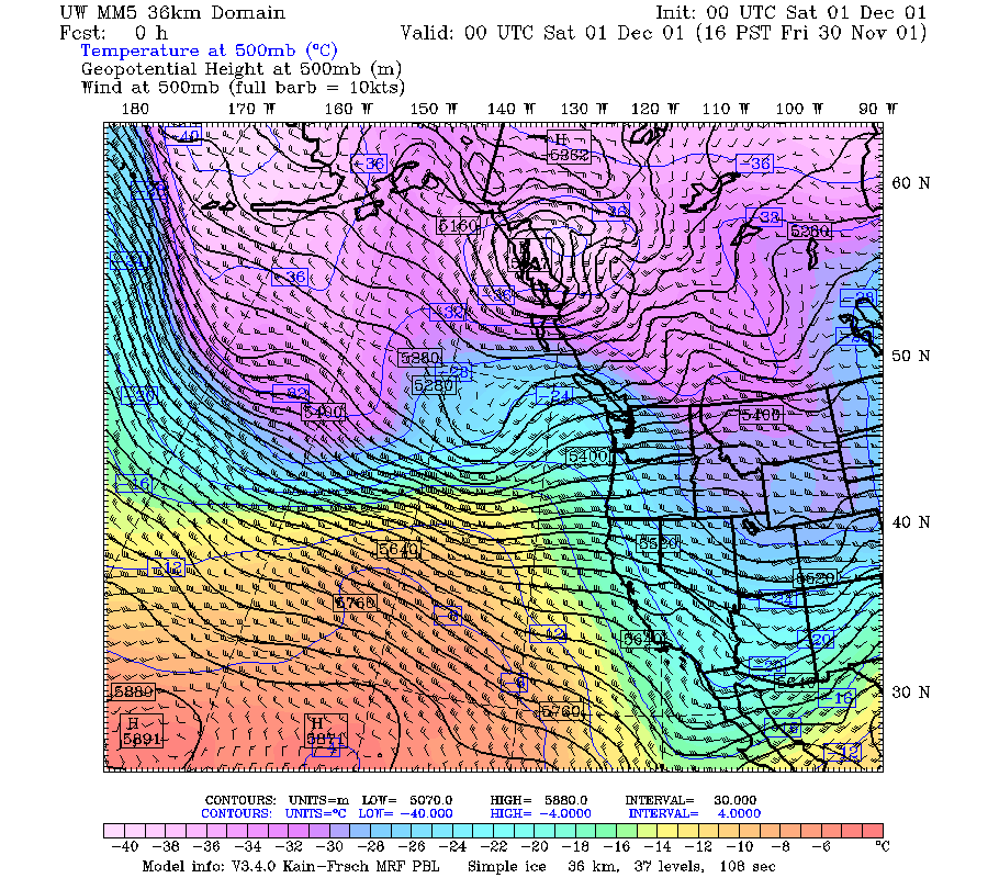
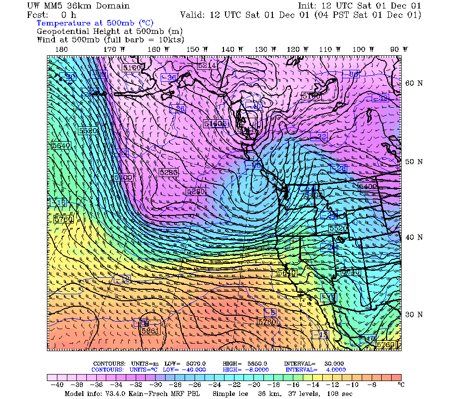
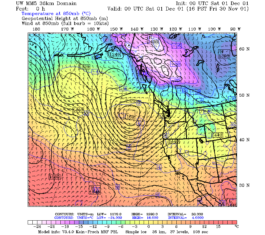
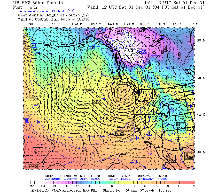
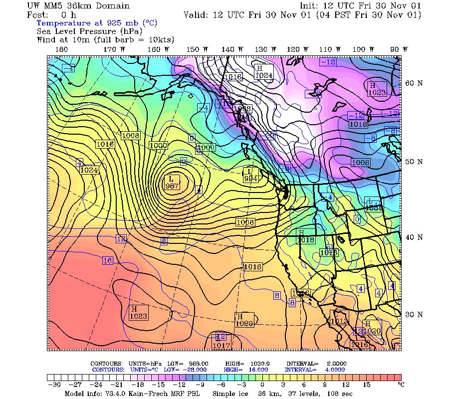
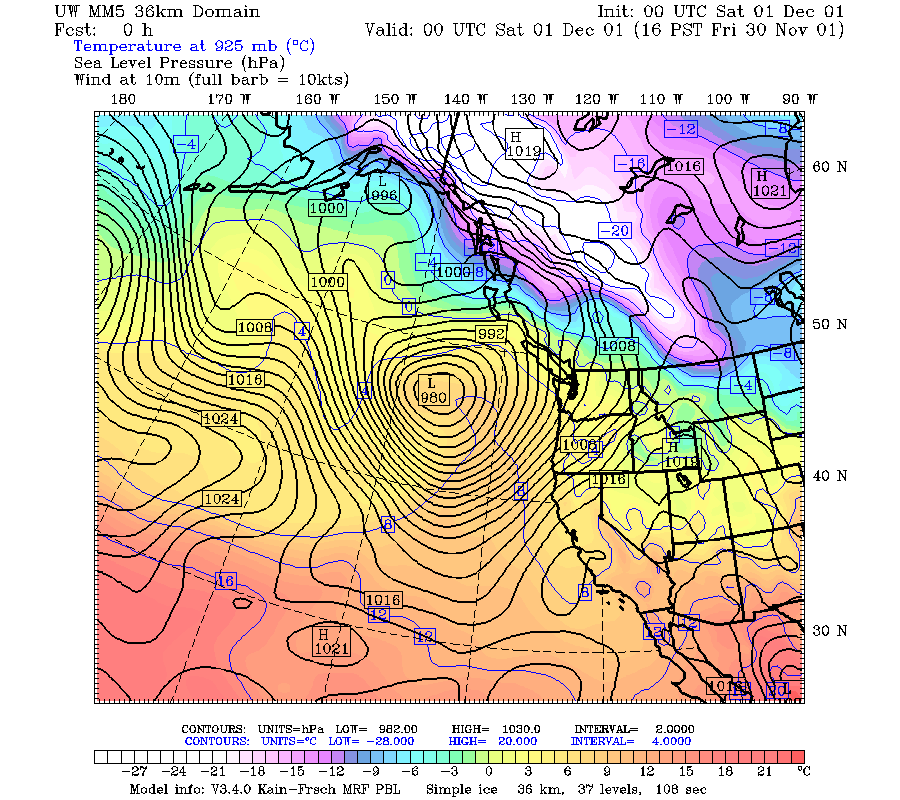
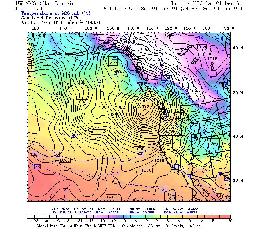
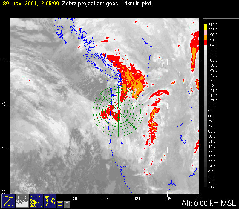
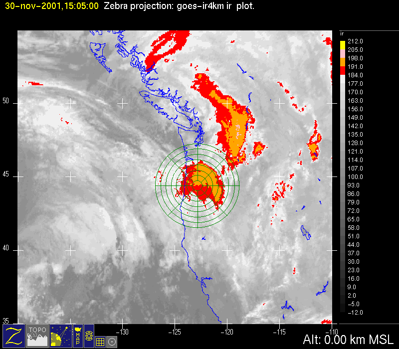
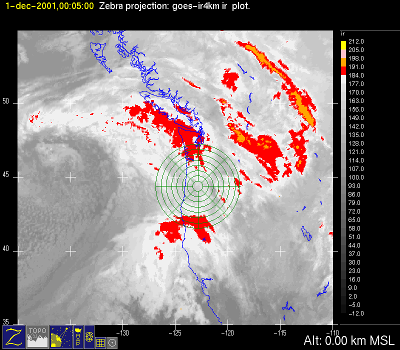
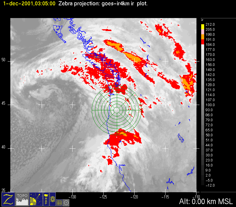
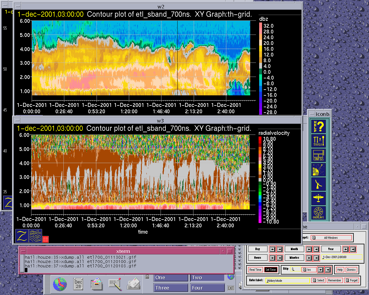
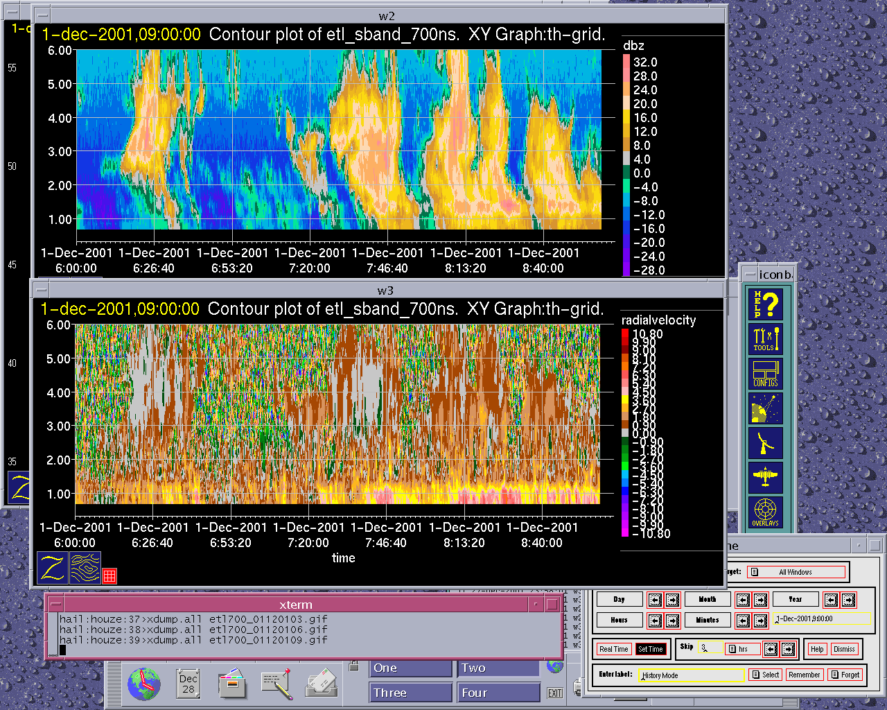
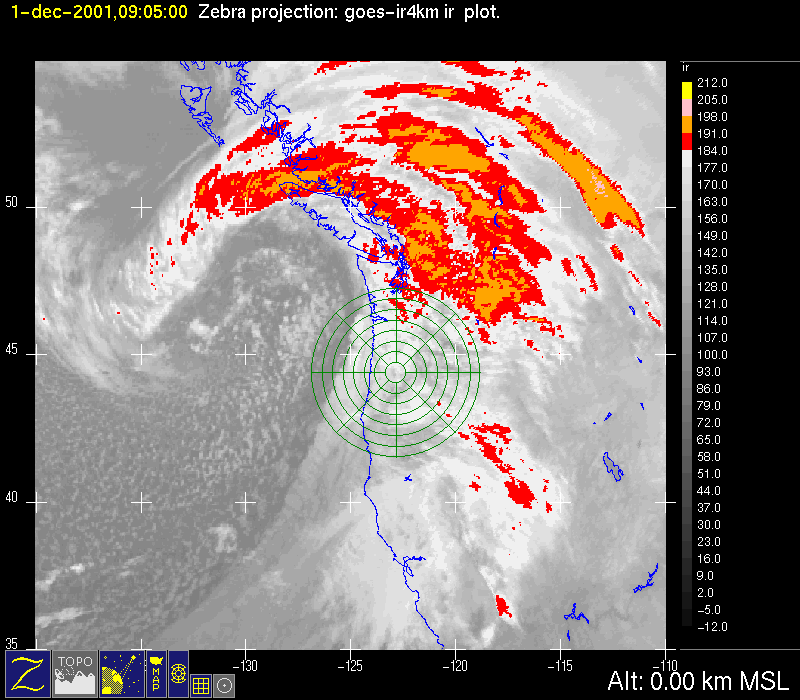
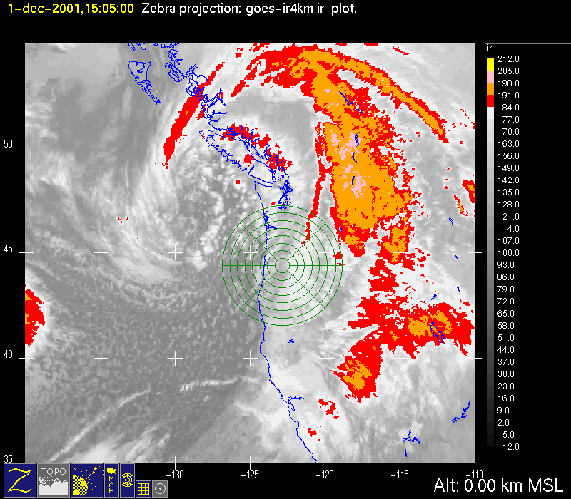
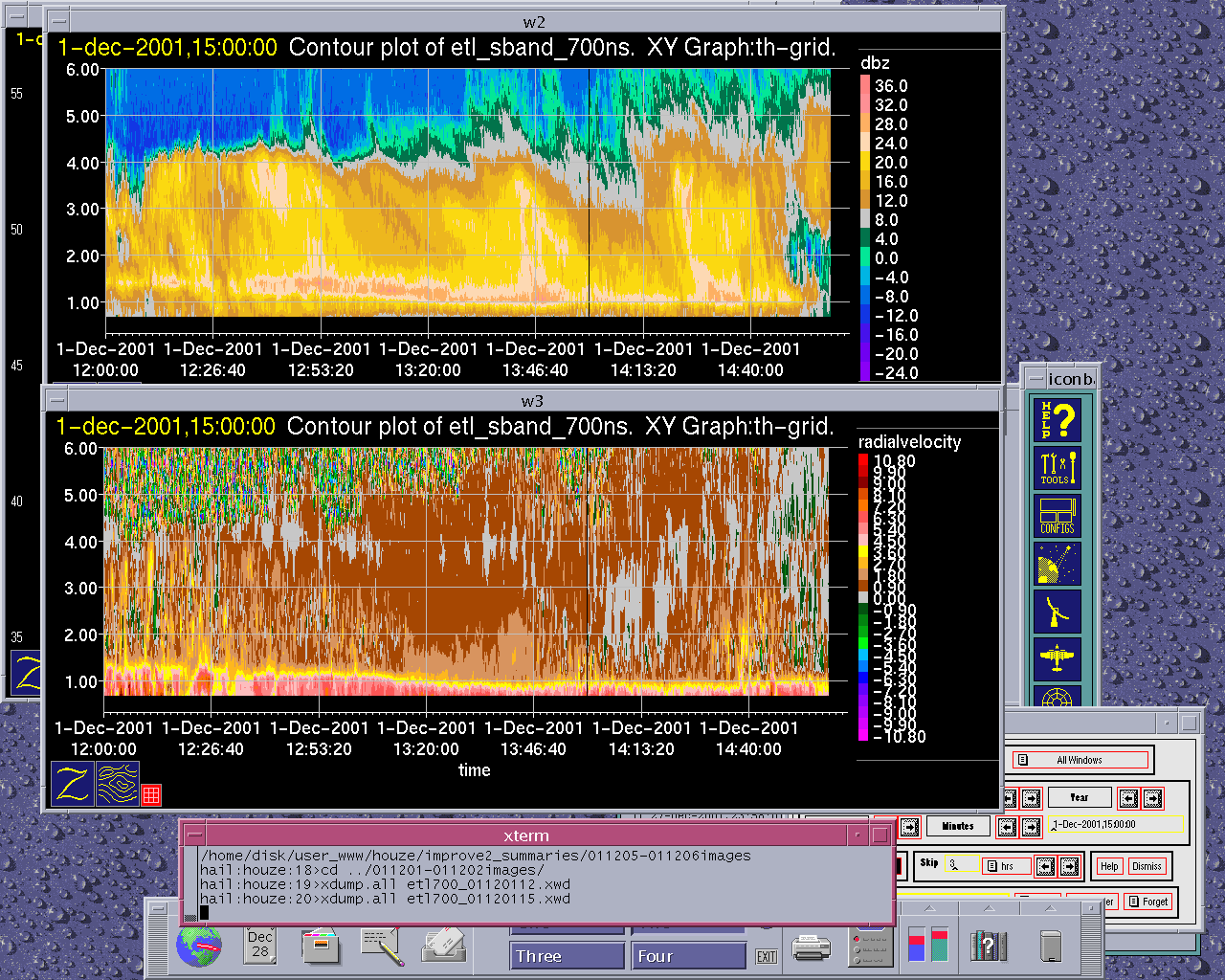
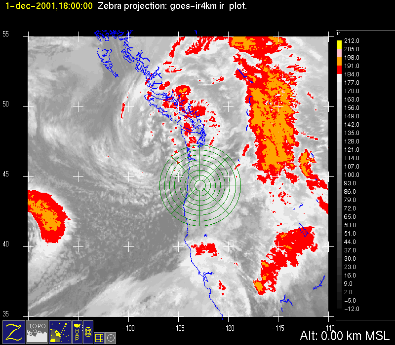
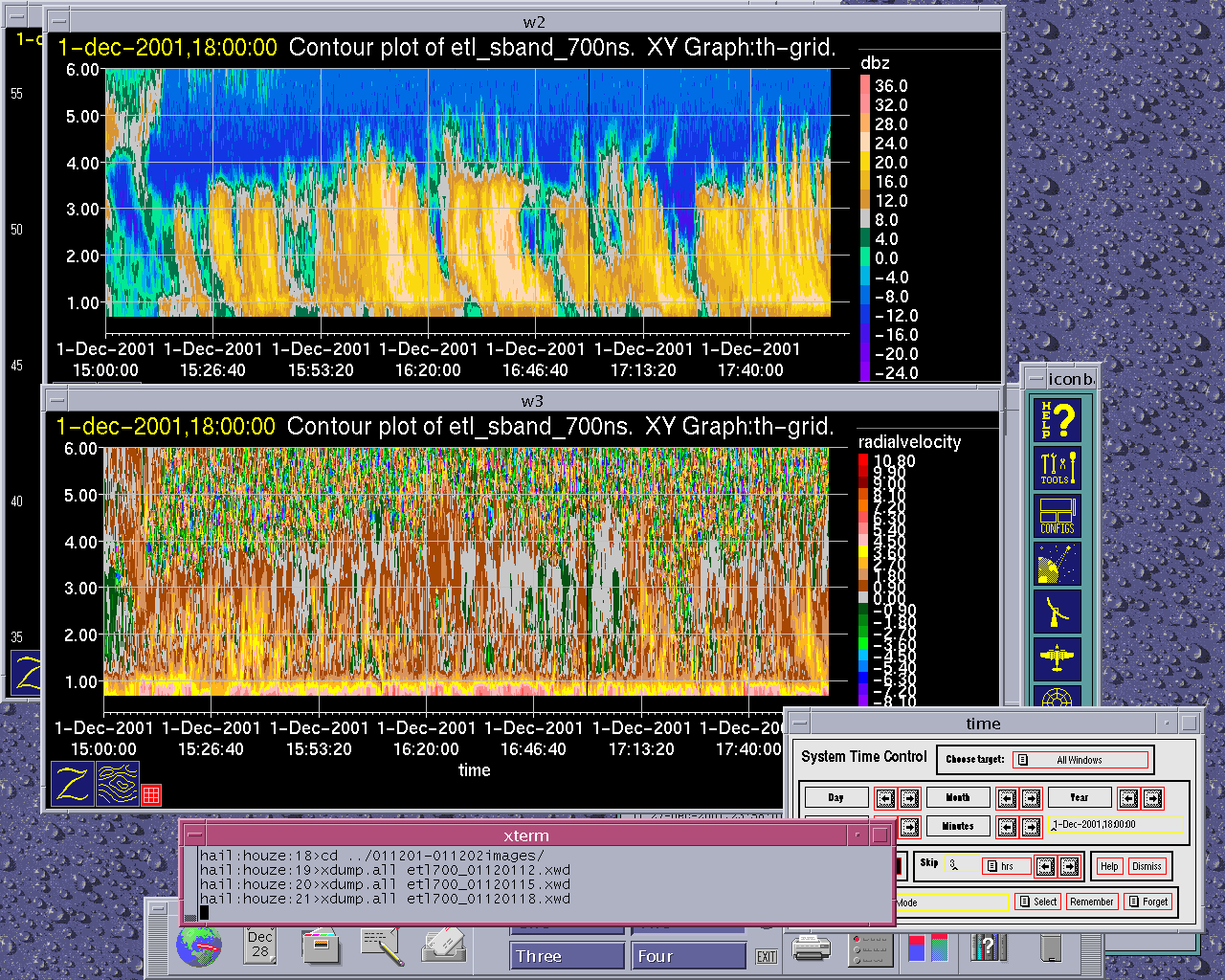
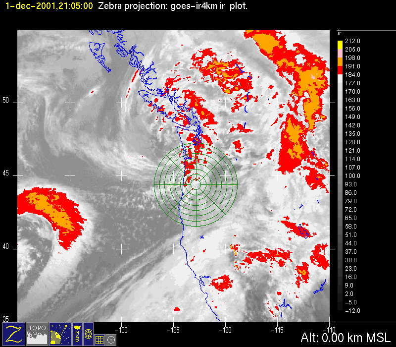
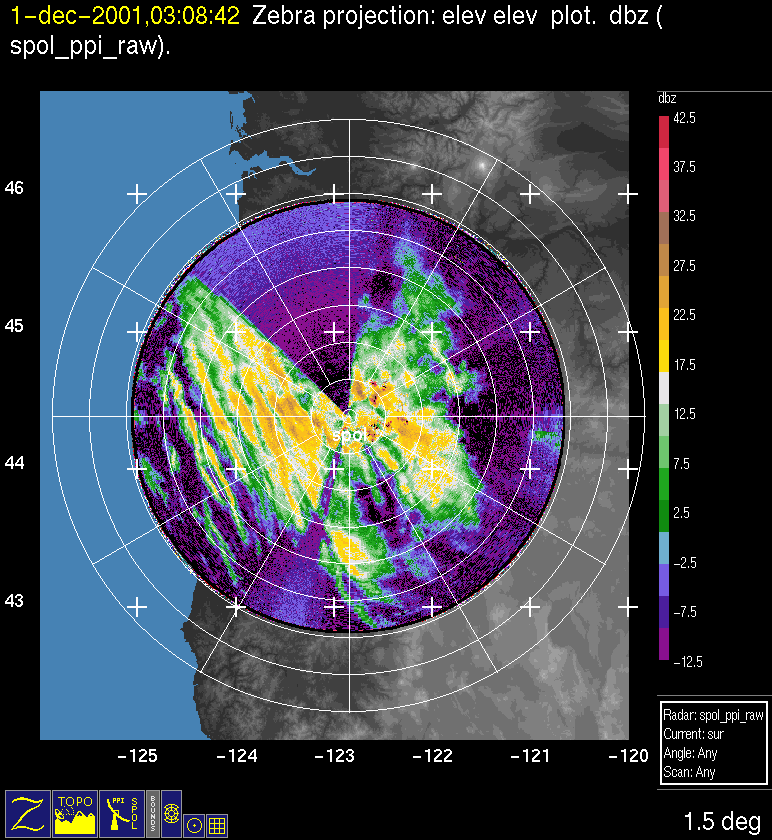
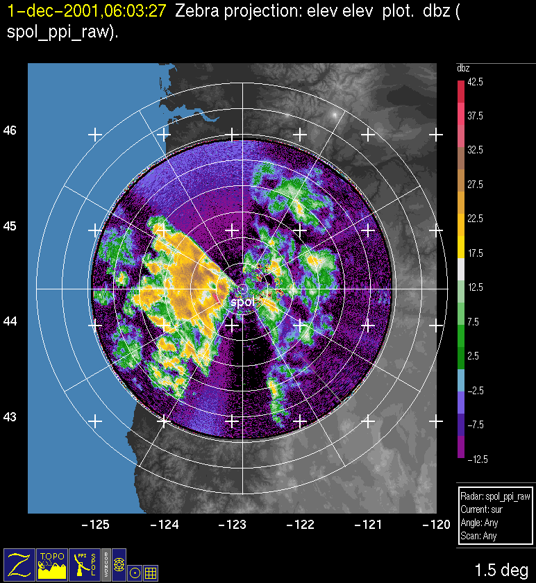
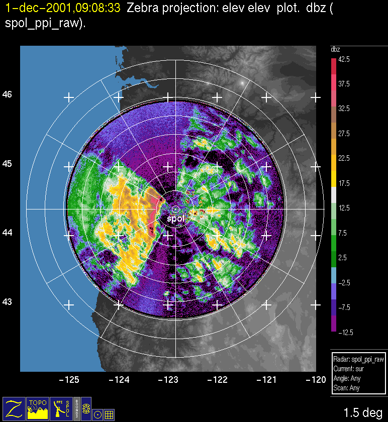
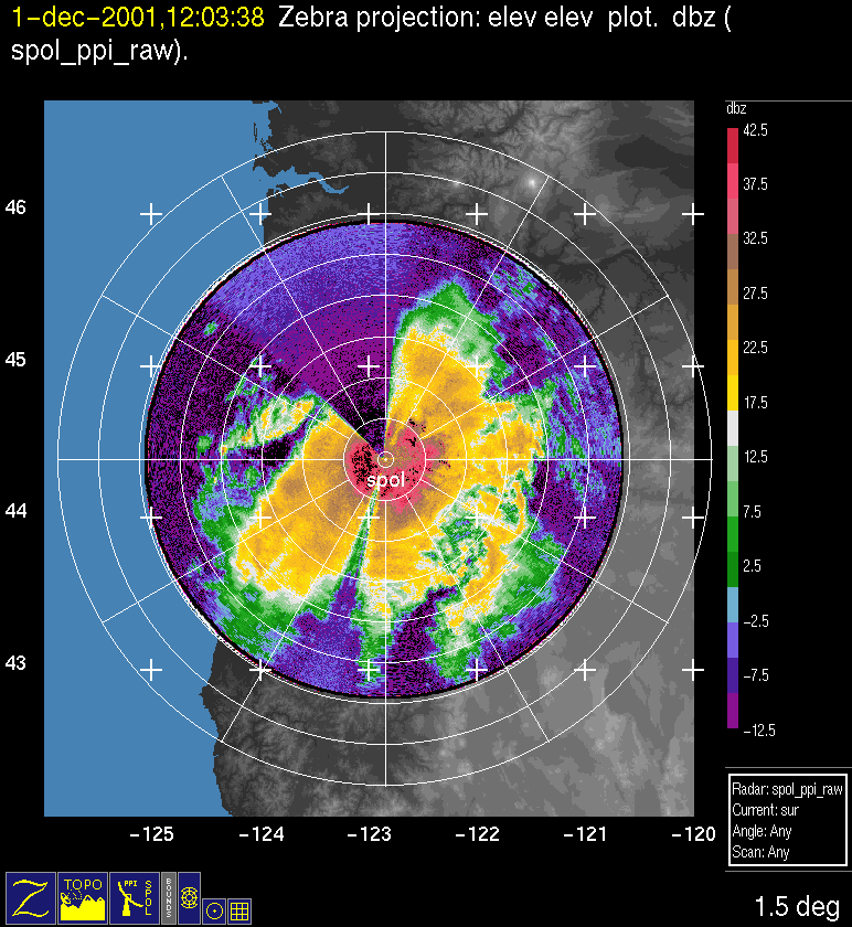
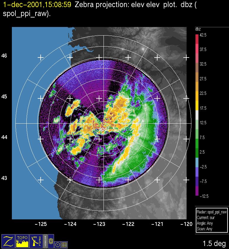
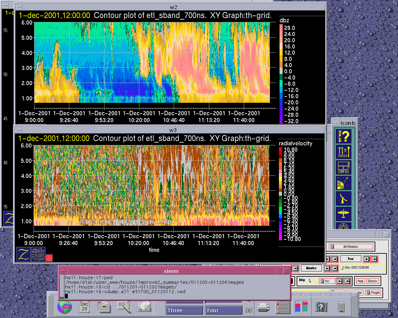
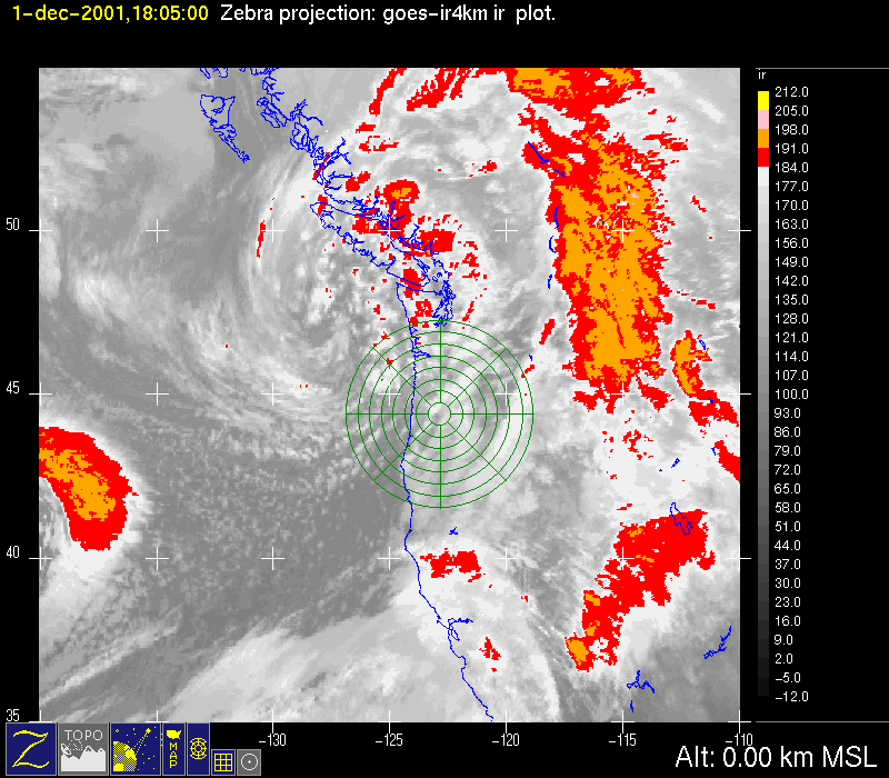
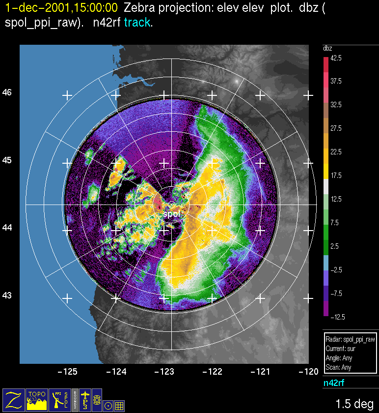
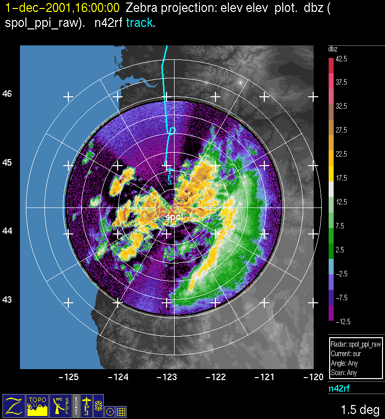
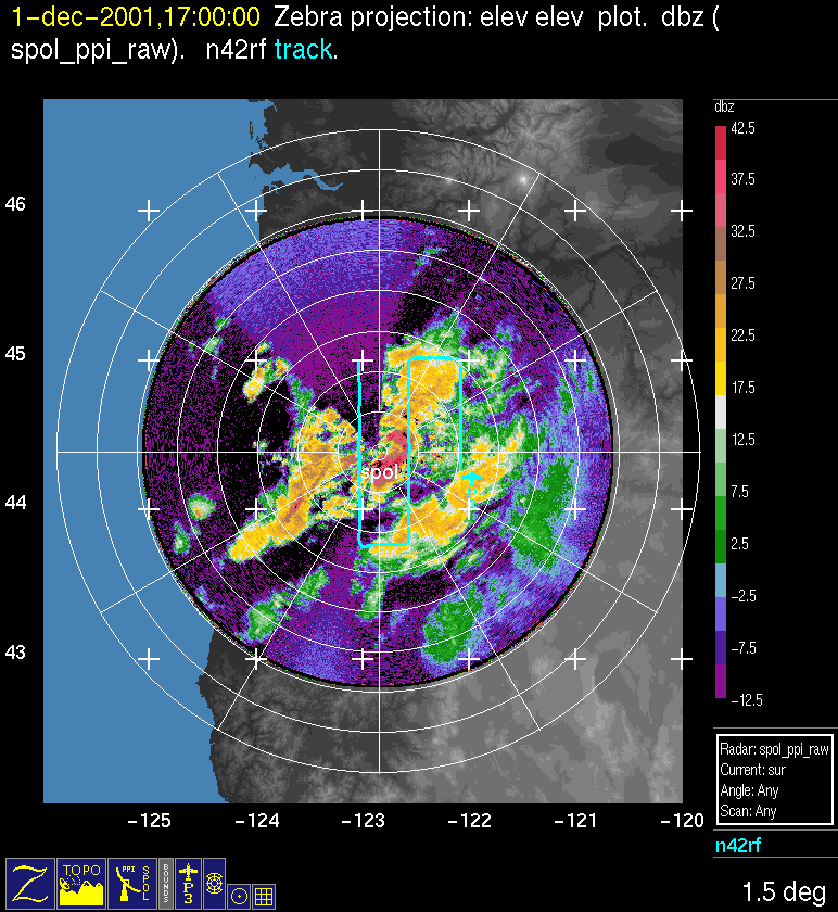
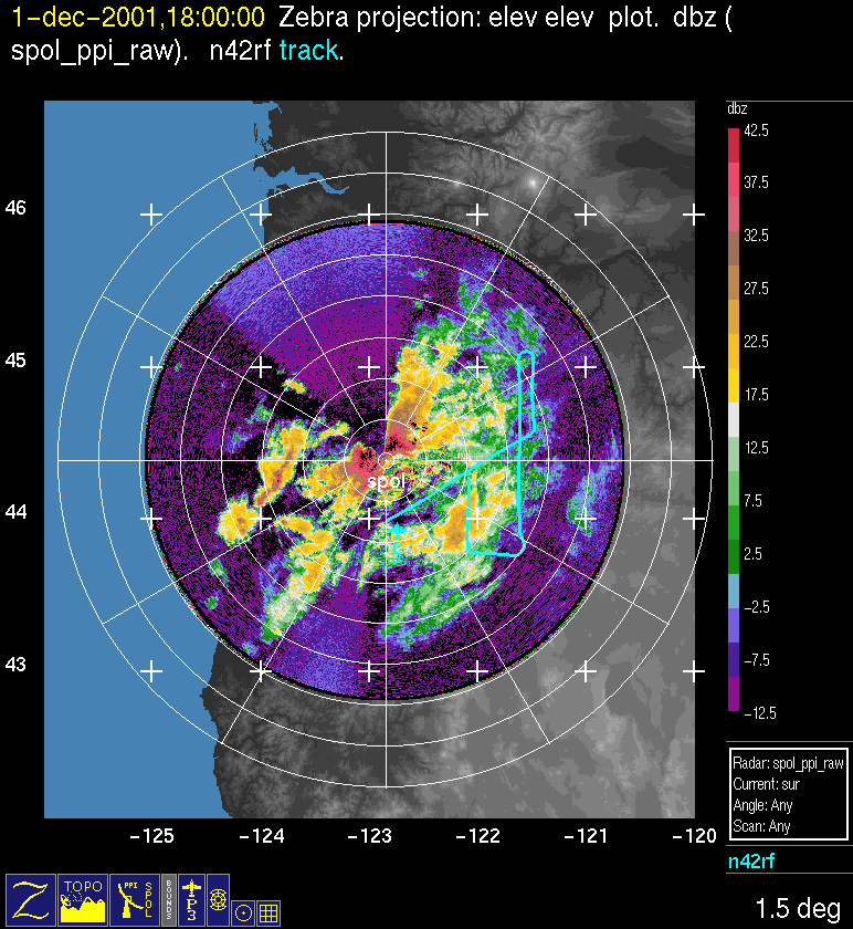
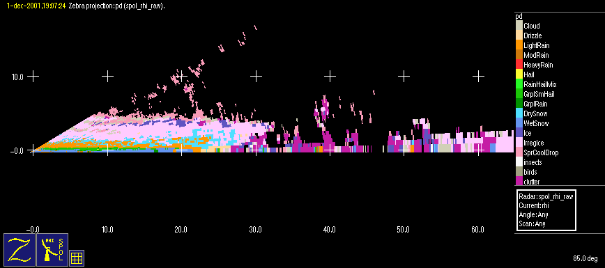
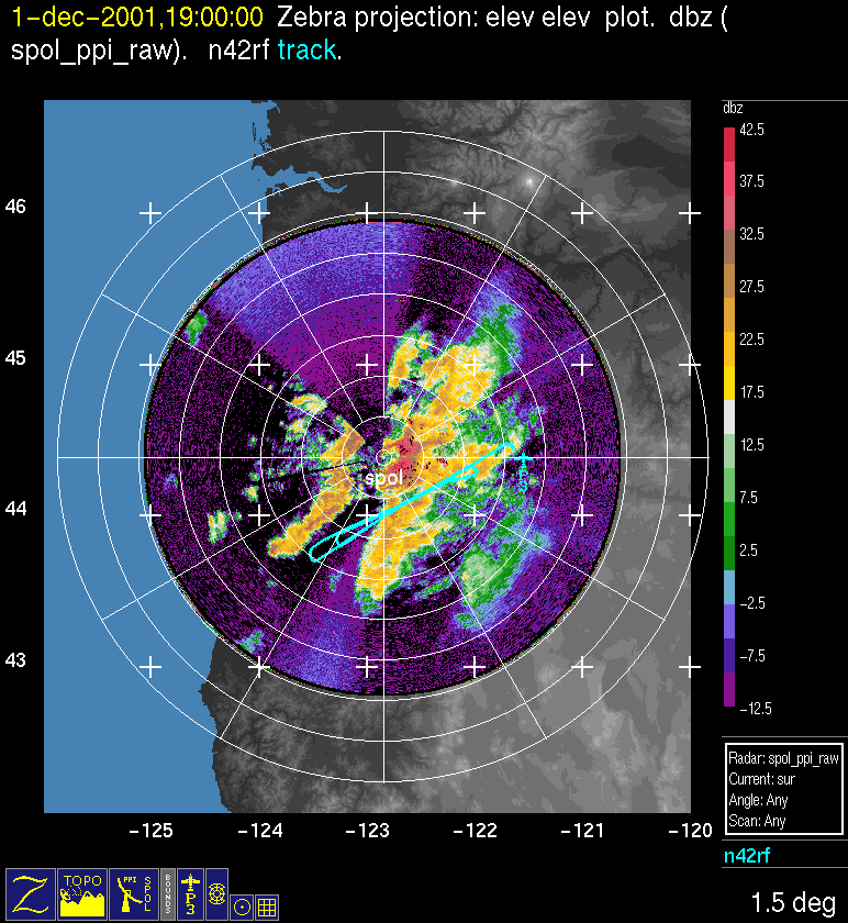
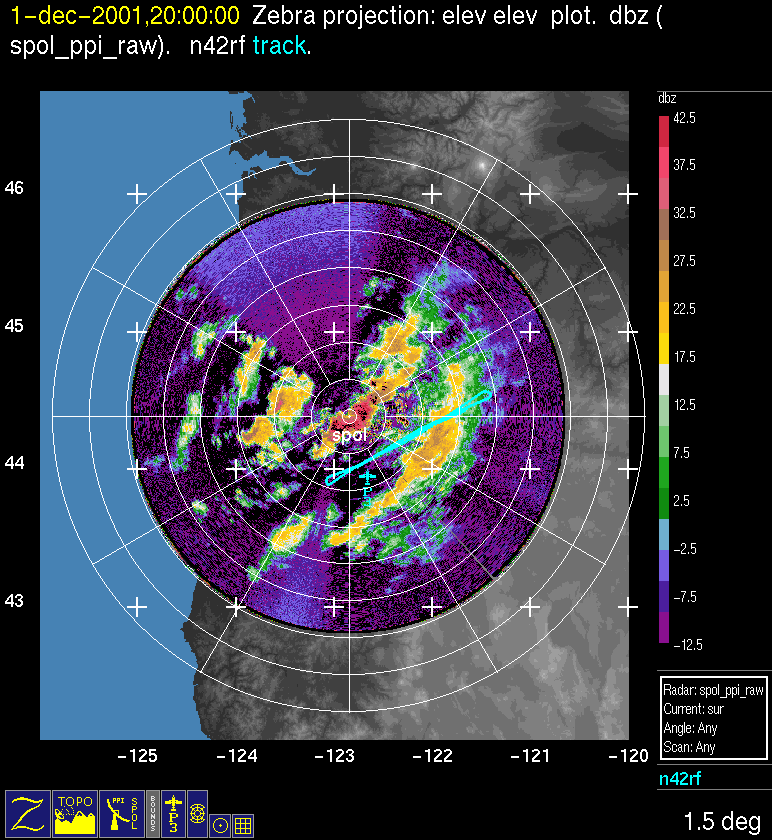
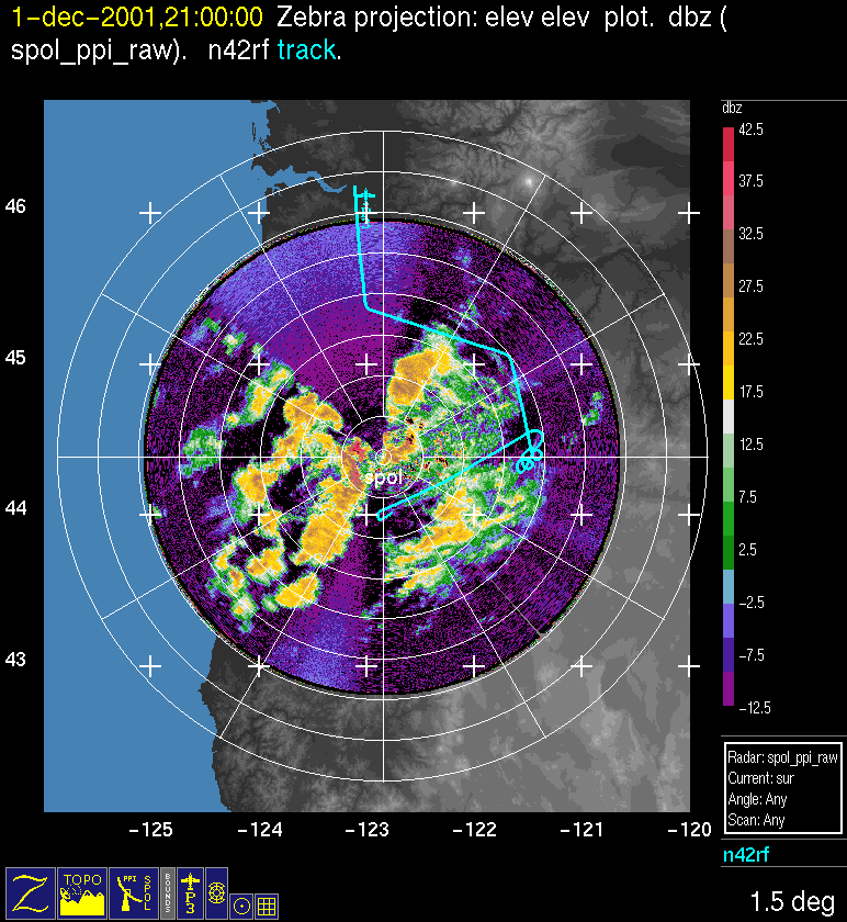
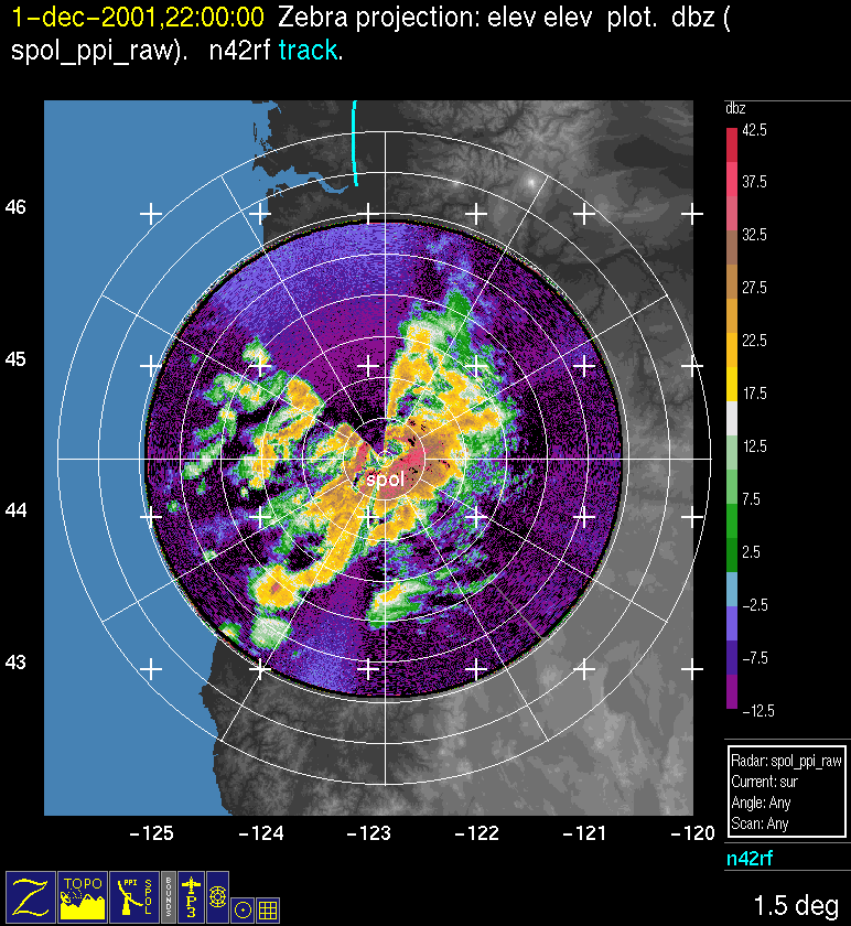
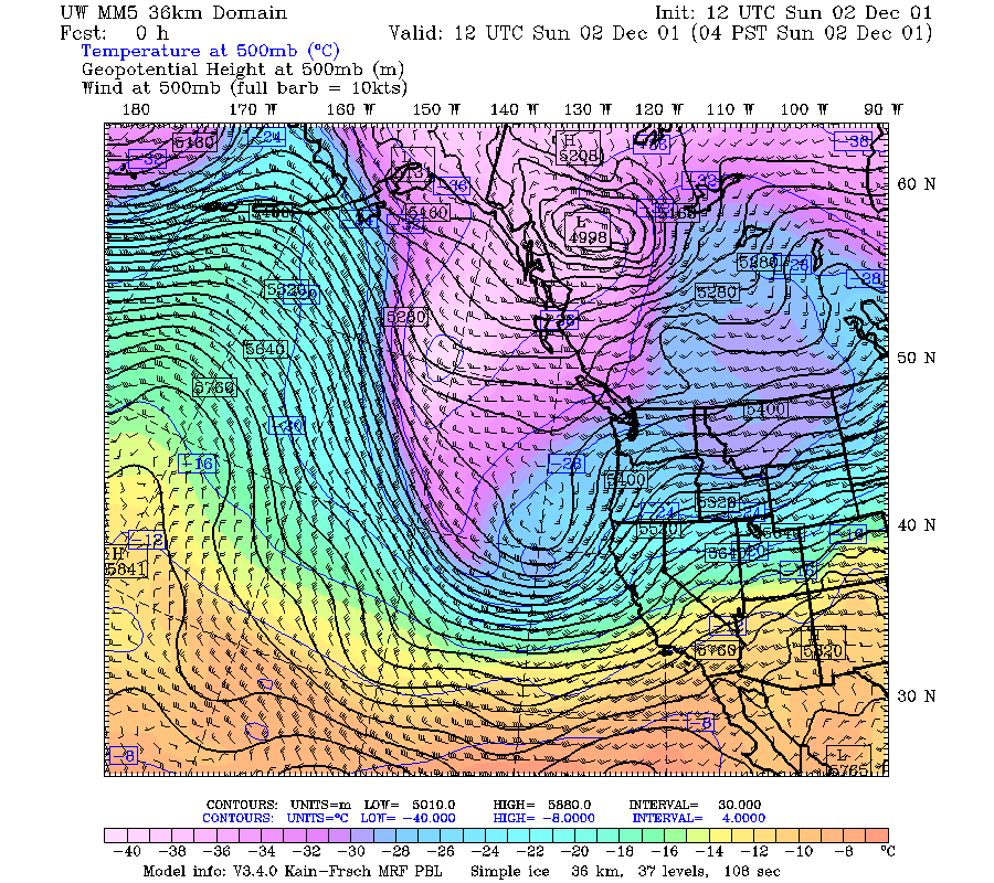
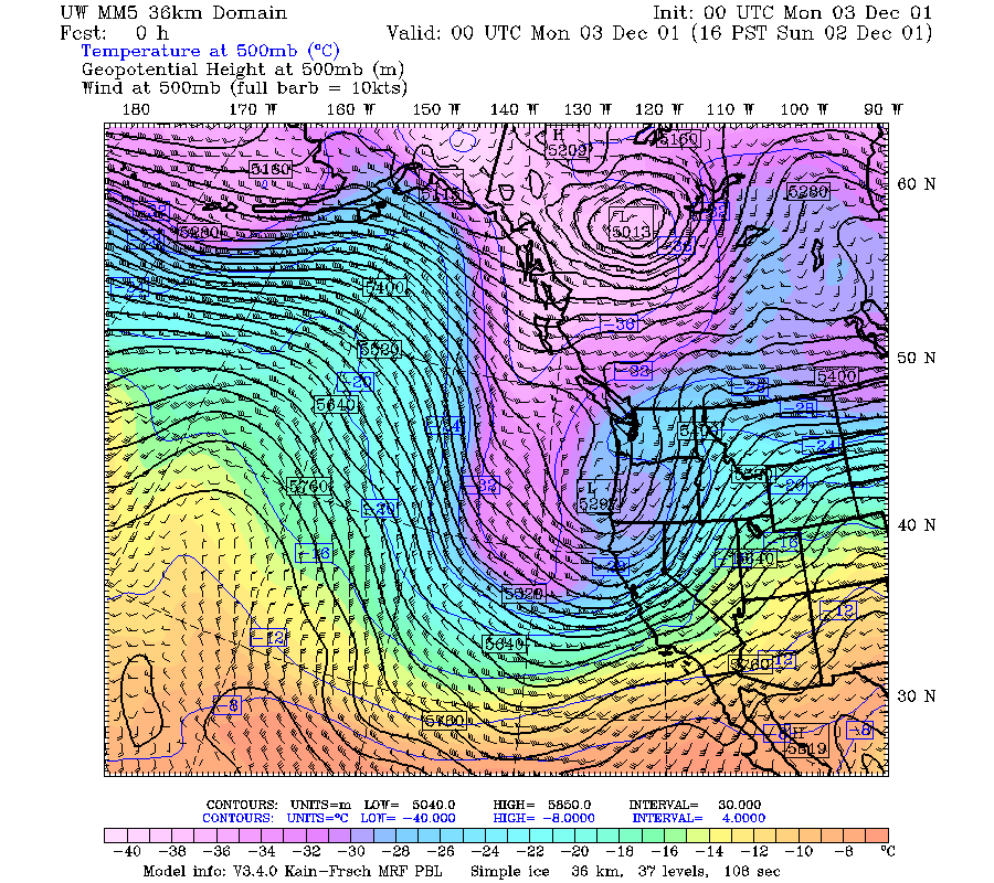
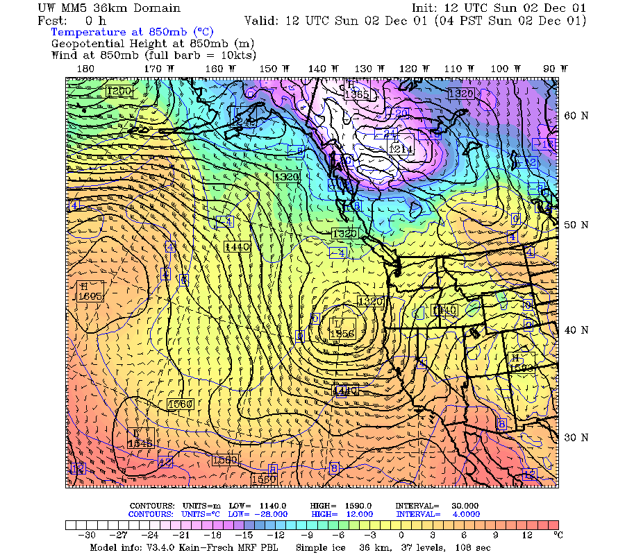
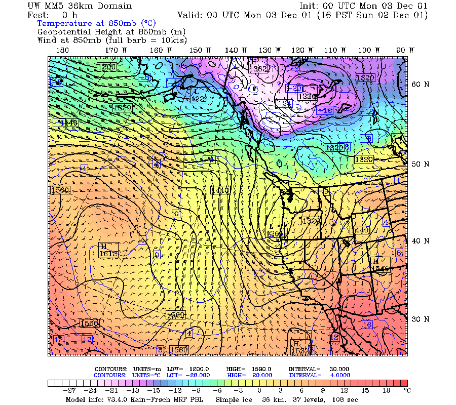
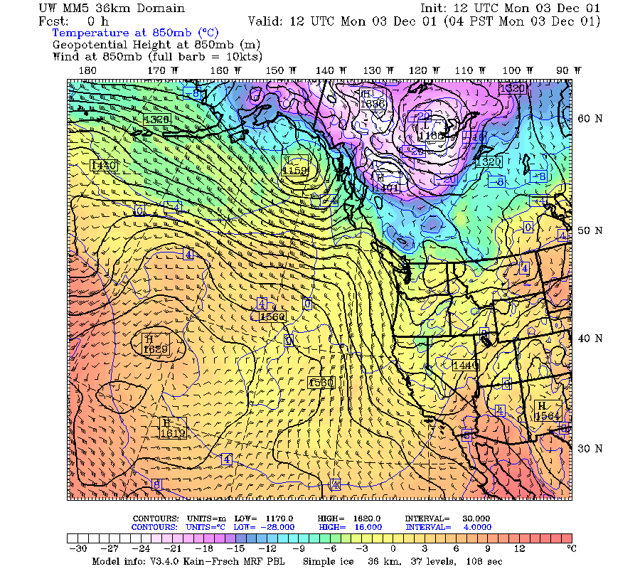
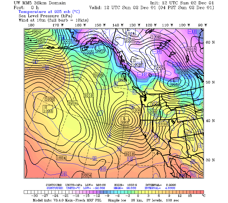
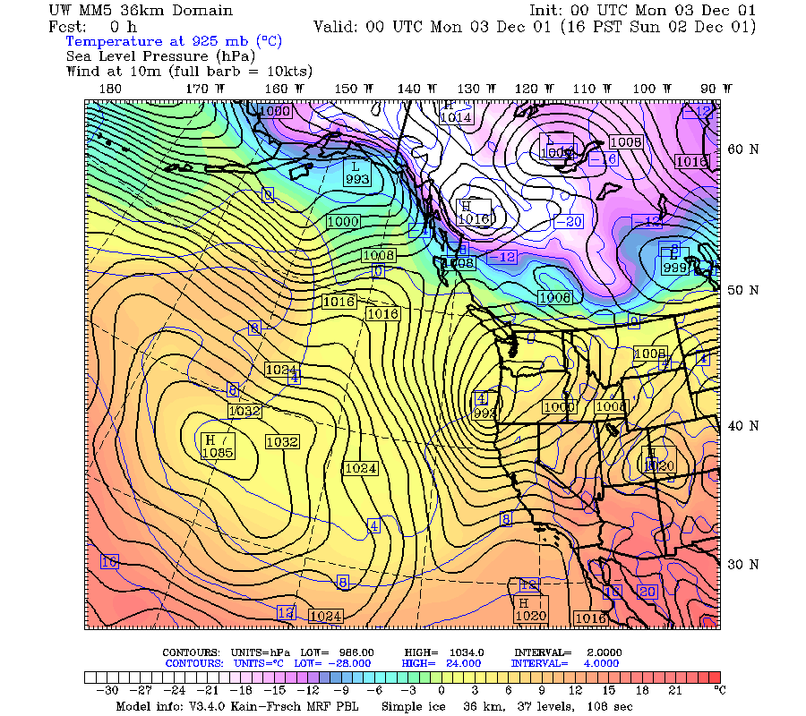
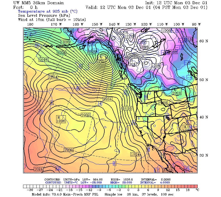
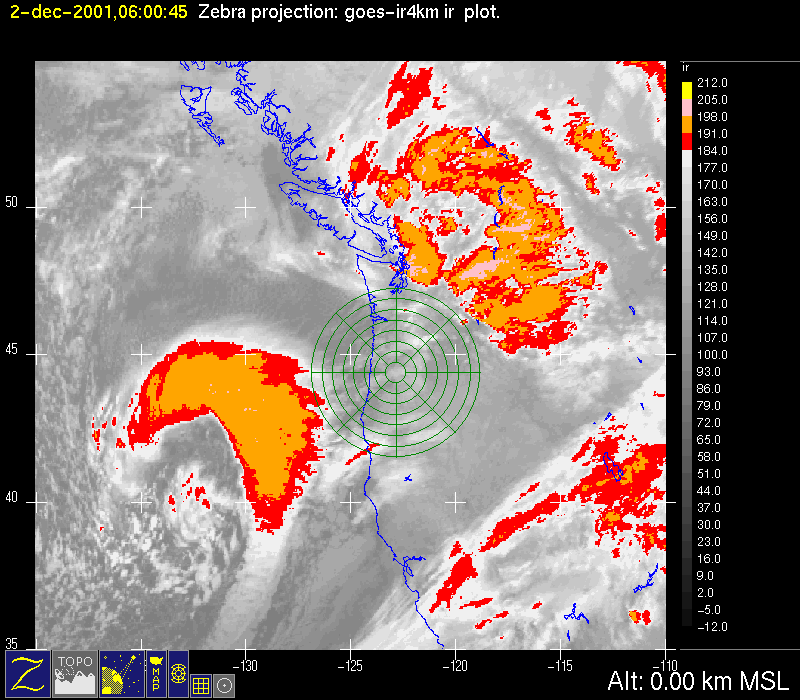
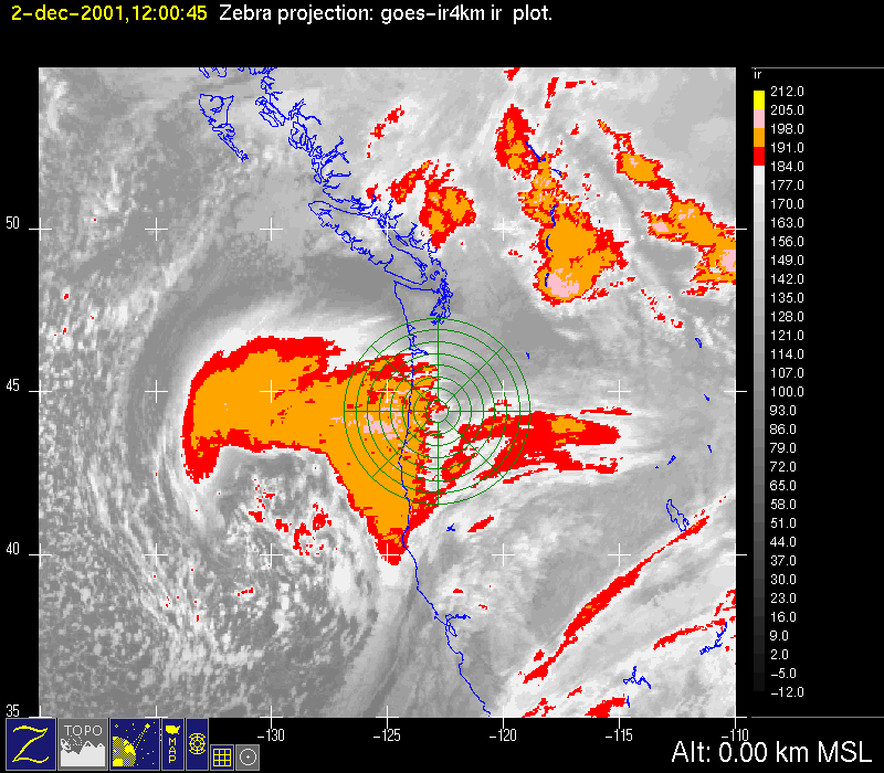
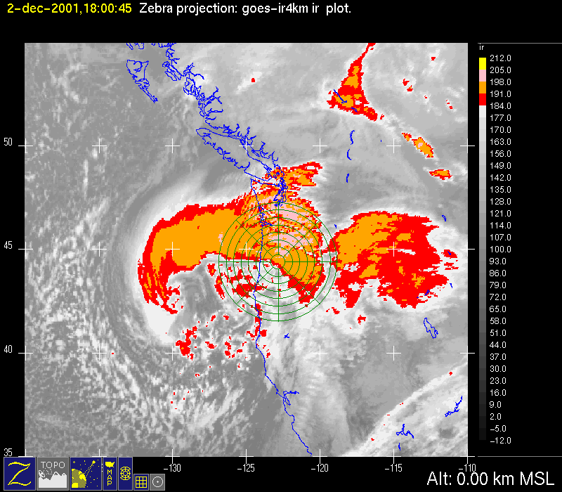
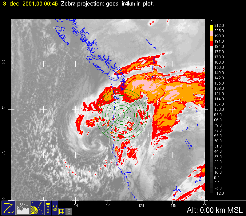
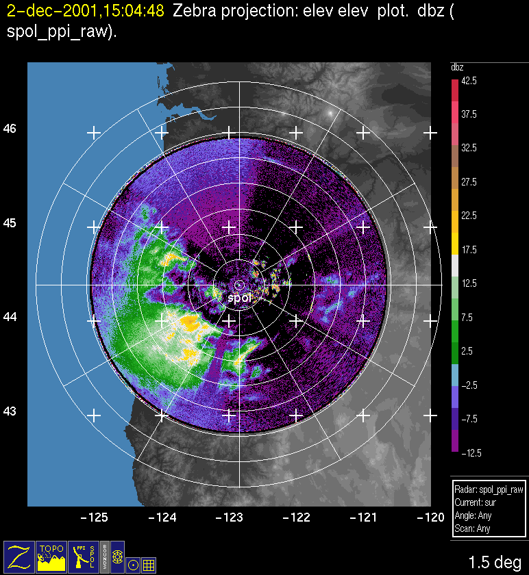
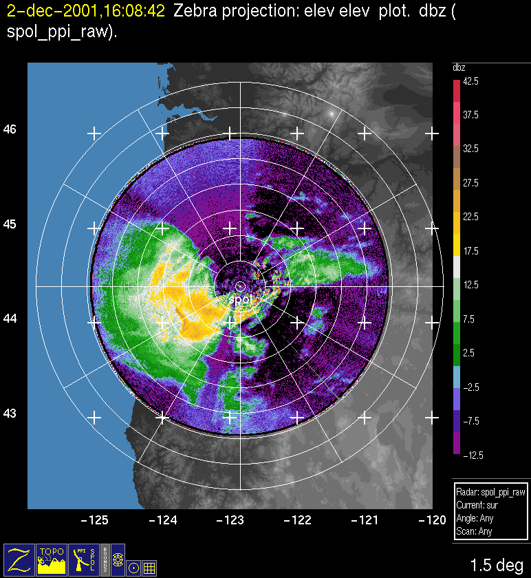
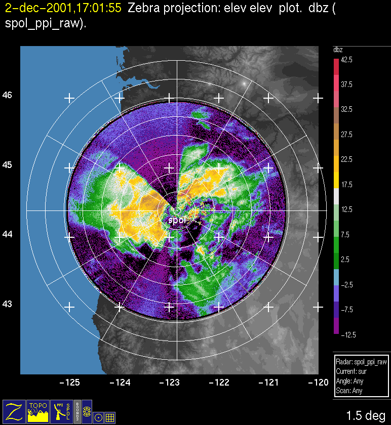
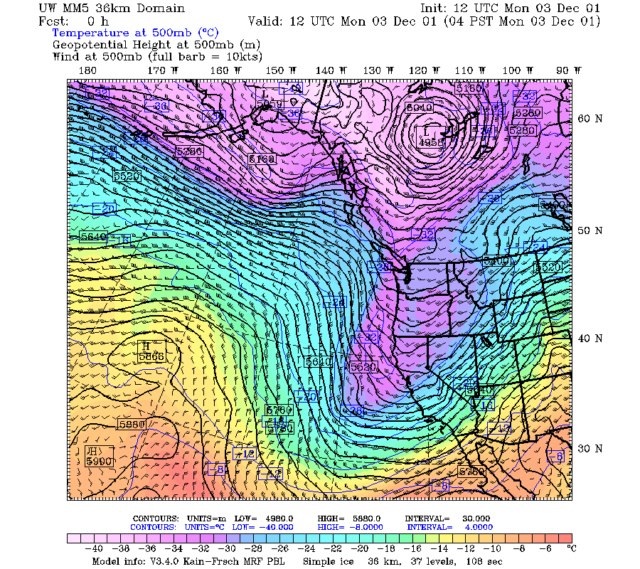
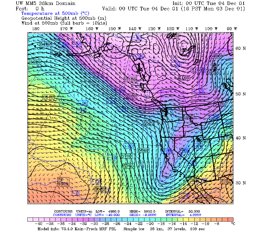
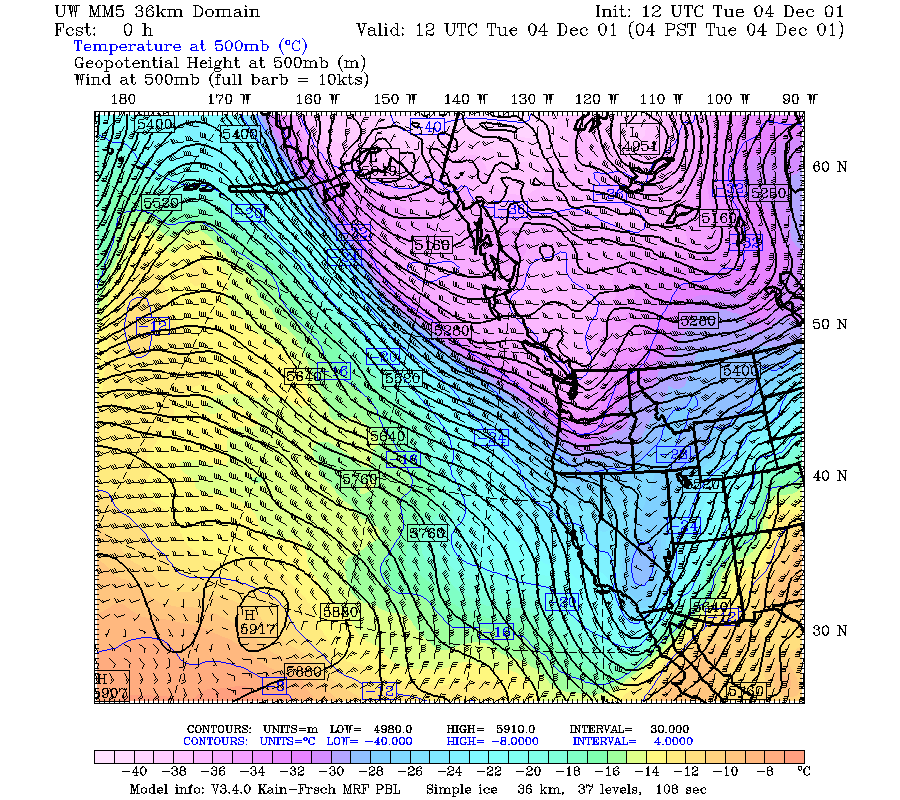
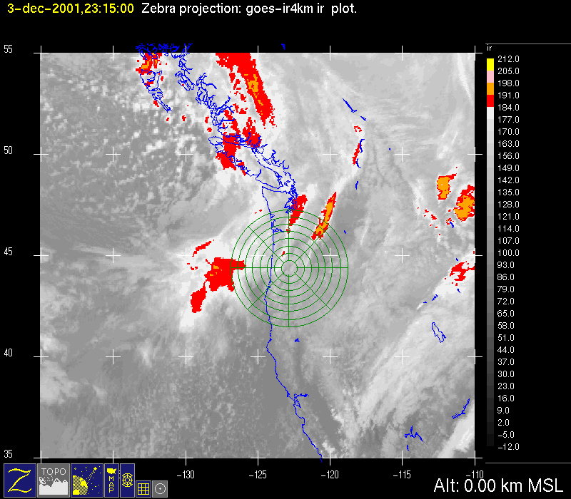
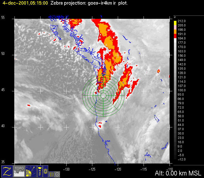
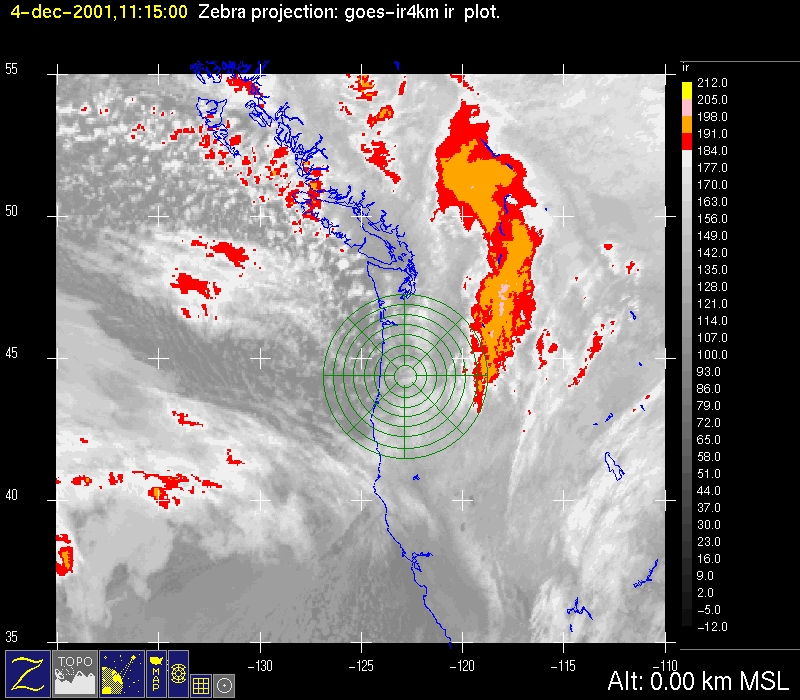
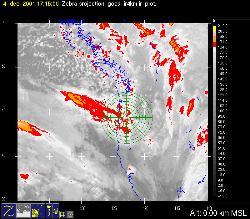
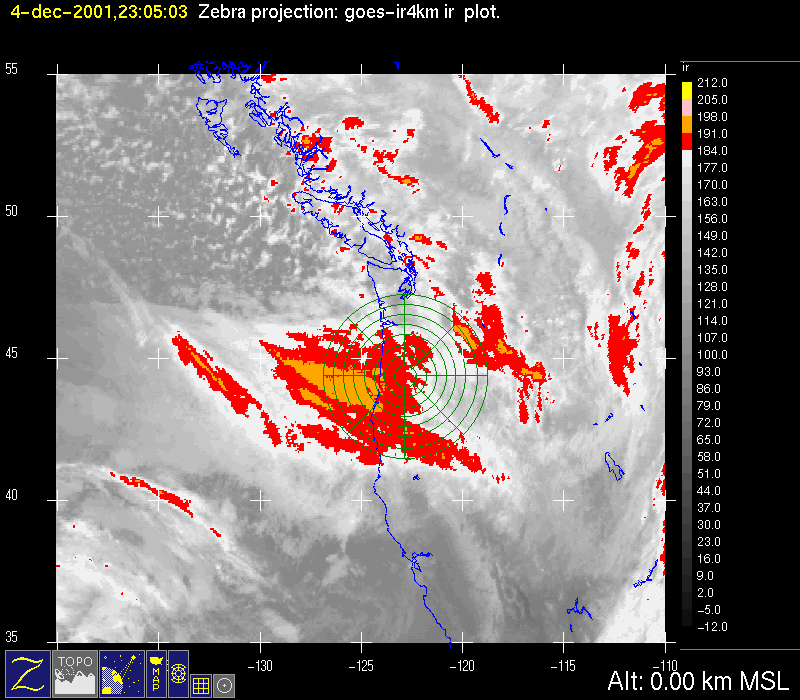
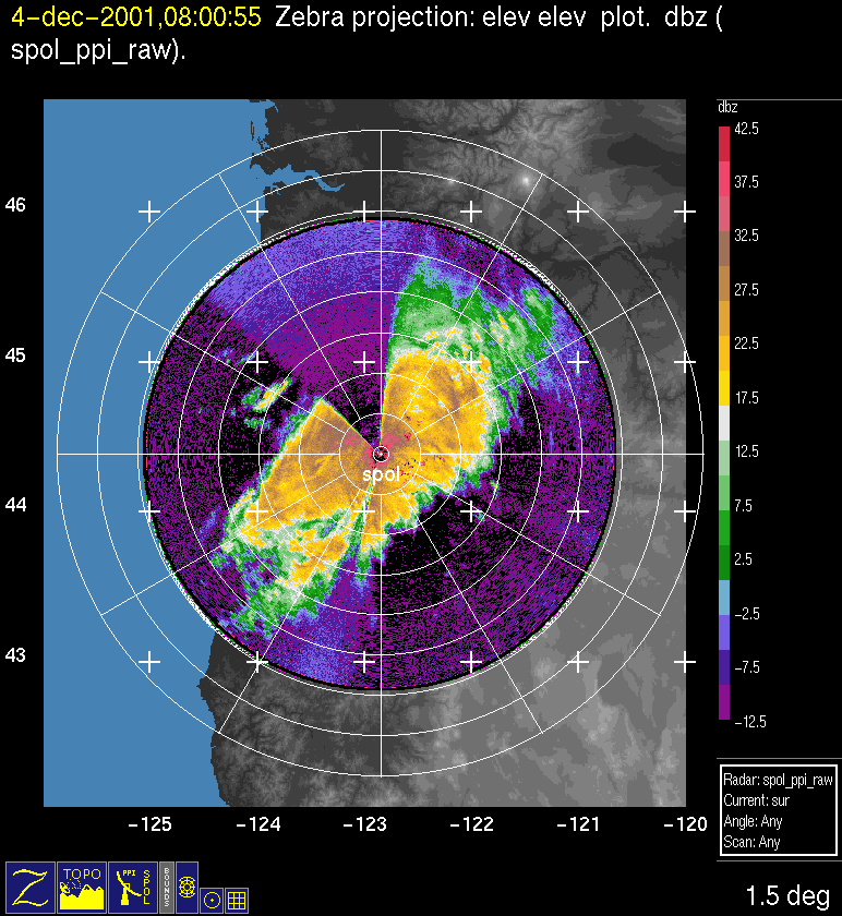
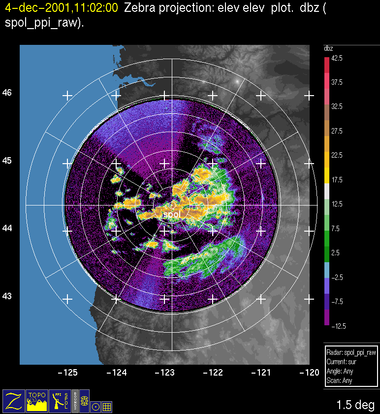
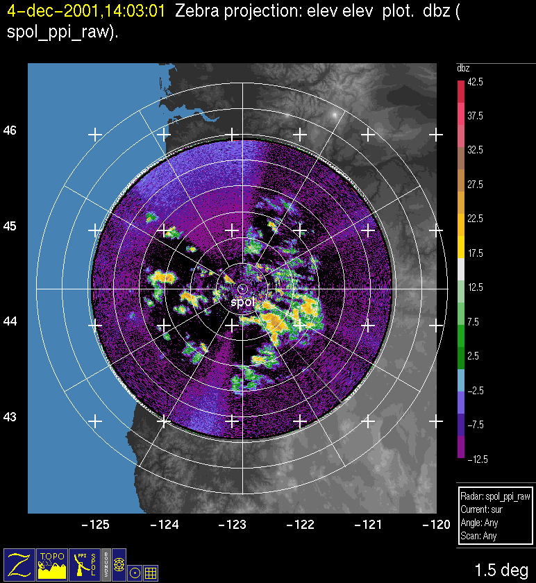
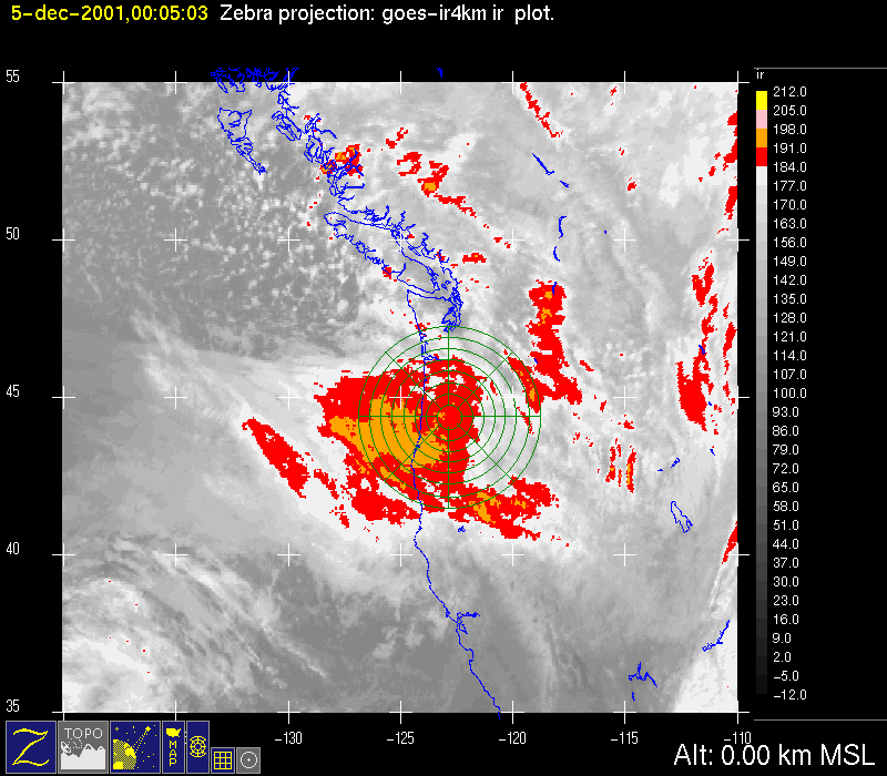
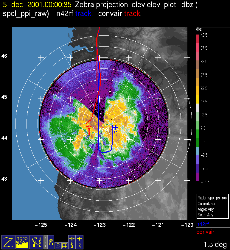
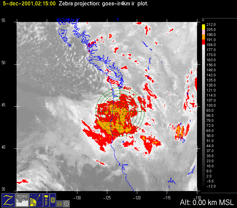
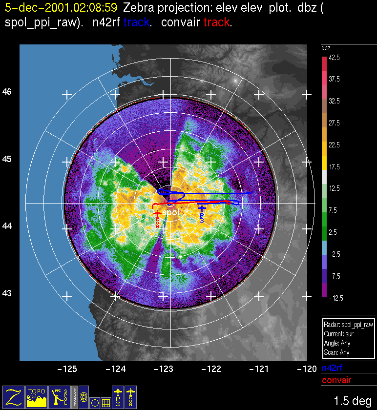
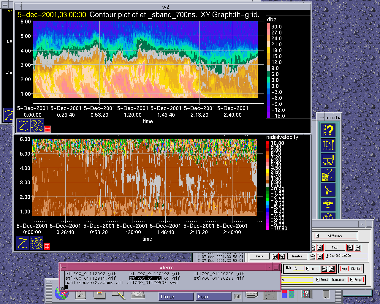
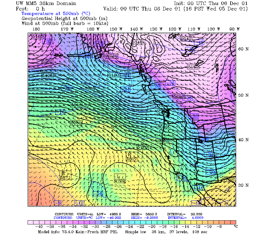
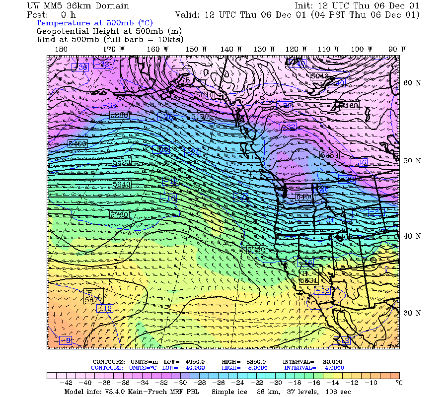
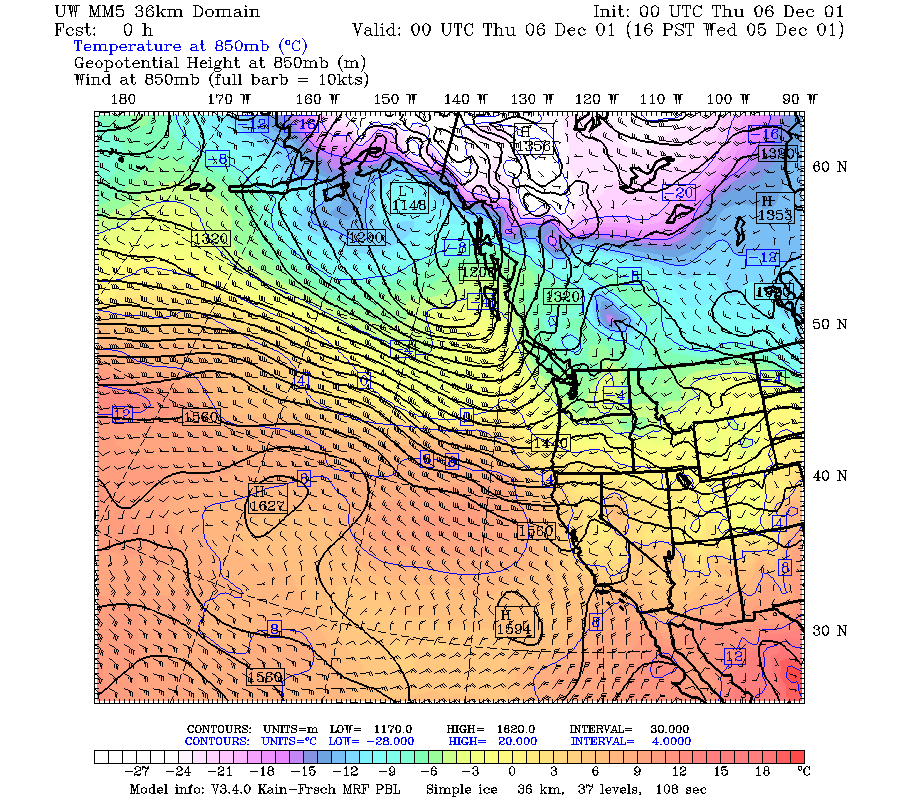
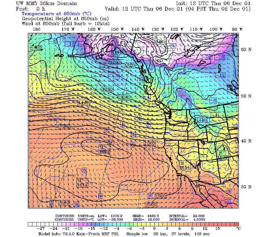
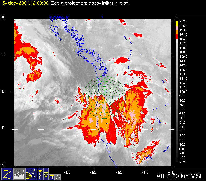
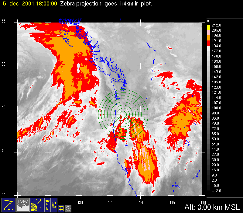
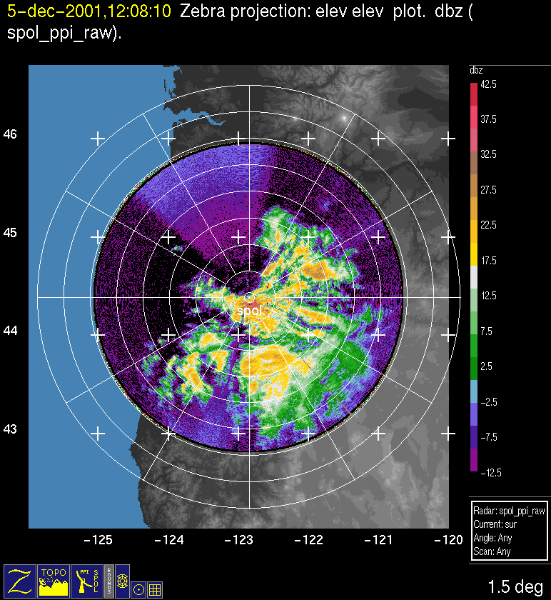
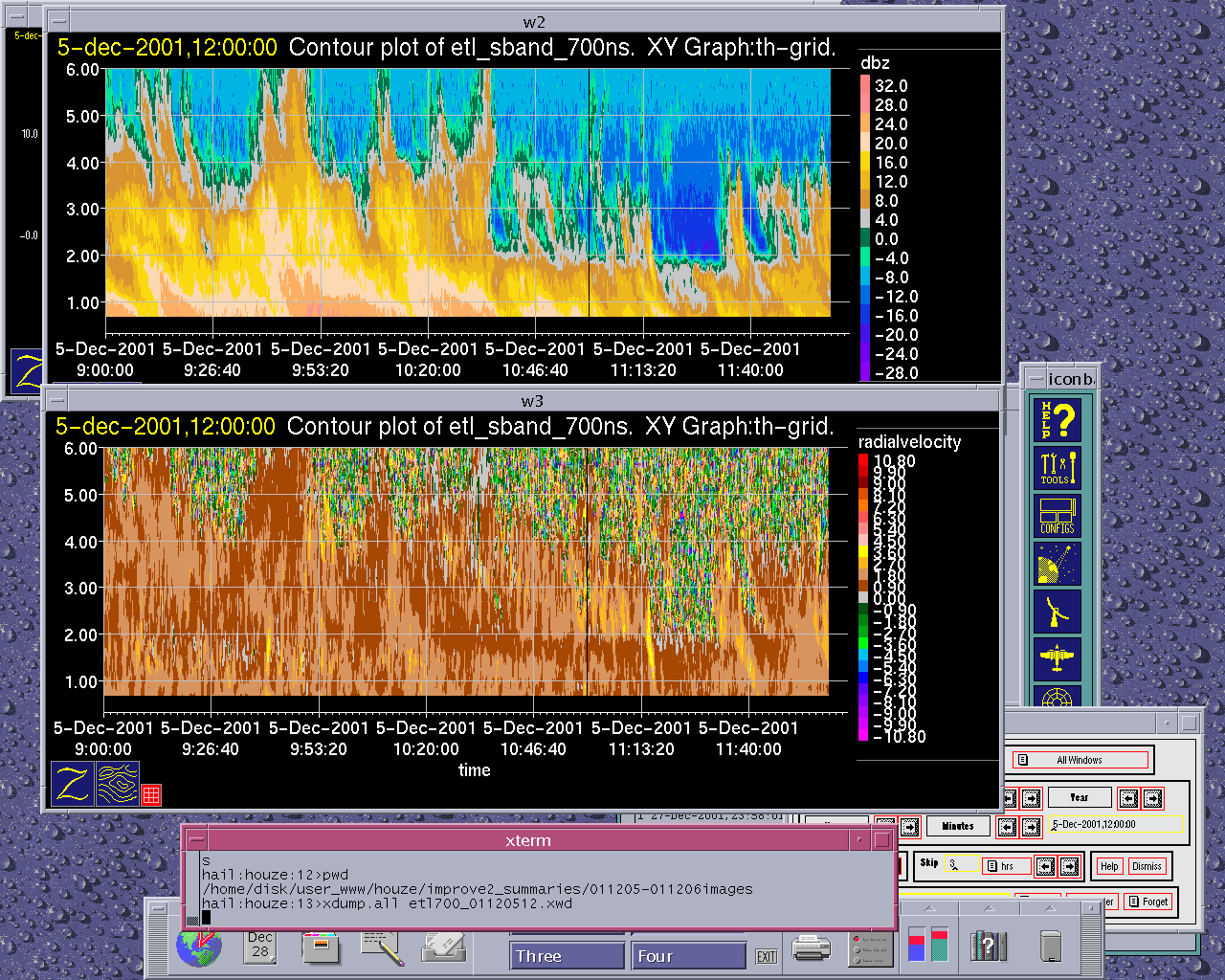
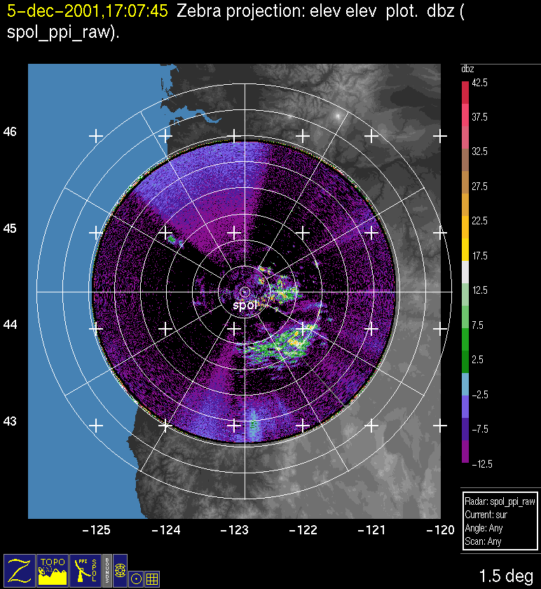
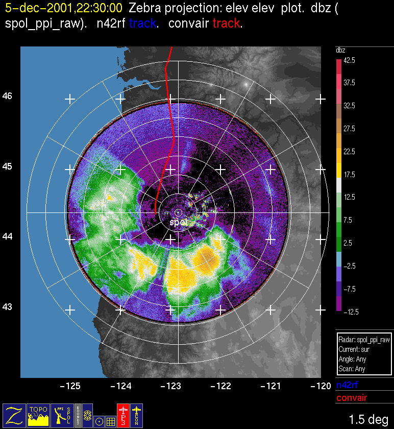
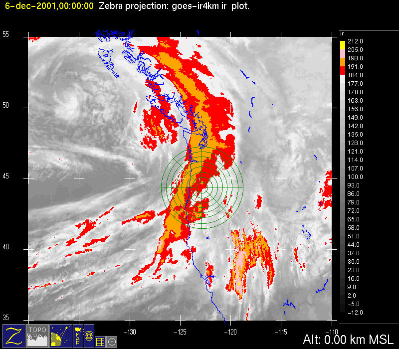
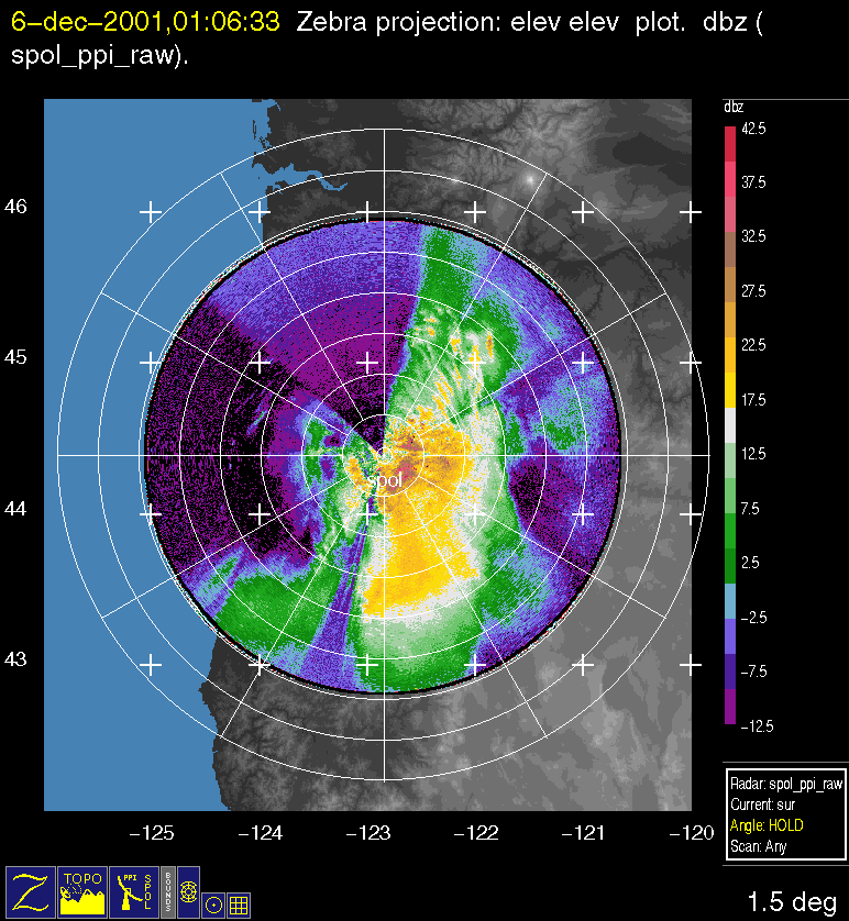
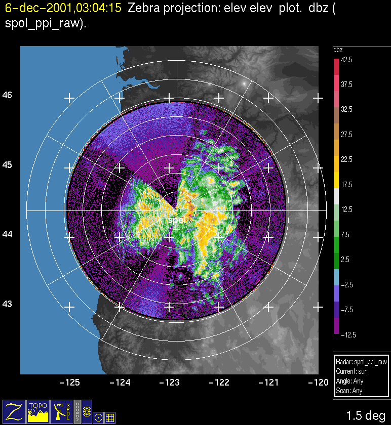
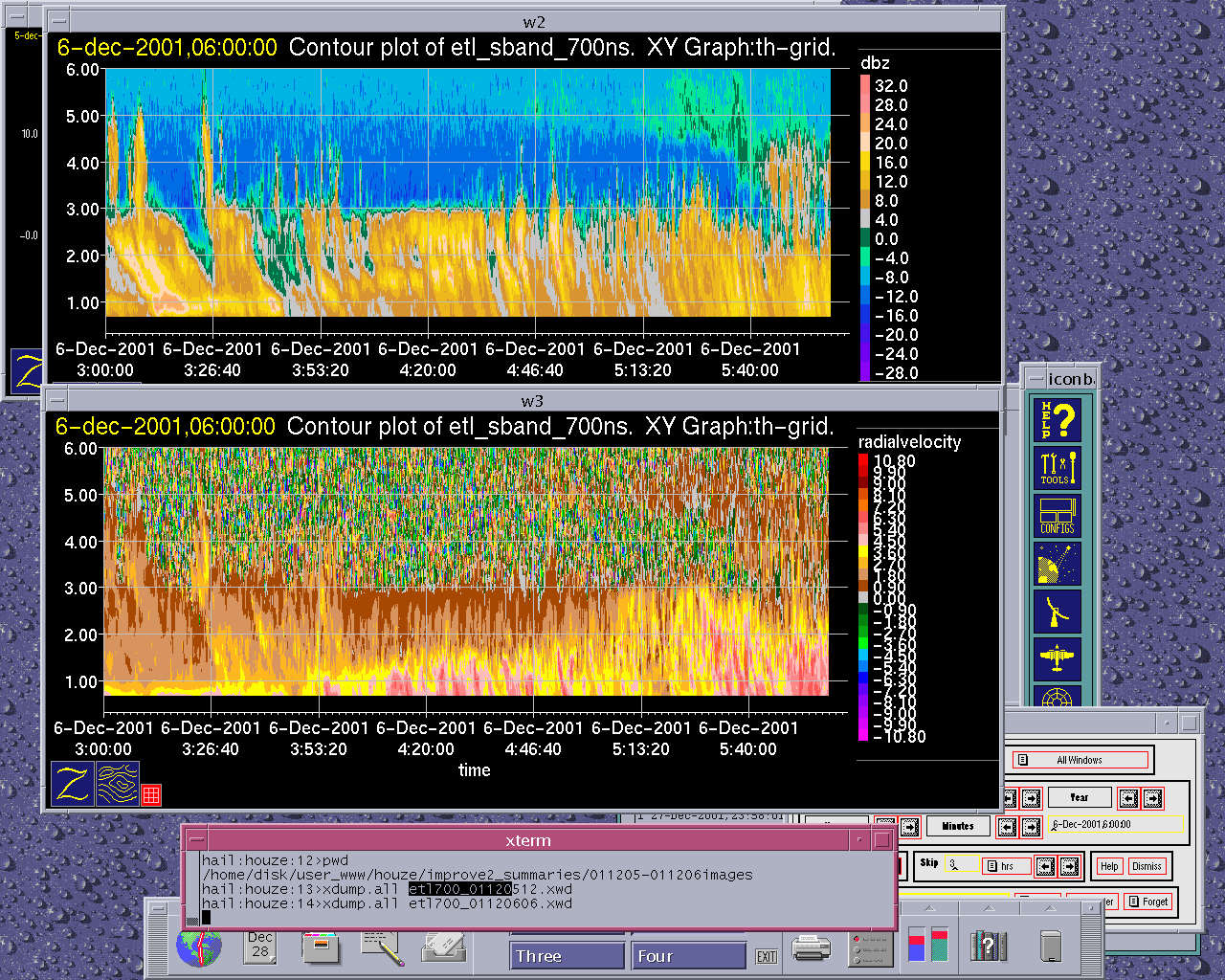
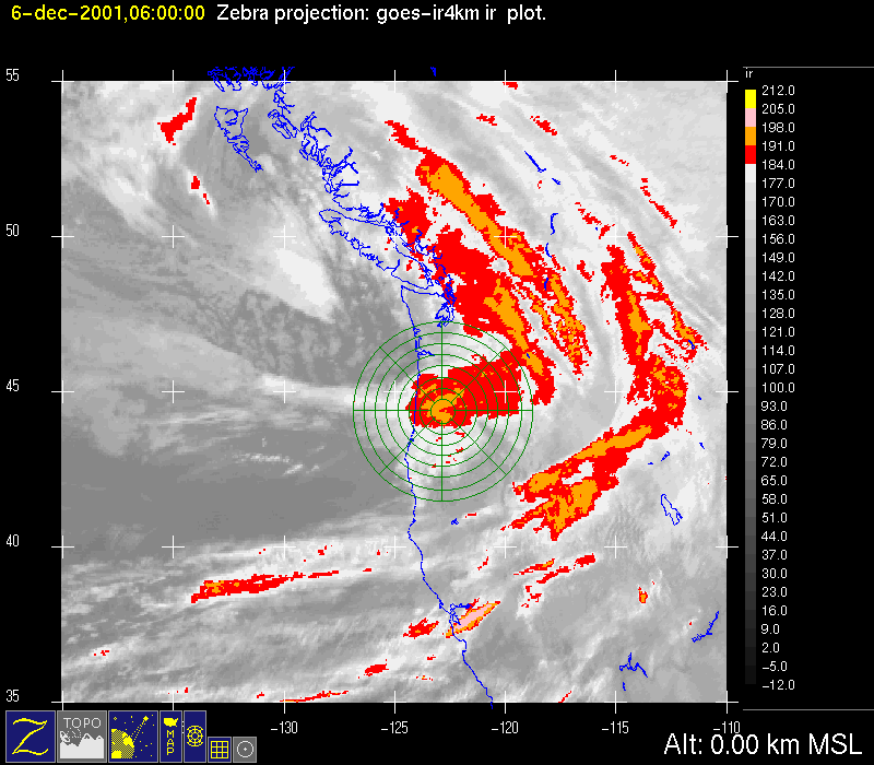
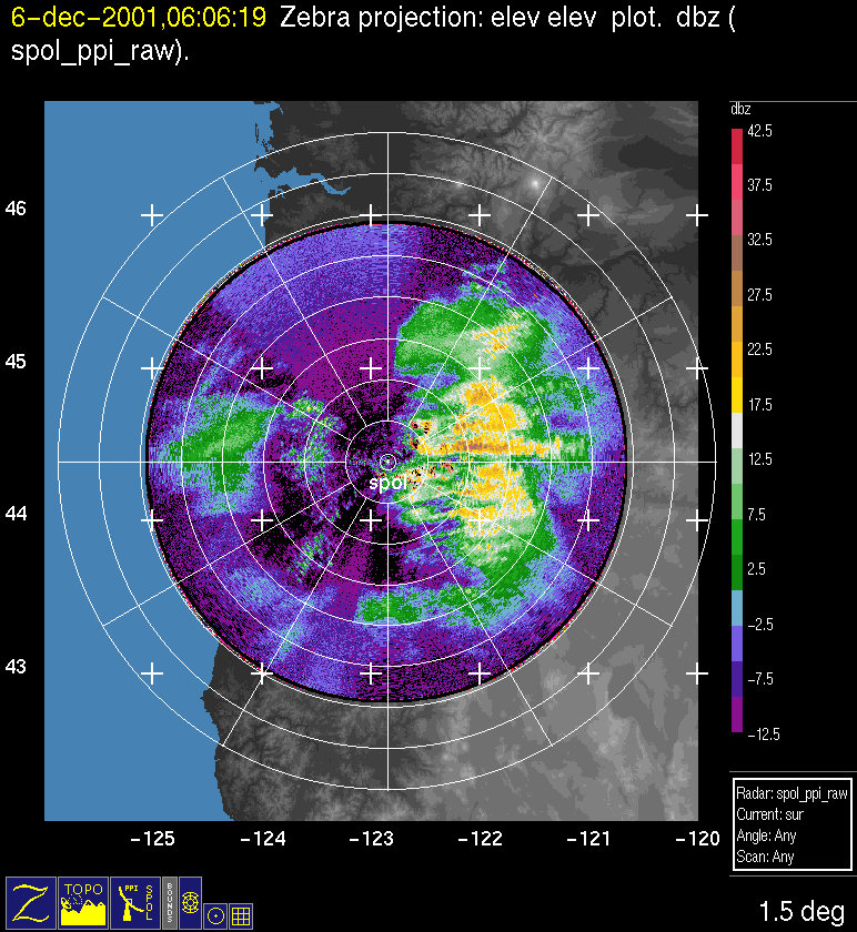
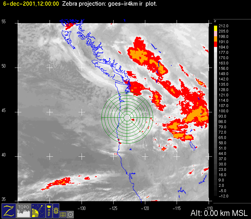
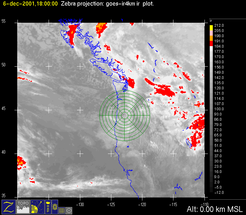
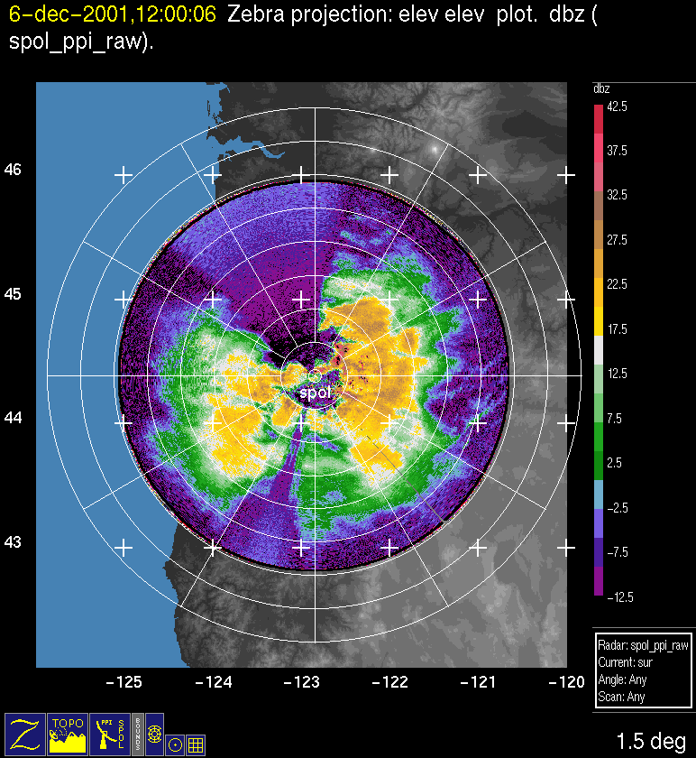
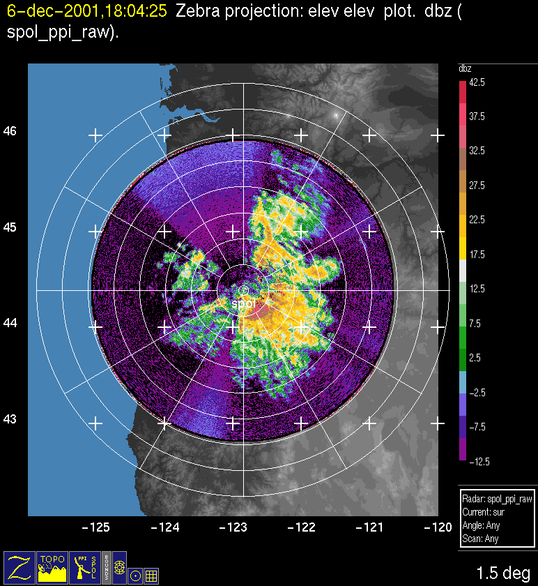
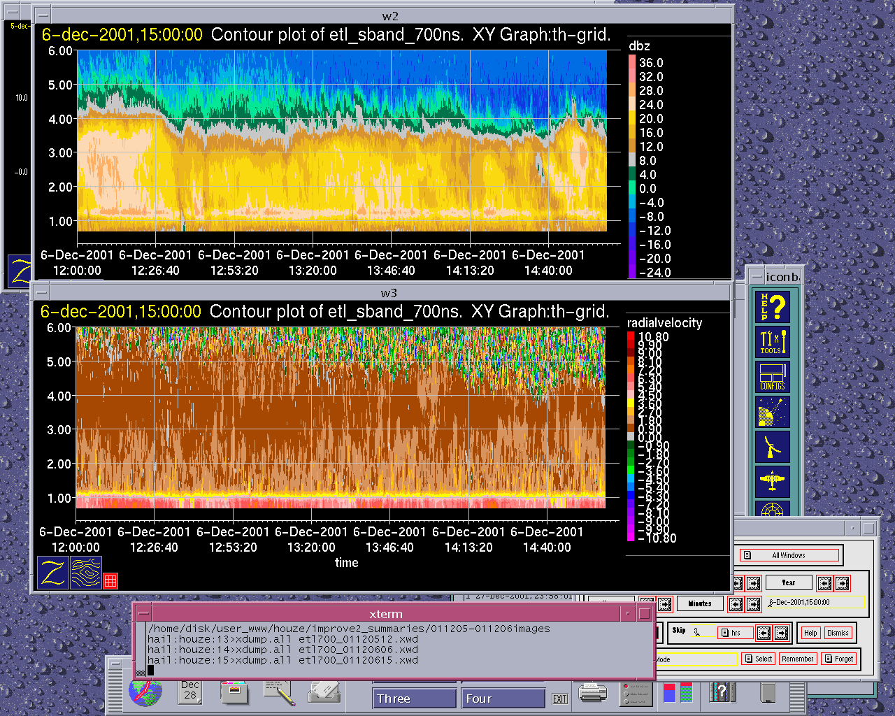
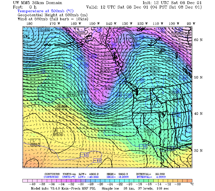
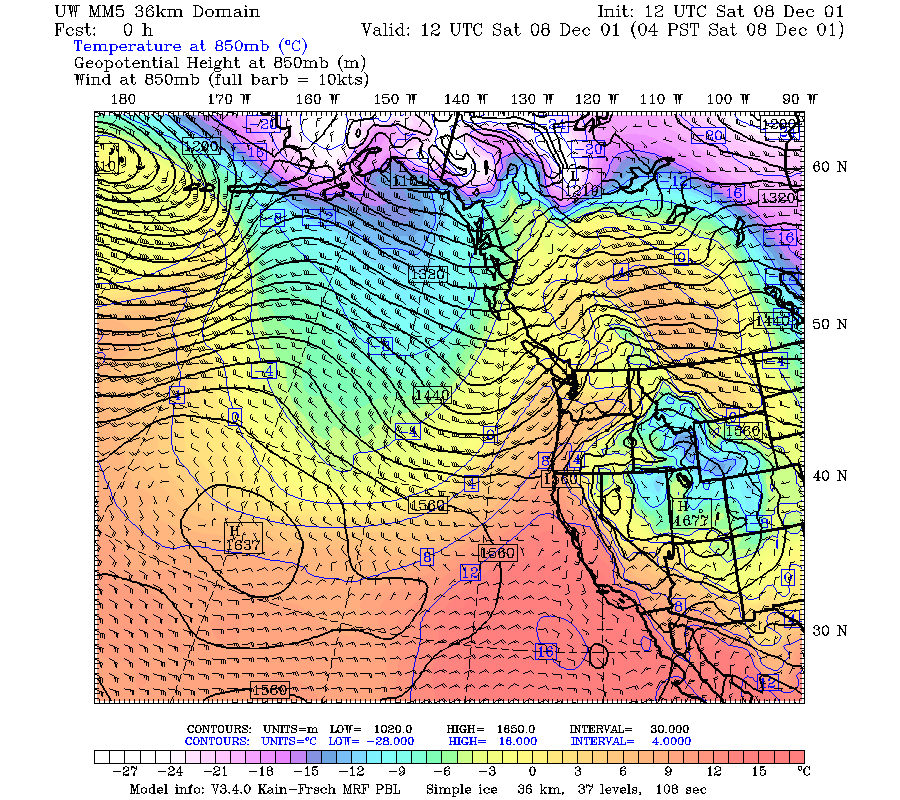
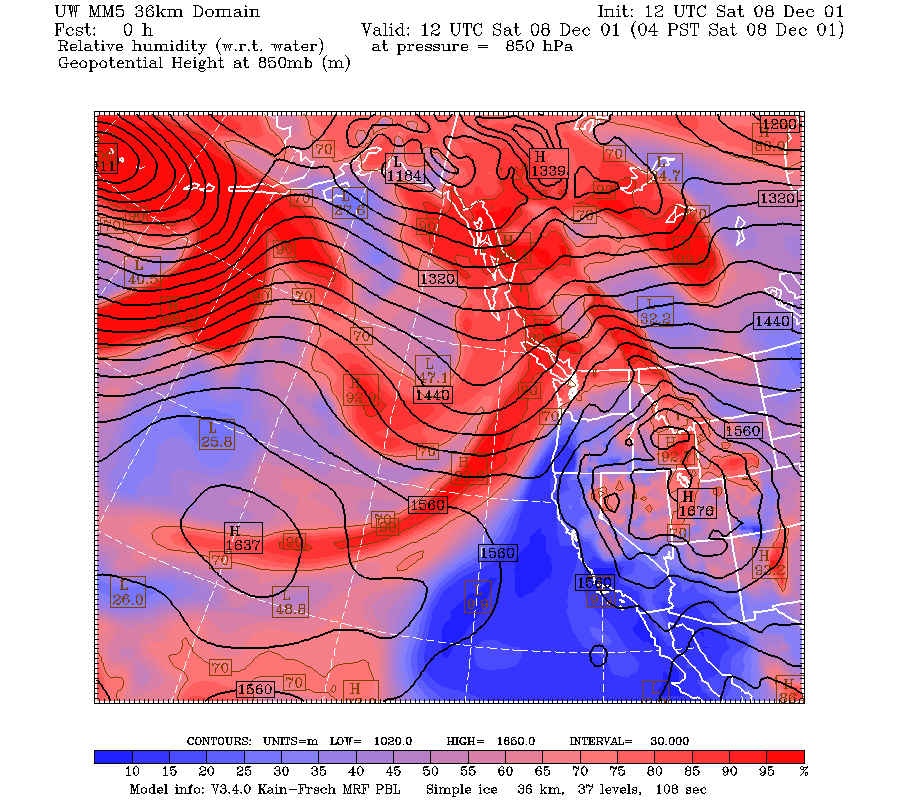
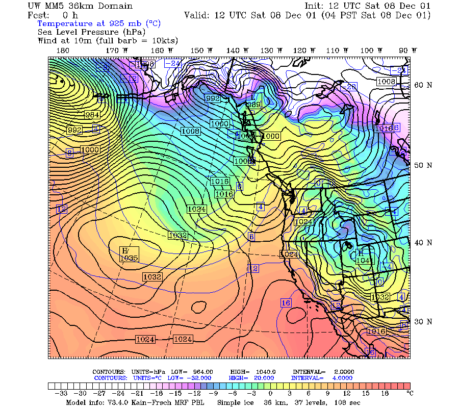
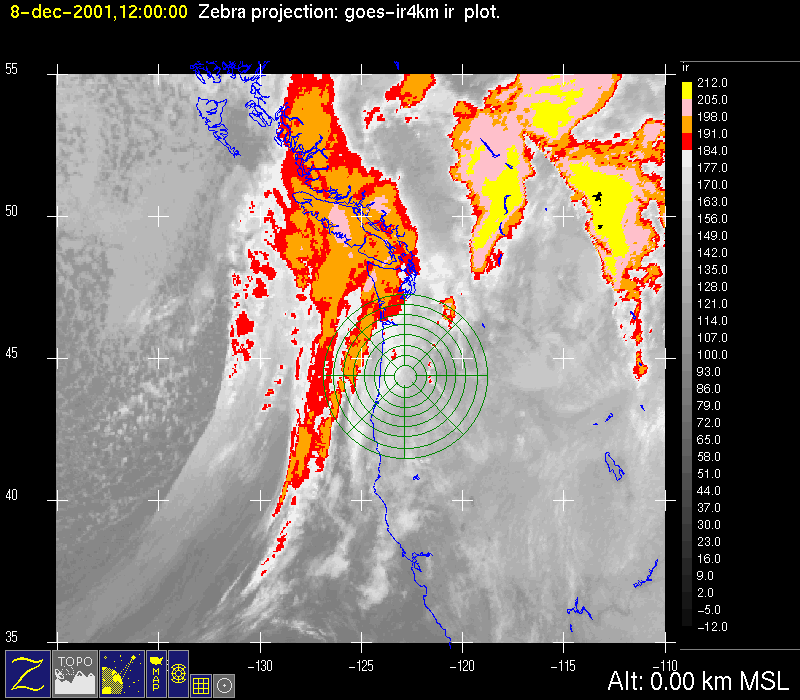
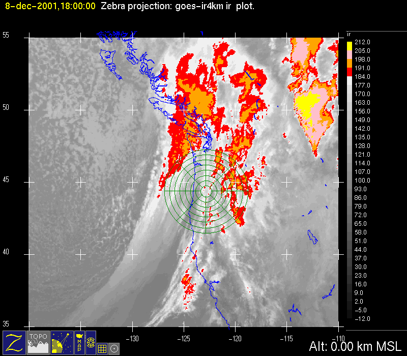
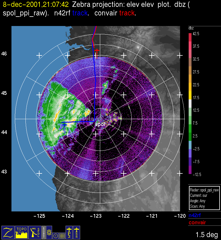
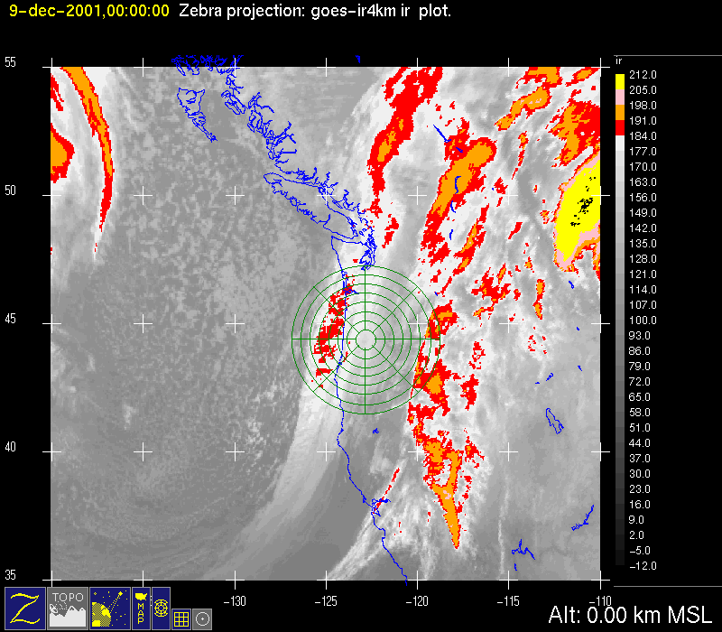
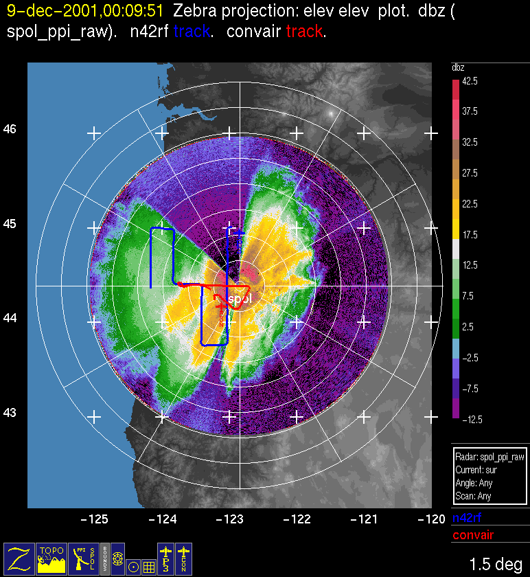
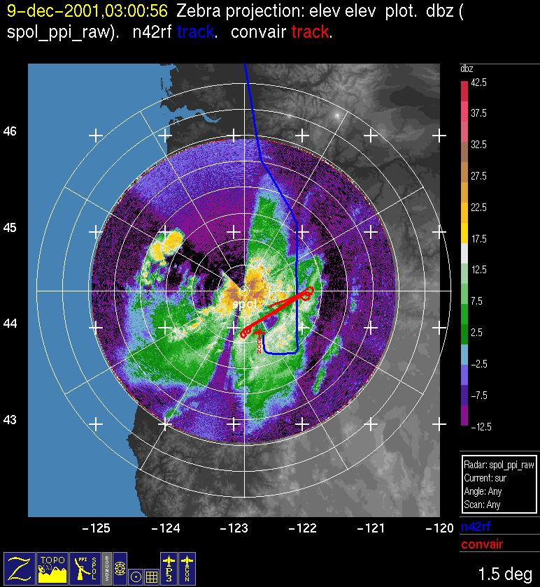
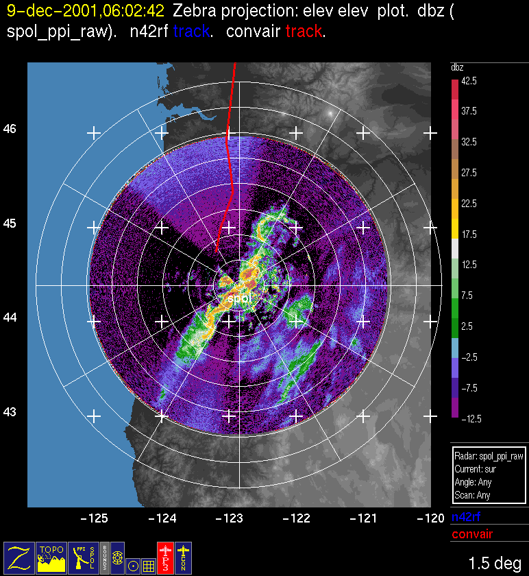
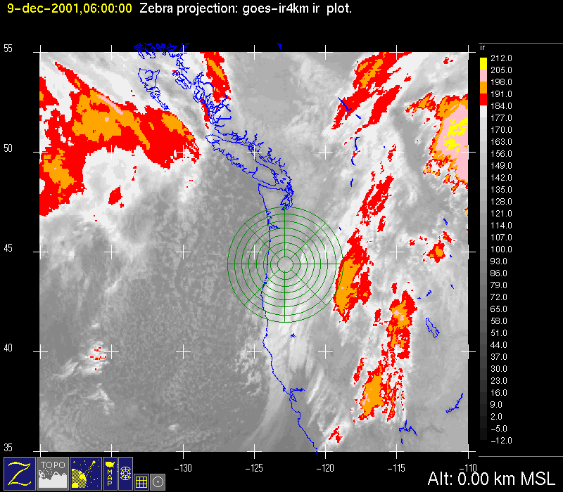
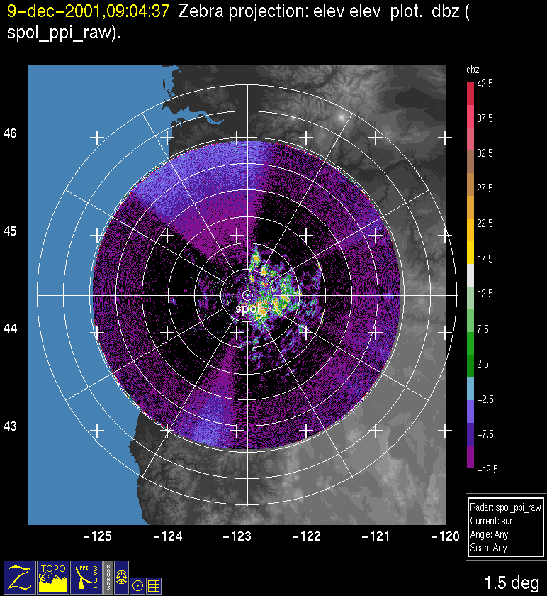
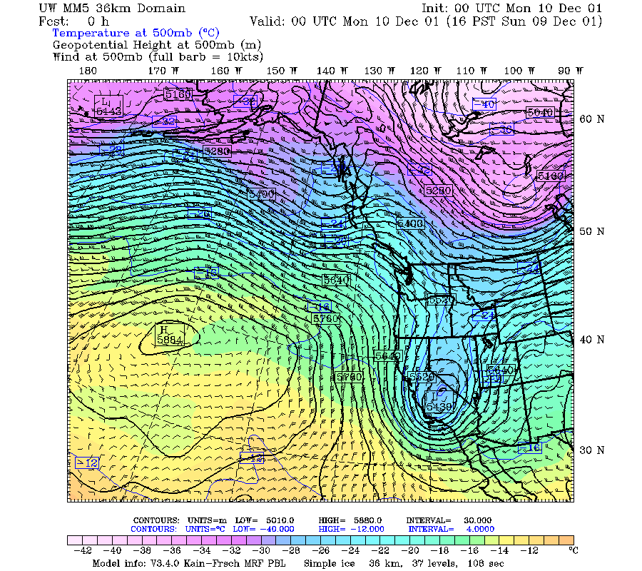
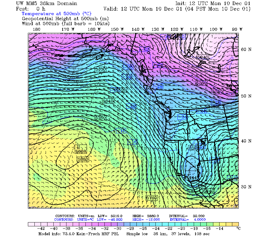
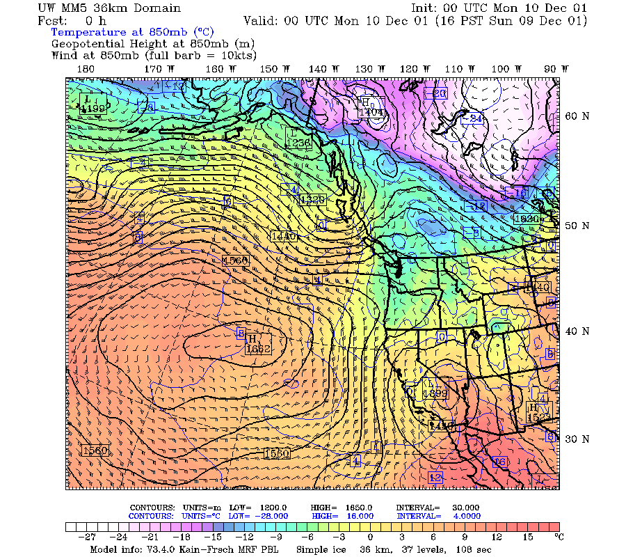
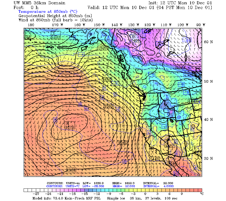
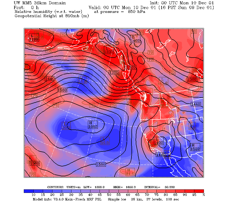
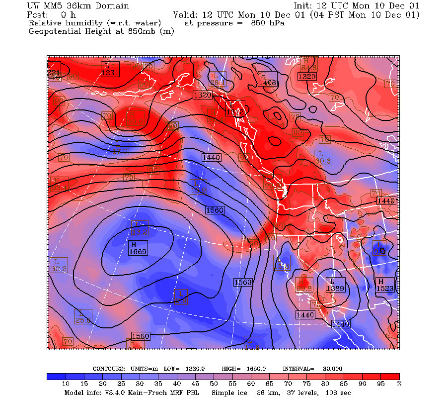
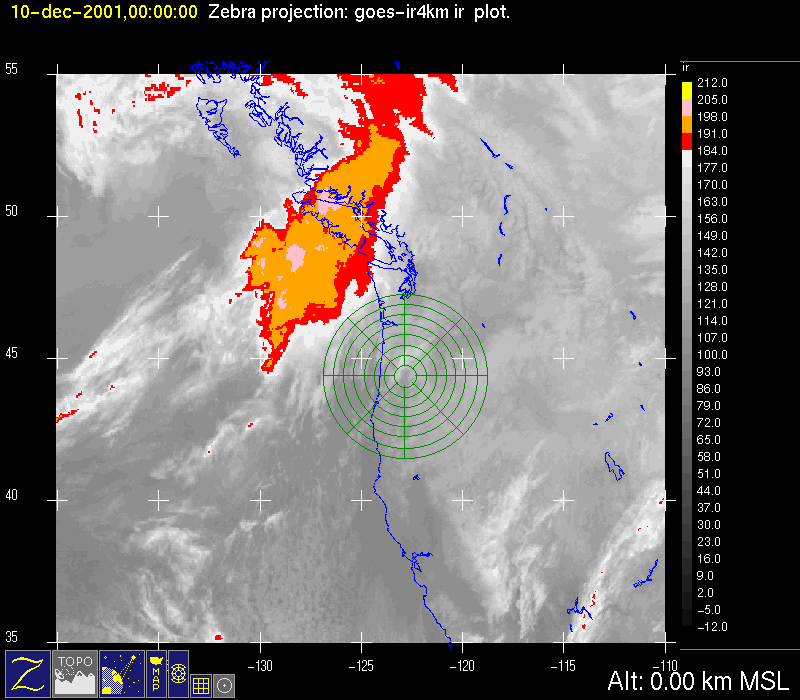
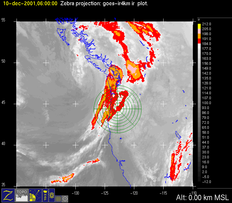
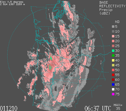
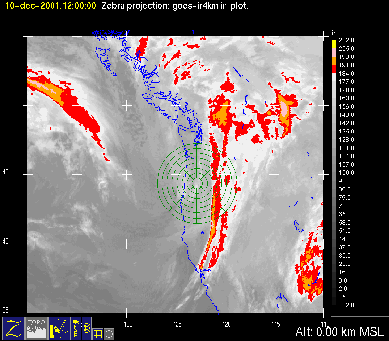
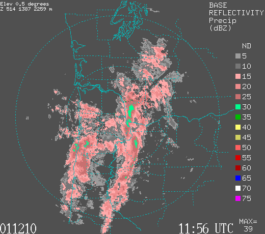
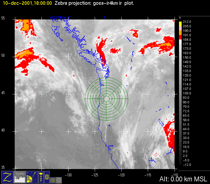
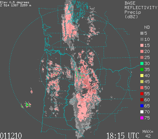
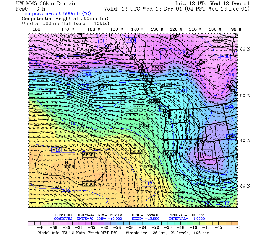
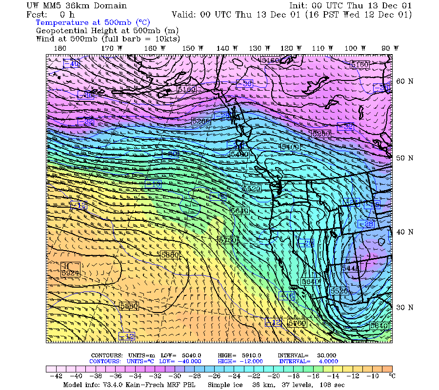
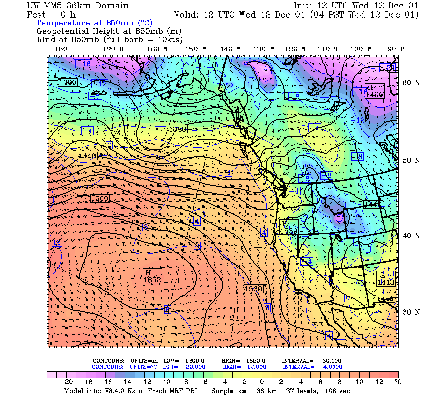
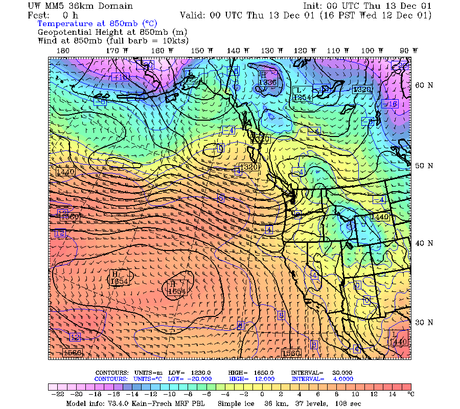
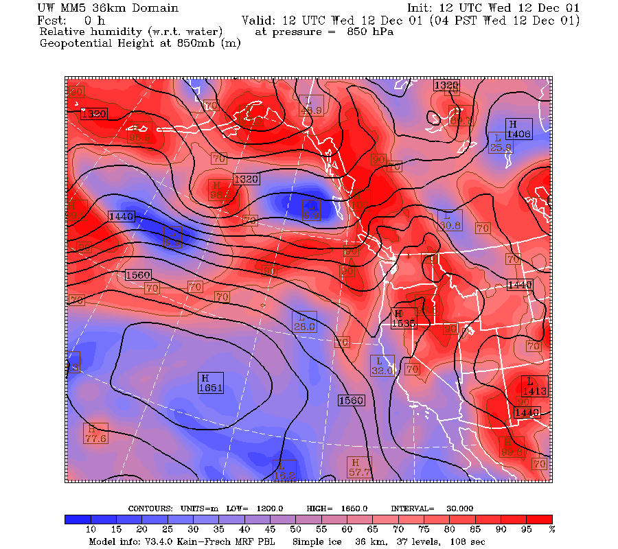
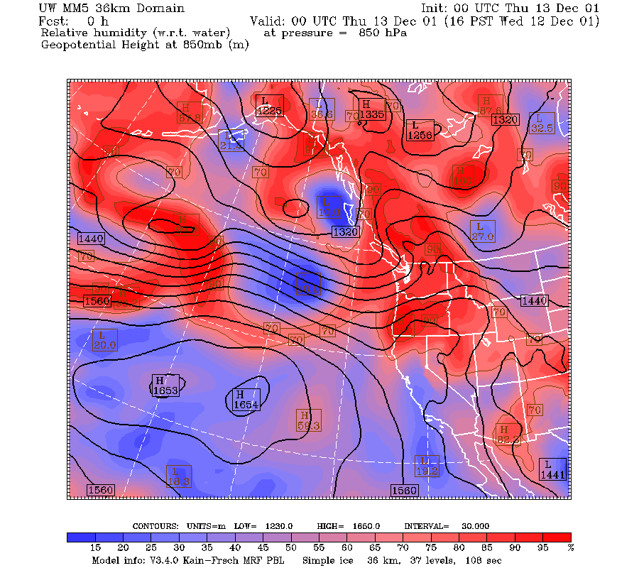
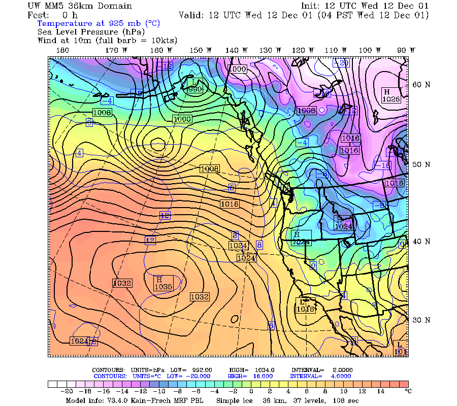
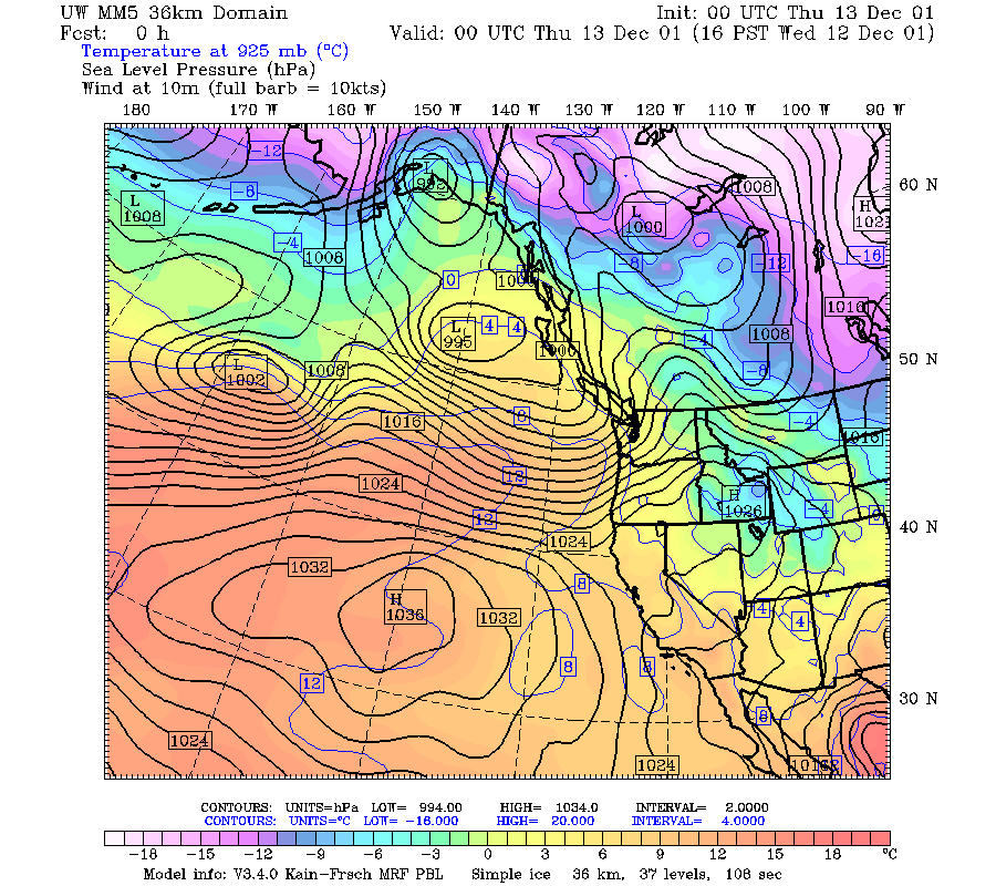
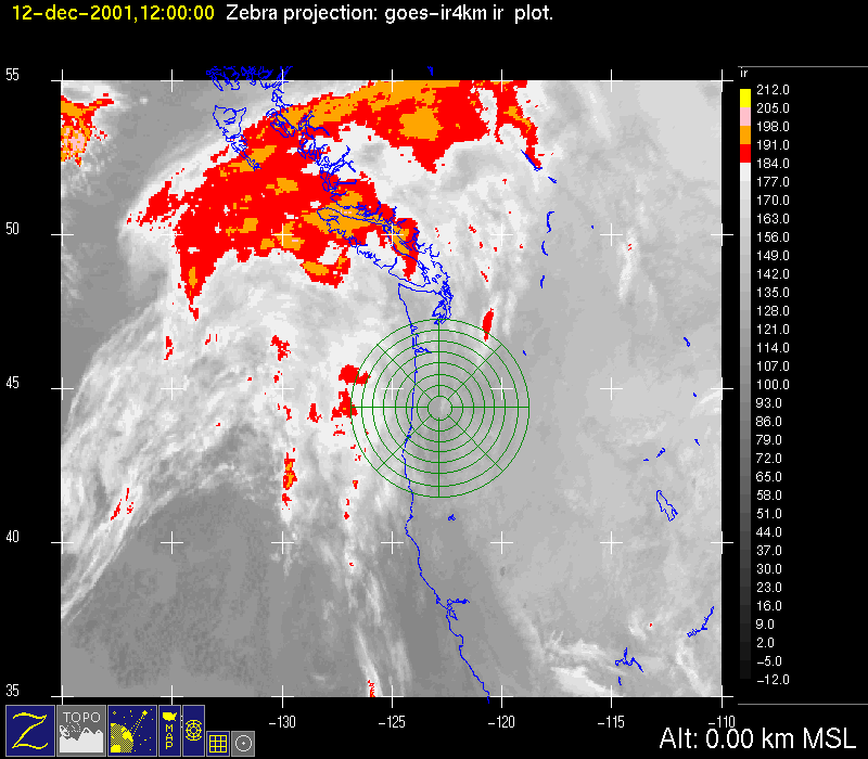
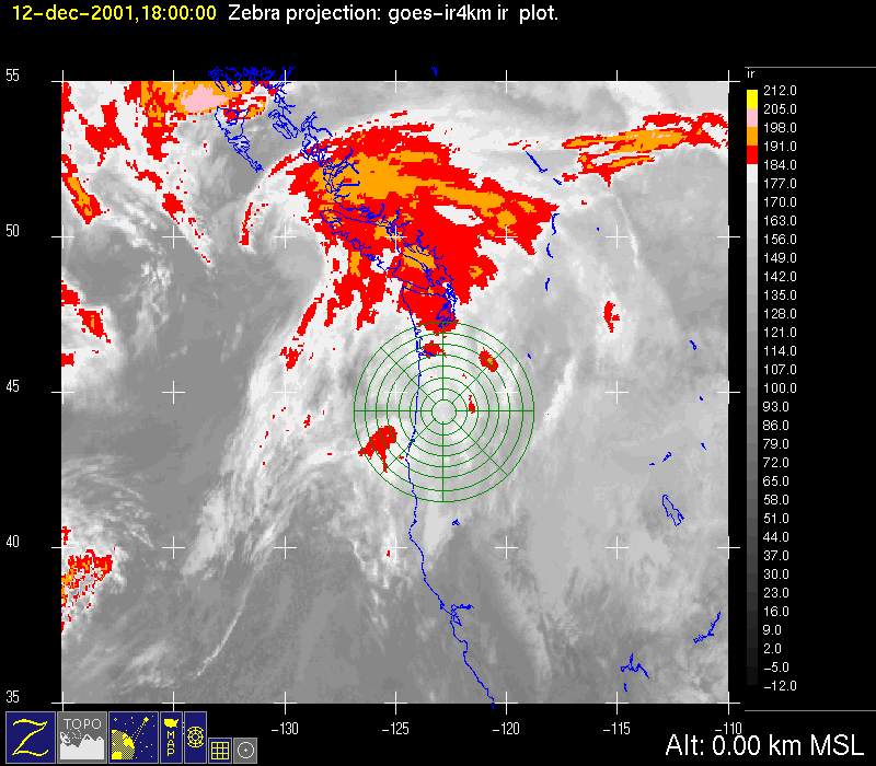
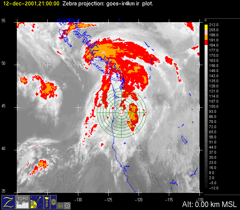
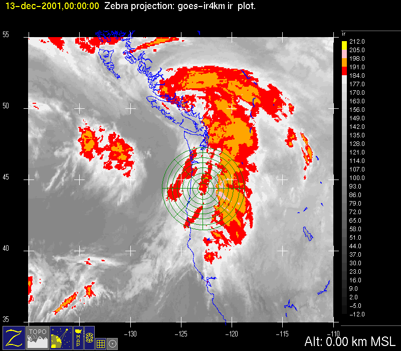
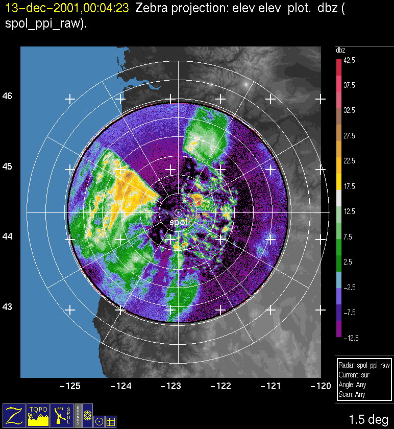
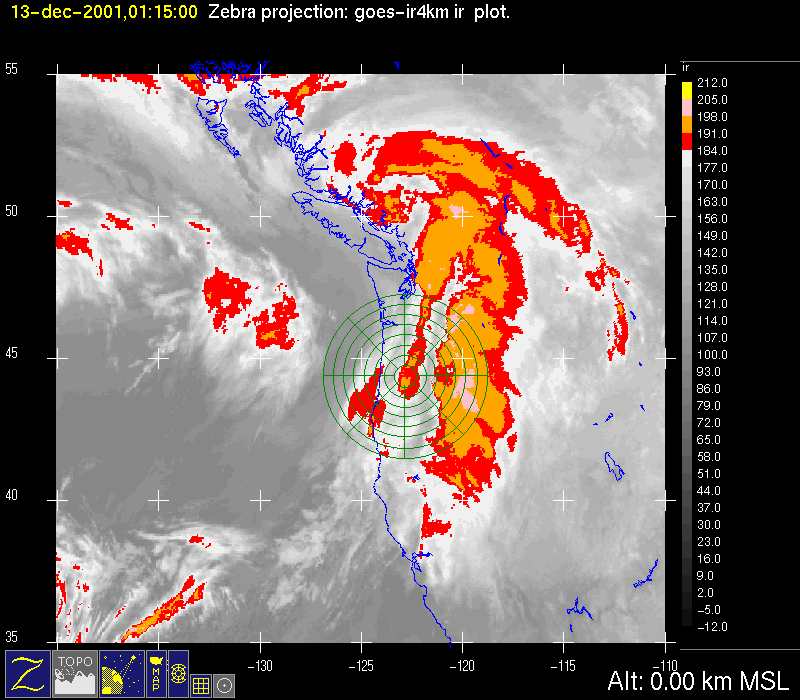
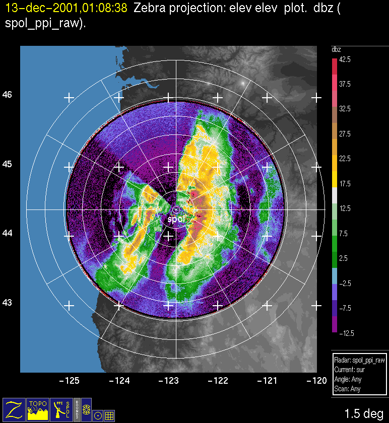
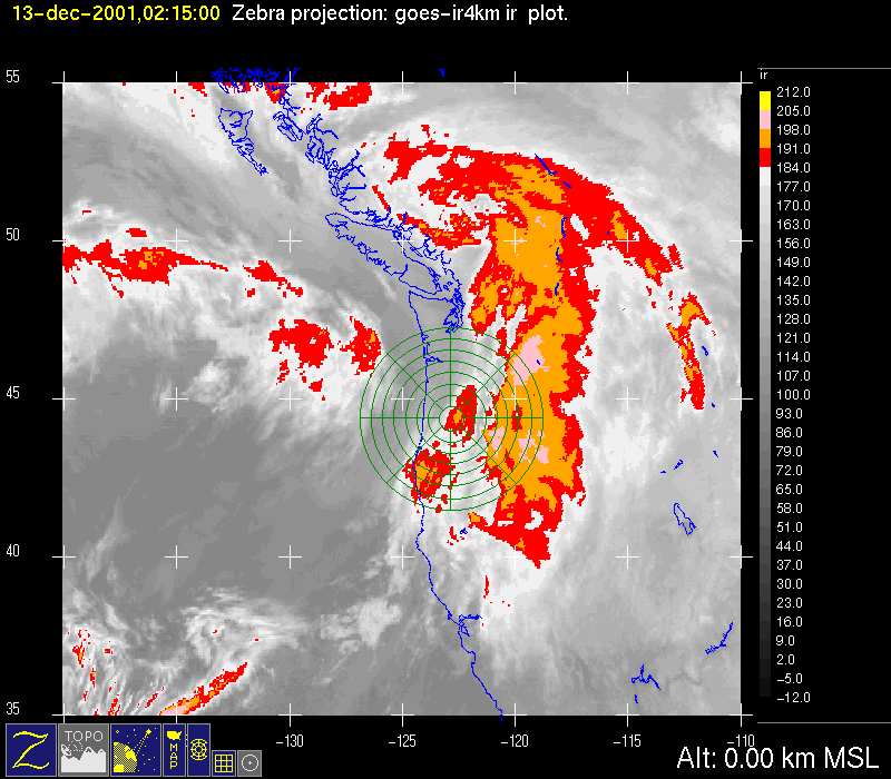
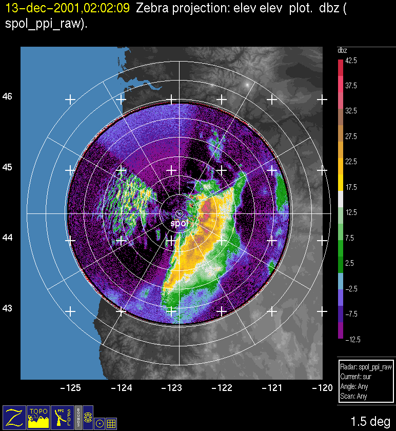
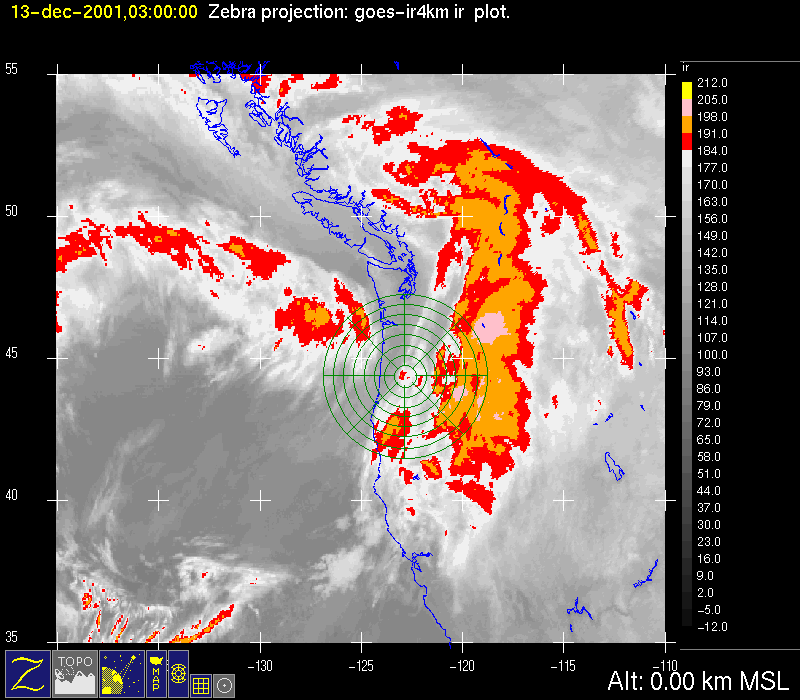
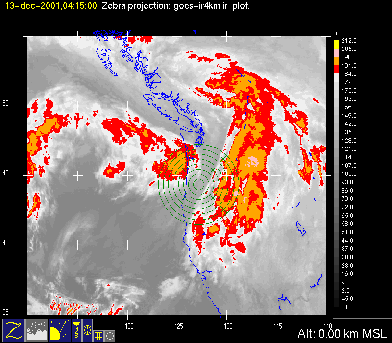
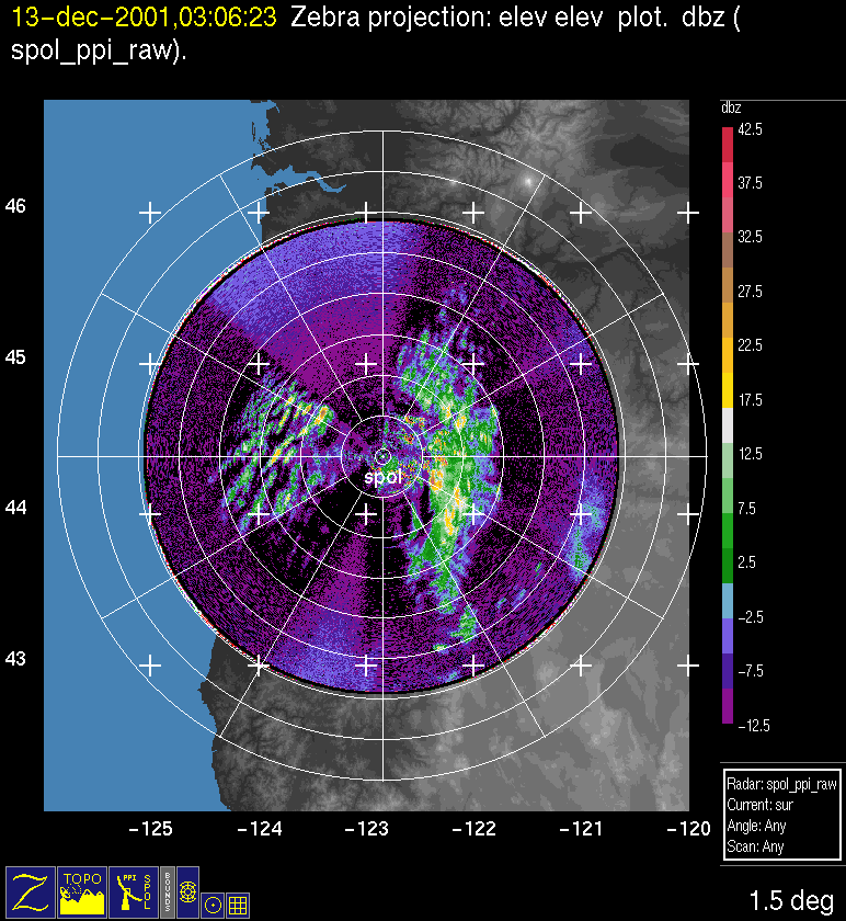
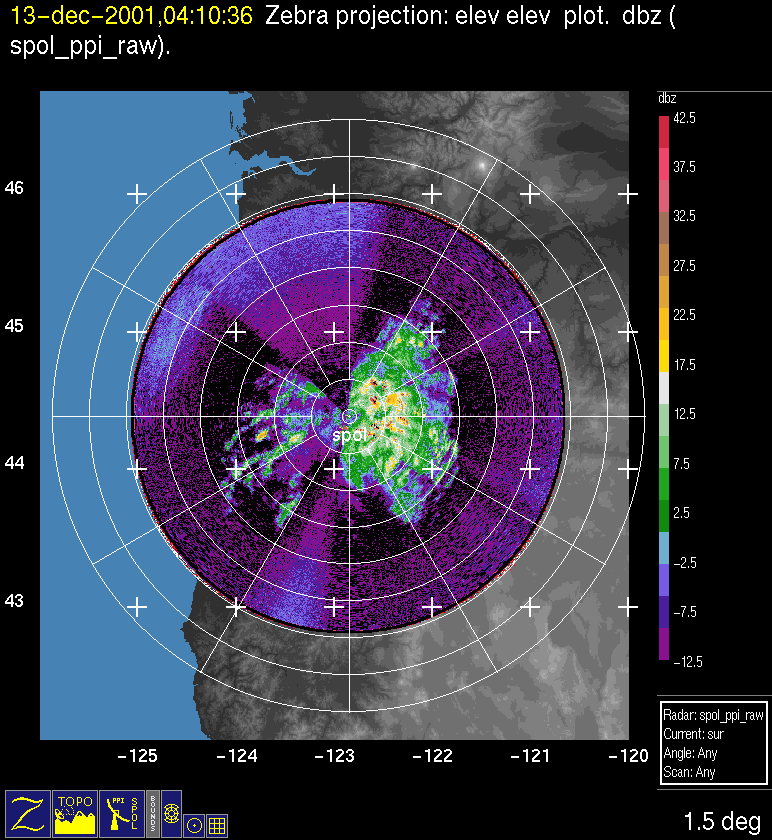
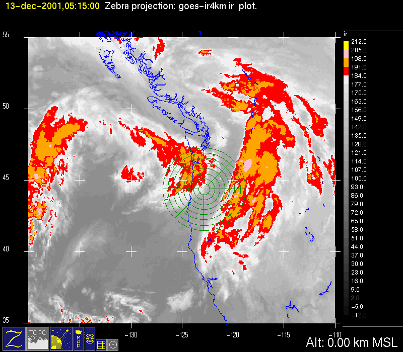
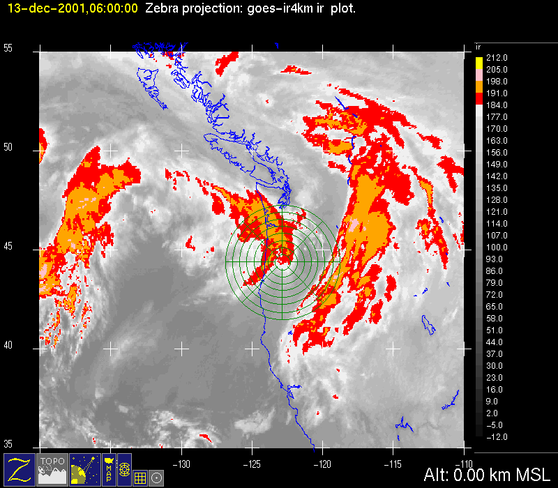
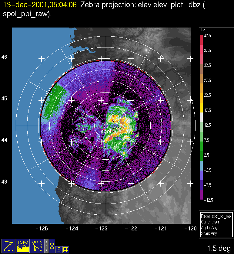
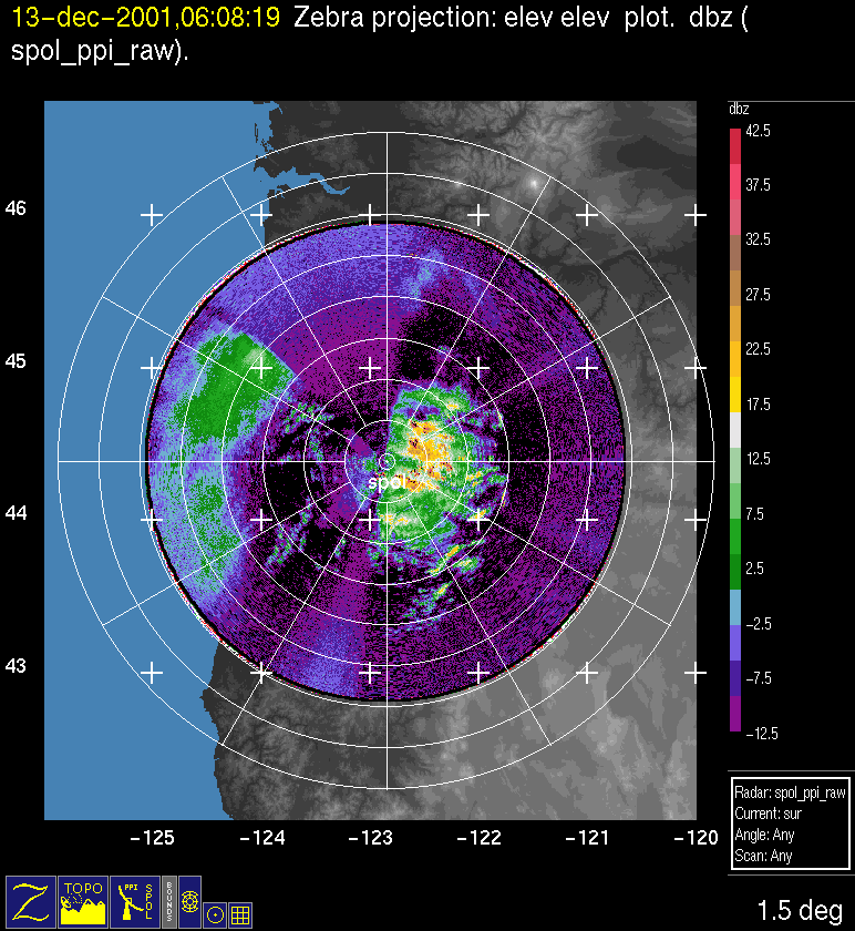
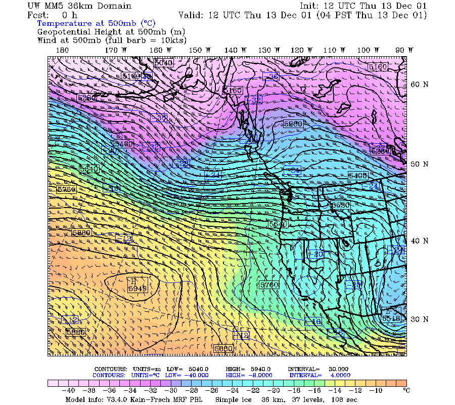
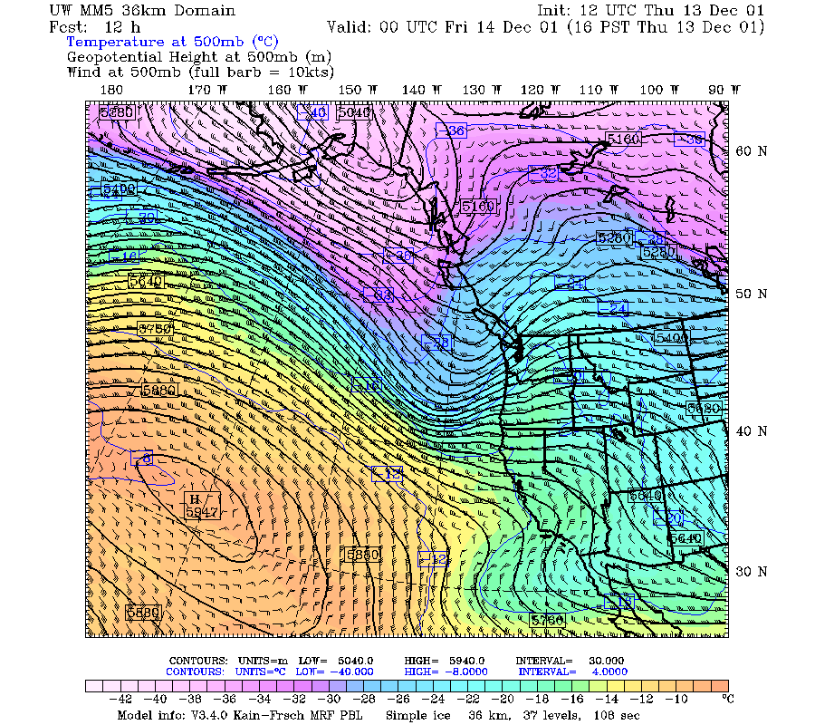
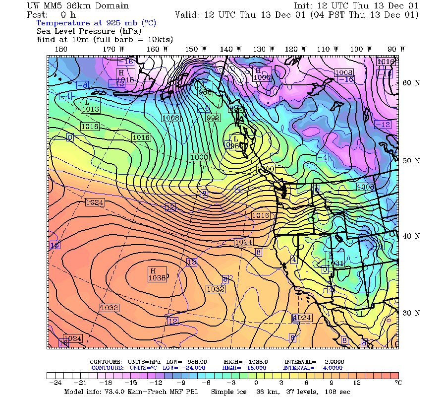
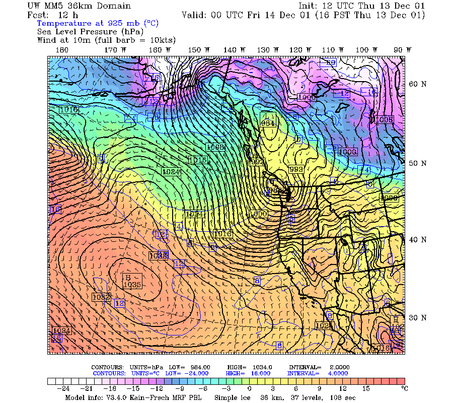
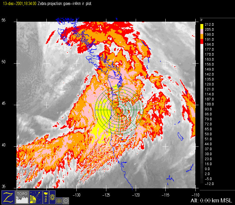
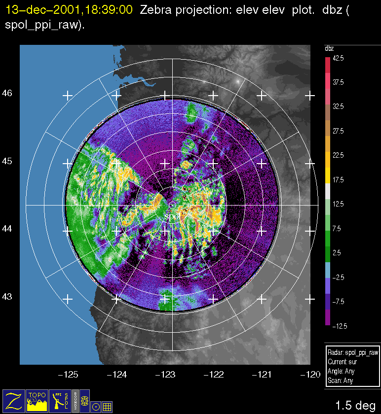
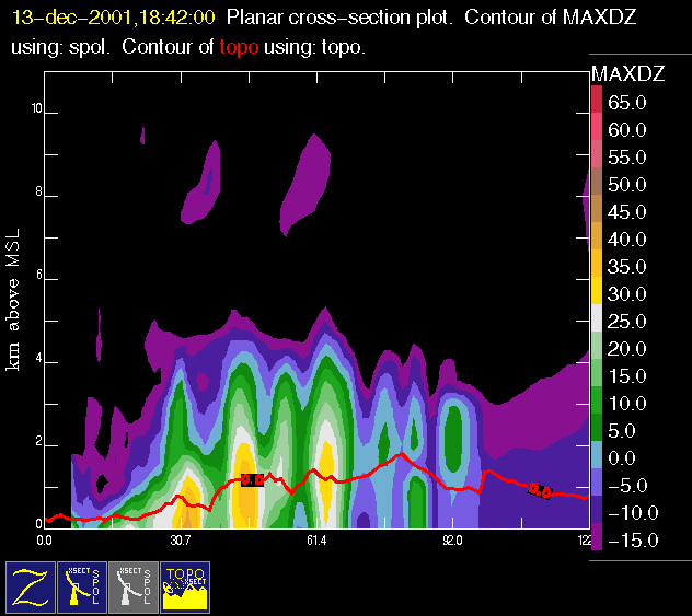
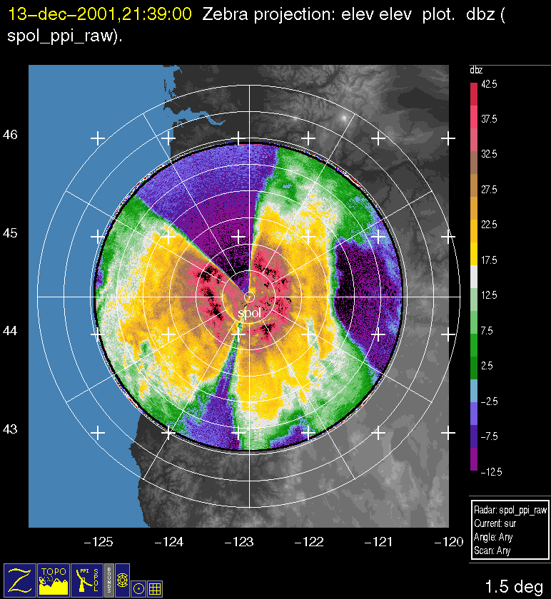
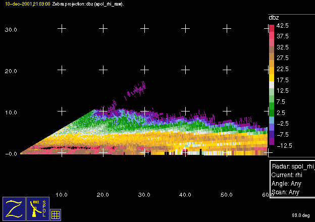
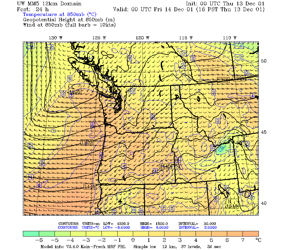
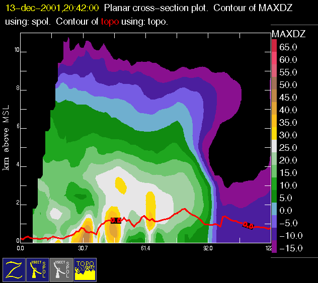
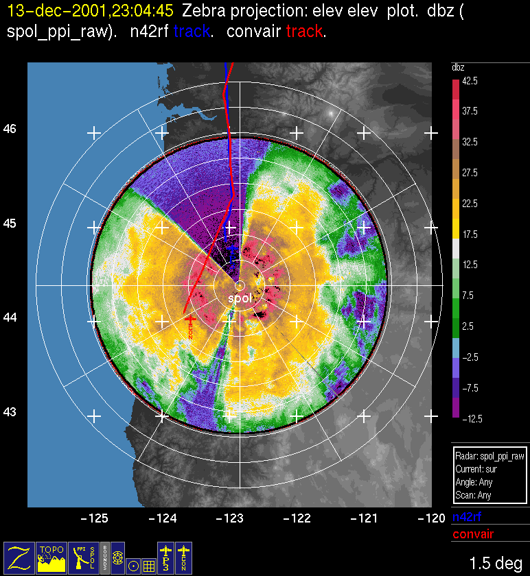
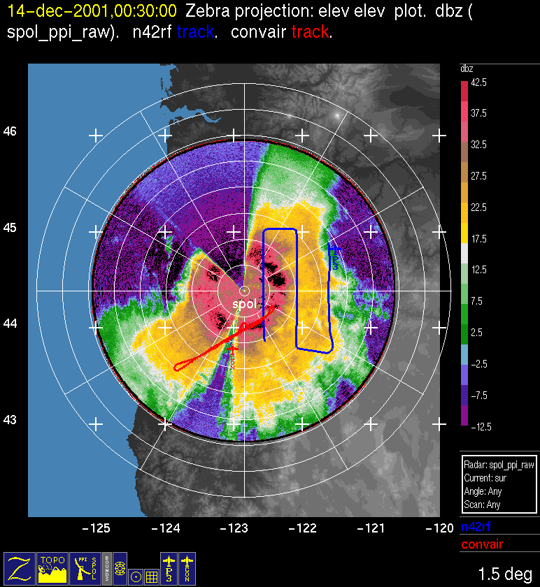
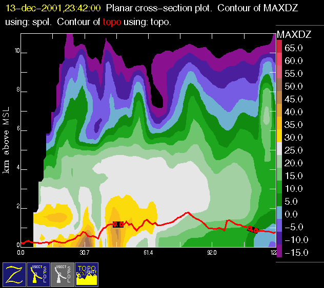
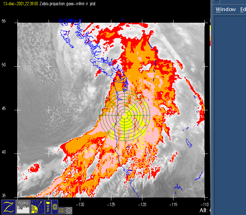
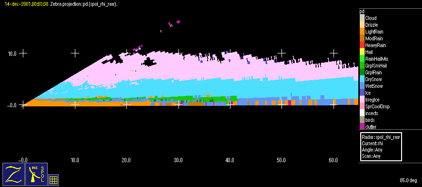
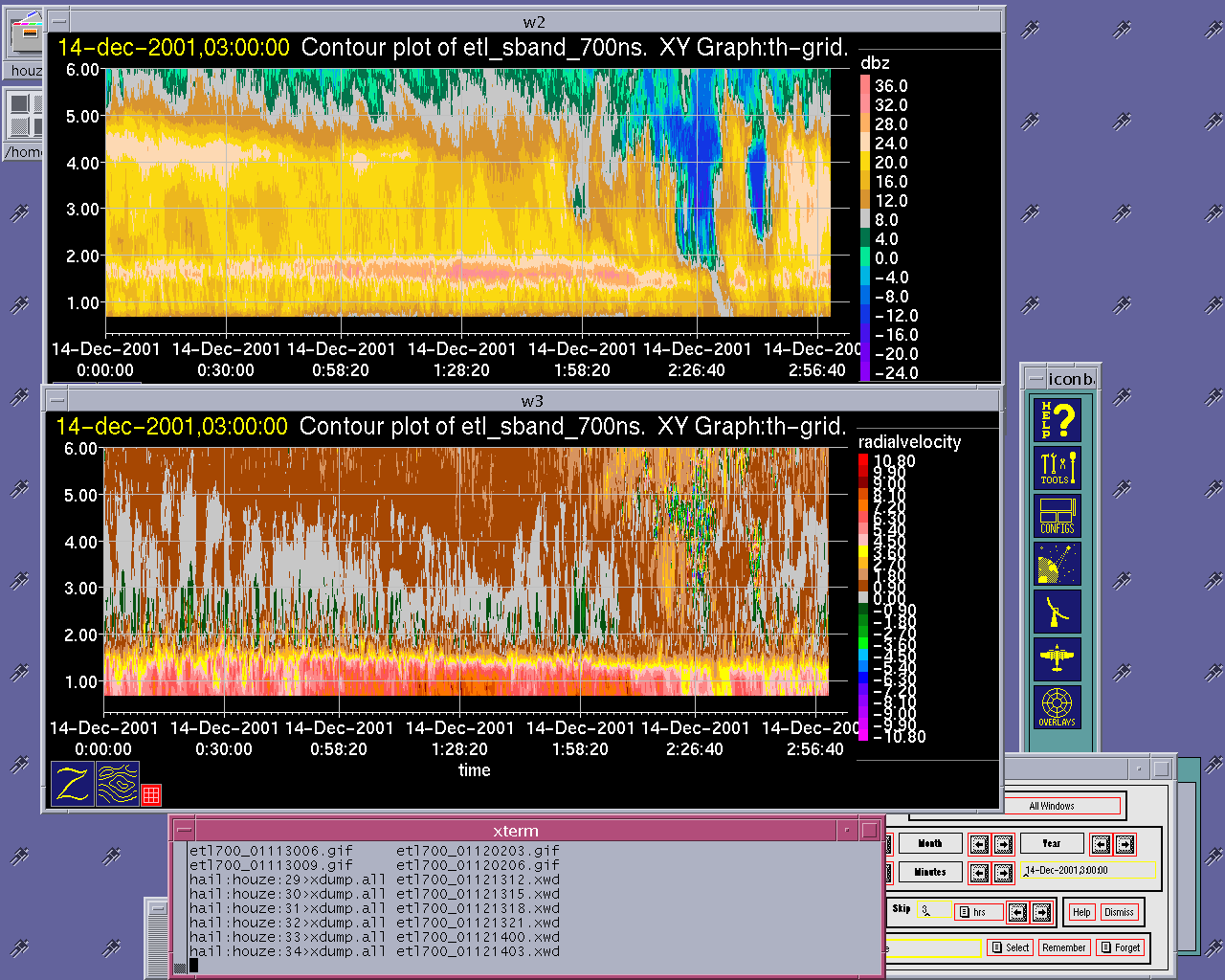
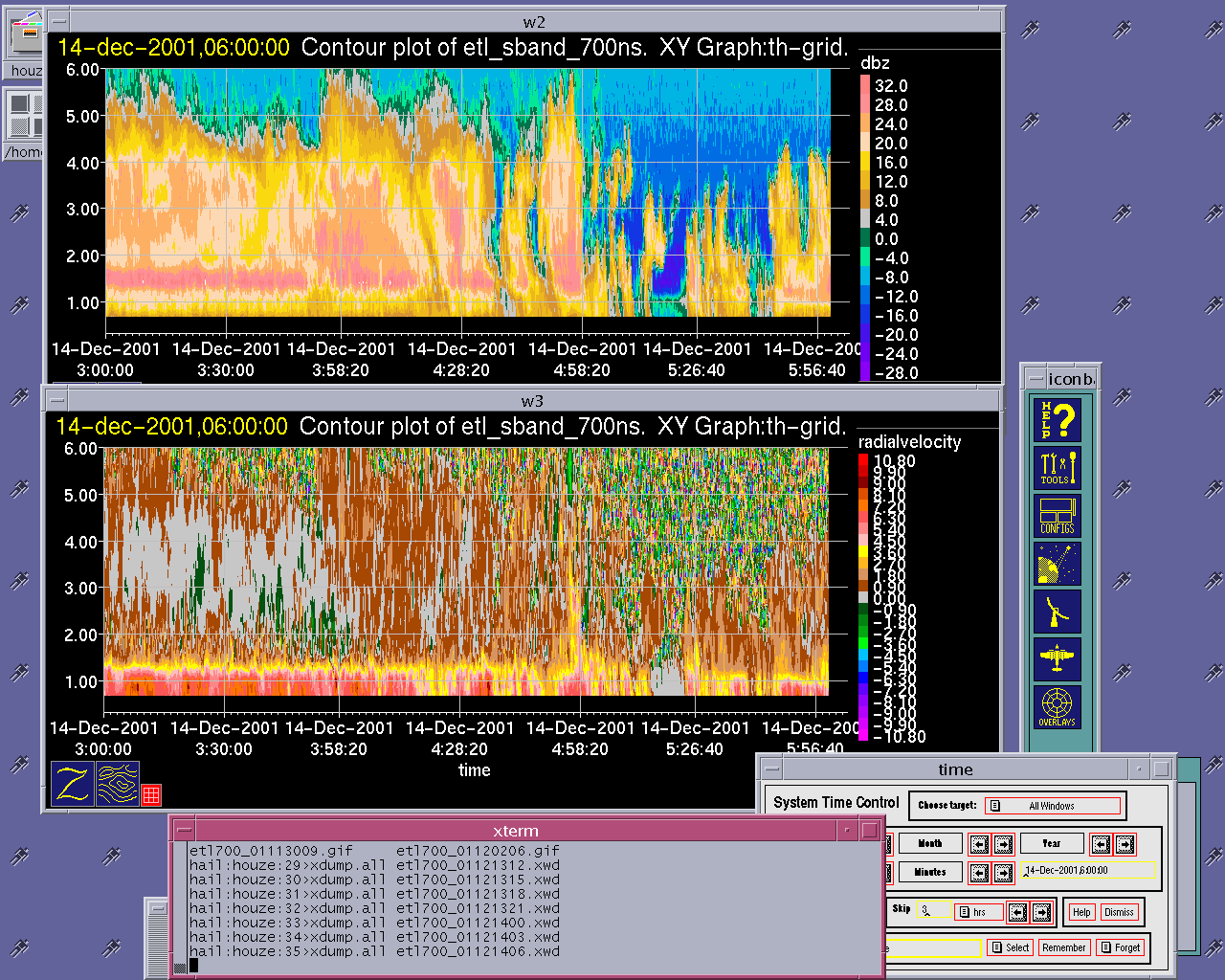
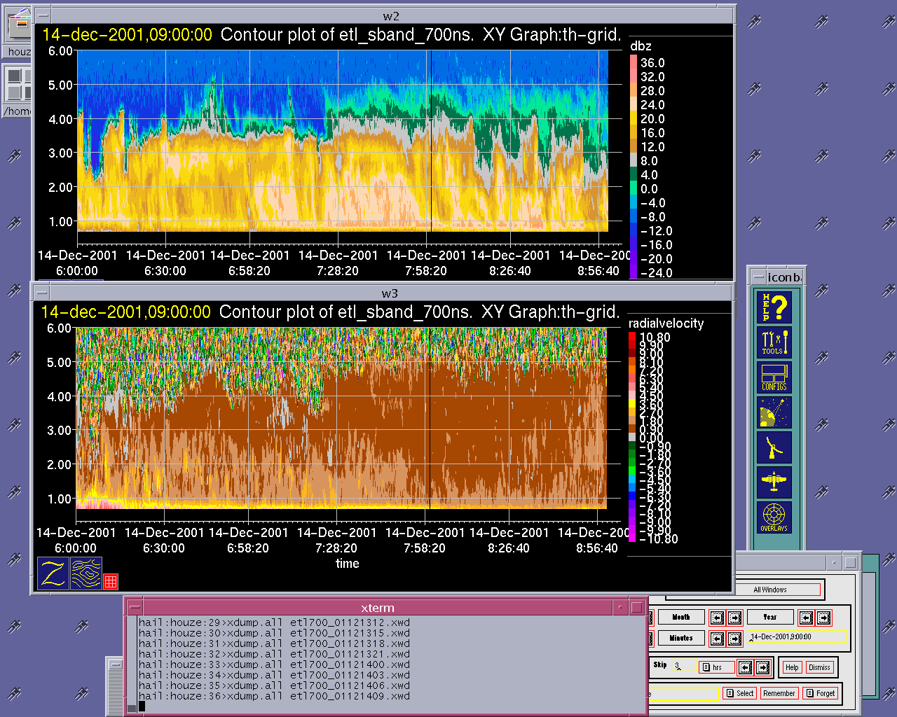
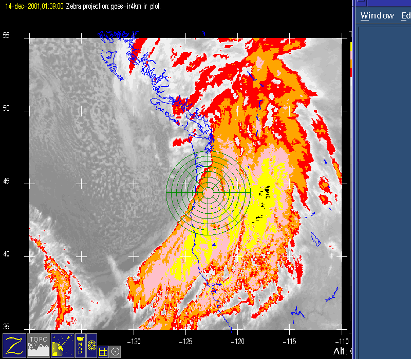
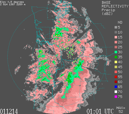
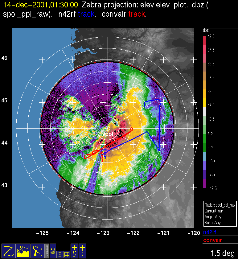
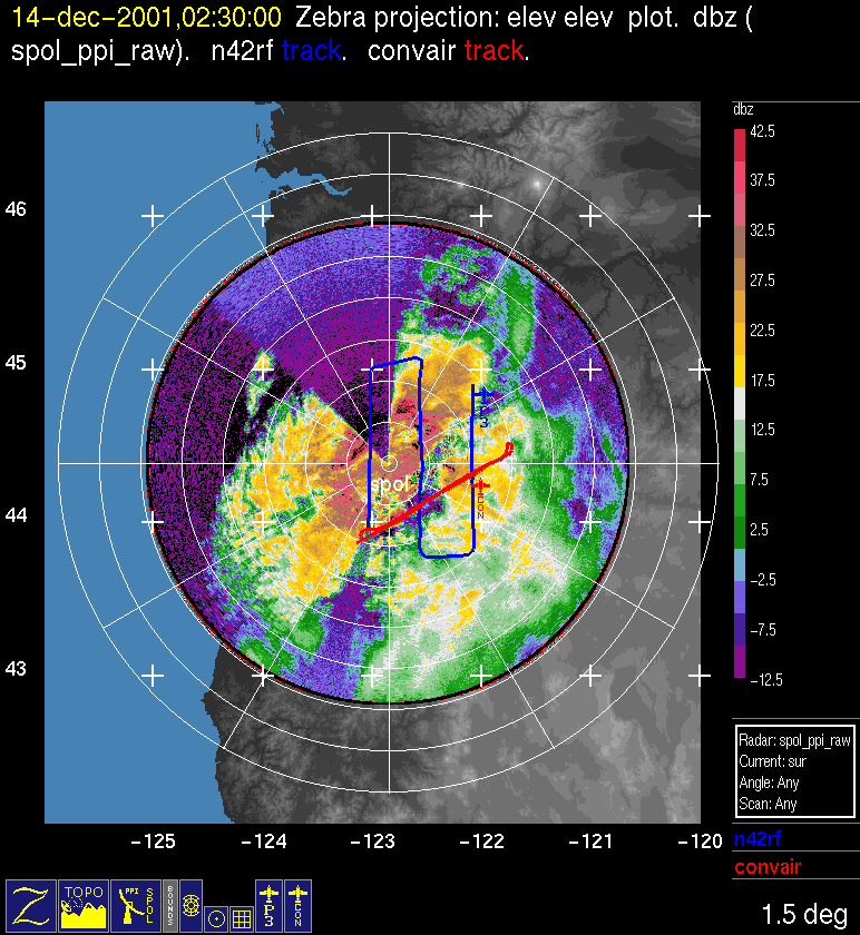
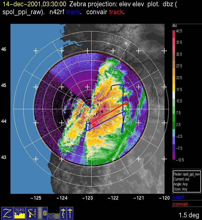
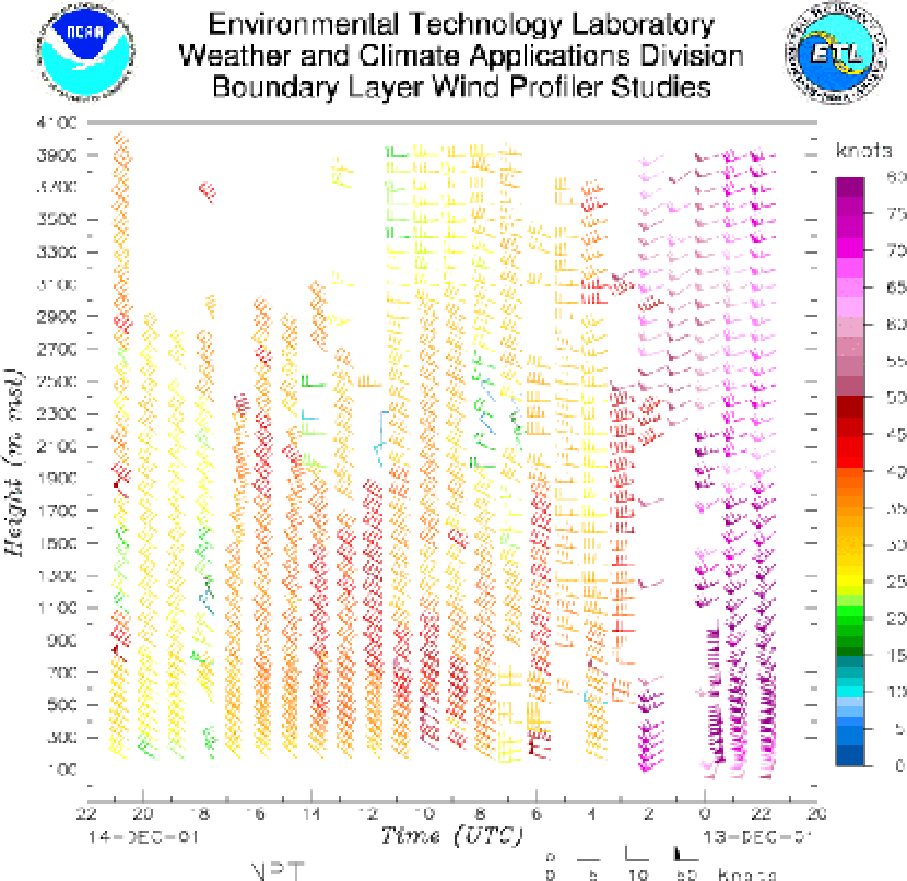
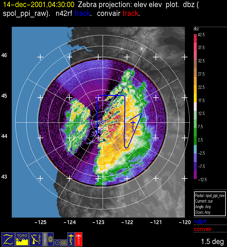
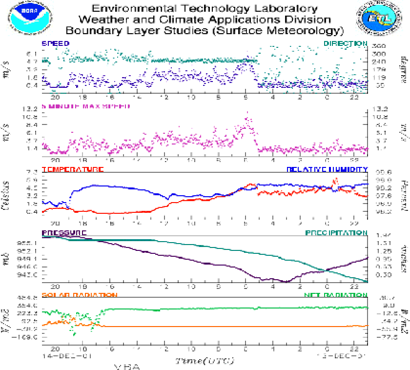
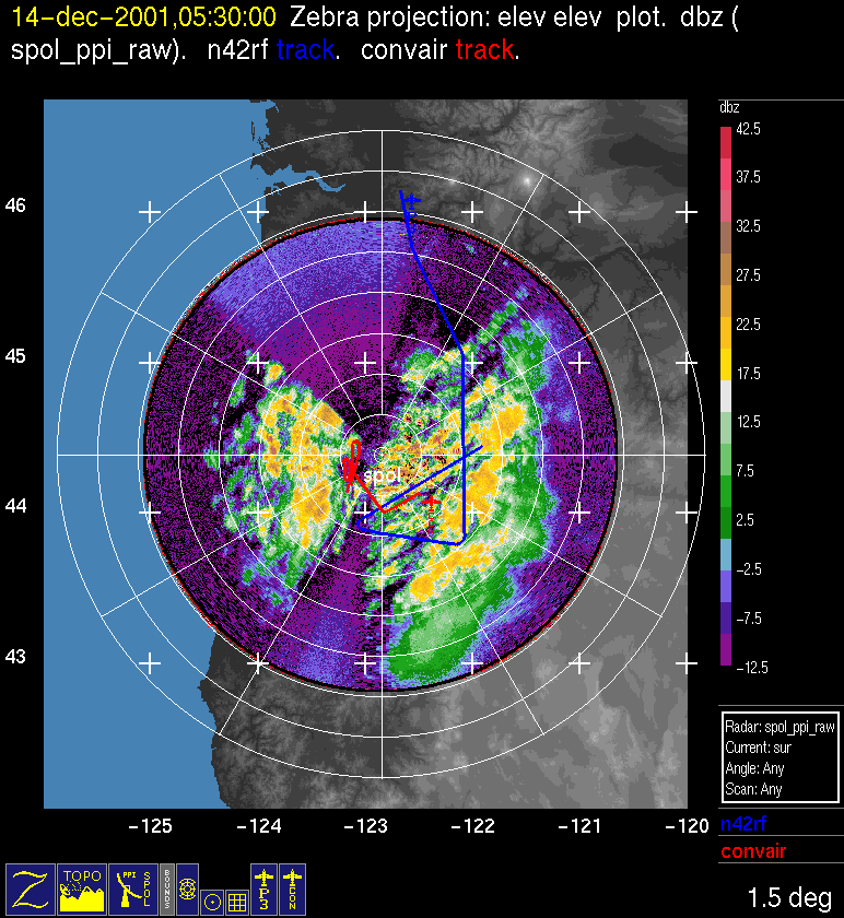
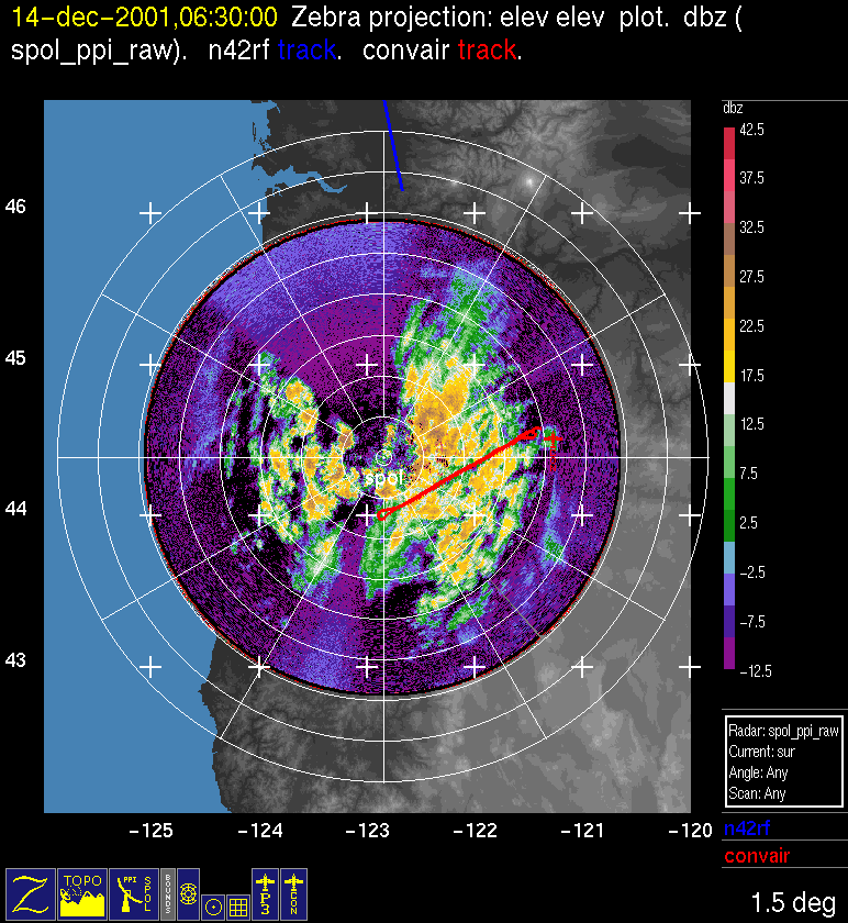
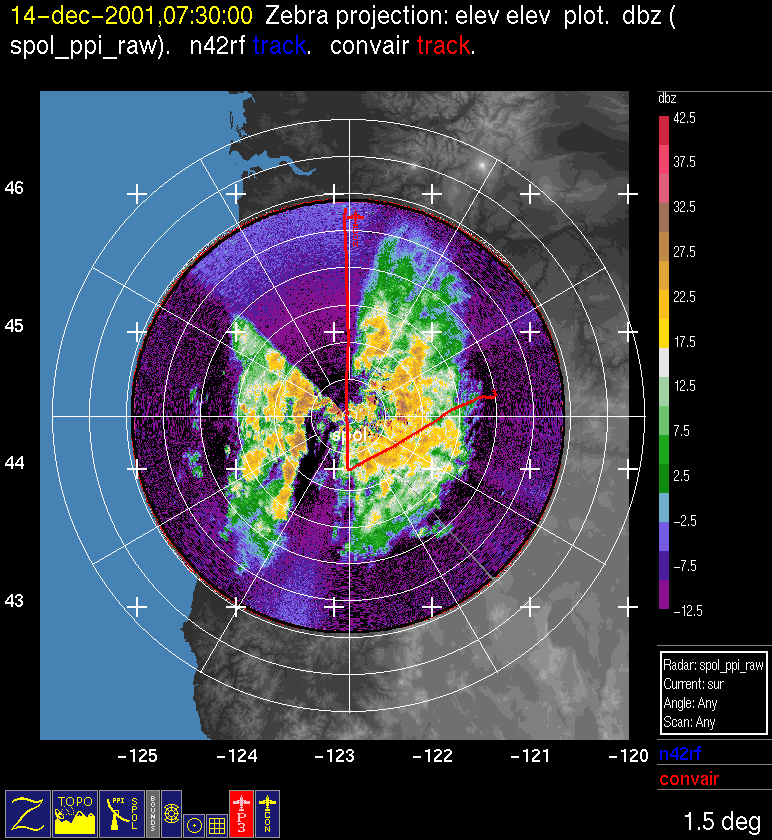
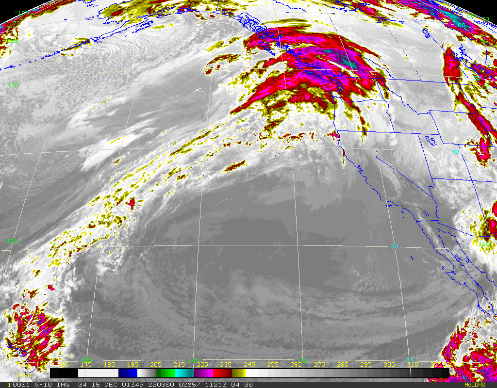
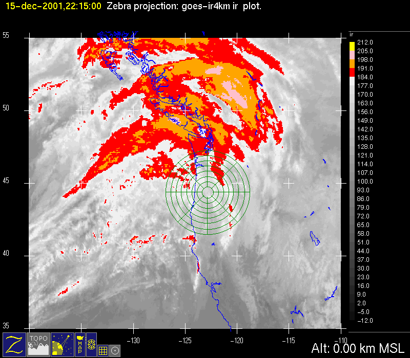
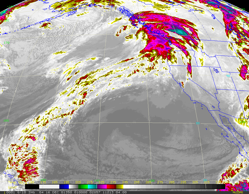
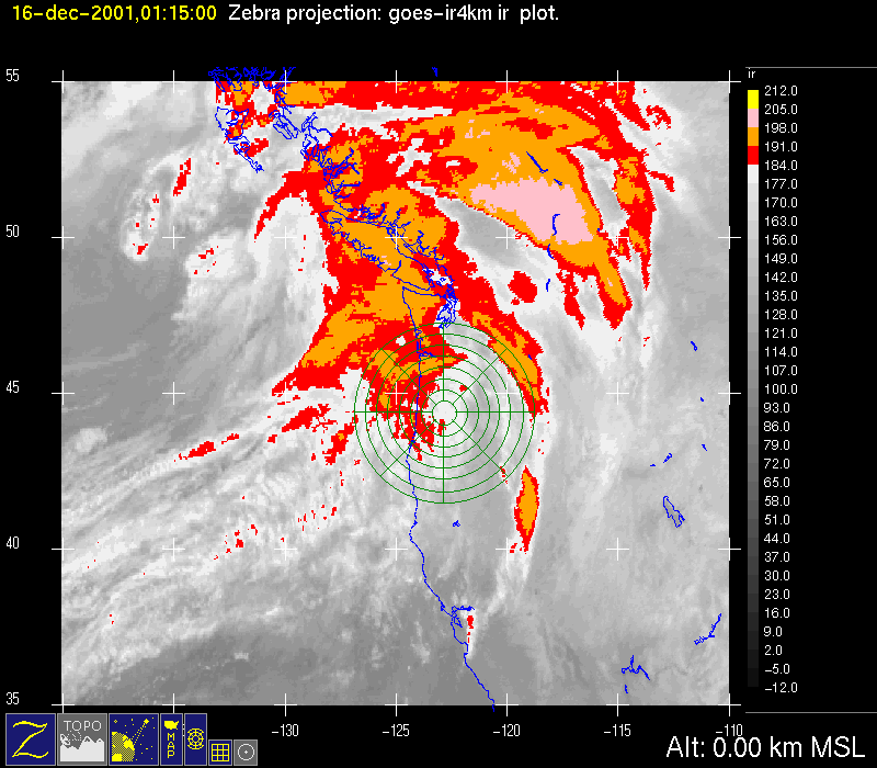
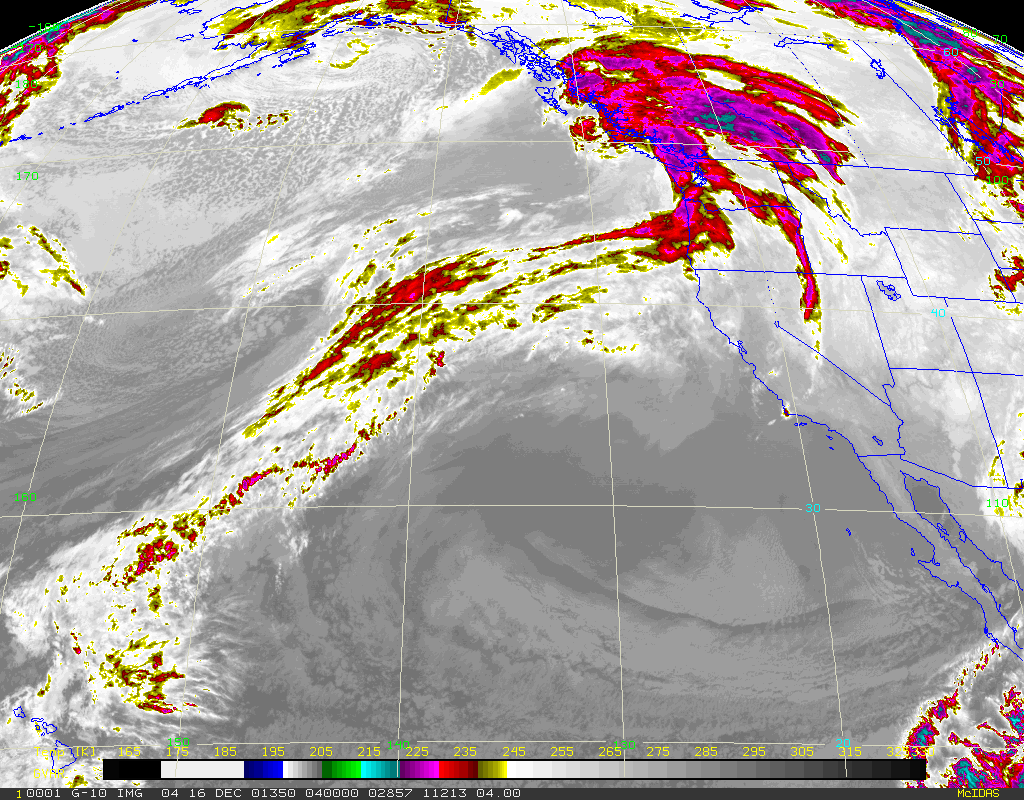
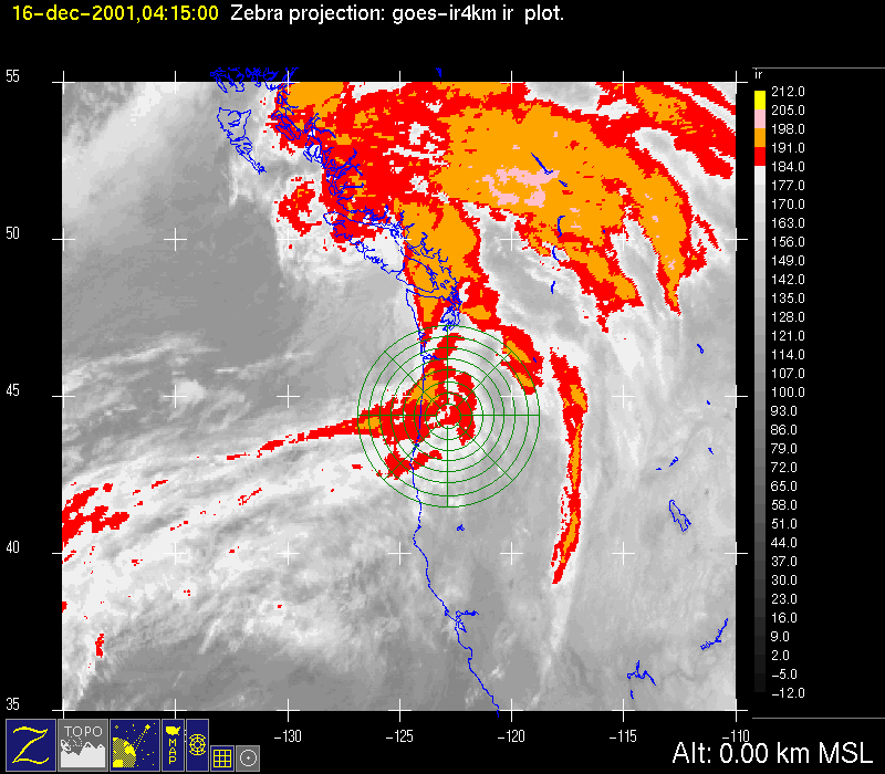
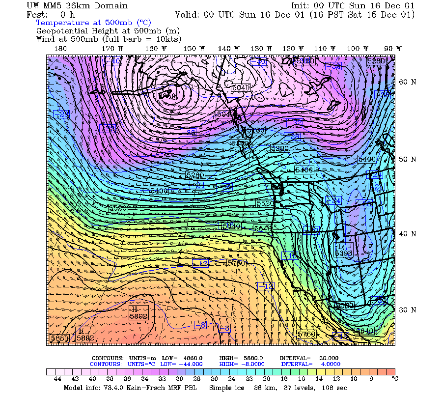
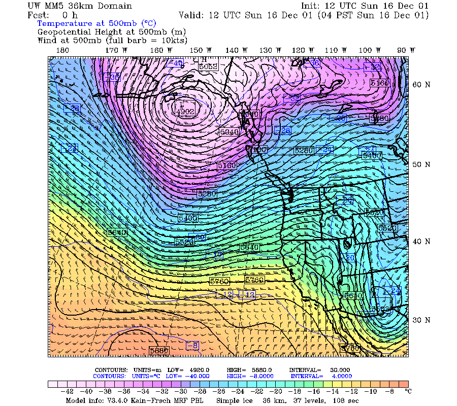
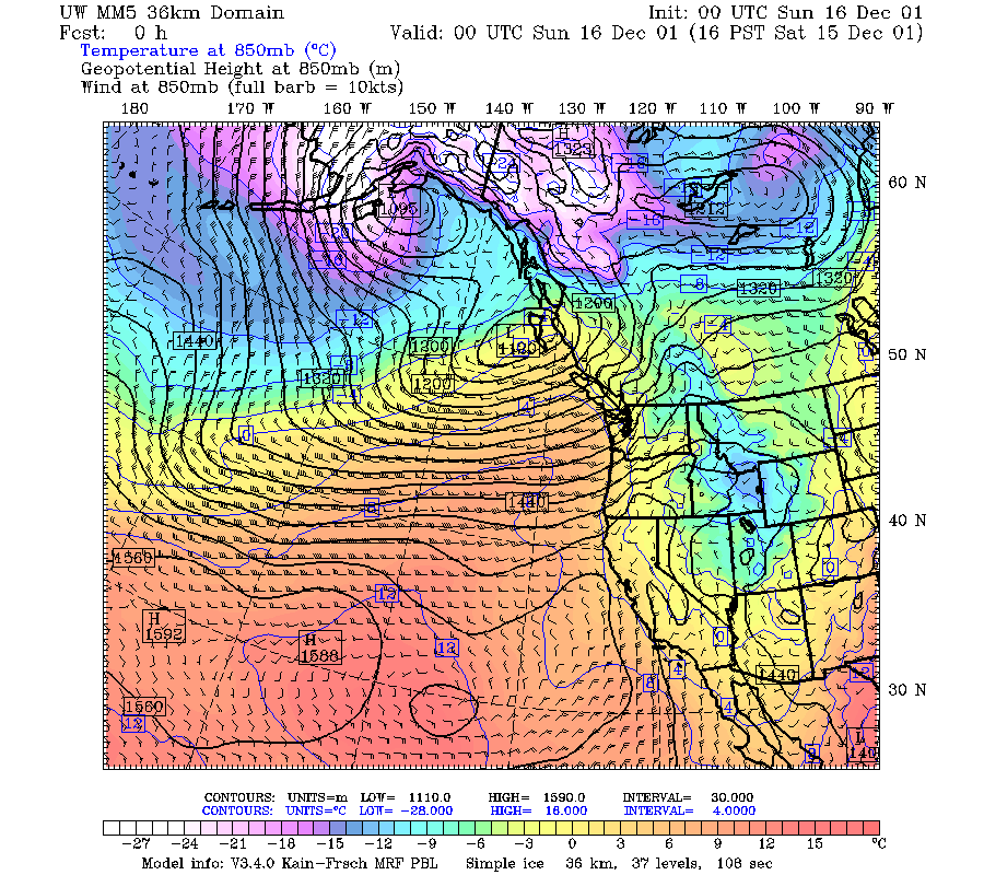
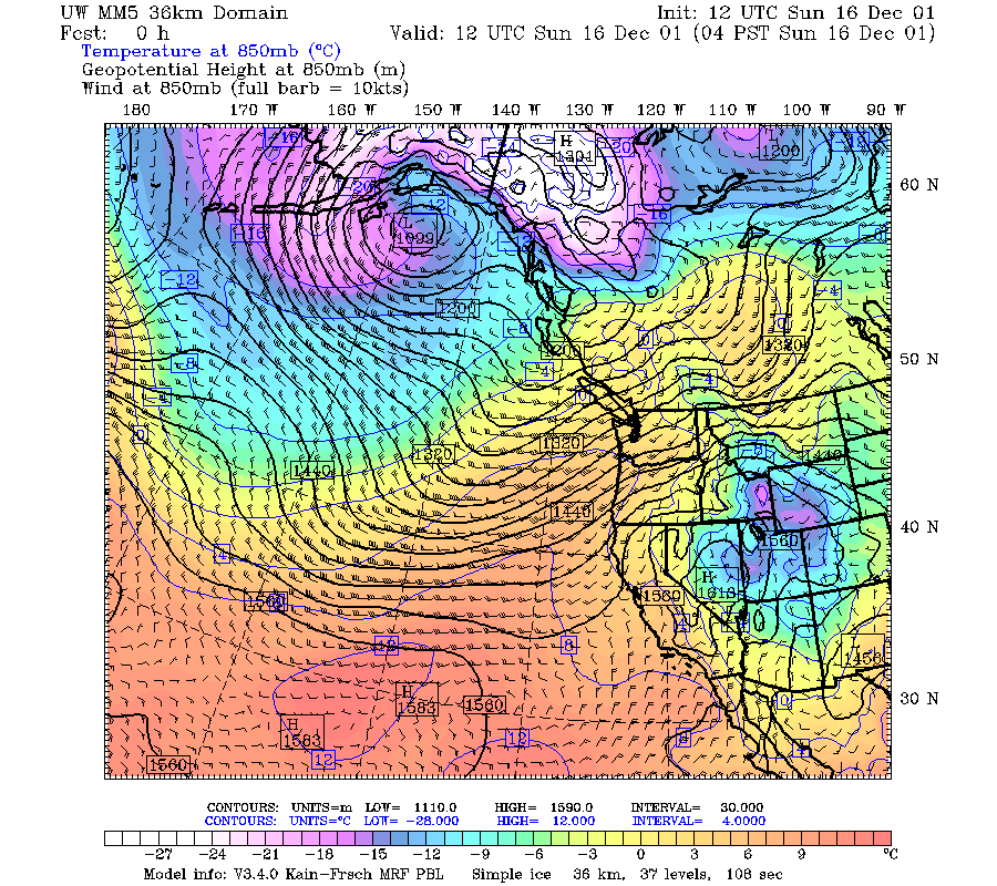
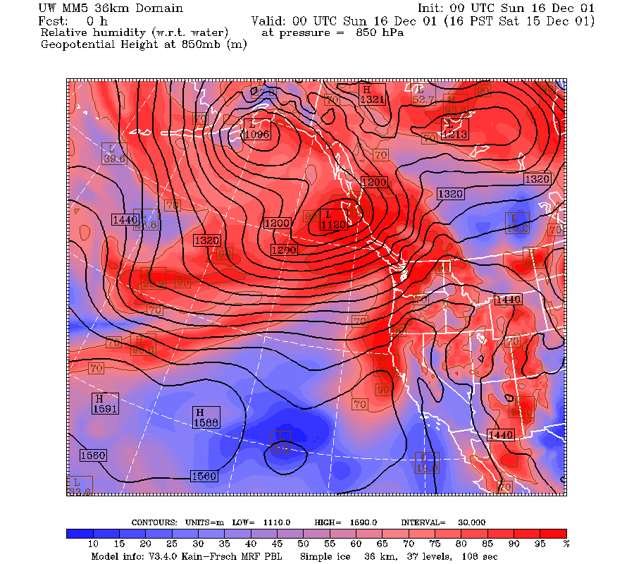
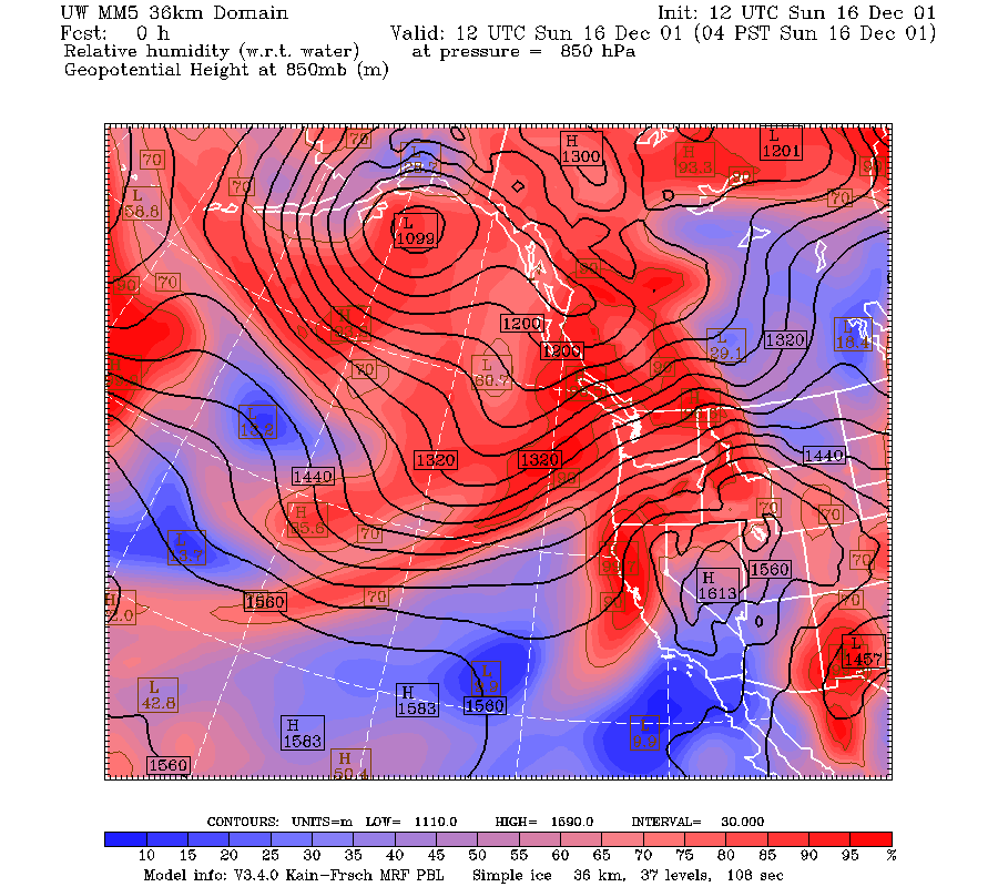
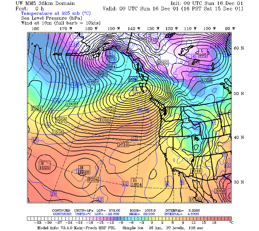
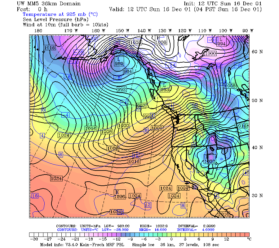
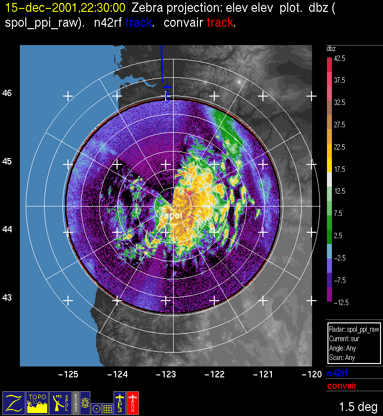
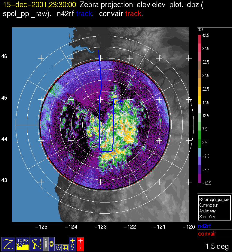
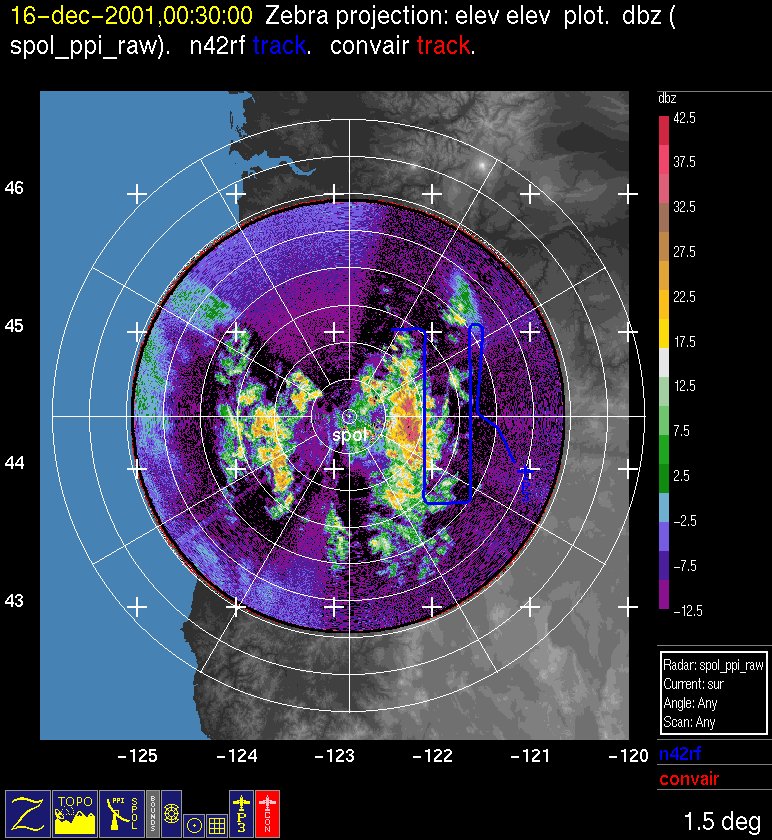
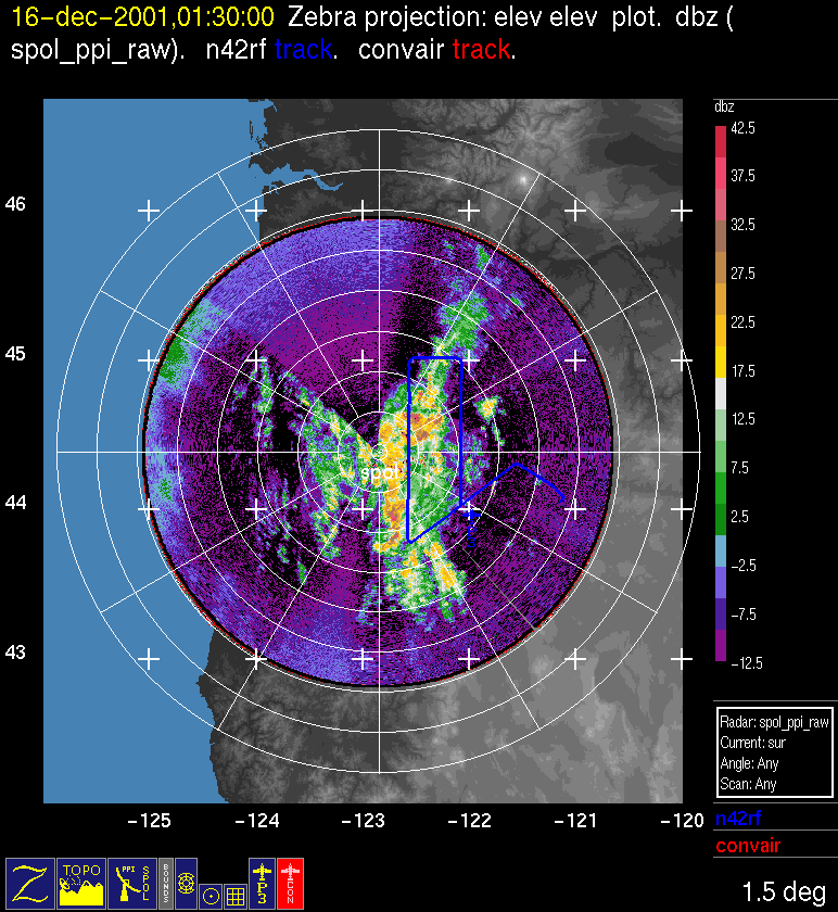
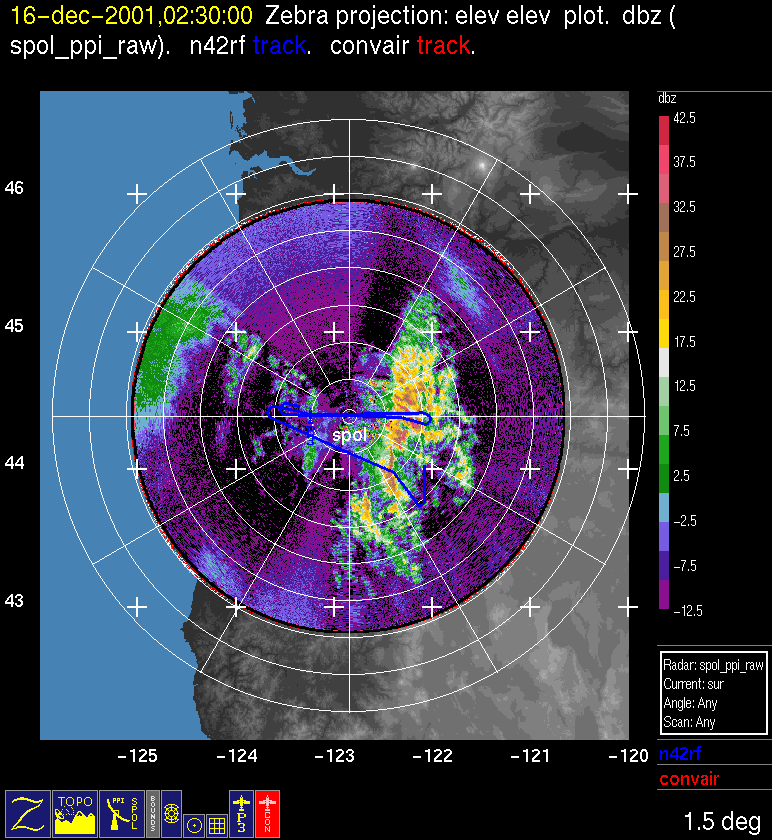
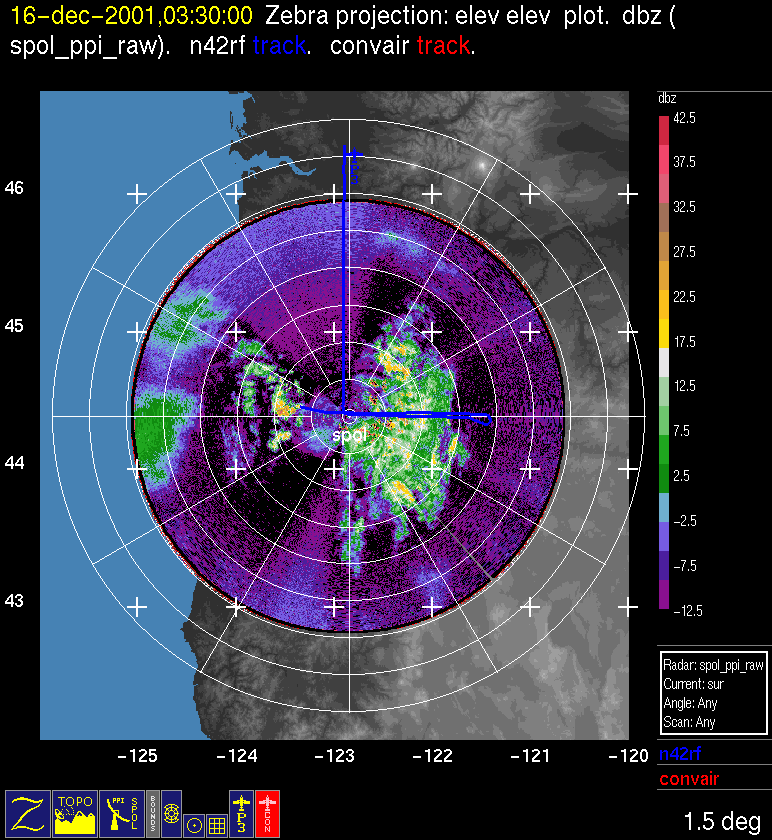
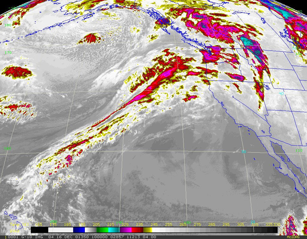
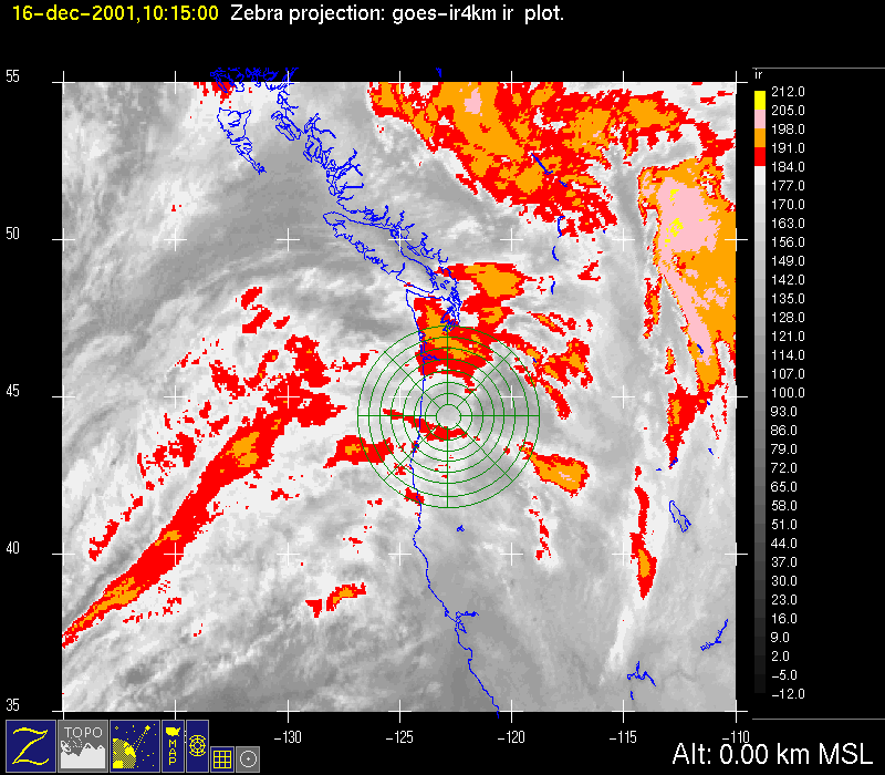
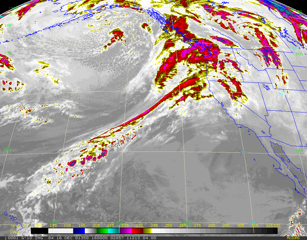
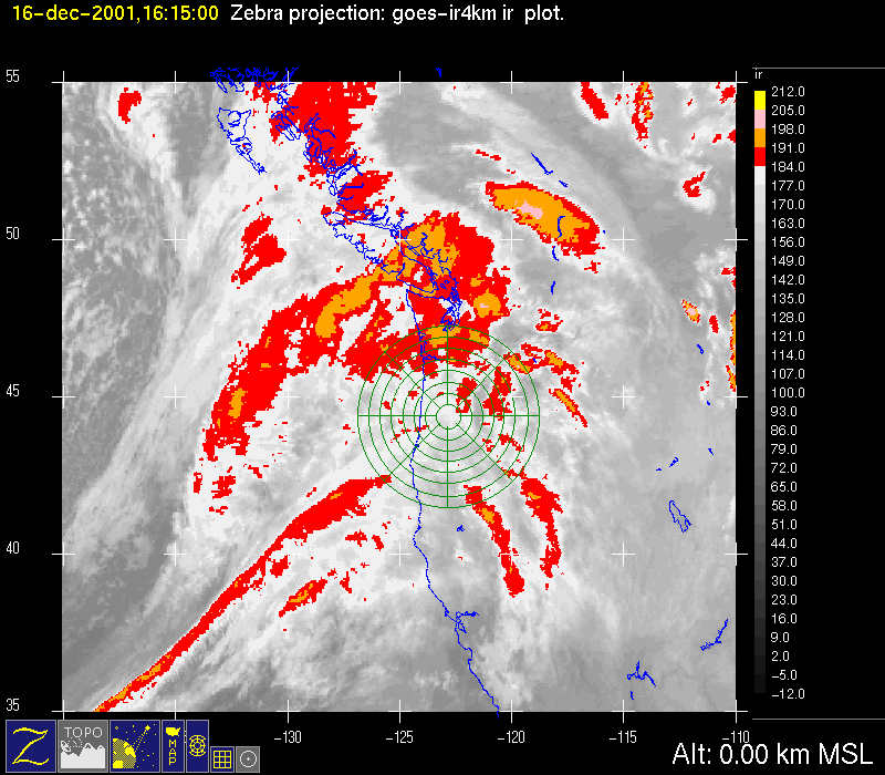
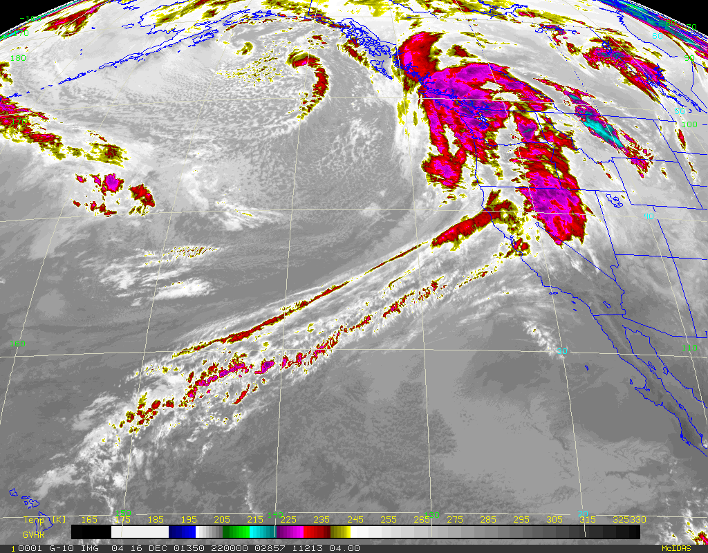
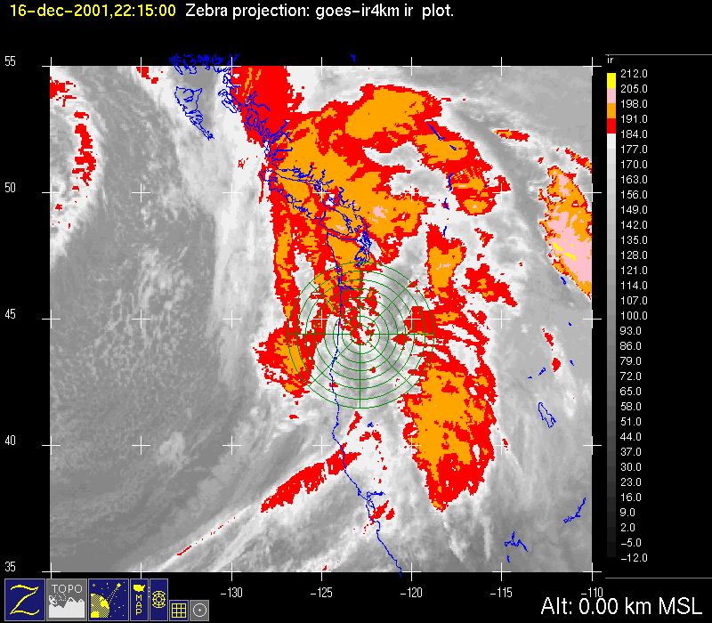
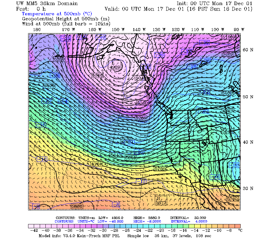
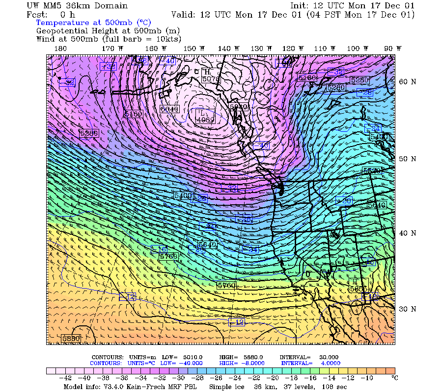
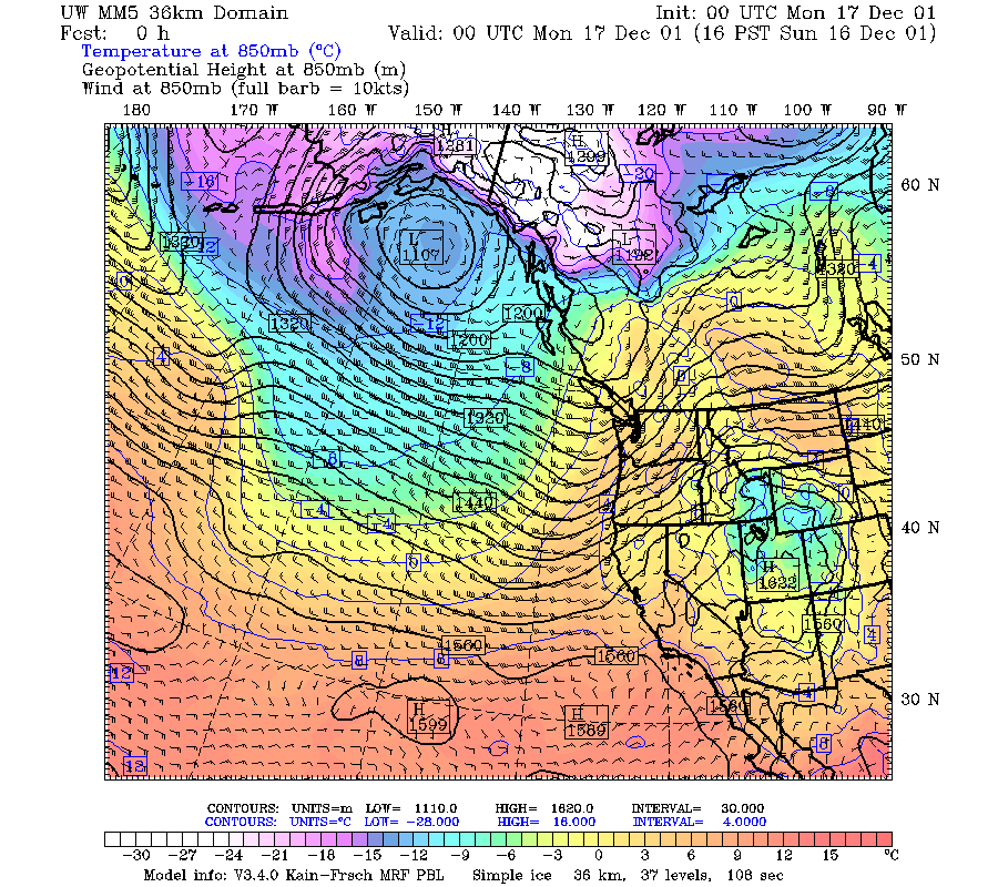
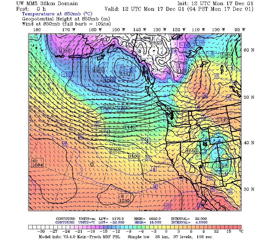
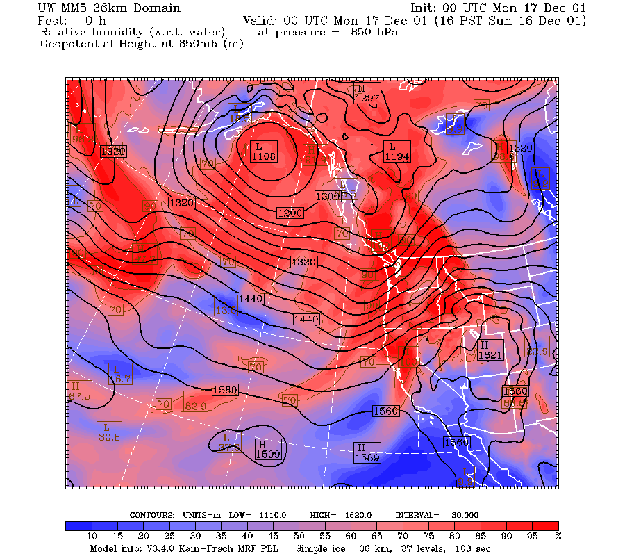
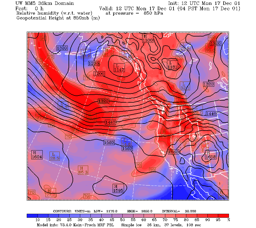
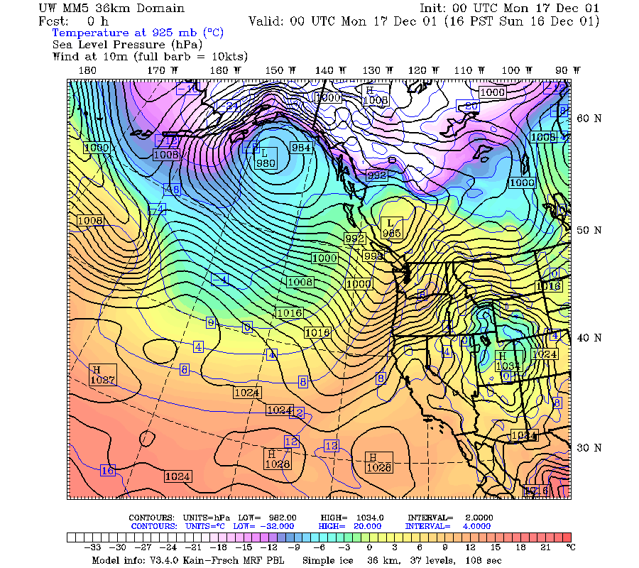
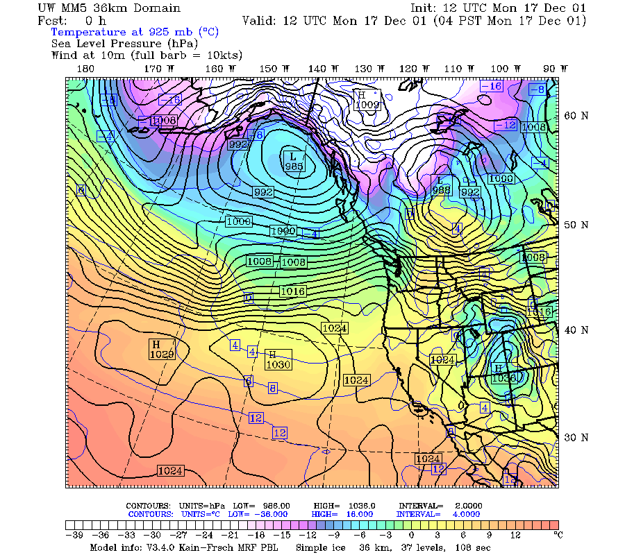
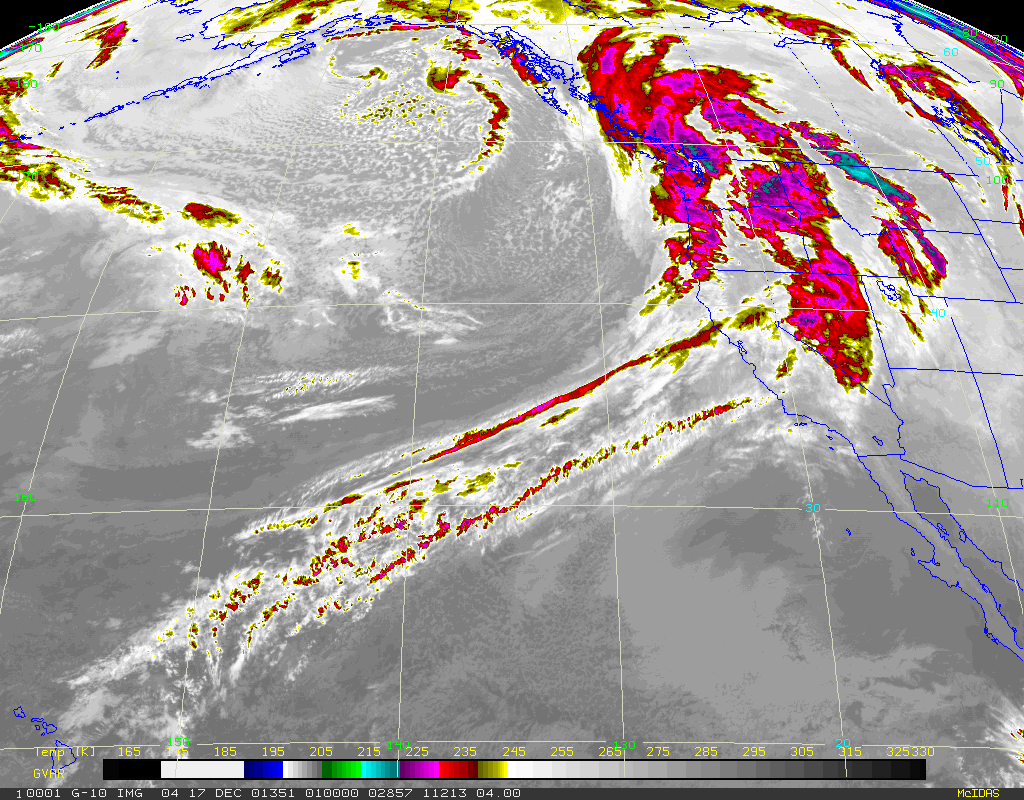
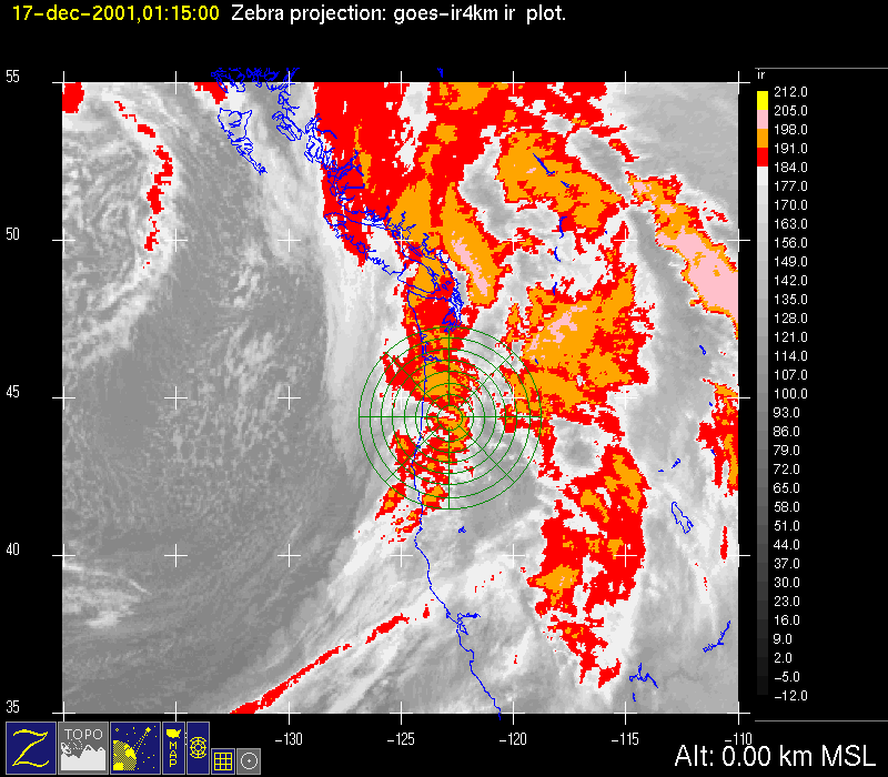
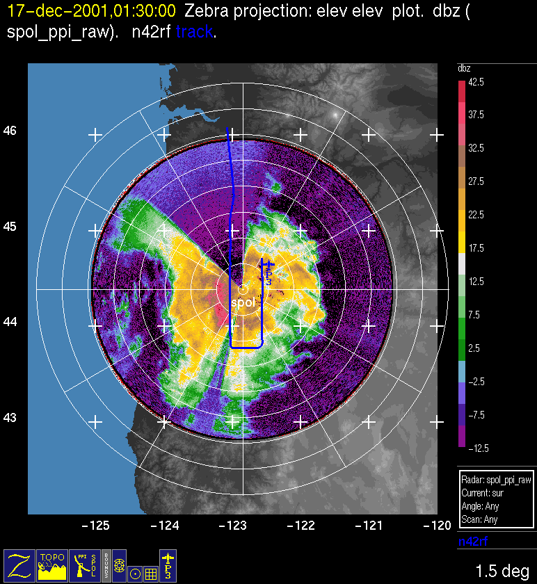
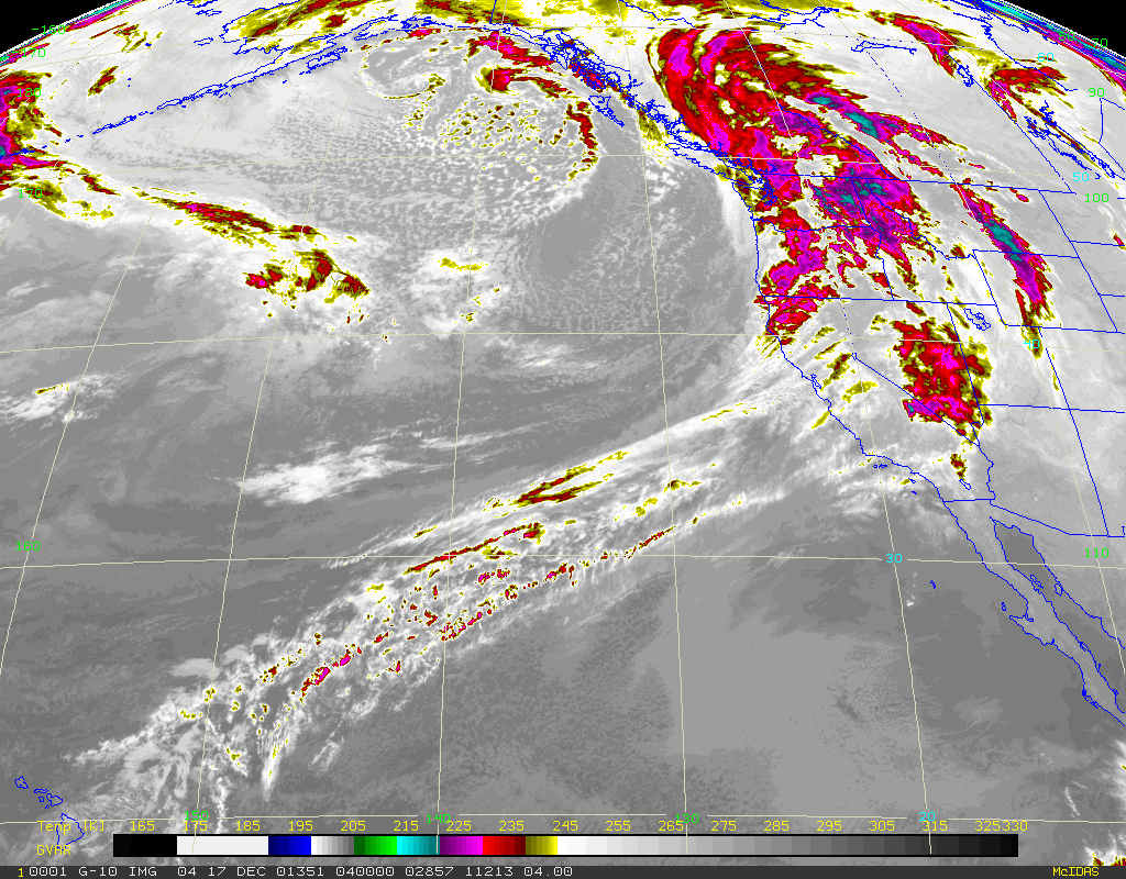
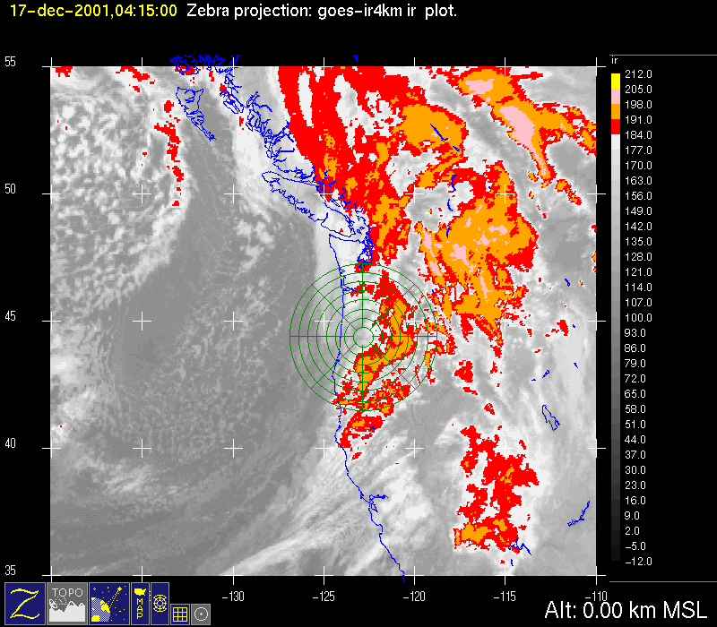
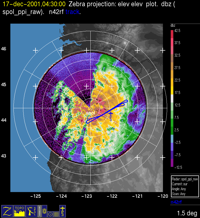
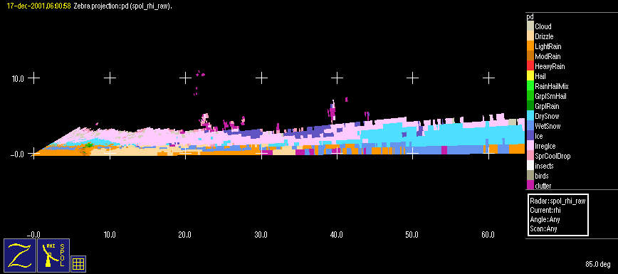
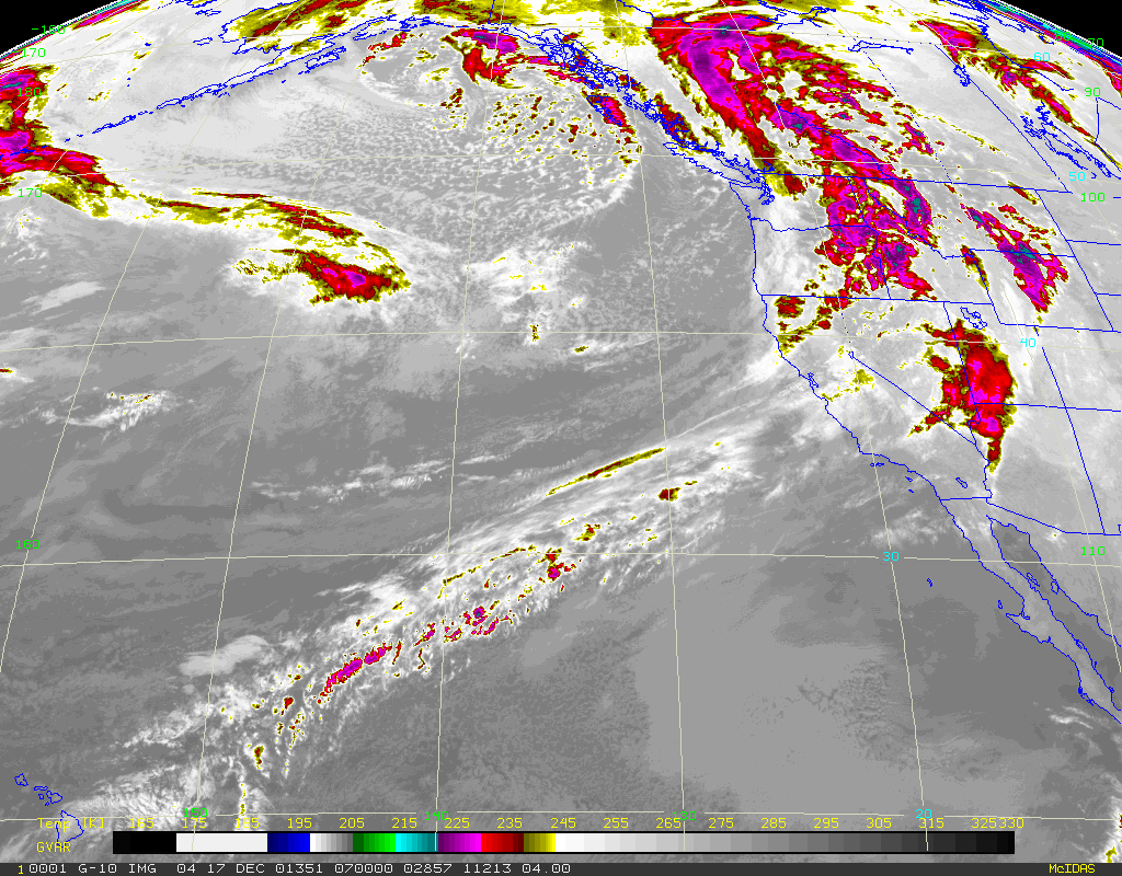
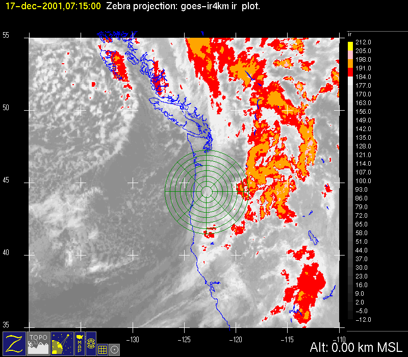
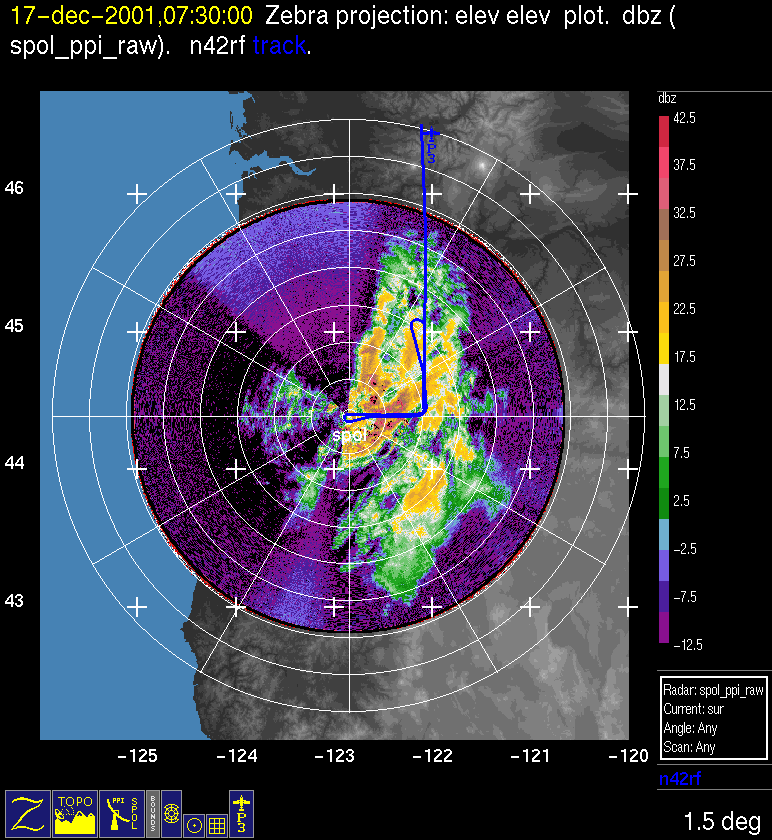
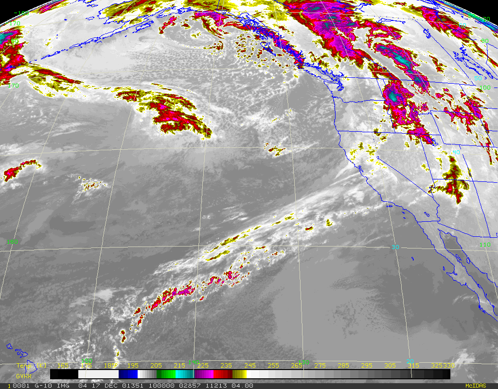
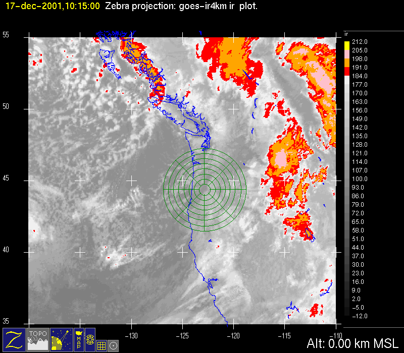
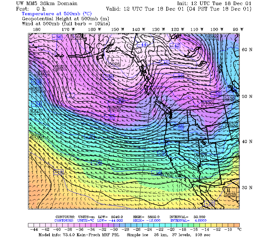
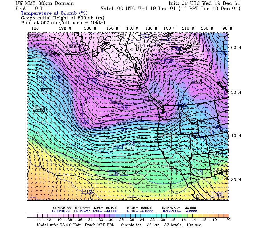
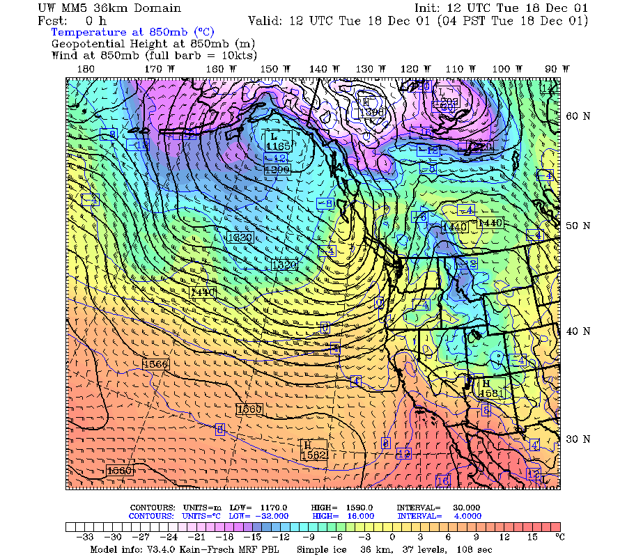
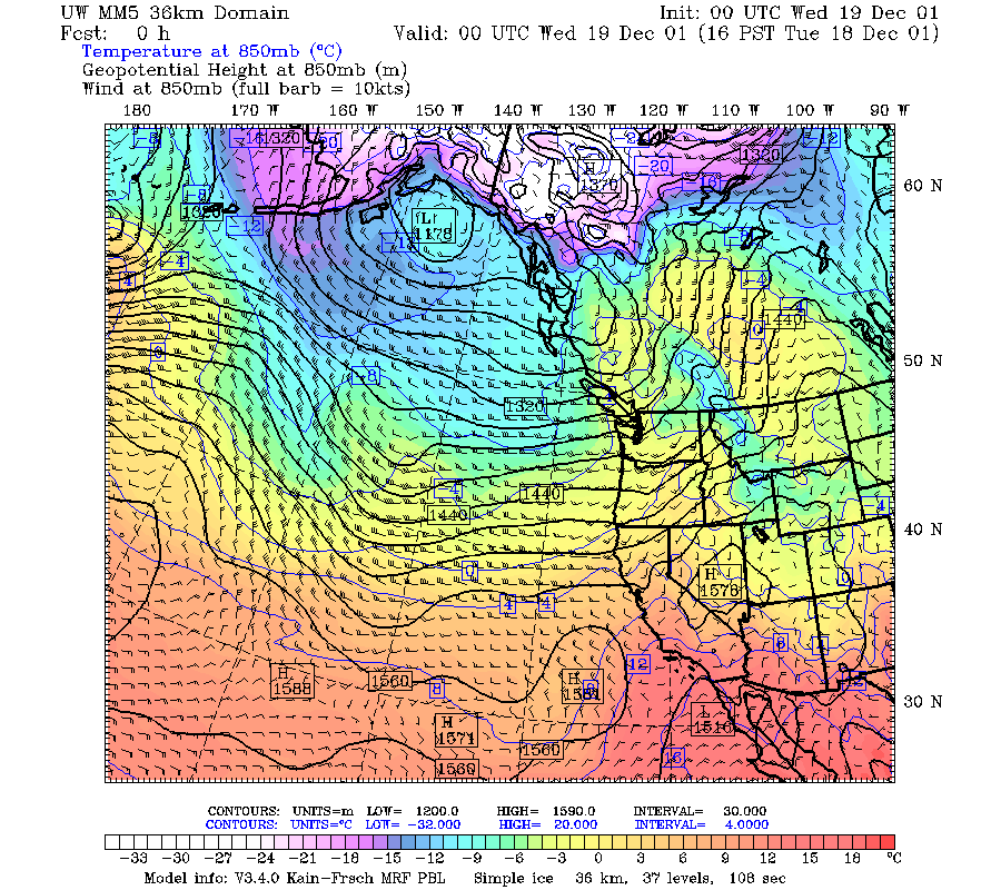
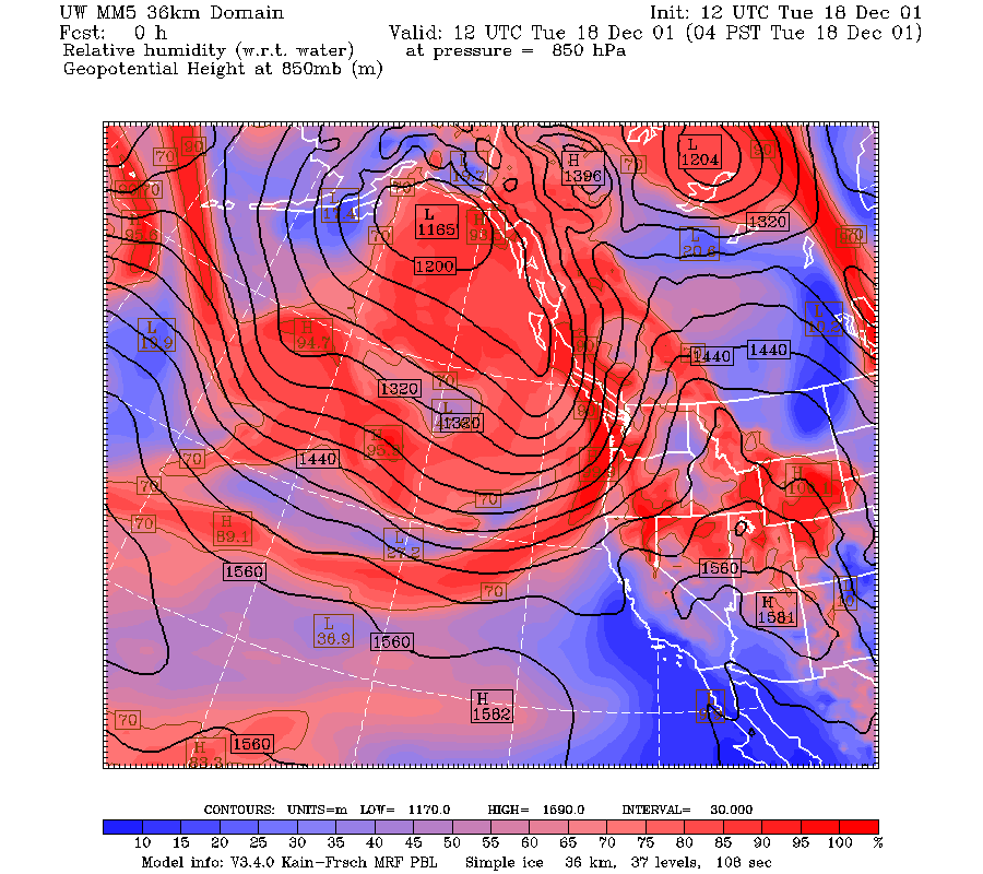
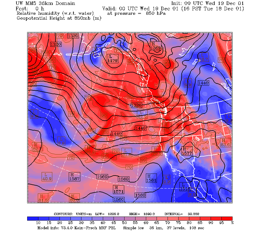
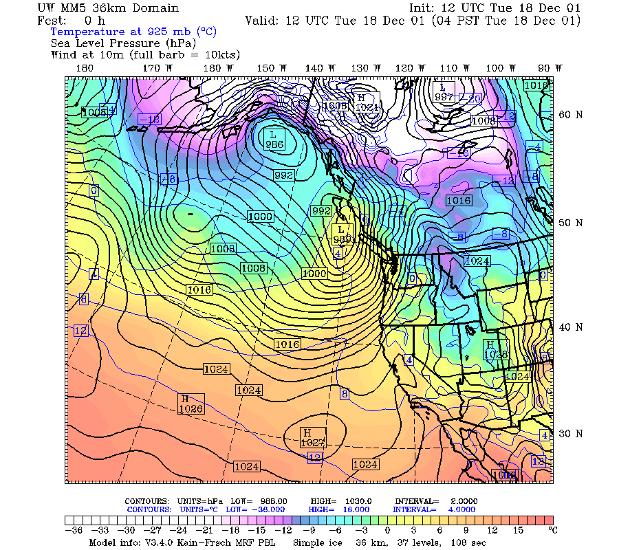
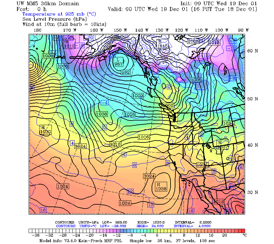
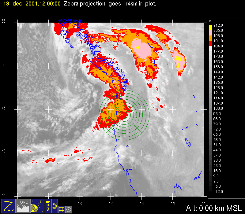
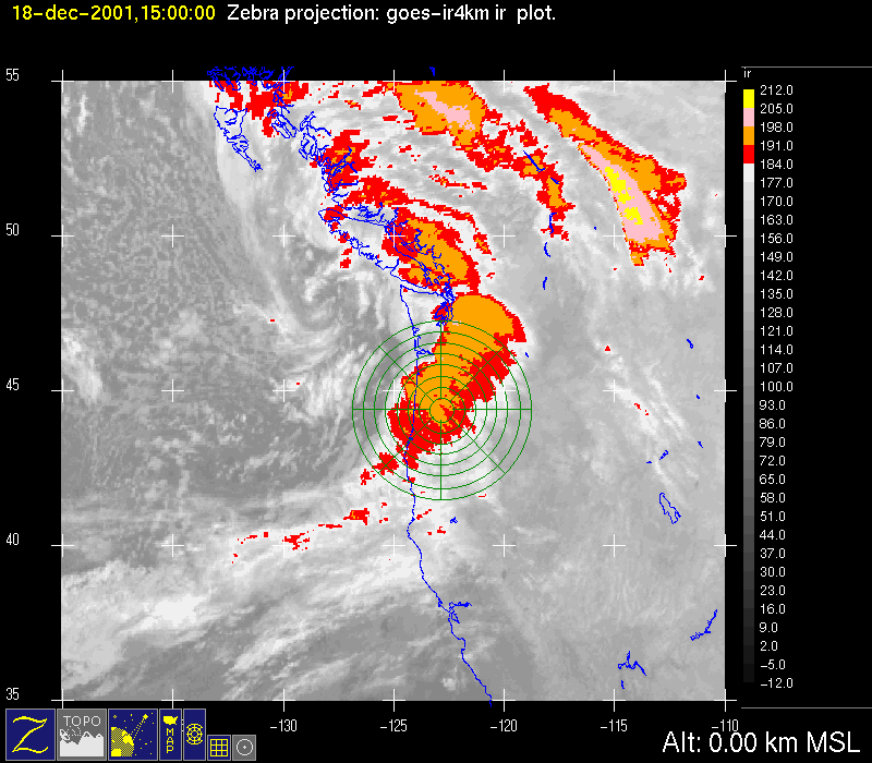
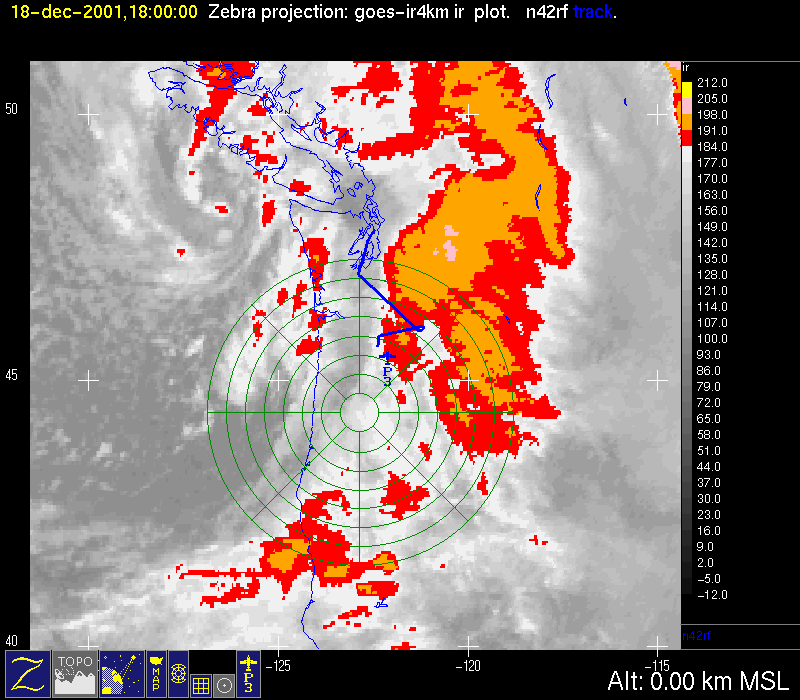
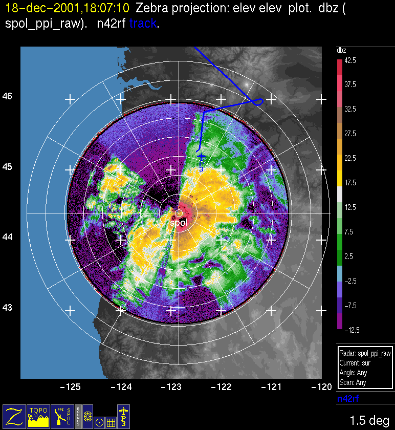
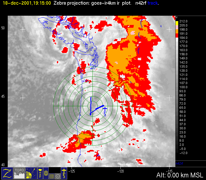
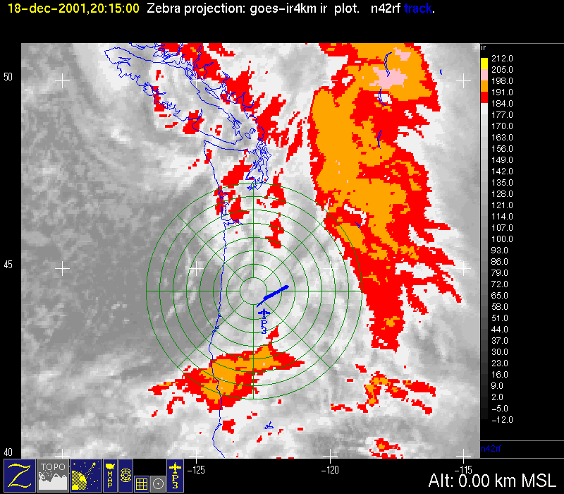
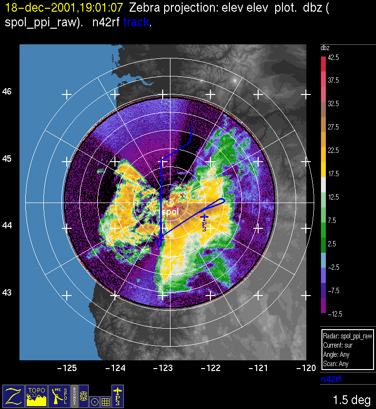
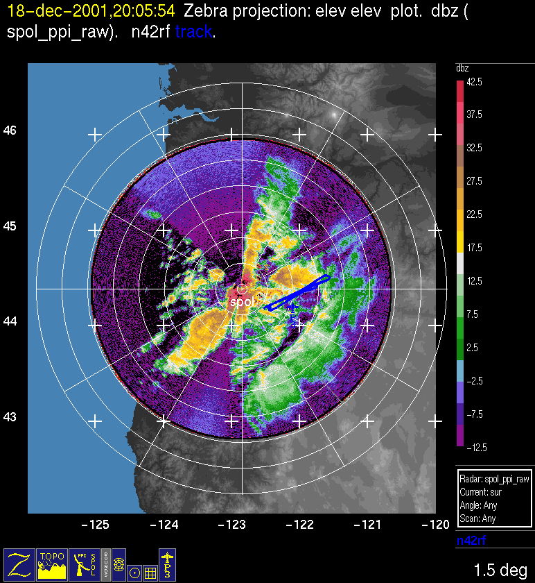
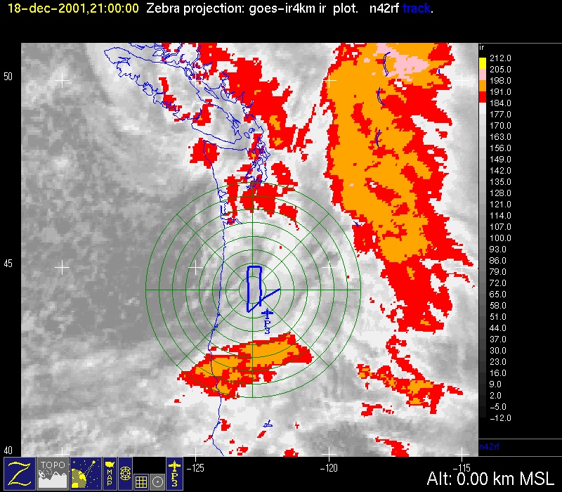
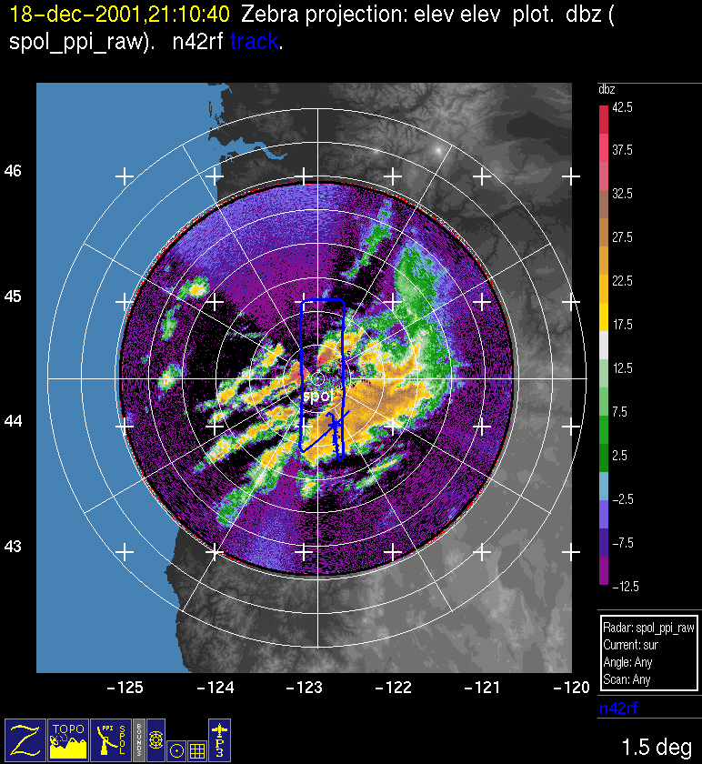
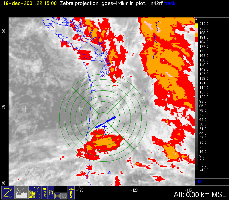
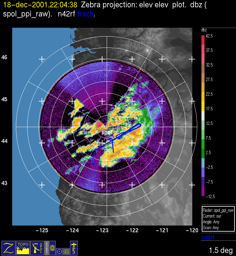
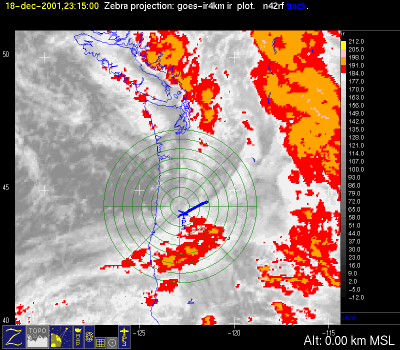
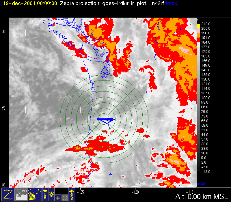
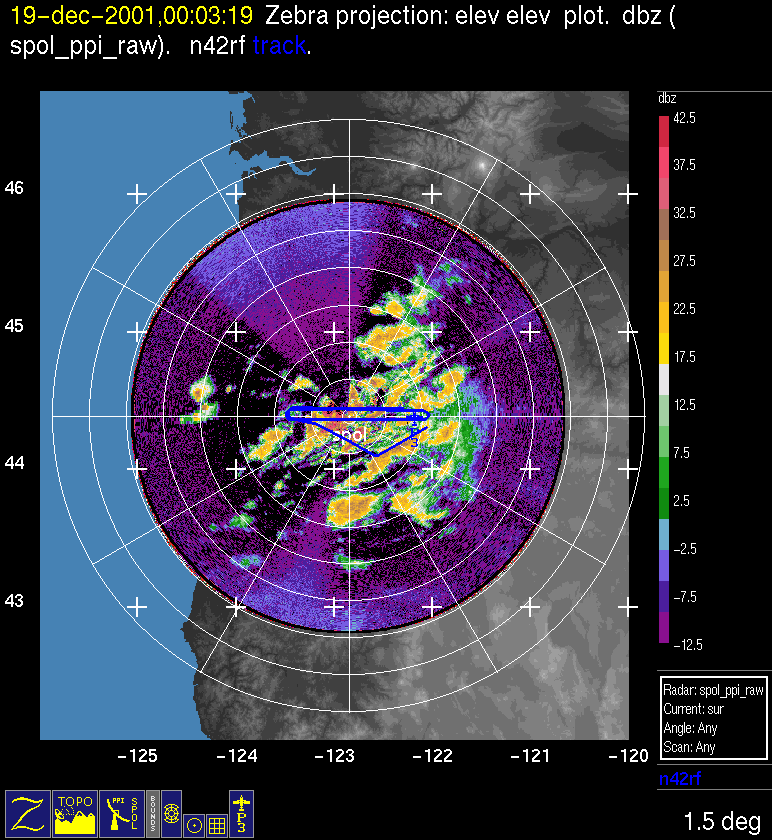
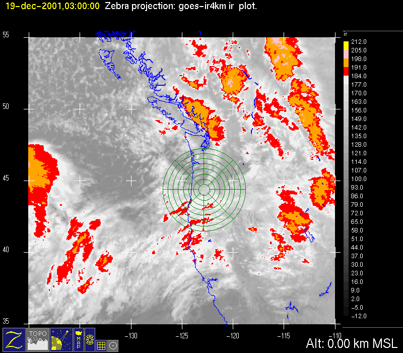
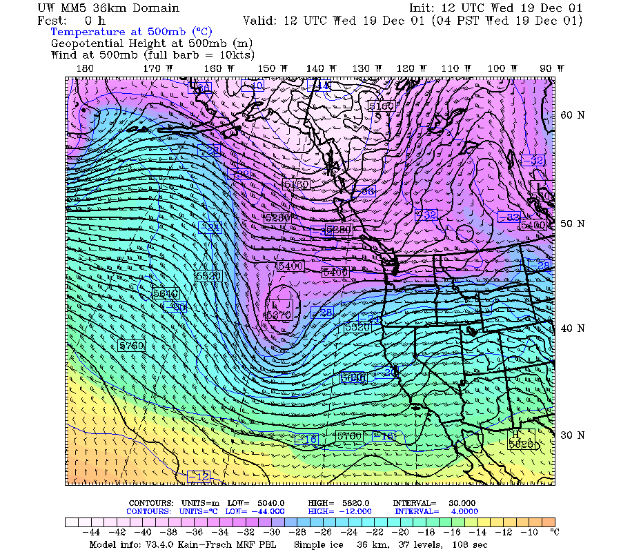
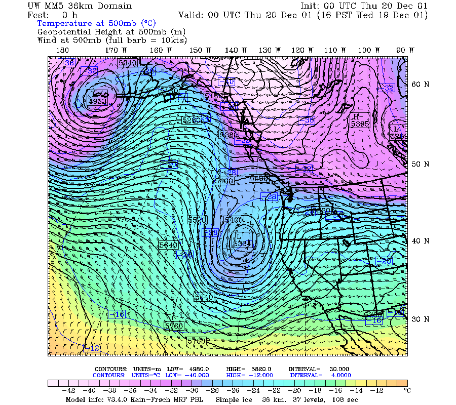
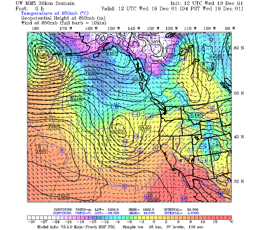
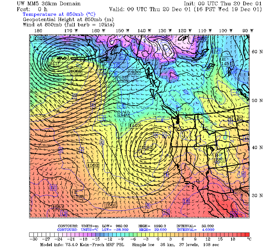
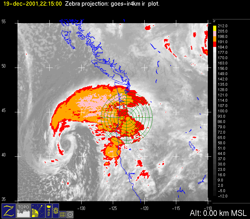
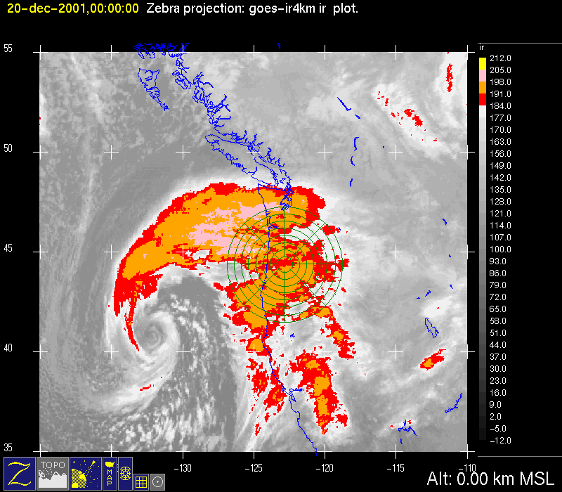
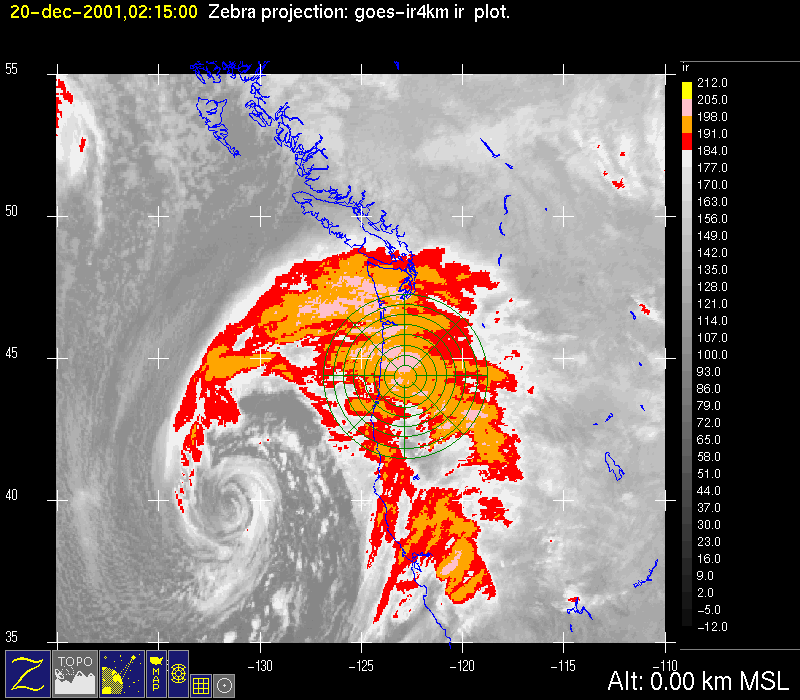
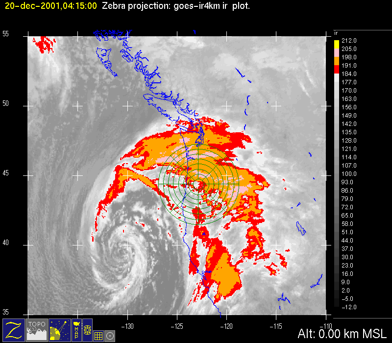
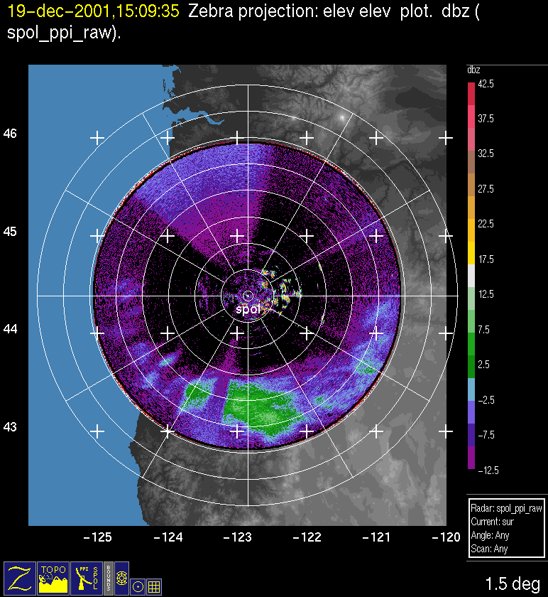
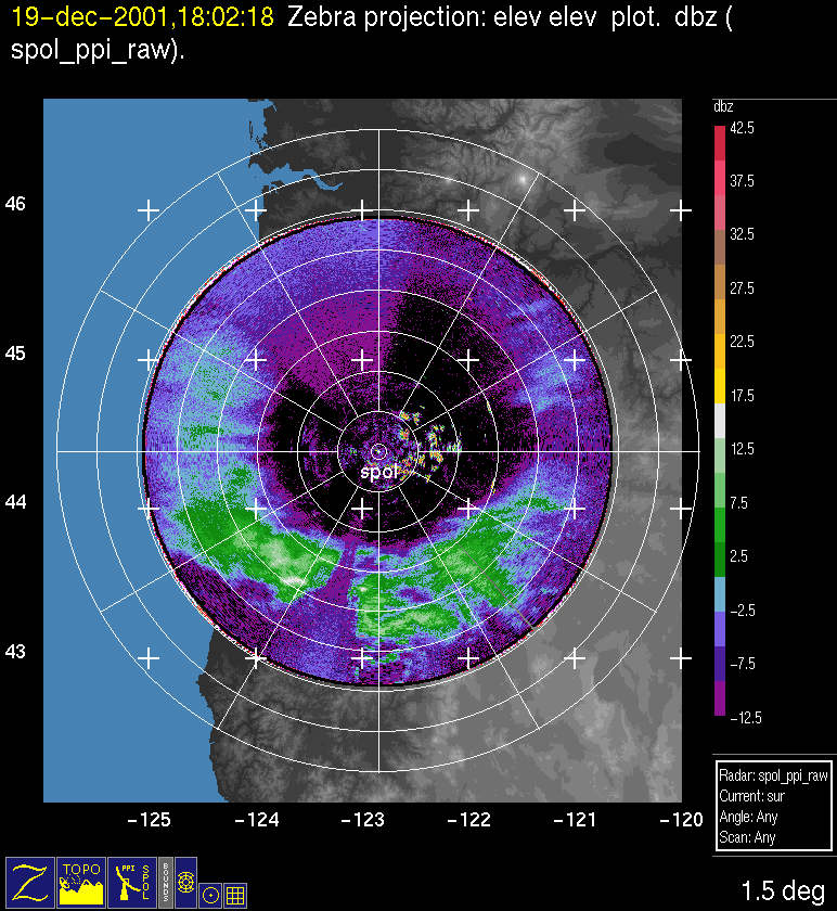
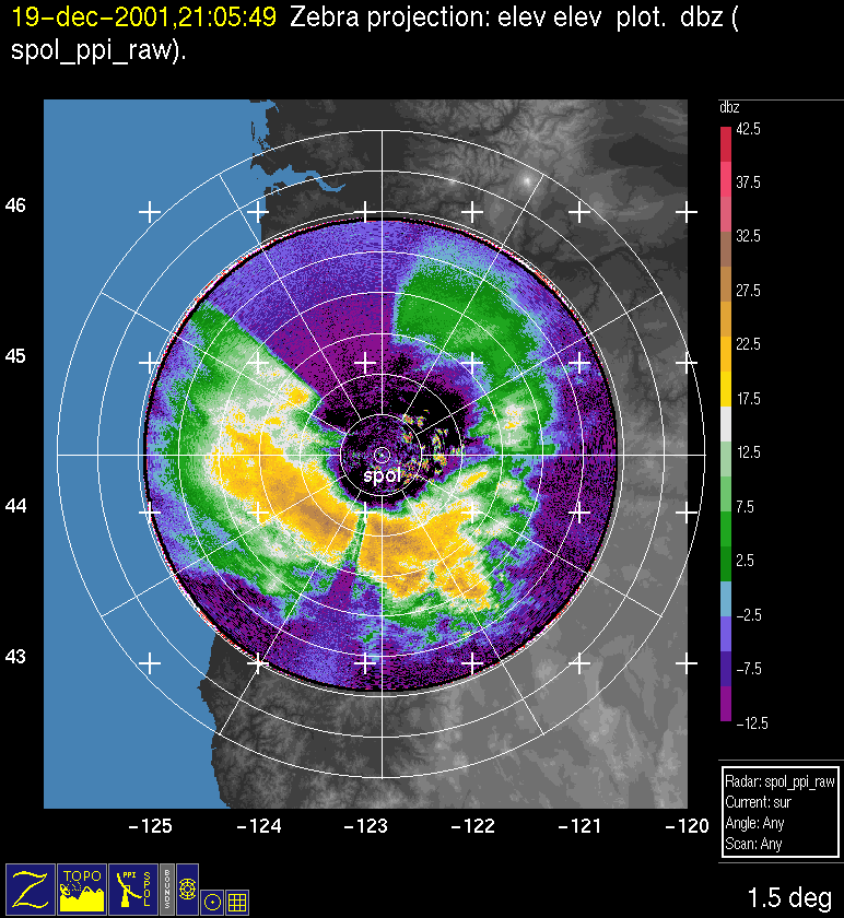
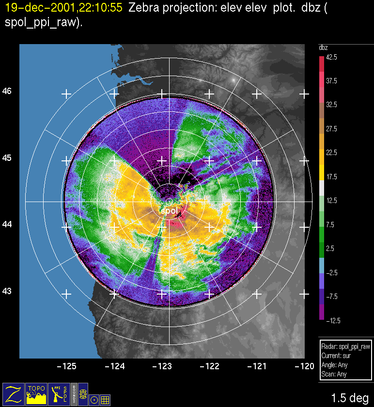
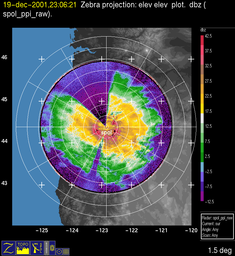
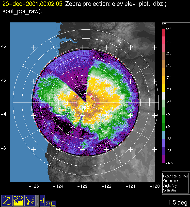
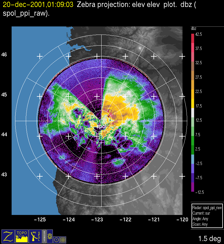
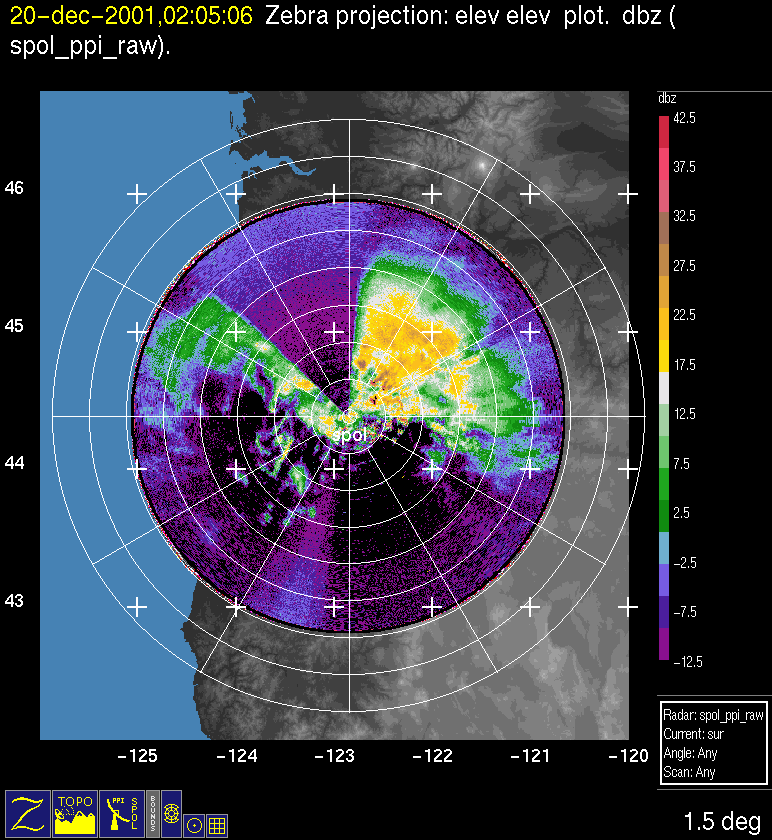
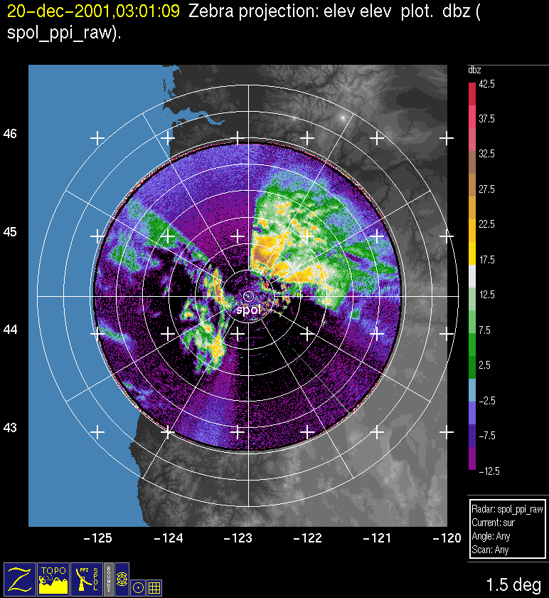
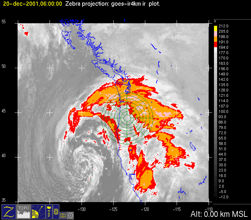
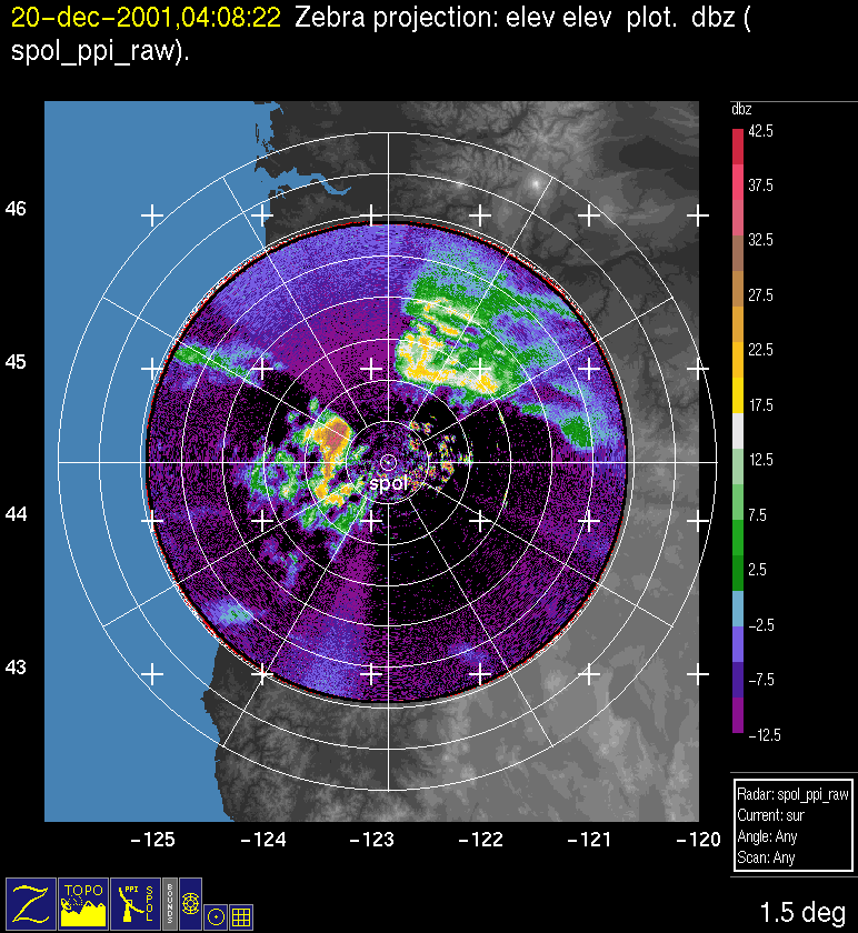
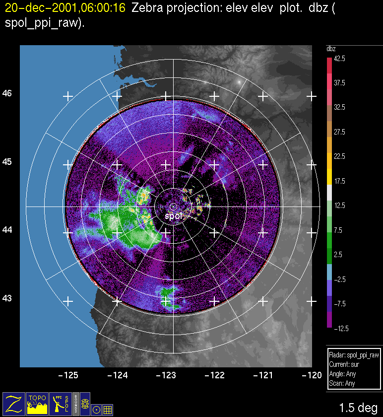
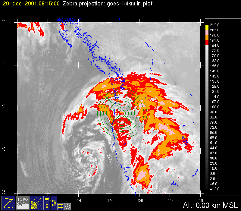
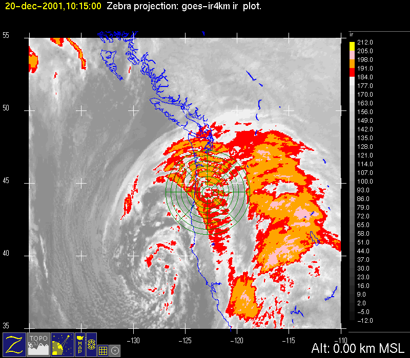
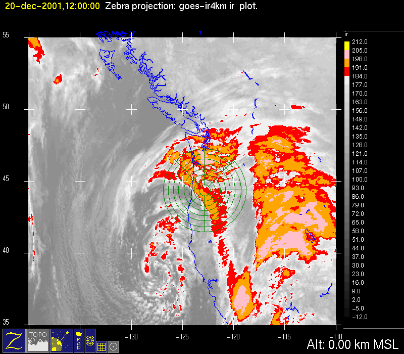
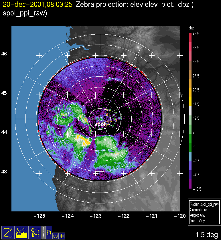
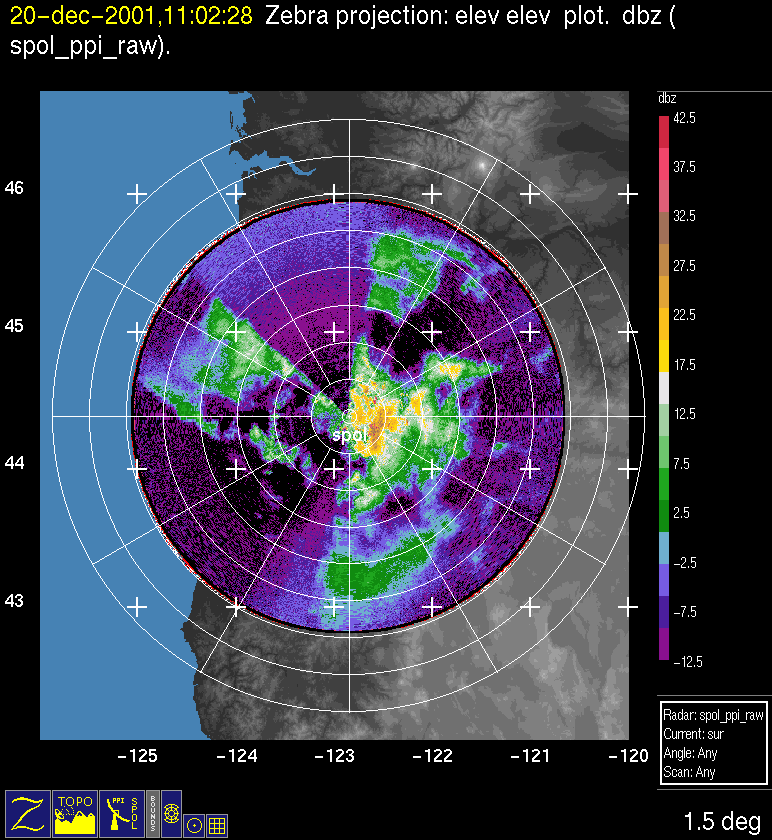
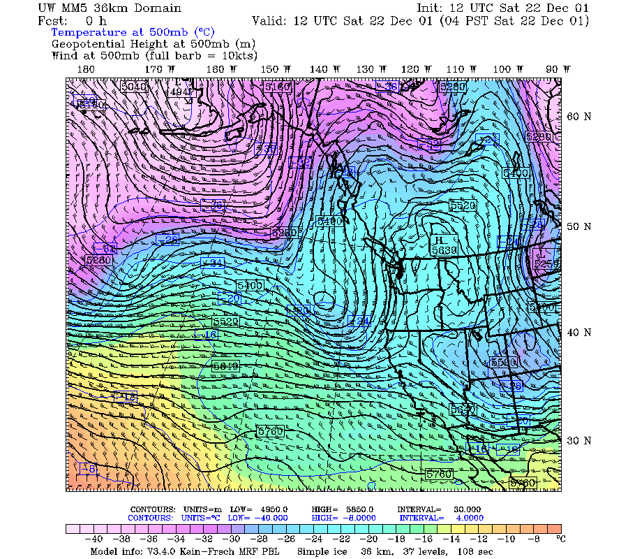
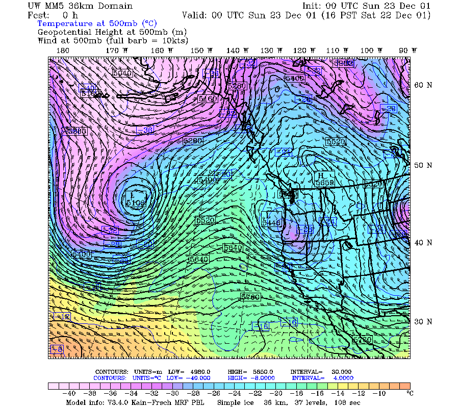
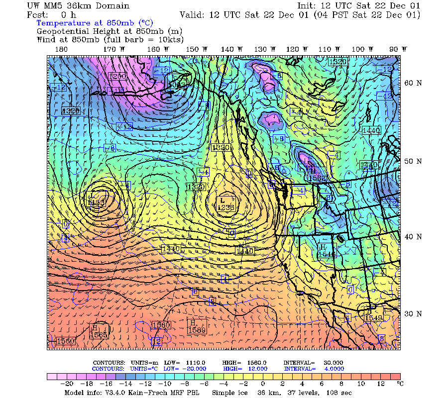
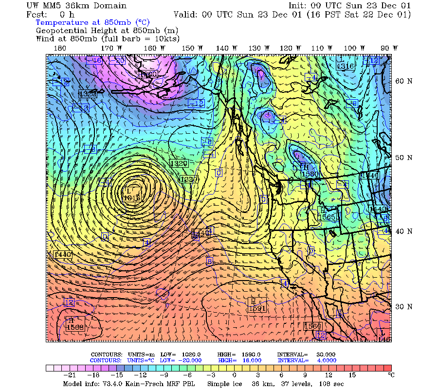
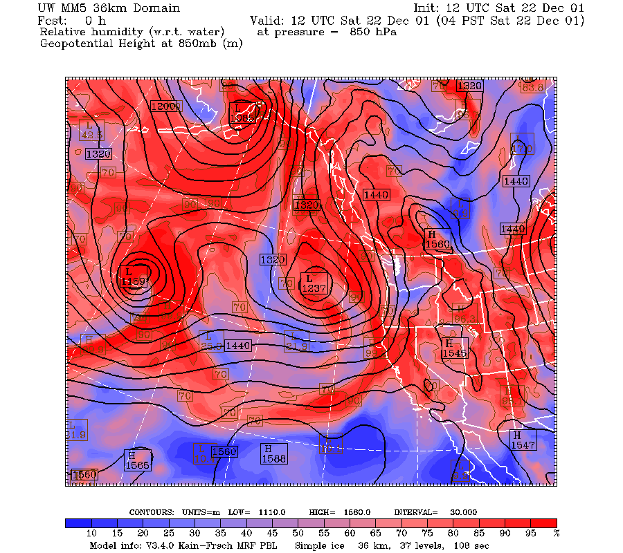
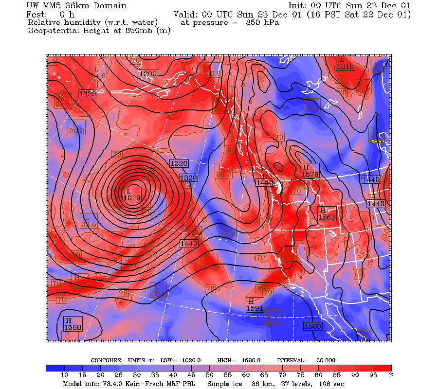
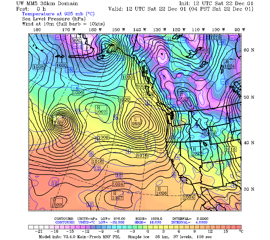
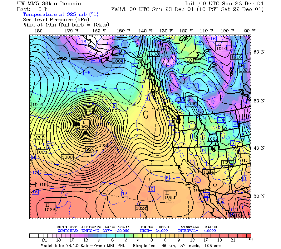
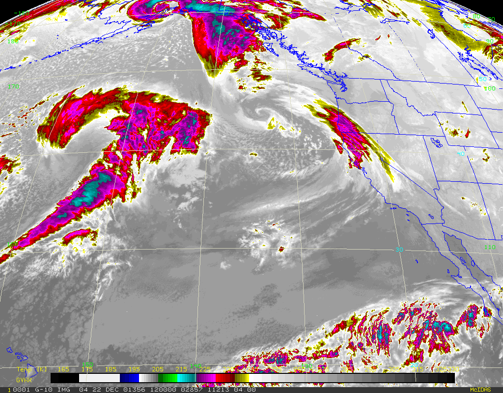
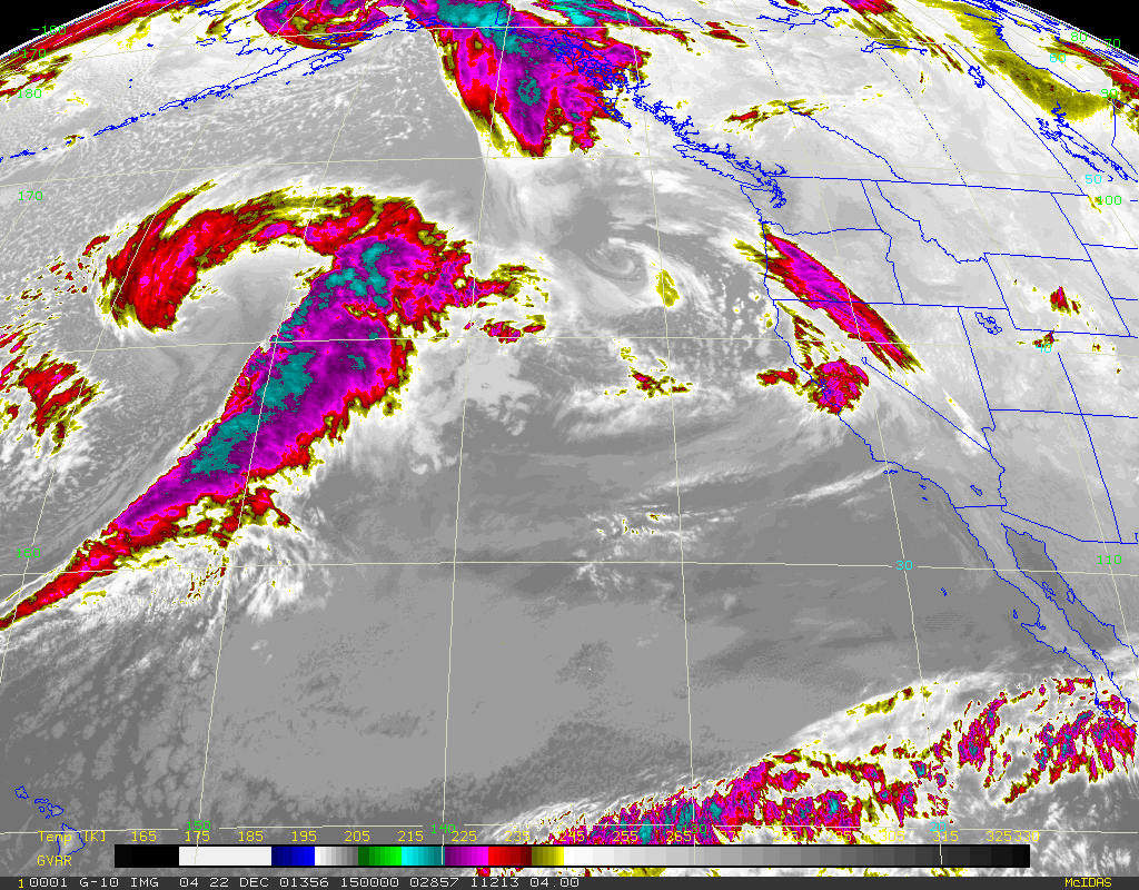
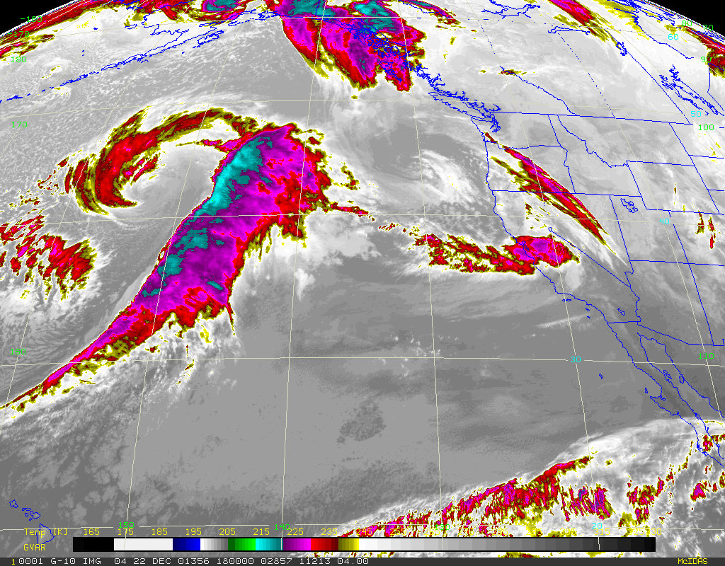
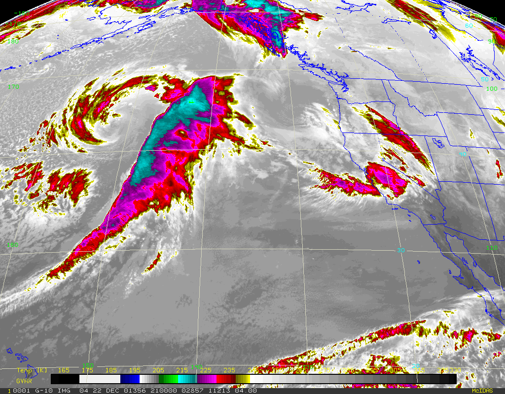
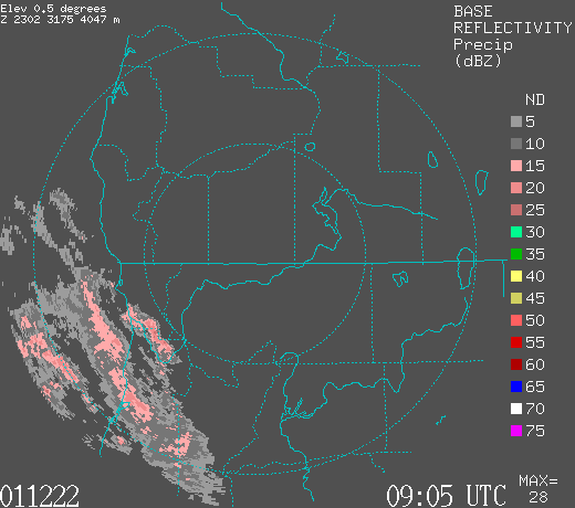
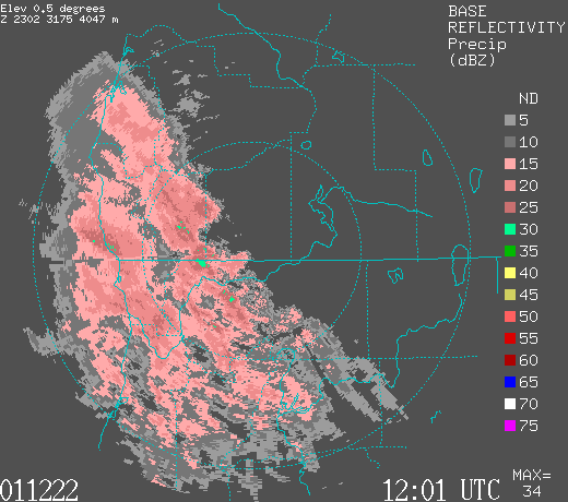
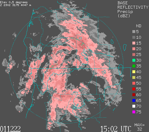
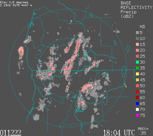
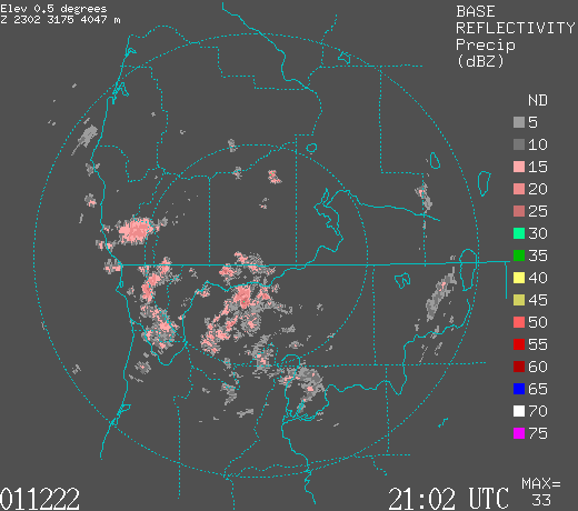